
Where Flight Simulation Enthusiasts Gather from Around the World!
AVSIM Library - Search Results

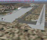
| Category: Flight Simulator X - AFCAD Files | |
| Cambodia 2 pack - VDPP Phnom Penh & VDSR Siem Reap Airports |

|
Images related to this file:
File Description:
Cambodia 2 pack, VDPP Phnom Penh & VDSR Siem Reap airport. Using ADEx 1.51, aeronautical maps and Google Earth I updated both airports to reflect the present situation. Please read the readme file for installation instructions.
| Filename: | Cambodia_2_pack__VDPP_Phnom_Penh__VDSR_Siem_Reap_A.zip |
| License: | Freeware |
| Added: | 9th June 2012, 15:38:04 |
| Downloads: | 1,885 |
| Author: | Menno C. Robert |
| Size: | 31.98 KB |
| Category: Flight Simulator 2004 - AFCAD Files | |
| Kalamazoo/Battle Creek Int'l |
|
File Description:
A remake of the default KAZO done with the help of satellite photographs from Google Earth. This does not add or delete any scenery, it merely moves things around to make it look more accurate.
| Filename: | KalamazooBattle_Creek_Intl.zip |
| License: | Freeware |
| Added: | 15th February 2006, 05:16:41 |
| Downloads: | 624 |
| Author: | Carlos Fernandez |
| Size: | 10.5 MB |
| Category: Flight Simulator X - Utilities | |
| GENav pro Navigation |
|
Images related to this file:
File Description:

Previous payware product at SimMarket, now 100% free.
With GENav pro you will view all AIRAC navigation data and terminal procedures inside Google Earth. GENav pro run under Windows and require only Google Earth for displaying. You can also edit your own routes or just copy routes into GENav to view in Google Earth. You can search for example an airport or a fix by short or long name, Google Earth will take you there.
You can connect to Microsoft Flight Simulator to view your aircraft. Moving map and heading is available.
GENav pro is highly optimized for best performance and clear views without clutter. There are smart filters to select relevant data to display, all AIRAC items are available. You will find all data such as nav-aid frequencies, airport runways with ILS frequencies by click the displayed icons in Google Earth.
You can edit routes visual direct inside Google Earth by click. The database can always be updated with Navigraph's latest AIRAC data.
With GENav you can easy build valid routes. Unlike other common autorouting program, GENav is the tool for you to build routes with correct airway direction and correct connected to SID/STAR's. You will easy draw your routes most straight and correct to destination. It is also excellent for visual and instrument navigation flights.
FEATURES:
*** Display airports, nav aids, waypoints
*** Display High/Low airways and airways direction
*** Display SID/STAR, Approaches and Transitions
*** Display ARTCC/FIR border
*** AIRAC data available by click
*** Search airport and fixes
*** AIRAC data compatible Navigraph data
*** Visual editable routes
*** VOR to VOR route navigation data
*** Display your aircraft
BASIC SYSTEM REQUIREMENTS:
*** Windows with Google Earth installed
( Notice, no flightsim program required )
OPTIONALLY REQUIREMENTS:
*** SID/STAR require the Navigraph purchase or an alternative free source
*** Airways direction & high/low info require the Navigraph purchase
*** To display aircraft, Microsoft Flight Simulator or Prepare3D v1/v2, with free FSUIPC is required
*** To display aircraft at a separate computer, also the payware WideFS is required
| Filename: | GENav_pro_Navigation.zip |
| License: | Freeware |
| Added: | 23rd May 2016, 19:57:35 |
| Downloads: | 1,576 |
| Author: | Lennart Vedin |
| Size: | 4.5 MB |
| Category: Flight Simulator 2004 - Utilities | |
| FS9Data Utility |
|
File Description:
This little utility captures longitude/latitude/altitude from the simulator and writes them on "latlonalt.txt". You can easily copy coordinates and paste them in a kml file and see your flight in 3D with google earth.
| Filename: | FS9Data_Utility.zip |
| License: | Freeware |
| Added: | 13th January 2007, 17:52:01 |
| Downloads: | 963 |
| Author: | Andrea Longoni |
| Size: | 44.26 KB |
| Category: Flight Simulator 2004 - Utilities | |
| FS9Data Utility |
|
File Description:
This little utility captures longitude/latitude/altitude from the simulator and writes them on "latlonalt.txt". You can easily copy coordinates and paste them in a kml file and see your flight in 3D with google earth.
| Filename: | FS9Data_Utility.zip |
| License: | Freeware |
| Added: | 22nd December 2006, 21:52:11 |
| Downloads: | 618 |
| Author: | Andrea Longoni |
| Size: | 16.53 KB |
| Category: Flight Simulator 2004 - AFCAD Files | |
| SBIL - Afonso Pena International Airport in Curitiba - Brazil |
|
File Description:
This is AFCAD for Afonso Pena INTL. - SBCT ( Default Scenery )
Internacional airport of Curitiba City in Brazil. This AFCAD have real gates position, real lights and ETC, all basing on Real Charts and Google Earth photos
| Filename: | SBIL__Afonso_Pena_International_Airport_in_Curitib.zip |
| License: | Freeware |
| Added: | 2nd September 2007, 01:48:06 |
| Downloads: | 1,270 |
| Author: | Luis Phelippe da Silva |
| Size: | 30.11 KB |
| Category: Flight Simulator 2004 - AFCAD Files | |
| Newark Liberty International Airport (KEWR) |
|
File Description:
My AFCAD for Steve Whalin's amazing Newark scenery (kewr.zip). I have added taxiway linings, runway linings, runways assigned. With help from visual images provided by Google Earth, this AFCAD adds MUCH more detail and realism. ENJOY!
| Filename: | Newark_Liberty_International_Airport_KEWR.zip |
| License: | Freeware |
| Added: | 22nd August 2006, 22:53:38 |
| Downloads: | 1,935 |
| Author: | Ryan Chadwick, Steve Whalin |
| Size: | 1.01 MB |
| Category: Flight Simulator 2004 - Scenery | |
| EDDR Saarbrucken-Ensheim |
|
File Description:
EDDR Saarbrucken-Ensheim for FS2004. Airport in western part of Germany near French border. Based on google earth picture. Enhanced airport layout and objects added. For those who don't have a payware scenery. Needs rwy12 objects.
| Filename: | EDDR_SaarbruckenEnsheim.zip |
| License: | Freeware |
| Added: | 24th April 2008, 03:09:33 |
| Downloads: | 2,501 |
| Author: | Detlev J. Rohmer |
| Size: | 809.41 KB |
| Category: Flight Simulator 2004 - Scenery | |
| LIRA Rome Ciampino light |
|
Images related to this file:
File Description:
LIRA Rome Ciampino for FS9 light
- made by using google earth and jeppesen charts,
- built with rwy12 objects,
- correct ILS approach
- surrounding city/landscape/streets using standard FS9 LC
Freeware by Gernot Zander, 2012-4-14
| Filename: | LIRA_Rome_Ciampino_light.zip |
| License: | Freeware |
| Added: | 14th April 2012, 22:04:33 |
| Downloads: | 1,612 |
| Author: | Gernot Zander |
| Size: | 3.78 MB |
| Category: Flight Simulator X - Scenery | |
| Ben Gurion Airport (LLBG) for FSX |
|
File Description:
Ben Gurion (LLBG) Airport for FSX:
the scenery include:
Afcad (Runways, Taxiways, Navaids etc.) of Ben Gurion Airport - Israel
also includes default terminal and default buildings relocated using google earth with real landclass and aprons polygons
| Filename: | Ben_Gurion_Airport_LLBG_for_FSX.zip |
| License: | Freeware |
| Added: | 18th January 2009, 17:56:55 |
| Downloads: | 9,640 |
| Author: | Tomer Haim |
| Size: | 185.44 KB |
© 2001-2026 AVSIM Online
All Rights Reserved
Privacy Policy |