
Where Flight Simulation Enthusiasts Gather from Around the World!
AVSIM Library - Search Results

| Category: Flight Simulator X - Aircraft Repaints, Textures and Modifications | |
| Air Canada Boeing 777-200LR (C-FNNH) |

|
Images related to this file:
File Description:
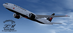
Air Canada C-FNNH "New Colours" for the payware Overland/Simmer Sky B777-200LR model. This package is painted in 32-bit textures, and is compatible with FSX and FS9. Textures only! Base aircraft model and textures by Overland/Simmer Sky, Repaint by Torsten Märtke. Visit me on Facebook https://www.facebook.com/martke.torsten.3
| Filename: | Air_Canada_Boeing_777200LR_CFNNH.zip |
| License: | Freeware |
| Added: | 10th December 2017, 18:01:03 |
| Downloads: | 497 |
| Author: | Torsten Märtke |
| Size: | 3.87 MB |
| Category: Flight Simulator 2002 - Scenery | |
| Patch for Rockcliffe Airport (CYRO) Ottawa, Canada |
|
File Description:
Three texture files for the static Cessna's were missing from the Rockcliffe download. Unzip into FS2002 main textures folder. Sorry about that!
| Filename: | Patch_for_Rockcliffe_Airport_CYRO_Ottawa_Canada.zip |
| License: | Freeware |
| Added: | 16th August 2002, 20:07:47 |
| Downloads: | 1,067 |
| Author: | Jim turner |
| Size: | 9.94 KB |
| Category: Flight Simulator 2004 - Scenery | |
| AI Helicopters for Penticton, British Columbia, Canada. |
|
Images related to this file:
File Description:

AI Helicopters for Penticton, British Columbia, Canada. This package is designed to compliment the exceptionaly fine enhancement of the airport (CYYF) by John Stinstrom. Featured are three repaints by John Burford of the Sikorsky S-76 AI Helicopter in Canadian Helicopter's colors. The AI Helicopter model by Chris "Elvis" Jones is not included but download details for it and other suggested enhancements are included in the documentation. The project uses the "invisible" airport and "forward departure" (no push-backs) techniques. Please unzip to a temporary folder and follow the very easy installation instructions. Compiled for your flying enjoyment by David "Opa" Marshall. ---
NOTE: This single package replaces three related files destroyed in the May hack upon Avsim.
| Filename: | AI_Helicopters_for_Penticton_British_Columbia_Cana.zip |
| License: | Freeware |
| Added: | 28th January 2010, 14:57:01 |
| Downloads: | 4,898 |
| Author: | David "Opa" Marshall & John Burford |
| Size: | 837.98 KB |
| Category: Flight Simulator X - AFCAD Files | |
| CYXU - London International Airport / London, Ontario, Canada |
|
Images related to this file:
File Description:
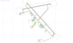
CYXU - London International Airport / London, Ontario, Canada
This airport update was made with the latest version of ADE (Airport Design Editor) and made for FSX as a replacement for the stock (default) airport. I've made several changes to the airport which are listed below. All these enchancements are as close to the real airport as I can get with stock library objects. I've used satellite images, terminal photos and maps throughout the whole process so building locations are as accurate as possible. Happy landings in the beautiful Canada!
Features:
*Expanded parking apron
*Main terminal building with its jetways and regional jet parking area
*Seperate parking aprons for GA traffic
*Hangars and other airport buildings added
*Airport vehicles and objects throughout the airport
*Parking lots with static vehicles
*Airport fire station with fire trucks
*De-icing vehicles/runway plows
*Cargo ramp
*Helipad
*Diamond Aircraft Industries building/apron
| Filename: | CYXU__London_International_Airport__London_Ontario.zip |
| License: | Freeware |
| Added: | 28th July 2012, 08:41:55 |
| Downloads: | 954 |
| Author: | Jaison Diaz / Endeavour ai |
| Size: | 128.88 KB |
| Category: Flight Simulator 2004 - Aircraft Repaints, Textures and Modifications | |
| POSKY Air Canada "Bare Metal" 767-200 |
|
File Description:
POSKY'S great Boeing 767-200 V4 with all the bells and whistles. Air Canada's newest livery (beta) in a polished scheme. This is for fuel economy purposes; and if passes the tests, all the B762's will be changed to this scheme.
| Filename: | POSKY_Air_Canada_Bare_Metal_767200.zip |
| License: | Freeware |
| Added: | 24th November 2005, 14:47:06 |
| Downloads: | 1,862 |
| Author: | Daniel Halpern |
| Size: | 4.69 MB |
| Category: Flight Simulator 2004 - Scenery | |
| St Andre-Avellin CAA2 in Quebec Canada |
|
Images related to this file:
File Description:
St Andre-Avellin is a new airfield in Quebec Canada, 35 miles east of Ottawa and 10 miles north of the Ottawa River, and just northwest of the village of the same name. There is a 03/21 grass runway that is 2,870 feet long and slopes up towards the north. To show this slope I have not "placed" a grass runway (which would immediately flatten the slope) and anway there is not so much traffic that the grass would be notably marked. Because of the lack of an FS-recognised runway I have not made parking or a traffic file as AI would not work; anyway this airfield with constant activity would not reflect reality. There are no facilities at the airfield except a hangar for the owner and space to park.
| Filename: | St_AndreAvellin_CAA2_in_Quebec_Canada.zip |
| License: | Freeware, limited distribution |
| Added: | 9th April 2011, 20:49:47 |
| Downloads: | 168 |
| Author: | Roger Wensley |
| Size: | 816.9 KB |
| Category: Flight Simulator 2004 - Scenery | |
| Aklavik CYKD in the Northwest Territories, Canada |
|
Images related to this file:
File Description:
Aklavik is a town of 650 or so inhabitants at N68 W135, which means 120 miles inside the Arctic Circle and on the West Channel of the Mackenzie River delta. It is 40 miles west of Inuvik and around 60 miles from where the Mackenzie meets the Beaufort Sea. There is only one airline serving the town on a regular basis and that is North Wright, which is headquartered in Norman Wells and also has a base in Inuvik. Aklavik village does not feature in FS9, so the first thing to do was to add it; not all the smaller streets are in place but it is the right shape and with around the right number of houses. The only building with (partly) correct textures is the school near the airfield. I couldn't begin to model 150+ houses, so think of it as a hand-made auto-generated village. I had to move the airfield over beside the river, so there is a DELETE file and a GRASS file, as well as an AFCAD for AI (the AI will follow later) and a scenery file.
| Filename: | Aklavik_CYKD_in_the_Northwest_Territories_Canada.zip |
| License: | Freeware, limited distribution |
| Added: | 10th October 2010, 03:02:19 |
| Downloads: | 628 |
| Author: | Roger Wensley |
| Size: | 1.91 MB |
| Category: Flight Simulator 2004 - Scenery | |
| Grande Prairie CYQU in Alberta, Canada, Updated |
|
Images related to this file:
File Description:
This is a new version of the original post from March 2014, made in 2018. It was made mainly to provide some missing textures, but has been modified to also add parked trucks and floodlights to the de-icing area (the floodlights are inoperative as they will not be on when there is no de-icing in progress) and also street and car parking lighting, a few more parked planes, and some further objects on the terminal apron area. The runway approach lighting was also corrected; moving the airport so that the ILS on 29 did not coincide with the roads would have been nice, but meant too many complications at this stage. The scenery is complete in itself and can be installed as-is if you do not have the original post. Grande Prairie is at 2,195 feet asl, 65 miles southeast of Dawsons Creek, 90 miles southwest of Peace River and around 60 miles east of the Rockies. The town has a population of around 55,000 and growing. The name comes from the wide expanse of prairies all around the town, and there is also a large forested area to the southwest leading up to the Rockies which supplies raw material for industries in the town. The airport is just to the west of the town. It was originally a military base, built during WW2. The two runways are 07-25 and 11-29 and 6,200 and 6,500 feet respectively, both 200 feet wide; runway headings had changed by 2010 in real life but take this as it was in 2008. When one is the active runway then the other is used as a taxiway. Taxiway A is very wide with in real life a repaired central section marked out for use.
| Filename: | Grande_Prairie_CYQU_in_Alberta_Canada_Updated.zip |
| License: | Freeware, limited distribution |
| Added: | 13th December 2018, 04:12:11 |
| Downloads: | 207 |
| Author: | Roger Wensley |
| Size: | 34.97 MB |
| Category: Flight Simulator 2004 - Scenery | |
| Anahim Lake CAJ4 in British Columbia, Canada |
|
Images related to this file:
File Description:
Anahim Lake is around 55 miles east of Bella Coola by air, and clear of the deep and rugged valley that connects the two with a road that is over 75 miles long. The two are also linked by a daily Pacific Coastal flight. A further 150 miles east is Williams Lake (200 miles by road). The town of Anahim Lake is small, but renowned for numerous surrounding fishing lodges on the lakes and the enjoyment of "nature" in what is known as the Chilcotin Wilderness. The Anahim Lake airport is an odd one. It appears to have fallen into disuse over a period of years, but is now in the process of being upgraded, with some new hangars (though oddly situated, and with only dirt track taxiway access) and a recently completed terminal building. There is also a plan to upgrade the runway (lights etc, there are currently no runway or taxiway lights) and in general to greatly improve the facilities on offer. The only current airline to fly there is Pacific Coastal. The runway is just under 4,000 feet of asphalt aligned 13-31 and 75 feet wide. There used to be another runway which is still visible but is now unusable, gravel that has not been maintained for several years. The notes for Anahim Lake airfield in the Nav Canada manual warn of "Extensive float plane activity at Nimpo Lake to the south" and of "possible large animals within the airport perimeter". Nimpo Lake activity will follow in further posts.
| Filename: | Anahim_Lake_CAJ4_in_British_Columbia_Canada.zip |
| License: | Freeware, limited distribution |
| Added: | 29th November 2018, 19:21:59 |
| Downloads: | 152 |
| Author: | Roger Wensley |
| Size: | 5.72 MB |
| Category: Flight Simulator 2004 - Scenery | |
| Fort Good Hope CZGH - Northwest Territories, Canada |
|
Images related to this file:
File Description:
This is the second in a series of airfields that follow that early access route to the Canadian northern shore, the Mackenzie River. At the far northern end of the river there are Tuktoyaktuk, Inuvik, and Fort McPherson, all posted. Fort Good Hope is at 268 feet ASL and on the east bank of the Mackenzie, 180 miles southeast of Fort McPherson and 100 miles west of Great Bear Lake. The town has a population of around 560, and the main sources of income are from the traditional trapping and hunting. The airport is a mile south of the town, and has almost 4,000 feet of gravel runway. There are scheduled flights to the town by North Wright; I also have two AI GA flights and a Buffalo Airways delivery trip that hops north and south from field to field.
| Filename: | Fort_Good_Hope_CZGH__Northwest_Territories_Canada.zip |
| License: | Freeware, limited distribution |
| Added: | 4th July 2014, 21:03:03 |
| Downloads: | 276 |
| Author: | Roger Wensley |
| Size: | 3.08 MB |
© 2001-2026 AVSIM Online
All Rights Reserved
Privacy Policy |