
Where Flight Simulation Enthusiasts Gather from Around the World!
AVSIM Library - Search Results

| Category: Flight Simulator 2004 - Scenery | |
| Alexandria Airport N85 |

|
File Description:
FS2004 Scenery - Alexandria Airport (N85) serves Pittstown and Hunterdon County in New Jersey and is owned by Leah Fritsche. The airport has more than one runway. The longest is a paved runway extending 2550 feet. The facility is at an elevation of 480 feet at a distance of about 2 miles from Pittstown. Alexandria Field is home to over 100 planes, and has an active flight school and maintenance shop. Created with EZ Scenery. EZ Scenery libraries required.
| Filename: | Alexandria_Airport_N85.zip |
| License: | Freeware, limited distribution |
| Added: | 17th June 2007, 23:39:52 |
| Downloads: | 692 |
| Author: | John B. Loney, Jr. |
| Size: | 943.55 KB |
| Category: Flight Simulator X - Scenery | |
| Cushman Air Park (WACP) |
|
File Description:
This is a new “fictitious" Air Park in the State of Washington designed specifically for FSX. It serves as the Fire Base Air operations in the Pacific North West. Designed for use with Ultimate Terrain X (UTX-USA), Mesh Resolution set to 10m, and Mesh Complexity set to 80.
Some older (FS9) object libraries have been used but are not required(see the readme). Includes AI and a special Fire Spotter repaint of the default Cessna 208B.
| Filename: | Cushman_Air_Park_WACP.zip |
| License: | Freeware, limited distribution |
| Added: | 14th September 2007, 18:24:31 |
| Downloads: | 1,200 |
| Author: | Bill Dick and Phil Cayton |
| Size: | 527.58 KB |
| Category: Flight Simulator X - AFCAD Files | |
| UWUU - Ufa International Airport |
|
File Description:
Ufa International Airport is situated near the capital of Bashkortostan and serves 2.2 million passengers each year.
As usual I have used ADEX to rework this airport. Google Earth for measurements. Charts for parking sizes and positions.
You should download the brilliant car park package by Sidney Schwartz, modified my Martin Gossman at Owls Nest. Also the great lights package by Jim Dhaenens. Both can be found on AVSIM and other good flight sim libraries.
| Filename: | UWUU__Ufa_International_Airport.zip |
| License: | Freeware |
| Added: | 27th September 2016, 19:36:29 |
| Downloads: | 638 |
| Author: | Mike Major |
| Size: | 5.92 MB |
| Category: Flight Simulator 2004 - Scenery | |
| FYKM Katima Mulilo Airport, Mpacha, Namibia |
|
File Description:
FYKM Katima Mulilo Airport, Mpacha, Namibia for FS9. Needs ez-scenery and/or rwy12 objects. I recommend to download "ezoliv33.zip" from flightsim.com (205 MB!), which is a collection of all available ez scenery object libraries. Compatible with the LOD9 (76-m) Terrain Mesh of Namibia, southwestern Africa, by Holger Sandmann found at avsim.com (File Names: namibia_ne.zip, namibia_nw.zip, namibia_se.zip, namibia_sw.zip, namibia_cp.zip) as well as his Landclass and Scenery enhancements of Namibia (namibia_lc.zip). Not tested with default scenery.
| Filename: | FYKM_Katima_Mulilo_Airport_Mpacha_Namibia.zip |
| License: | Freeware |
| Added: | 8th November 2008, 00:14:34 |
| Downloads: | 1,242 |
| Author: | Detlev J. Rohmer |
| Size: | 1.18 MB |
| Category: Flight Simulator X - Scenery | |
| Visalia Municipal Airport (KVIS) |
|
File Description:
This is the next addition to my California airport series: Visalia Municipal. This package updates many aspects of this airport. Buildlings were resized and placed in their real-life locations, parking was updated, the parking ramp at the southern end of the airfield was added, and more. Satellite images from Google Earth were used for accuracy. Many default scenery objects were placed from the FSX scenery libraries. View Readme file for installation and notes. Compiled using Airport Design Editor.
| Filename: | Visalia_Municipal_Airport_KVIS.zip |
| License: | Freeware |
| Added: | 1st December 2008, 02:30:11 |
| Downloads: | 765 |
| Author: | Phillip Coyle |
| Size: | 315.36 KB |
| Category: Flight Simulator X - Scenery | |
| LIPK - Forlì X |
|
Images related to this file:
File Description:
Airport Rinolfi-Forli' for FSX/P3D (all versions), ICAO: LIPK. Also known as Luigi Ridolfi Airport, situated in Forli, Italy.
This is a conversion of Alessandro Monti's FS2004 Scenery. I have added new apron as per Jeppesen's charts and new lights for better vision. Many thanks to Alessandro for the permission of using his FS2004's Scenery, and for Aldo della Vedova for libraries and all the designers that contributed for the objects used.
| Filename: | LIPK__Forl_X.zip |
| License: | Freeware |
| Added: | 11th December 2014, 12:44:37 |
| Downloads: | 2,105 |
| Author: | Andrea Deplano |
| Size: | 5.46 MB |
| Category: Flight Simulator 2004 - Scenery | |
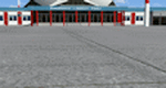
| RAF Northolt |
|
Images related to this file:
File Description:

This station is home to No.32 (The Royal) Squadron, flying BAe 125's, BAe 146's Islanders and Squirrel helicopters. It is the main gateway for officials and high-ranking officers of foreign governments and also for emergency and diplomatically sensitive flights. There is also a static Spitfire gate guardian, many thanks to John Young for allowing us to use his model.
Scenery is made up from several object libraries, details can be found in the readme.
| Filename: | RAF_Northolt.zip |
| License: | Freeware, limited distribution |
| Added: | 17th August 2013, 22:41:26 |
| Downloads: | 1,880 |
| Author: | Brian Clarke - Daryl Payne |
| Size: | 2.37 MB |
| Category: Flight Simulator 2004 - Scenery | |
| FS2004 Scenery - Elizabeth Field 0B8 |
|
File Description:
FS2004 Scenery - Elizabeth Field Airport (0B8) serves Fishers Island and Suffolk County Long Island, N.Y. and is owned by Town Of Southold. The airport has more than one runway. The longest is a paved runway extending 2328 feet. The facility is at an elevation of 9 feet. The scenery objects were placed using Instant Scenery using the EZ Scenery libraries. Instructions for Ultimate Terrain users included. Created in collaboration with Ray Lunning by John B. Loney, Jr.
| Filename: | FS2004_Scenery__Elizabeth_Field_0B8.zip |
| License: | Freeware, limited distribution |
| Added: | 21st December 2007, 04:36:10 |
| Downloads: | 815 |
| Author: | John B. Loney, Jr. |
| Size: | 219.35 KB |
| Category: X-Plane - Scenery | |
| 2017 TMA Fortaleza XP11 Package SBFZ SJCM SJDS SNFF v1.1.0 |
|
Images related to this file:
File Description:

Version 1.1.0 (2017) - This is an X-Plane 11 scenery package for Fortaleza, Ceara, Brazil. It includes four airfields located in the metropolitan area of Fortaleza. 1. SBFZ/FOR - Pinto Martins International Airport v1.1.0. 2. SJCM - Catuleve Aeronautical and Sports Airfield v1.0.0. 3. SJDS - Fabrica Fortaleza Private Airport v1.0.0. 4. SNFF - Feijo Flight School and Private Airfield v1.0.0. It includes corrected aprons, ramps, taxiways and lighting system for SBFZ/FOR airport. v1.1.0 includes also the construction work of the terminal expansion, and XP11 ground services (like pushback) enabled. SBFZ/FOR scenery was tested and is operational (as of February 04, 2017) in "X-Plane 11 Public Beta #8 64 bit", Windows 10 Home. It was also tested but is NOT operational (as of January 27, 2017) in "X-Plane 10.51 64 bit", Windows 10 Home. This happens for two reasons: (a) XP11 native ground traffic/services enabled for SBFZ/FOR ground, a feature compatible only with XP11, and (b) the use of some internal Laminar Research made libraries for XP11 only, not present in XP10 libraries.
| Filename: | 2017_TMA_Fortaleza_XP11_Package_SBFZ_SJCM_SJDS_SNF.zip |
| License: | Freeware |
| Added: | 4th February 2017, 20:00:41 |
| Downloads: | 251 |
| Author: | Rui Mesquita |
| Size: | 18.35 MB |
| Category: X-Plane - Scenery | |
| BR GO SDXF - Alto Paraiso Airfield v1.0.0 |
|
Images related to this file:
File Description:
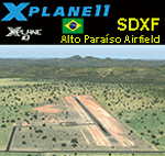
This is an X-Plane 11 and X-Plane 10 scenery package for Alto Paraiso de Goias Airfield (ICAO: SDXF), which is the airfield serving Alto Paraiso, Goias, in Brazil. It includes corrected aprons, ramps, gates, taxiways, lighting system, city buildings, ortho-photoscenery for the airfield area, and (XP11 only) airport ground services (like push back). Alto ParaÃso de Goiás (usually referred to as Alto ParaÃso) is a municipality in northeastern Goiás state, Brazil. It has become known for its ecological and New Age tourism. Alto ParaÃso is part of Chapada dos Veadeiros. It lies 230 km northeast of the federal capital BrasÃlia/SBBR and 423 from the state capital Goiania/SBGO. This scenery was tested and is operational (as of May 21, 2017) in "X-Plane 11.01 64 bit", Windows 10 Home. It was also tested and is also operational (as of May 21, 2017) in "X-Plane 10.51 64 bit", Windows 10 Home. Only the default X-Plane 11 libraries, by Laminar Research, are needed. No third party libraries are used.
| Filename: | BR_GO_SDXF__Alto_Paraiso_Airfield_v100.zip |
| License: | Freeware |
| Added: | 21st May 2017, 16:41:16 |
| Downloads: | 79 |
| Author: | Rui Mesquita |
| Size: | 14.76 MB |
© 2001-2026 AVSIM Online
All Rights Reserved
Privacy Policy |