
Where Flight Simulation Enthusiasts Gather from Around the World!
AVSIM Library - Search Results

| Category: Flight Simulator 2004 - Scenery | |
| Amposta Airfield - LEAO |

|
File Description:
FS2004 Scenery-Amposta Airfield (LEAO) is a fictional airfield located in the Amposta area of Spain. Though there is currently no airport there, there may be one built in the future. The runway is 4000 ft long and the airport is controlled. Created entirely with EZ Scenery, the scenery requires the EZ Scenery and Rwy12 libraries. AFCAD2 and Traffic Tools are also required. By John B. Loney, Jr.
| Filename: | Amposta_Airfield__LEAO.zip |
| License: | Freeware |
| Added: | 22nd July 2006, 04:54:17 |
| Downloads: | 771 |
| Author: | John B. Loney, Jr. |
| Size: | 540.29 KB |
| Category: Flight Simulator X - AFCAD Files | |
| Aspen-Pitkin County/Sardy Field (KASE) |
|
File Description:
This scenery update is for Aspen-Pitkin County airport. Located high in the Rocky Mountains, Aspen is known for it's challenging high altitude runway 15 approach. It updates various aspects of the airport, including taxiways, runways, and parking. Real world demensions were used through Google Earth. A few objects form the default FSX libraries were also added. View Readme file for installation and notes. Compiled using Airport Design Editor.
| Filename: | AspenPitkin_CountySardy_Field_KASE.zip |
| License: | Freeware |
| Added: | 5th June 2008, 20:12:14 |
| Downloads: | 1,157 |
| Author: | Phillip Coyle |
| Size: | 286.85 KB |
| Category: Navigation and ATC - Navigation | |
| Papua New Guinea Charts 2 of 3 |
|
Images related to this file:
File Description:
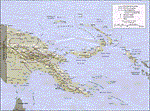
Calibrated for FSMap, but scanned images can be used in other map software, such as FSM Moving Map (FSMMM) by Rana Hossain. Chart source: Topographic Maps U.S. Army Map Service, Series T504, original scale 1:250,000, date 1964-. Courtesy of the University of Texas Libraries, The University of Texas at Austin. Missing: I could not find equivalent charts for New Britain; for this island, a lower-quality chart is included.
| Filename: | Papua_New_Guinea_Charts_2_of_3.zip |
| License: | Freeware |
| Added: | 7th May 2010, 10:45:02 |
| Downloads: | 795 |
| Author: | David Wilson-Okamura |
| Size: | 34.63 MB |
| Category: Navigation and ATC - Navigation | |
| Papua New Guinea charts 1 of 3 |
|
Images related to this file:
File Description:

Calibrated for FSMap, but scanned images can be used in other map software, such as FSM Moving Map (FSMMM) by Rana Hossain. Chart source: Topographic Maps U.S. Army Map Service, Series T504, original scale 1:250,000, date 1964-. Courtesy of the University of Texas Libraries, The University of Texas at Austin. Missing: I could not find equivalent charts for New Britain; for this island, a lower-quality chart is included.
| Filename: | Papua_New_Guinea_charts_1_of_3.zip |
| License: | Freeware |
| Added: | 5th June 2010, 03:40:04 |
| Downloads: | 1,213 |
| Author: | David Wilson-Okamura |
| Size: | 34.25 MB |
| Category: Flight Simulator X - Scenery | |
| Boire Field Airport KASH |
|
File Description:
This is a pretty basic rework of the original FSX KASH scenery matching taxiways, buildings & GA parking's, no extra libraries are required. The original KASH airport in FSX is really nothing like the real deal, so I used ADE, Skyvector and Google Earth to collect all the information I needed to complete this design and the result is a more realistic airport that matches the real geography of the airport.
| Filename: | Boire_Field_Airport_KASH.zip |
| License: | Freeware |
| Added: | 3rd February 2017, 04:07:00 |
| Downloads: | 173 |
| Author: | Leonardo Pierry |
| Size: | 11.53 KB |
| Category: Flight Simulator 2004 - Scenery | |
| Komatsu Air Base (RJNK) |
|
Images related to this file:
File Description:
Komatsu Air Base (RJNK) is a dual use civilian and military airport in Ishikawa Prefecture, Japan. It is the home of the the 303rd and 306th tactical fighter squadrons of the Japanese Air Self Defense Force and the Komatsu Air Rescue Squadron of the JASDF. See the readme file for a list of available AI aircraft that operate from this airport and object libraries needed to bring it to life.
| Filename: | Komatsu_Air_Base_RJNK.zip |
| License: | Freeware |
| Added: | 21st October 2015, 20:28:28 |
| Downloads: | 645 |
| Author: | Brent Newman |
| Size: | 45.99 KB |
| Category: Flight Simulator 2004 - Scenery | |
| Franklin County State KFSO Scenery |
|
File Description:
Franklin County State Airport (KFSO), Vt. principally serves Highgate and is owned by the State Of Vermont. The paved runway extends 3,000 feet. The facility is at an elevation of 228 feet and is about three miles from Highgate. Download incorporates FSDS3, Rwy12, EZ Scenery and Lago's FSE. Also a new AFCAD2 file and AI Traffic via Traffic Tools. FSDS3 textures included. Rwy12 and EZ Scenery libraries required.
| Filename: | Franklin_County_State_KFSO_Scenery.zip |
| License: | Freeware |
| Added: | 14th May 2006, 21:40:56 |
| Downloads: | 751 |
| Author: | John B. Loney, Jr. |
| Size: | 822.9 KB |
| Category: Flight Simulator X - Scenery | |
| FSX SCENERY KGRB Green Bay WI and area with AI PACKAGE |
|
File Description:
Custom built terminal, FOBs, hangars, hotels, and casinos surrounding Austin Straubel Intl airport.
Downtown Green bay gets a facelift from the default with custom buildings, industries and
working lighthouses. Lambeau Field and sports complex, home of the Packers, is modeled
using a photoreal ground texture. An AI traffic file is provided to add GA traffic and jets
at the terminal. Some scenery libraries (the usual) required.
By Dan French.
| Filename: | FSX_SCENERY_KGRB_Green_Bay_WI_and_area_with_AI_PAC.zip |
| License: | Freeware |
| Added: | 17th December 2021, 00:23:23 |
| Downloads: | 352 |
| Author: | Dan French |
| Size: | 12.28 MB |
| Category: Flight Simulator X - AFCAD Files | |
| Charles M. Schulz - Sonoma County Airport (KSTS) |
|
File Description:
This updates Sonoma County Airport for FSX. Taxiways, runways, and other aspects were updated using real satellite images from Google Earth for accuracy. This airport is home to some CDF Fire Tankers, and the taxiways leading up to their facility have been accuratly depicted in this release. Default objects from the FSX scenery libraries were used. View Readme file for installation and notes. Compiled using Airport Design Editor.
| Filename: | Charles_M_Schulz__Sonoma_County_Airport_KSTS.zip |
| License: | Freeware |
| Added: | 10th August 2008, 17:28:31 |
| Downloads: | 746 |
| Author: | Phillip Coyle |
| Size: | 244.08 KB |
| Category: Flight Simulator X - Scenery | |
| NL2000 V4.02 Library package |
|
Images related to this file:
File Description:
This is the NL2000 v4.02 libraries package for the NL2000 scenery version 4.
Mandatory objects used by most airports of NL2000, including effect files and AI Airplanes.
You need the NL2000 v4.0.20 installer to install this package.
The Netherlands 2000 v4 Scenery is a modular free FSX scenery covering the Netherlands.
Visit our website for other available packages.
By The Netherlands 2000 Scenery Design Team (www.nl-2000.com).
| Filename: | NL2000_V402_Library_package.zip |
| License: | Freeware |
| Added: | 22nd December 2011, 13:49:48 |
| Downloads: | 4,151 |
| Author: | NL2000 scenery design team |
| Size: | 220.05 MB |
© 2001-2026 AVSIM Online
All Rights Reserved
Privacy Policy |