
Where Flight Simulation Enthusiasts Gather from Around the World!
AVSIM Library - Search Results

| Category: Flight Simulator X - Utilities | |
| skyLOGX v2.0 ** UPDATE ** |

|
Images related to this file:
File Description:
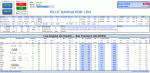
skyLOGX is a virtual navigation log (PLOG) coded in Microsoft Excel VBA to ease your preflight workload before you hop in bush wilderness aboard the selected general aviation aircraft - currently supported are A2A Cessna 172R, A2A Cessna 182T, and SibWings Antonov An-2. Although with slight modification in programming code, the logic can be applied to any GA aircraft.
It can also convert your native FSX/P3D flight plans or those created in Plan-G (in PLN format) to Google Earth KML and/or SkyVector format. The reversed conversion between flight plan formats is also possible.
| Filename: | skyLOGX_v20__UPDATE_.zip |
| License: | Freeware |
| Added: | 6th June 2015, 13:48:42 |
| Downloads: | 803 |
| Author: | Vuqar Quliyev |
| Size: | 13.75 MB |
| Category: Flight Simulator X - AFCAD Files | |
| KSEE - Gillespie Field - El Cajon, California - USA |
|
File Description:
This is a rework of KSEE Gillespie Field a GA airport in El Cajon, California just east of San Diego, California.
Displaced thresholds are adjusted on all runways, added parking spaces and helipads, aprons, runup areas, scenery objects (FSX stock for the most part, I hope) changed the fuel spot to the correct location, and shifted and added buildings and hangers to make it look more like the real airport. The default runway is now 9L-27R as that is the one that is most used at the real airport. AI will not use the others.
| Filename: | KSEE__Gillespie_Field__El_Cajon_California__USA.zip |
| License: | Freeware |
| Added: | 5th March 2016, 11:59:32 |
| Downloads: | 369 |
| Author: | Johannes Long |
| Size: | 696.32 KB |
| Category: Prepar3D V1-4 - Original Aircraft | |
| KCVN Clovis Municipal Airport (Clovis, NM) + Photoscenery for FSX , FSX:SE & P3D |
|
File Description:
This is an attempt to bring KCVN into P3D and FSX for the first time. Built from the ground up based on 2020 satellite images in order to provide the most accurate layout possible. Includes an optional photoscenery file.
FEATURES:
Properly aligned runway, taxiways and aprons perfect for flying online
Glideslope path corrected to match real setup
Taxi signs placed according to real location
Correct designation of taxiways
Accurate gate and GA Apron based on satellite images
Accurate-to-size terminals & hangars
Apron lighting
Night and day photoreal textures from January 2020 (courtesy of Google & Maxar Technologies)
| Filename: | KCVN_Clovis_Municipal_Airport_Clovis_NM___Photosce.zip |
| License: | Freeware |
| Added: | 1st February 2020, 16:51:36 |
| Downloads: | 187 |
| Author: | Matt Lock |
| Size: | 98.01 MB |
| Category: Flight Simulator 2004 - AFCAD Files | |
| EIDL Project |
|
File Description:
Since AER ARANN (www.freewebs.com/aerarannva) started real services to Donegal and it is also home to many private aircraft I have re-done the stock AFCAD for this location. EIDL. I have included GA Parking and 2 Small commerical aircraft spots. Runway and taxi-ways fictional as I have no idea what they are really like. Runway widened and extended and airport capable of supporting small Jets and STOL aircraft. MRAI Flight plans for private aircraft, Cessna, Beech King Air from Default AI included with flights to Belfast and Sligo among other destinations. See Read Me for more details.
| Filename: | EIDL_Project.zip |
| License: | Freeware |
| Added: | 27th April 2004, 18:15:28 |
| Downloads: | 406 |
| Author: | René Bruun |
| Size: | 7.21 KB |
| Category: Flight Simulator 2004 - AFCAD Files | |
| Ronaldsway Improvements |
|
File Description:
Ronaldsway Improvements:
This airport is fairly quiet in FS2004. Since it is close to Liverpool, Prestwick, Dublin and Belfast, it's ideally located for small and short hops over the Irish Sea. I have removed some apron and taxi space which go nowhere in the default AFCAD file. I changed the small GA gates to large to cater for turbo-propliners and add some Helicopter pads for anyone wanting militart flights to and from Valley AB or Aldergrove AB in Belfast. A new feature I added was a small service road around the airport. I hope you enjoy these improvements.
| Filename: | Ronaldsway_Improvements.zip |
| License: | Freeware |
| Added: | 19th June 2004, 17:02:07 |
| Downloads: | 510 |
| Author: | René Bruun |
| Size: | 29.35 KB |
| Category: Flight Simulator 2004 - Aircraft Repaints, Textures and Modifications | |
| AI Beechcraft King Air B200 - 8 Repaints with flightplans |
|
File Description:
It's finally here! Replacement for your FS default KingAirs for AI use. FS9 default King Air poly count is 5709 (ACM). That's nearly twice of this excellent model from Henry. 8 repaints and flightplans for Henry Tomkiewicz' low polygon version AI Beechcraft King Air B200. Models are approximately 2900 polygons (ACM) in size, feature animated landing gear, flaps, props, animated passenger door (when nav lights are off), 8 levels of detail (LODs), and are suitable for AI use. Repaints include 7 GA and 1 USN, all derived from pictures from airliners.net. This upload is the complete aircraft package.
| Filename: | AI_Beechcraft_King_Air_B200__8_Repaints_with_fligh.zip |
| License: | Freeware, limited distribution |
| Added: | 21st December 2004, 05:02:17 |
| Downloads: | 5,392 |
| Author: | Henry Tomkiewicz, Paul Holstein |
| Size: | 1.45 MB |
| Category: Flight Simulator 2004 - AFCAD Files | |
| Sept-Iles Airport (CYZV) |
|
File Description:
An AFCAD2 File for Sept-Iles Airport (CYZV), Quebec, Canada. This AFCAD2 completely reconfigures the default airport with more apron space, new taxiways, lighting, Gates, Cargo Area and GA parking. Rwy 09/27 has been extended to 7250FT and rwy 13/31 is now 7200FT. The out of use rwy 05/23 is now utilised as a taxiway. A tower frequency and a tower view have also been added. Airline Gate allocations are included, based on published airline schedules. This file is for the default FS2004 scenery. This is an AFCAD2 project only, no buildings have been added.
| Filename: | SeptIles_Airport_CYZV.zip |
| License: | Freeware |
| Added: | 31st December 2004, 04:55:38 |
| Downloads: | 780 |
| Author: | Lee Brompton |
| Size: | 18.84 KB |
| Category: Flight Simulator 2002 - Original Aircraft | |
| Gulfstream IV Version 3 for FS2002 |
|
File Description:
Due to requests I received via e-mail and from reading the Forums, I did a Version 3 in order to fix everything that was asked for.
Changes Include:
New .air and .cfg file. It no longer flies like an F-15, fixed the Autopilot so it will now do an AP approach at any fuel load without falling to the ground (see notes), Autothrottle fixed, TO/GA fixed, Engine gauges are now labeled, Oil gauge now readable, Horizontal Stabilizer is now "Thicker", Fuel Flow more realistic, added a knob for the altimeter setting, rearranged some gauges, fixed some internal errors.
| Filename: | Gulfstream_IV_Version_3_for_FS2002.zip |
| License: | Check within download |
| Added: | 20th December 2002, 13:35:32 |
| Downloads: | 8,663 |
| Author: | Rick Sasala and Simming Community |
| Size: | 2.03 MB |
| Category: Prepar3D V1-4 - Scenery | |
| KPAH, Paducah KY |
|
Images related to this file:
File Description:
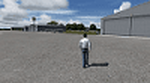
This package covers KPAH, Barkley Field airport in Paducah KY. It has two runways, 4-22 which is 6500 feet long and 14-32 which is 5499 feet long. It has scheduled airline service using CRJ's to Chicago each day. On one side of the field is the GA component with Midwest Aviation as the FBO. On the other side of the field is the airline terminal. All of the buildings are custom made from Google Maps including the new large armed forces reserve center. I also modeled the Nexrad radar which is on the field. I hope you enjoy!
| Filename: | KPAH_Paducah_KY.zip |
| License: | Freeware |
| Added: | 23rd June 2017, 01:09:14 |
| Downloads: | 442 |
| Author: | Shannan Landreth |
| Size: | 27.1 MB |
| Category: Flight Simulator 2004 - Scenery | |
| The Oaks Airfield |
|
File Description:
The Oaks Airfield is south west of Sydney and is the home of Ultralight flying
for Sydney enthusiasts and is a hive of activity most weekends. A number of
ultralight flying clubs use the airfield as well as some GA aircraft. I got a
"fix" on the Lat(S34* 05.13')/Lon(E150* 33.47') and altitude of 900ft using one
of the Sydney Ultralight Flying Club member's GPS.
I have also included a "fictional" AFCAD2 file which will make the airfield show up in fs9
and so you will have the ability to create flightplans to and from the airfield.
| Filename: | The_Oaks_Airfield.zip |
| License: | Freeware |
| Added: | 22nd December 2005, 16:02:25 |
| Downloads: | 703 |
| Author: | Mark Dickinson |
| Size: | 1.61 MB |


© 2001-2026 AVSIM Online
All Rights Reserved
Privacy Policy |