
Where Flight Simulation Enthusiasts Gather from Around the World!
AVSIM Library - Search Results

| Category: Flight Simulator X - AFCAD Files | |
| Essex County Airport (KCDW), NJ |

|
File Description:
Located 02 miles N of Caldwell, New Jersey on 275 acres of land, Essex County Airport is a public airport with two asphalt runways, the longest of which is 4552'. Major changes include Runway 9/27 updated to the current 10/28; Runway 4/22 markings are custom made to match the real world, with threshold stripes on Runway 22 only; the beacon has been relocated to its real world location atop the control tower. Additionally, 221 parking locations have been accurately placed around the airport, broken up into 6 sections. See the included airport diagram that labels the various parking areas. 89 of these parking spaces are labeled RAMP_GA and these spaces are occupied by static aircraft. Collision with all static aircraft is disabled but still, if you do not want to start occupying the same space as another airplane, do not choose parking spots labeled RAMP_GA. Instead, all user aircraft should choose either RAMP_GA_SMALL (for wingspans up to 40') or RAMP_GA_MEDIUM (for wingspans up to 60' and only available in East Parking). Also, only 86 of these parking spaces are available for AI aircraft to spawn in. There are hangars available to transient aircraft: the two in South and Southeast parking are able to accommodate small craft with wingspans up to 40'; the one in Northeast parking is able to accommodate larger aircraft with wingspans up to 54'. Helicopters can start either on Taxiway P (South helipad), Taxiway N (North helipad) or in front of the main terminal (East helipad). Fuel is available in both the East and South parking areas by stopping anywhere on the concrete next to the fuel tank/pump. Take note that the runway patterns are both Left and Right and the pattern altitude varies for aircraft type. There are known issues with the AI for this airport, see the ReadMe for more details.
Scenery constructed with use of satellite images/streetview/aerial photos - the author has not been there in person.
This scenery is meant to be used in conjunction with MegaScenery Earth New York 005. It is not required, but apron use is minimized to allow satellite scenery to show through as much as possible, and objects are placed based on the MSE textures - lack of it may make scenery look out of place.
| Filename: | Essex_County_Airport_KCDW_NJ.zip |
| License: | Freeware |
| Added: | 14th April 2011, 01:50:13 |
| Downloads: | 416 |
| Author: | Drew Sikora |
| Size: | 2.4 MB |
| Category: Flight Simulator X - Scenery | |
| Chicago Midway Airport V2 |
|
File Description:
This is my second version of Chicago Midway Airport in Chicago IL for FSX. This version was created with Airport Design Editor 1.30, which was designed exclusively for use with FSX. The following improvements have been made: 1. All commercial and GA aircraft will park at their assigned spots. All gates for all airlines are included. 2. The vehicle paths have been redesigned, which should eliminate the problem of airport vehicles using taxiways, which can cause taxiing airplanes to come to a standstill and cause traffic to back up. 3. When in tower view, the view will be from the roof of the control tower, thanks to Airport Design Editor. 4. Crosswind runways have been activated, which will open more runways to airline traffic. This is an optional feature, and will be explained in the Readme file. 5. Several fuel trucks have been added, and should serve departing aircraft quickly. 6. Settings have been changed in ADE so that all jetways will display as long as Scenery Density in FSX is set at Normal or higher. Please be aware that this scenery is for use with FSX only. It will not work with FS9.
| Filename: | Chicago_Midway_Airport__V2.zip |
| License: | Freeware, limited distribution |
| Added: | 30th June 2008, 08:50:03 |
| Downloads: | 4,811 |
| Author: | Patrick Finch |
| Size: | 39.13 KB |
| Category: Flight Simulator X - Scenery | |
| 1F2 - Plateau Sky Ranch - Edinburg, NY |
|
File Description:
Here is an improved version of the stock Plateau Sky Ranch. This is a privately owned field, open to the public. It consists of two grass runways and is located just north of the Great Sacandaga Lake.
In FSX, there were no buildings at all, so I added the hangar, and the hangars and planes that are located across a public road. I moved both runways because, with UTX, the road crossed both runways. Now the runways clearthe road. In FSX there were taxiways with hold-short lines, taxiway signs, etc, which didn't belong so they
were removed. I added a dirt driveway, parking area, fuel station, light pole, flag, and a couple of local houses and barn.
There is a lot of nice scenery in any direction from Plateau Sky Ranch. If you take off from runway 6 and follow the waterway you will come to the earthen Conklingville dam and the upper Hudson River.
I've added an extra file for UTX users called Boats.bgl. It will add several marinas and boats in correct locations on the Great Sacandaga Lake.
| Filename: | 1F2__Plateau_Sky_Ranch__Edinburg_NY.zip |
| License: | Freeware |
| Added: | 22nd March 2009, 17:44:40 |
| Downloads: | 1,347 |
| Author: | Jim Cook |
| Size: | 4.56 KB |
| Category: Flight Simulator X - AFCAD Files | |
| Southern Cross Airport (C01), NJ |
|
File Description:
Located 03 miles SW of Williamstown, New Jersey on 18 acres of land, Southern Cross is a public turf airstrip with an ample 2400' runway. The runway is hard surfaced in order to allow for AI traffic to use this airport, however the end user must enable flights to arrive/depart from this airfield within their AI traffic program in order for AI to appear here. Tie down space is available north of Runway 09 and fuel is available at the tank next to the hangar. This airport is not lit at night so daytime VFR operations only are recommended. In addition to trees at the ends of both runways, power lines are strung up across there too.
Scenery constructed with use of satellite images/streetview/aerial photos - the author has not been there in person.
This scenery is meant to be used in conjunction with MegaScenery Earth New Jersey/Delaware 004. It is not required, but apron use is minimized to allow satellite scenery to show through as much as possible, and objects are placed based on the MSE textures - lack of it may make scenery look out of place.
| Filename: | Southern_Cross_Airport_C01_NJ.zip |
| License: | Freeware |
| Added: | 25th March 2011, 16:38:00 |
| Downloads: | 192 |
| Author: | Drew Sikora |
| Size: | 630.77 KB |
| Category: Flight Simulator 2004 - Scenery | |
| Durban Island CWFB FOX-E DEW line station in Nunavut, Canada |
|
Images related to this file:
File Description:
Durban Island is 40 miles north of Cape Dyer on the southeast corner of Baffin Island, and around 60 miles southeast of Qikiqtarjuaq (known as Broughton until recently). Sitting on the top of the island is FOX-E, an intermediate station that was part of the DEW line. There is no runway (and once you have seen the island you will know why) and the station and its (usually) five man crew were supported by helicopter flights from Cape Dyer. The main feature is a 300' high mast, topped by comms gear to link both to Broughton to the north and Cape Dyer to the south. There was only one really habitable building, 80' x 30' in round figures, and this contained the generators, technical spaces, sleeping areas, kitchen, mess, and showers etc. There were also what were known as Anderson shelters, originally put up to house the construction crew and used in the summer for any maintenance people who visited for short periods. There was also a garage for a snow cat and tanks for fuel. And a view.
This post also includes new bgls for Cape Dyer to provide the 300' tower there too.
| Filename: | Durban_Island_CWFB_FOXE_DEW_line_station_in_Nunavu.zip |
| License: | Freeware, limited distribution |
| Added: | 1st July 2011, 22:11:33 |
| Downloads: | 316 |
| Author: | Roger Wensley |
| Size: | 1.87 MB |
| Category: Flight Simulator X - AFCAD Files | |
| Suwannee County Airport - 24J |
|
Images related to this file:
File Description:
Located two miles west of the bustling town of Live Oak, Suwannee County Airport is a public use airport serving 40,000+ citizen of Suwannee County, Florida. Featuring a newly resurfaced 4,000ft runway
with numerous lighting upgrades, this airport is quickly becoming a frontrunner in GA service for Northern Florida. Home to Fessler Aviation and Suwannee County FBO, and the rapidly-developing Suwannee Landing residential community, this is a great fuel stop for inbound/outbound
pilots and virtual aviators alike! Come visit this quickly expanding airport!
Things added:
Expanded Taxiway "A" all the way to Runway 7 (which was paved in back in 1999, I do not know how ACES/Microsoft missed this...)
Lengthened Runway 7/25 from 4,035ft to its actual 4,037 feet
Added appropriate runway markings per real life
Added appropriate VASI and runway lighting systems per real life
Fixed the taxiway width and adjusted it to proper coordinates
Added 24 parking spots!
Moved Tower Viewpoint to FBO location
Increased traffic scalar from 0.70 to 1.00
Added AWOS frequency and adjusted the names of the UNICOM/CTAF
Changed apron texture from Asphalt to Concrete and added sections of temp resurfacing (all appropriate to RL airport)
Added taxiway signs
| Filename: | Suwannee_County_Airport__24J.zip |
| License: | Freeware |
| Added: | 27th January 2012, 15:16:50 |
| Downloads: | 212 |
| Author: | Alex Melia |
| Size: | 335.29 KB |
| Category: Flight Simulator 2004 - Scenery | |
| Embrun CPR2 in Ontario Canada 2012 Revision |
|
Images related to this file:
File Description:
Embrun is in Ontario a few miles southeast of Ottawa, and southwest of my posted strips Russel Farm, Russellet Strip, and Indian Creek. It is a real airfield, used by Embrun Flying Club, and there is now fuel since the owner built a house on the field and moved in, and more hangars than there used to be. All in all a nice airfield with a grass runway 2,260 feet long, and in this REVISED version with a new windsock. There are electric cables strung along the road at the eastern end of the runway, marked by visibility balls; watch out for those. At the western end there are some old grain silos; these shouldn't be a problem, and if you are flying a taildragger give you something to aim at until the tail comes up. I did my first grass field landing and take off there when I was learning to fly, and it is just the right distance from Rockcliffe for a nice afternoon training flight. Look out for geese taking off from the fields to the west when you use 26; that departure from Embrun along with 50 geese was more entertaining than most.
| Filename: | Embrun_CPR2_in_Ontario_Canada_2012_Revision.zip |
| License: | Freeware, limited distribution |
| Added: | 9th February 2012, 01:31:31 |
| Downloads: | 303 |
| Author: | Roger Wensley |
| Size: | 3.8 MB |
| Category: Flight Simulator X - AFCAD Files | |
| MYGF - Grand Bahama International Airport / Freeport, Bahamas |
|
Images related to this file:
File Description:
Features:
*Accurate parking apron
*Main terminal building with parking area for commercial traffic
*Domestic terminal building
*Cargo ramp
*Separate parking area for GA traffic
*Misc airport buildings added
*Airport vehicles and objects throughout the airport
*Parking lot with vehicles
*Properly placed control tower
*Fire station
*Fuel tanks and trucks
*Rental car building with static rental vehicles
*Birds flying near runway (beware)
*Palm trees/vegetation added near terminal
(For more information on Endeavourai please visit our site at endeavourai.com or our forums at http://endeavourai.boards.net/)
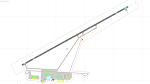
This airport update was made with the latest version of ADE (Airport Design Editor) and made for FSX as a replacement for the stock (default) airport. I've made several changes to the airport which are listed below. All these enhancements are as close to the real airport as I can get with stock library objects. I've used satellite images, terminal photos and maps throughout the whole process so building locations are as accurate as possible. Happy landings in the tropical Bahamas!
| Filename: | MYGF__Grand_Bahama_International_Airport__Freeport.zip |
| License: | Freeware |
| Added: | 12th August 2012, 05:15:17 |
| Downloads: | 954 |
| Author: | Jaison Diaz / Endeavour AI |
| Size: | 107.42 KB |
| Category: Flight Simulator X - Scenery | |
| NZWV - Waihi Beach Airfield, New Zealand |
|
Images related to this file:
File Description:
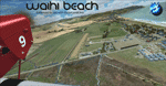
Waihi Beach (ICAO: NZWV) is a small airstrip north of Tauranga and near the small beach settlement of the same name, in the Bay of Plenty of New Zealand. It is a grass strip with offset thresholds giving usable landing lengths of 640m and 517m for RWY 13 and 31 respectively, a width of 55m and a group rating of 5. No night lighting or fuel is available. A very basic airstrip, there is only one recently built hanger and the airstrip is slowly being encroached on by
new housing developments. The airstrip itself is usually very sodden due to its low elevation but is a nice stop over for sightseeing from Tauranga and up the Coromandel peninsula.
The FSX model includes custom textures and models placed on a high resolution aerial image and a 15m mesh. It makes extensive use of items from the free VLC object libraries which are required to be installed (Available from www.vectorlandclass.co.nz Downloads menu). This scenery and
the VLC libraries have been funded by sales of VectorLandClass and although you do not need VLC to use it, your purchase helps further development.
| Filename: | NZWV__Waihi_Beach_Airfield_New_Zealand.zip |
| License: | Freeware, limited distribution |
| Added: | 1st November 2012, 10:01:38 |
| Downloads: | 1,006 |
| Author: | Tim Barnes / VectorLandClass |
| Size: | 11.13 MB |
| Category: Flight Simulator X - AFCAD Files | |
| KLEX - Blue Grass Airport - Lexington, Kentucky |
|
Images related to this file:
File Description:
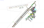
This airport update was made with the latest version of ADE (Airport Design Editor) and made for FSX as a replacement for the stock (default) airport. I've made several changes to the airport which are listed below. All these enchancements are as close to the real airport as I can get with stock library objects. I've used satellite images, terminal photos and maps throughout the whole process so building locations are as accurate as possible. Happy landings in charming Kentucky!
Features:
*Expanded parking apron
*Taxiways properly desginated
*Runway 8/26 renamed to 9/27 and moved to correct location as FSX had it completely wrong, appropriate taxiways have been repositioned and/or removed as well as per latest airport diagram
*Completely redesigned main terminal building with accurate airline assigned gates
*Seperate parking areaa for GA traffic
*Misc airport buildings added
*Airport vehicles and objects throughout the airport
*Fuel tanks and vehicles
*Fire station and vehicles
*De-icing trucks
*Static aircraft
*Autogen removed from a few areas around the airport as several buildings were popping up on airport property and a few trees were too close to runway
| Filename: | KLEX__Blue_Grass_Airport__Lexington_Kentucky.zip |
| License: | Freeware |
| Added: | 22nd December 2012, 00:03:01 |
| Downloads: | 599 |
| Author: | Jaison Diaz / Endeavour ai |
| Size: | 153.05 KB |


© 2001-2026 AVSIM Online
All Rights Reserved
Privacy Policy |