
Where Flight Simulation Enthusiasts Gather from Around the World!
AVSIM Library - Search Results

| Category: Fly! II - Miscellaneous Files | |
| Switzerland Flight Plan |

|
File Description:
This flight plan is from the St. Gallen Altenrheim Airport, Switzerland to the Bern-Belp Airport (LSZB), Switzerland. Some of the airports included in this flight plan are by Danny H. Masson. Included are waypoints and navaids. The flight plan has 12 airports. Also included is a metar file. Web links are provided to download the airport diagrams.
| Filename: | Switzerland_Flight_Plan.zip |
| License: | Freeware |
| Added: | 2nd September 2005, 16:11:29 |
| Downloads: | 70 |
| Author: | Wayne Roberts |
| Size: | 17.19 KB |
| Category: Flight Simulator X - Aircraft Repaints, Textures and Modifications | |
| Suncountry Boeing B737-800 |
|
File Description:
MN Airlines, LLC, operating as Sun Country Airlines, is an American low-cost airline headquartered in the Minneapolis-St. Paul suburb of Mendota Heights, Minnesota. Sun Country uses nearby Minneapolis-Saint Paul International Airport (MSP) as its main hub and flies scheduled and charter flights from the Humphrey terminal to destinations in the United States, Mexico, and the Caribbean.
| Filename: | Suncountry_Boeing_B737800.zip |
| License: | Freeware |
| Added: | 14th December 2008, 12:06:06 |
| Downloads: | 884 |
| Author: | Andreas Spyrou |
| Size: | 9.59 MB |
| Category: Flight Simulator 2004 - Scenery | |
| CTH3 Canada, Quebec, Les Grandes-Bergeronnes |
|
Images related to this file:
File Description:
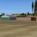
This is the scenery Les Grandes Bergeronnes (CTH3), which represents the reality. Les Grandes Bergeronnes is a small village located on Northern bank of the St-Laurent river of Quebec at Canada. This scenery is designed with FSDS and it accepts Mesh of Gilles Gauthier. This scenery functions for both FS-2004 and FS-X.
| Filename: | CTH3_Canada_Quebec_Les_GrandesBergeronnes.zip |
| License: | Freeware |
| Added: | 2nd January 2010, 19:29:43 |
| Downloads: | 375 |
| Author: | Regis Dassylva |
| Size: | 2.32 MB |
| Category: Flight Simulator 2004 - Scenery | |
| Princess Juliana Int'l (TNCM) |
|
Images related to this file:
File Description:
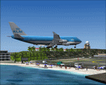
Princess Juliana Int'l Airport, v1.2. Scenery of TNCM, Princess Juliana International Airport of St-Maarten in the Netherlands Antilles. Adds an ILS on runway 9 though in reality Juliana airport is not equipped with this instrument. Adds the weather station, cars on the airport parking, extends the hill near Maho hotel and adds the Juliana heliport. By Delblond Christian.
| Filename: | Princess_Juliana_Intl_TNCM.zip |
| License: | Freeware |
| Added: | 8th June 2022, 00:35:24 |
| Downloads: | 717 |
| Author: | Delblond Christian |
| Size: | 4.76 MB |
| Category: Flight Simulator X - Sounds | |
| Aeroflot CrewPack Airports: ULLI for FS Announcement Panel v2.0 |
|
Images related to this file:
File Description:
This update adds an announcement after landing at the Pulkovo Airport (IATA: LED, ICAO: ULLI), St. Petersburg. For the FS Announcement Panel v2.0 Aeroflot CrewPack. IMPORTANT: FS Announcement Panel v2.0 and Aeroflot Crewpack are required and should be installed prior to installing the update.
You can evaluate the sound quality in this video:
https://youtu.be/EWw4-GSjT68
| Filename: | Aeroflot_CrewPack_Airports_ULLI_for_FS_Announcemen.zip |
| License: | Freeware, limited distribution |
| Added: | 2nd January 2018, 18:09:10 |
| Downloads: | 156 |
| Author: | Gene Churumov |
| Size: | 720.5 KB |
| Category: Flight Simulator 2004 - AFCAD Files | |
| Mustique Island, Saint Vincent and the Grenadines (TVSM) |
|
File Description:
Afcad2 for TVSM, The island of Mustique, St Vincent and the Grenadines, in the Carribean. By default this has a runway only so I have added some parking ramps, in addition I have entered a tower frequency and added VASI 2 lights to each end of the runway. Hope some of you find it useful. www.matva.org.uk
| Filename: | Mustique_Island_Saint_Vincent_and_the_Grenadines_T.zip |
| License: | Freeware |
| Added: | 20th March 2005, 23:33:41 |
| Downloads: | 551 |
| Author: | Louie Maclennan MATVA |
| Size: | 1.52 KB |
| Category: Flight Simulator X - AI Flight Plans | |
| Retro Capitol Air 1994 AI Package |
|
File Description:
Capitol Air leased 2 Empire Air Metroliners and began operating flights to Chicago Midways and Milwaukee from the St. Paul Downtown Airport(STP) near Minneapolis rather than the Minneapolis/St. Paul Airport(MSP) which was used for all commercial service in the area at the time. Air LA bought the airline in January 1995 and continued the STP-based flying with their own aircraft for a few months until Air LA folded in September of 1995. These plans represent the airline in 1994 pre-merger based on a Feb 94 flight schedule. My Air LA 1995 plans are post-merger, so if you install them as well, I recommend that you delete the 2 aircraft doing the STP/MDW/MKE flying so as not to have duplicate flights. Includes a repaint for the DJC Metroliner.
| Filename: | Retro_Capitol_Air_1994_AI_Package.zip |
| License: | Freeware |
| Added: | 7th February 2017, 05:07:17 |
| Downloads: | 97 |
| Author: | chasen richardson |
| Size: | 703.35 KB |
| Category: Flight Simulator 2004 - Scenery | |
| VFR of Lario, Area B3 - Como lake, Italy |
|
Images related to this file:
File Description:

This 13th scenery covers approximately an area of 7.5x6 kmt, from Barni (NW) to the southern Grigna mountain (NE), from Canzo (SW) to Barro mountain (SE); some of specific buildings are included, as the Moto Guzzi rowing club (Mandello), the monument to Antonio Stoppani, the St. Nicolao church and bell tower, the Social theater with Giuseppe Garibaldi's monument, the war Memorial, the Rowing club building and the Kennedy bridge (Lecco); are included two NLC piers (Abbadia Lariana and Lecco) and the motorboat Ninfea of the NLC navigation; from Mandello to St. Martino mountain several sections of the freeway SS36 are included, with overpasses and tunnels. Some other minor boats and docks are placed alongside the lake coast.
Check video available here: http://youtu.be/EPPto_dCkSE
| Filename: | VFR_of_Lario_Area_B3__Como_lake_Italy.zip |
| License: | Freeware |
| Added: | 30th May 2013, 23:34:58 |
| Downloads: | 810 |
| Author: | Aldo Della Vedova, Daniele Lanfranchi, Gian Mario Verga |
| Size: | 24.01 MB |
| Category: Flight Simulator 2004 - Scenery | |
| E T Joshua TVSV on Saint Vincent in the eastern Caribbean |
|
Images related to this file:
File Description:
Saint Vincent island is the northernmost of the group of islands known as St Vincent and the Grenadines, just south of St Lucia. St Vincent is around 17 miles long and 10 miles wide and by far the largest in the group, and the islands have a total population of around 120,000. E T Joshua is at the southern end of the island, adjacent to the capital Kingstown. There is a new airport under construction a few miles to the east which will have a longer runway and a larger apron, and when it is ready E T Joshua will probably be closed and redeveloped.
The terminal and the other smaller buildings are all made with photographic textures; the terminal is now quite old and has seen better days. The airport is a hub for small local airlines and also has regular LIAT flights connecting to other islands. The runway is just a shade under 4,700 feet of asphalt, so there are no direct flights from Europe. The new airport to the east is depicted as under construction; obviously I have not flown there and I have not tried to depict the terminal building which is also under construction but a mystery to me.
| Filename: | E_T_Joshua_TVSV_on_Saint_Vincent_in_the_eastern_Caribbean.zip |
| License: | Freeware, limited distribution |
| Added: | 11th June 2013, 16:29:42 |
| Downloads: | 536 |
| Author: | Roger Wensley |
| Size: | 3.13 MB |
| Category: Flight Simulator 2004 - Scenery | |
| TNCS - Juancho E. Yrausquin Airport - Saba, Netherlands Antilles |
|
Images related to this file:
File Description:
This island is the smallest municipality of the Netherlands. Saba is just under 30 miles south of St. Maarten, the island that was split between France and the Netherlands; to the southeast and 20 miles away is the small island of St. Eustatius, then St Kitts and then Nevis. The island comes out of the water like the top of Everest and keeps going, and there is no large space for a runway and no possibility of creating one with landfill with those steep sea cliffs. So what you have is a small runway (aligned 12/30) of 1,000 feet plus over-runs at each end that have small "closed" markings (see the white crosses) for a usable total of around 1,300 feet.
The airport restricts access as there is only space for four planes to park, plus a helicopter. And of course there is also the short runway to contend with. Landings are carried out under waivers issued by the Netherlands Civil Aviation Authority, and will always be on runway 12 as the southeast trade winds predominate. Twotters land there but only in real life; FS9 AI Twotters don't seem to find it adequate. There is no fuel or any other facility except for a small terminal building and a car park.
| Filename: | TNCS__Juancho_E_Yrausquin_Airport__Saba_Netherland.zip |
| License: | Freeware, limited distribution |
| Added: | 8th May 2013, 02:52:26 |
| Downloads: | 1,500 |
| Author: | Roger Wensley |
| Size: | 3.09 MB |


© 2001-2026 AVSIM Online
All Rights Reserved
Privacy Policy |