
Where Flight Simulation Enthusiasts Gather from Around the World!
AVSIM Library - Search Results

| Category: Flight Simulator X - Scenery | |
| Flattening Patch for FSX Tarija (SLTJ), Bolivia When Used with FreeMeshX |

|
Images related to this file:
File Description:
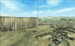
That is a flattening patch for the airport of Tarija (SLTJ), Bolivia when using FreeMeshX terrain by NineTwo Production, a freeware global terrain mesh for FSX. Comes with a French readme too. Freeware
| Filename: | Flattening_Patch_for_FSX_Tarija_SLTJ_Bolivia_When_.zip |
| License: | Freeware |
| Added: | 18th January 2017, 17:11:39 |
| Downloads: | 225 |
| Author: | G. Guichard |
| Size: | 125.39 KB |
| Category: Flight Simulator X - Panels | |
| FIX - FS9, FSX Panel for Savoia Marchetti SM 79 (sm79_sp1.zip) |
|
File Description:
FIXES PROBLEMS of a PREVIOUS RELEASE.
This panel was created from original pictures and it is intended to be a good compromise between historical accuracy (see enclosed .jpg pictures) and the need to concentrate the most frequently used controls in one window. For this reason there are some differencies in gauges location from the VC provided with the aircraft. The most relevant are the addition of a small side panel to host light switches, and the location of the autopilot on the left of the cockpit.
Since this SM 79 is one of the most beautiful freeware airplanes available (both graphic and dynamic models wise), to ease her usage a modern days navigation kit is also available.
Uses original SM 79 package gauges plus some additional ones (included).
| Filename: | FIX__FS9_FSX_Panel_for_Savoia_Marchetti_SM_79_sm79.zip |
| License: | Freeware |
| Added: | 12th February 2008, 23:42:13 |
| Downloads: | 831 |
| Author: | Ezio Sibilla |
| Size: | 1.35 MB |
| Category: Flight Simulator X - Missions | |
| Discover FSX flight 4 : (YMAY) - (YMLT) (404 NM) (Regional Commuter Service) |
|
File Description:
(Albury, Australia, (YMAY) - Launceston, Tazmania. Australia (YMLT)----- You have been contacted by operations and informed that you will be commanding tomorrows regional commuter jet service flight to Tazmania's Launceston Airport, enjoy the High Speed Approach.
(Just place the included PLN file (Plan File) in your saved routes folder and load it from the FSX flight planner)
| Filename: | Discover_FSX_flight_4__YMAY__YMLT_404_NM_Regional_.zip |
| License: | Freeware |
| Added: | 4th November 2007, 08:12:44 |
| Downloads: | 2,629 |
| Author: | Ali Zied |
| Size: | 523.79 KB |
| Category: Flight Simulator X - Aircraft Repaints, Textures and Modifications | |
| United States Marine Corp KC-130J/C-130J, VMGR-352 FSX |
|
File Description:
This repaint depicts a KC-130J (Pods removed) from the US Marine Corp VMGR-352 based at MCAS Miramar. This repaint requires Captain Sim's "C-130Xperience Extra Pack I" and is 100% ACE compliant. This is an update of my FS9 version.
| Filename: | United_States_Marine_Corp_KC130JC130J_VMGR352_FSX.zip |
| License: | Freeware |
| Added: | 31st July 2008, 16:11:01 |
| Downloads: | 693 |
| Author: | David (Dax) Sweetman & Captain Sim |
| Size: | 2.26 MB |
| Category: Flight Simulator X - Aircraft Repaints, Textures and Modifications | |
| Westfalia Express va - McDonnell Douglas MD11F Cargo livery (pmdg fsx version) |
|
File Description:
We are a german virtual airline who fly in the IVAO network. This is the livery from our McDonnell Douglas MD11F Cargo in "Westfalia-Express va" colors for FSX. The original aircraft (payware) from "PMDG" is required. Feel free to visit us under www.westfalia-express.de.
| Filename: | Westfalia_Express_va__McDonnell_Douglas_MD11F_Carg.zip |
| License: | Freeware, limited distribution |
| Added: | 11th January 2009, 03:52:55 |
| Downloads: | 75 |
| Author: | Karsten Schwegmann |
| Size: | 1.13 MB |
| Category: Flight Simulator X - Miscellaneous Files | |
| Correcting Prop Issues with FSX & Service Pack 2 - An Illustrated Tutorial |
|
Images related to this file:
File Description:
Correcting Prop Issues with FSX & Service Pack 2 - An Illustrated Tutorial.
Improper display of aircraft propellers when using FS2004 aircraft in FSX with Service pack 2 is a well known issue. The "fix" has been documented in several forum posts but I thought an Illustrated tutorial outlining the correction steps would be useful. If I can do it, anyone can.
Compiled in .Doc and .PDF formats for your flying enjoyment by David "Opa" Marshall.
| Filename: | Correcting_Prop_Issues_with_FSX__Service_Pack_2__A.zip |
| License: | Freeware |
| Added: | 22nd December 2009, 15:00:35 |
| Downloads: | 2,656 |
| Author: | David "Opa" Marshall |
| Size: | 1.27 MB |
| Category: Flight Simulator 2004 - Scenery | |
| Canyonlands National Park South, Monticello (U43), Utah, Photo-Scenery (FSX too) |
|
Images related to this file:
File Description:
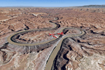
This scenery covers the southern part of Canyonlands National Park (Needles District) in Utah. The colorful layers of sand- and limestone that you can see today built over hundreds of millions years by advancing and retreating oceans as well as rivers that deposited huge amounts of sediment. About 15 million years ago these layers began to rise due to a colliding movement of plates in the earth's crust, forming what is today called the Colorado Plateau. As the land rose higher, erosion accelerated, resulting in countless canyons, mesas and buttes. The uplifting land caused the rivers to carve in even faster, resulting in the deep canyons of the Colorado and Green Rivers. The needles and fins in the Needles District have yet another story: First uplifts and later slides created a system of perpendicular cracks. Then he resulting crosshatched pattern of "joints" widened by erosion until only thin fins and needles of rock remained. The scenery extends my Arches National Park scenery to the south and brings you another 3.500 sq km in 4.7m/pix quality. To explore the scenery depart from Monticello (U43) and head north. YourDonation@Work: Dedicated to Nels, David and Michael. Thanks!
| Filename: | Canyonlands_National_Park_South_Monticello_U43_Uta.zip |
| License: | Freeware, limited distribution |
| Added: | 30th December 2009, 21:44:56 |
| Downloads: | 1,528 |
| Author: | Gottfried Razek - blueskyscenery.com |
| Size: | 95.76 MB |
| Category: Flight Simulator 2004 - Scenery | |
| Canyonlands National Park, The Maze-North, Utah, Photo-Scenery (FSX too) |
|
Images related to this file:
File Description:
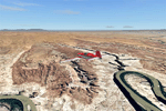
This is a re-upload of a package that was corrupted during the crash of the AVSIM library. The Maze is the wildest and least accessible district of Canyonlands National Park. It is a perplexing jumble of canyons that has been described as a '30 sq miles puzzle in sandstone'. The Maze covers the area west of the Green River and north of the Colorado River. Getting to most locations requires multiple hours of 4WD road driving. Hiking trails usually require multi day backpack trips.
Too strenous? Let's go flying! Checking out the area from an eagles perspective is certainly a stunning experience. The colors are awesome and the landforms are of breathtaking beauty. The scenery extends my Arches National Park scenery to the west and brings you another 3.500 sq km in 4.7m/pix quality. YourDonation@Work: Dedicated to Frans, Francois and James. Thanks!
| Filename: | Canyonlands_National_Park_The_MazeNorth_Utah_Photo.zip |
| License: | Freeware, limited distribution |
| Added: | 31st December 2009, 11:01:39 |
| Downloads: | 2,373 |
| Author: | Gottfried Razek - blueskyscenery.com |
| Size: | 92.88 MB |
| Category: Flight Simulator 2004 - Scenery | |
| Canyonlands National Park, The Maze-South, Utah, Photo-Scenery (FSX too) |
|
Images related to this file:
File Description:
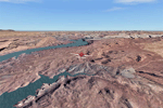
This is a re-upload of a package that was corrupted during the crash of the AVSIM library. This is the fourth package of the Arches/Canyonlands area. It covers the area southwest and including the confluence of the Colorado and Green Rivers. From there you can fly down Cataract Canyon which is famed for its premium whitewater rafting oportunities. Or explore the Maze (the area west of the Green and north of the Colorado River) with it's labyrinth of canyons and colorful sandstone formations. The scenery extends west to Hite (UT03) on Lake Powell. Brings the total Southern Utah coverage to 14.000 sq km in 4.7m/pix quality. YourDonation@Work: Dedicated to Patrick, Hideyuki and Art. Thanks!
| Filename: | Canyonlands_National_Park_The_MazeSouth_Utah_Photo.zip |
| License: | Freeware, limited distribution |
| Added: | 31st December 2009, 22:33:46 |
| Downloads: | 2,085 |
| Author: | Gottfried Razek - blueskyscenery.com |
| Size: | 95.67 MB |
| Category: Flight Simulator 2004 - Scenery | |
| Lake Powell, Navajo Mountain (04UT), Utah/Arizona, Photo-Scenery (FS9 & FSX) |
|
Images related to this file:
File Description:
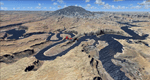
This package contains the center of Lake Powell and the Navajo Nation around Navajo Mountain. It contains remote areas of stunning beauty. Wonderful sandstone formations in bright shades of red and pink. Contains landmarks like the Rainbow Bridge National Monument and the confluence of the Colorado and San Juan Rivers. Extends my Monument Valley scenery to the west and brings you another 3.500 sq km in 4.7m/pix quality. To explore the scenery depart from Navajo Mountain dirt strip (04UT). High resolution versions of this scenery for FS9 and FSX (much sharper, but larger and multiple downloads) are available at www.blueskyscenery.com/CNY_South3West2.html . The screenies are taken from the high-res versions, so expect this version to be slightly more blurry. YourDonation@Work: Joaquin, Donald and Scott.
| Filename: | Lake_Powell_Navajo_Mountain_04UT_UtahArizona_Photo.zip |
| License: | Freeware, limited distribution |
| Added: | 23rd January 2010, 23:06:49 |
| Downloads: | 1,788 |
| Author: | Gottfried Razek - blueskyscenery.com |
| Size: | 91.43 MB |


© 2001-2026 AVSIM Online
All Rights Reserved
Privacy Policy |