
Where Flight Simulation Enthusiasts Gather from Around the World!
AVSIM Library - Search Results

| Category: Flight Simulator X - Scenery | |
| Slovenia - LOD11 (19 meters resolution) Mesh |

|
Images related to this file:
File Description:
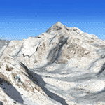
Slovenia, no matter how small, is a country with wide variety of landscapes.
From flat lands in the North-Eastern part one can see lovely rolling hills in
southern regions and razor sharp edges of 8500 ft peaks of the Alps in the
North-Western region.
SRTM elevation data that was used and is provided as default FS X terrain simply
can't cope with the task of representing our terrain in at least a little close
to reality manner, shapes and altitudes of some of our nicest peaks are deformed
beyond recognition, our highest mt. Triglav is with 38 meters SRTM mesh falling
short by almost 3000 ft!
So Slovenia Scenery Team developed this 19 meters resolution using FSX compatible
tools for it's payware scenery, but after development of even finer mesh with 10
meters resolution, we decided to offer the original 19 meters mesh to general
fligt simulation public. Mesh is FS X only and is not compatible with FS9.
Even if released as freeware, this files were uploaded to only some selected
flight simulation sites and redistribution of this scenery is not allowed without
written permission from the authors.
File is packed into a convenient installer that should perform all of the actions
automatically, but, please, do read the License agreement and "Read me" file
included in the installation.
| Filename: | Slovenia__LOD11_19_meters_resolution_Mesh.zip |
| License: | Freeware, limited distribution |
| Added: | 15th May 2012, 19:03:19 |
| Downloads: | 2,216 |
| Author: | SST - Slovenia Scenery Team |
| Size: | 45.15 MB |
| Category: Flight Simulator 2004 - Scenery | |
| Nicholson Peninsula CWNP & Liverpool Bay CWLB DEW sites in Northwest Territories, Canada |
|
Images related to this file:
File Description:
These are DEW line sites in northern mainland Canada, to the east of Tuktoyaktuk.
Nicholson Peninsula is 100 miles east of Tuktoyaktuk and was not included in FS9. The peninsula is sometimes more like an island than a peninsula as it is barely connected to the mainland and at times is not connected at all (see the current Gogle Earth!). At the northern end there is another long and narrow gravel bar that is formed by the tide and currents and the gravel runway is on the top of this. It is now officially closed, but is still usable. The annual refuelling and maintenance to the NSW station up on the hills is carried out from a barge that lands tanker trucks onto the shore for the drive up the existing gravel roads that have been there since the early DEW station was established.
Liverpool Bay is 50 miles east of Tuktoyaktuk, up on higher land at around 300 feet ASL. The NWS (there was no previous DEW station at this site) is serviced by helicopter from Tuktoyaktuk or from a barge a mile away on the beach. There is a gravel landing pad on the north side of the station. To answer your question, the three little houses on stilts are actually fuel tanks for the generators, shaped to shed snow.
| Filename: | Nicholson_Peninsula_CWNP__Liverpool_Bay_CWLB_DEW_s.zip |
| License: | Freeware, limited distribution |
| Added: | 17th July 2012, 18:55:24 |
| Downloads: | 238 |
| Author: | Roger Wensley |
| Size: | 1.84 MB |
| Category: Flight Simulator 2004 - Scenery | |
| PASN St Paul Island in Alaska |
|
Images related to this file:
File Description:
This is St Paul Island airport, plus the town and the harbour which has featured alongside Dutch Harbor in the tv series Deadliest Catch.
St Paul is in the Pribilof group of five islands around 250 miles north of Dutch Harbour. The town has a population of less than 600, so a lot smaller than Dutch Harbour and with only one processing plant, Trident.
The Ai includes a PenAir flight, a Coast Guard C-130, and Coast Guard helicopters; sea AI includes a fishing boat and a Coast Guard cutter. The Coast Guard C-130 and helicopter flights are to Dutch Harbor, so both sceneries are required to make it work as it should. The airport has 6,500 feet of 150 feet wide asphalt with 1,000 feet of over-run at each end, aligned 36/18, lit, and with two aprons at the southern end. There is no hangerage except for Coast Guard helicopters. Runway 36 has at its northern end a hill.
In real life the runway slopes up to the north by over 60 feet, but in FS9 it doesn't; hence the change in airport elevation to 80 feet ASL to get the northern end at least partly out of a box canyon. There is fuel available and it is dispensed from a truck, there are no pumps.
| Filename: | PASN_St_Paul_Island_in_Alaska.zip |
| License: | Freeware, limited distribution |
| Added: | 12th August 2012, 17:39:02 |
| Downloads: | 1,101 |
| Author: | Roger Wensley, Sidney Schwartz |
| Size: | 4.06 MB |
| Category: Flight Simulator 2004 - AI Flight Plans | |
| Chilean Transports and Tankers Complete AI Package |
|
Images related to this file:
File Description:

The members of Military AI Works are proud to bring you this freeware AI package, produced by Mike Guenthner in conjunction with Military AI Works and adds the three recently acquired KC-135E aircraft of the Chilean Air Force (FACh) as well as their C-130B aircraft to your FS9 skies.
This package is the first release of the MGAI KC-135E model which is based on the original MAIW KC-135R AI model and shares the same animations and features as its newer cousin. The Henry Tomkiewicz C-130 AI models round out the included military aircraft in this package.
These three Hercules AI aircraft were originally released in 2007 as part of the "MAIW Exotic Alberts" package. If you have previously installed the "Exotic Alberts Chile" package, you should remove all contents from that package prior to installing this package. We have updated the textures for these C-130B aircraft as well as made some other minor changes to them which reflect the changes that have occurred since 2007.
Credits:
Models by Mike Guenthner and Henry Tomkiewicz;
FDE/Effect by Mike MacIntyre and Henry Tomkiewicz;
Repaints by Graham King and Mark Walsh;
Flightplans by Desmond Burrell and Barry Taylor;
VCPs by Stewart Pearson;
Scenery Libraries and Placement by John Stinstrom and Mark Campbell
| Filename: | Chilean_Transports_and_Tankers_Complete_AI_Package.zip |
| License: | Freeware |
| Added: | 9th December 2012, 19:20:59 |
| Downloads: | 664 |
| Author: | Mike Guenthner, Military AI Works (MAIW) |
| Size: | 7.87 MB |
| Category: Flight Simulator 2004 - Scenery | |
| Ontario Small Fields in Canada: #05 Pelee Island (CYPT) |
|
Images related to this file:
File Description:
This is the fifth in a series of small airfields in southern Ontario Canada, Pelee Island CYPT, an airfield on the island in Lake Erie and the southernmost airfield in Canada. The airfield has an asphalt runway of 3,300 feet, aligned 09/27 in FS9 while today in real life it is 10/28 due to the wandering magnetic pole. There is also a second runway, 36/18 and around 1,500 feet of gravel. There is a small terminal building which now has blue cladding; here it is still in the dirty yellow of the original colour scheme.
This version is based upon what appears to be a "lost" 2005 scenery of Pelee Island. When I started to make Pelee Island I discovered that in fact I already had a version installed; my memory can be excused, as I installed it in 2005. I modified the scenery to include parking, taxiways that connected, revised runway markings, new windsocks, new signage, larger apron, parked cars and planes, revised landclass, AI, etc. My intention was to instruct you to download and install the original and then incorporate my changes. Problem: it does not appear to exist for download; perhaps it was washed away when the Avsim site crashed. I have included it in this post. If anyone knows who made it please let me know.
| Filename: | Ontario_Small_Fields_in_Canada_05_Pelee_Island_CYP.zip |
| License: | Freeware, limited distribution |
| Added: | 5th August 2015, 18:52:25 |
| Downloads: | 171 |
| Author: | Roger Wensley |
| Size: | 4.39 MB |
| Category: Flight Simulator 2004 - Scenery | |
| Alaska South Slope 3; Kiana PAIK |
|
Images related to this file:
File Description:
The town of Kotzebue is in the far northwest of Alaska, and served by Alaska Airlines. These are villages to the (mostly) east of Kotzebue on the South Slope of the Brooks Range of mountains, served by local flights from Kotzebue. There will be further additions. Kiana is a small village (population now around 360) on the bank of the Kobuk River, around 60 miles east of Kotzebue. The airfield, called Baker Memorial, is just north of the village, with 4,000 feet of lit gravel aligned 06-24 (as are several other runways in the area) with PAPI on 24. There are scheduled flights by Era (now renamed Ravn) and by Bering Air, both of them originating in Kotzebue and routing east to Noorvik, Kiana, Ambler, Shungnak, Kobuk, and then back again. The AI includes these flights along with Everts Air and Northern Air Cargo flights and GA. In real life the runway is around 200 yards closer to the village; this complicated the removal of roads and revised ground textures so I left it as is to make my life easier. The post includes missing night textures that were omitted from the post of Noatak PAWN. Noatak also has incorrectly installed original FS9 taxiway lights that were, as a result, impossible to remove. I had hoped to somehow manage it, but there is no way.
| Filename: | Alaska_South_Slope_3_Kiana_PAIK.zip |
| License: | Freeware, limited distribution |
| Added: | 7th September 2016, 22:00:17 |
| Downloads: | 214 |
| Author: | Roger Wensley |
| Size: | 4.5 MB |
| Category: Flight Simulator 2004 - Scenery | |
| Mackenzie CYZY in British Columbia, Canada |
|
Images related to this file:
File Description:
Mackenzie is around 120 miles west of Peace River and the BC/Alberta border, at the southern end of Williston Lake. The lake is 135 miles long and the population of the town is about 3,500; those figures illustrate typical Canada, a huge area enjoyed by the few. The main occupations relate to timber and mining in some form, plus tourism (in particular winter sports tourism). The airport is 2 miles southwest of the town, with no regular scheduled flights but it is not unusual to find Central Mountain Air there delivering either charter passengers or freight. The single runway is aligned 16-34 and 100 feet wide lit asphalt that is just over 5,000 feet long, with (in 2010 or so) an additional 1,500 feet of gravel. There is PAPI at both ends of the asphalt. The largest operation based at the airfield is a helicopter company, at the northern end of the apron. There is a "mandatory frequency" of 123.5 which is a Canadian invention; you MUST have a radio. There is no control tower at the actual airfield, and if or when there is no response from further afield then you announce your intentions etc. In FS9 there is no way to "switch off or on" the monitoring of a MF radio frequency so you will find that this one is always silent.
| Filename: | Mackenzie_CYZY_in_British_Columbia_Canada.zip |
| License: | Freeware, limited distribution |
| Added: | 27th December 2018, 20:19:05 |
| Downloads: | 135 |
| Author: | Roger Wensley |
| Size: | 19.81 MB |
| Category: Flight Simulator 2004 - Aircraft Repaints, Textures and Modifications | |
| VT ANG Air Museum Collection - Part 2 |
|
File Description:
The Vermont Air National Guard was organized on 1 July 1946 at Burlington Municipal Airport and was federally recognized as the 134th Fighter Squadron on 14 August 1946 making it the fifth US ANG unit so formed and recognized. Since that time the VT ANG has flown eight different aircraft types in its primary mission and several more in support of it. The primary mission aircraft flown include the P-47D-40, P-51D-25, F-94B, F-89J, F-102A, EB-57B, F-4D, F-16A and the current F-16C. The mission support aircraft flown include the L-5, AT-6C, AT-11, C-47B, T-33A, C-45H (?), C-54G, C-131D, C-12F and C-26A. The VT ANG has a small air museum near the main gate to their base at Burlington
International Airport which currently includes a T-33A, F-94B, F-89J, F-102A, F-4D, C-47B, C-45H and C-131D. My virtual VT ANG Air Museum Collection for FS9 is an attempt by an old 134th FS veteran to duplicate and expand upon the actual VT ANG Air Museum. This second download package, vamc2.zip, includes my VT ANG repaints of the AT-6G Texan by Cliff Presley, the P-51D Mustang by Andrew Wai and the P-47D Thunderbolt by Krzysztof Malinowski/Greg Pierson/Tom Kohler.
| Filename: | VT_ANG_Air_Museum_Collection__Part_2.zip |
| License: | Freeware, limited distribution |
| Added: | 9th March 2004, 00:28:31 |
| Downloads: | 865 |
| Author: | Mike MacIntyre |
| Size: | 7.17 MB |
| Category: Flight Simulator 2004 - Original Aircraft | |
| Savoia Marchetti S.79CS "Sparviero/Corsa-Transatlantico" |
|
Images related to this file:
File Description:

Civilian "CS" (Competizione Sportiva=Sporting Race) versions of the known medium and torpedo bomber Savoia-Marchetti S.79 "Sparviero", deployed by Regia Aeronautica, or Italian Royal Air Force, were successfully flown (w/civil marks) in the "Istres-Damascus-Paris (Lindberg Cup)" 1937 air race, where they ranked the first three places of the final scoreboard. The also "civilian" "T" (Transatlantic) version of the very same S.79 performed exceptionally in the 1938 Atlantic crossing Roma-Dakar-Rio de Janeiro and in a 1939 experimental test meant to verify the feasibility of an airline passengers and mail line between Italy and South America for the civilian airlines (Ala Littoria S.A.- Linee Aeree Atlantiche, later called L.A.T.I./Linee Aeree Transcontinentali Italiane) over the routes of Southern Atlantic Ocean.
3 new different GMax models, covering 3 different versions of the civilian S.79 described above and featuring the standard animated parts, such as all flight controls, props pitch and leading-edge slats. Ten (10) different liveries depicting all the S.79CS team which flew the 1937 Istres-Damascus-Paris Race, the 1938 Roma-Rio de Janeiro Expedition and 1939 Transatlantic Test flight. This plane was originally developed for FS9, but an FSX version is also available in another separated release. VC only. GMax Models and Skins by Manuele Villa & Italianwings.Installation instructions included. By Manuele Villa/MVG3D, April 2016.
| Filename: | Savoia_Marchetti_S79CS_SparvieroCorsaTransatlantic.zip |
| License: | Freeware |
| Added: | 22nd April 2016, 22:22:42 |
| Downloads: | 330 |
| Author: | Manuele Villa |
| Size: | 54.25 MB |
| Category: Flight Simulator 2004 - Scenery | |
| Teslin CYZW in the Yukon, Canada |
|
Images related to this file:
File Description:
Teslin is a village on the Alaska Highway around 85 miles east of Whitehorse, on the banks of the very long Teslin Lake and where there is a sizeable bridge across an offshoot of the lake. The Hudson Bay trading company established a post there in 1903. The current population is a rather meagre 120 or so and the only reason I am making this scenery is that I know one of the 120. This scenery, in addition to the terrain, village, bridge, and airport items also modifies the Alaska Highway. The AI includes a school excursion trip on a chartered Air North Hawker Siddeley 748 on Saturday. There are no scheduled flights to the field. The runway is now around 5,600 feet of gravel aligned 08-26 and with VASI at both ends. It is lit with runway lighting on the tops of traffic cones, and you will need to download the lighting library from my earlier postings of either Allakaket Lights or Anaktuvuk Lights earlier this week. A note here about my scenery making. There will not be many more to follow this as I am almost at the end of the photos I either took or found for scenery purposes, plus I expect to move on from FS9 at some point during next year.
| Filename: | Teslin_CYZW_in_the_Yukon_Canada.zip |
| License: | Freeware, limited distribution |
| Added: | 5th December 2019, 18:37:13 |
| Downloads: | 134 |
| Author: | Roger Wensley |
| Size: | 6.87 MB |


© 2001-2026 AVSIM Online
All Rights Reserved
Privacy Policy |