
Where Flight Simulation Enthusiasts Gather from Around the World!
AVSIM Library - Search Results

| Category: Flight Simulator X - AI Aircraft | |
| Hellenic Air Force Lockheed Martin C130 AI Traffic Package V2 - MAIW ELEFSIS Version |

|
Images related to this file:
File Description:

The package represents the active Hellenic Air Force squadrons and combat wings 112CW 356TTS with C130B and C130H aircraft. The camouflage repaints are updates, a total repaint rework for the existing repaints by Henry Tomkiewicz, The grey and the grey display repaint variants are new from scratch. The package is fully compatible with the fresh MAIW release "MAIW Hellenic Air Force Transports - Elefsis", you will find detailed install instructions at readme file. For FS2004/FS9 and FSX. Thanks for downloading.
| Filename: | Hellenic_Air_Force_Lockheed_Martin_C130_AI_Traffic.zip |
| License: | Freeware, limited distribution |
| Added: | 16th June 2014, 07:41:14 |
| Downloads: | 597 |
| Author: | Christopher Barbas / Henry Tomkiewicz / Gary Barker |
| Size: | 5.22 MB |
| Category: Flight Simulator 2004 - Scenery | |
| Ketchikan PAKT in southern Alaska plus float planes 5KE and the town |
|
Images related to this file:
File Description:
This is Ketchikan PAKT in southern Alaska, 45 miles north of the Canadian border and 220 miles south of Juneau. It is the closest major Alaskan airport to the lower 48 and most flights from or to Seattle pass through Ketchikan en route. The airport is on the southern side of the stretch of water known as The Narrows and the town is on the northern side, with ferries connecting the two. The town side was somewhat modified as part of one of the three Misty Fjords sceneries, so there were already some marinas and docked cruise liners etc before I started this. In addition, Ketchikan Airport had been partly made way back in 2006, and further modified in 2007; I say "partly" as there is in fact no way to accurately make PAKT within the limitations of FS9 as there is a 50 or 60 feet difference in elevation between runway and apron, and the taxiways are actually ramps up from the apron to the ends of the runway. This has a knock-on effect on the float plane and ferry docks on the water below the airport. I can see why the Misty Fjord sceneries avoided it. This scenery retains the original buildings from the Alan Wright scenery. It also includes the modification made by John Hinson, who created the second taxiway to the western end of the runway; FS9 had not included this as the original airport started operations with only one taxiway in place. There are new vehicles on the apron (fuel etc), new apron markings and some parking modifications to enable AI with Boing 737, DC6, Beechcraft 1900, and GA, plus runway and taxiway signage, windsocks, some car parking, freight items, etc. There is a road and covered bridges down to the docks and ferry, and the town side of the water has been modelled to include other float plane docks along with waterfront buildings, including the ship repair facility with it's dry dock (actually a floating dock that lifts ships out of the water) and the Alaskan Ferry Terminal wharf etc. The ferry forms a part of the AI, generously permitted by FSAddon and originally a part of the payware Tongass Fjords package, as are the AI aircraft also included here. There are new waterside buildings that stretch from the ship repair yard, past the shopping plaza and onward to the stationary cruise liners (that were part of the Tongass payware scenery) including float docks for the float plane companies that are based in Ketchikan, plus a new AI liner. The AI is a further adaptation of the already posted CF36 AI and PAKN AI, as listed in the AI folder. Due to the surrounding hills there may be some interference with AI float aircraft, depending on the wind direction, though I have watched succesful Beaver landings with the wind from the east. The combined AI for float planes creates a float plane take off or landing at, on average, 20 minute intervals; this is still well short of the actual busy summertime period.
| Filename: | Ketchikan_PAKT_in_southern_Alaska_plus_float_plane.zip |
| License: | Freeware, limited distribution |
| Added: | 12th February 2017, 23:27:59 |
| Downloads: | 1,232 |
| Author: | Roger Wensley |
| Size: | 47.11 MB |
| Category: Flight Simulator X - Scenery Design | |
| (Version 2.0) KEFD -Ellington 2025 Refresh FSX (Circa 2006-2010)- Johnson Space Center Houston |
|
Images related to this file:
File Description:
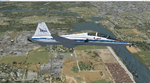
Version 2.0 covers landclass across the entire greater Houston area, with a large increase in LOD. This version significantly tightens up and improves the landclass from version 1.0, and adds a vast amount of scenery objects that brings the Bay Area-KEFD area into the modern era. This improves and adds a highly accurate runway 17 approach with accurate placement of buildings and scenery around the year 2011-modern day. In addition, includes several new files including a new airport/helipad via Houston Clear lake regional airport, T41 La Porte Municipal and surrounding shipping ports, Kemah Boardwalk, and a giant improvement to Johnson Space Center Houston. Rundway 35 and Runway 22 landclass is significantly increased, and more accurate as well. You can fly an accurate VFR approach or set up an ILS for any one of KEFD's runways with ease with this improvement.List of Version 2.0 additions and changes: - I added a ton of scenery objects and tightened up the landclass at Johnson Space Center Houston- NASA Control Center--- Added Talon Park with T38s (via static objects)--- Added Gemeni V rocket and 747 for the shuttle transporter--- And a whole bunch of vegetation, new buildings, and tour buses.- Added Kemah boardwalk and several boat docks- Removed a TON of highrise textures and replaced with medium and large city suburb landclass.- Added Clear Lake regional Hospital with helipad and surrounding scenery by Walter Reed Park- Added El Jardin or "Bayport Container port" with several scenery objects and significantly tightened up landclass.-- Looks great when setting up ILS approach for RWY 22- Tightened up Bay Area BLVD landclass, "adding" University of Houston Clear Lake"-- UHCL was semi already present, just made it more pronounced.- Made Red Bluff road landclass super recognizable!-- Red Bluff road is used to set up VFR approach and or field break for RWY 22 and RWY 17 R.----- Its common to see private jets and the USAF doing a break along Red Bluff road.- Added First Baptist Church, and water tower to Pasadena Convention center- Made Fairmont Parkway pronounced with landclass- Added Houston Port Authority at Morgan's Point--- Another Landmark for the RWY 22 ILS approach, NASA religiously uses this to line up the 10 mile ILS.- Tightened up landclass at Village Grove East and along Fairmont Parkway- Added a TON of scenery objects and landclass corrections for approach of RWY 17 L and 17 R.---- Added Home Depot, Lowes, Walmart Super center, Guitar center etc.---- added South Main Baptist Church--- Bondy Jr High, Turner Elementary, and Pasadena Memorial High School--- Added Saint Luke's Hospital--- Added Hampton Inn Suites and HCA rehab hospital--- Added a ton to the container facility behind best buy and storage facility--- Added smaller churches on RWY 17 approach--- Added a ton of scenery at the base of RWY 17 R, i.e., concrete plant, containers, trucks-- Added gas stations on the corner of beltway 8 and genoa red bluff-- Significantly changed and tightened up landclass at the base of RWY 22 and RWY 17 L and 17 R-- Made several roads and Beltway pronounced------ This decision looks AWESOME at night, really adds demarcation to the roads.**All of this makes the RWY 17 approach super recognizable** RWY 22 approach landclass is much more accurate.- Significantly changed and tightened up landclass near southbelt ellington and interstate 45.- Added Grace Church-- I wanted to do San Jacinto College south, but seemed over kill at that point.- SIGNIFICANTLY tightened up landclass for RWY 35 approach and near baybrook mall.-- Along I45- Added TDECU stadium at the University of Houston Main Campus---- So you can practice flybys for Cougar games!- Added the Battleship at San Jacinto Monument- I also "borrowed" T41 La Porte Municipal's tower camera to make a SWEET view of KEFD.- I included landclass for Sealy Texas this time, as well as my significant enhancements of Austin, Texas greater area as well (optional, but recommended!)---------------------------------------------------------------------------Version 1.0 originally added:- Added the Johnson Space Center Houston, which is now greatly enhanced and blended.- San Jacinto Community College-Central- Pasadena Convention Center- Pasadena Water Treatment Facility- NASA Bouncy Lab- Pasadena Shopping center, now greatly enhanced and blended.- Baybrook Mall and other shopping spots.- Significant Landclass improvements across the entire greater Houston Area File also includes landclass and scenery improvements for the greater Austin, Texas Area (optional), KIAH, KDWH, and Sealy, Texas. Each of these projects combined covers roughly 15,000 square miles of landclass improvement. Allowing you to fly entirely from Houston to Austin, or Houston to San Antonio in accurate landclass. -Enjoy!DJN
| Filename: | Version_20_KEFD_Ellington_2025_Refresh_FSX_Circa_2.zip |
| License: | Freeware |
| Added: | 12th October 2025, 16:15:47 |
| Downloads: | 67 |
| Author: | Dan Nelson |
| Size: | 277.28 MB |
| Category: Flight Simulator X - Scenery | |
| Marchwood Sea Mounting Centre & Power Station |
|
File Description:
Marchwood Sea Mounting Centre & Power Station Scenery.
Had a few hours over the Christmas period to have a go at FSX secenery design. Know it's not perfect but using a few free programs, knocked up a Marchwood scene to try and improve the look of VFR Photographic Scenery in the area.
The programs I used as follows:-
Google Earth Pro (to take overhead screen shots of area)
ModelconverterX (to import Sketchup .skp file and convert to BGL
Sketchup Make (to model buildings and export .skp to .dae files)
Microsoft Paint (save copy of screen shot)
GIMP2 (to enhance image & cut / blend image to import to Sketchup)
My thanks to the people who provide these tools especially Arno and the people behind MCX.
The ships I converted from ones provided on the free Sketchup 3D Warehouse, my thanks to them.
Install: Copy the Final Marchwood & MW Power Station Folders to your FSX Addon scenery folder.
Do that for the HMS Trio & Husband Shore Folders also if you think it may improve the scenery. It did using my set up.
Make sure you have the fx_SmokeStack2.fx effect in your Effects folder. If not copy the file into the folder.
Install all as normal using the FSX Add Scenery facility.
Provided as freeware. Not to be distributed by anyone for gain.
Hope you like the scenery and hope it dosent affect frame rates too much.
ijm1959... ([email protected])
| Filename: | Marchwood_Sea_Mounting_Centre__Power_Station.zip |
| License: | Freeware |
| Added: | 7th January 2018, 16:59:11 |
| Downloads: | 165 |
| Author: | Ian McAdam |
| Size: | 9.9 MB |
| Category: Flight Simulator X - Aircraft Repaints, Textures and Modifications | |
| Centurion Cargo "Frank Fine" McDonnell-Douglas MD-11F (N985AR) |
|
Images related to this file:
File Description:
Centurion Cargo is a privately owned company founded in 2001. Based at
Miami International Airport, it currently operates a fleet of ten MD-11F,
and has an impressive 550,000 square foot warehouse, divided into two
different sections, a 159,000 square foot cooler and 391,000 square foot
Dry Cargo Area. The Centurion Cargo Center is by far the largest privately
owned all cargo airline facility in North America.
Centurion is one of the leading cargo airlines operating to and from
Latin America and is No. 1 in the handling of live animals and perishable
goods. Centurion has recently expanded its network to include 4 weekly flights
from Amsterdam, The Netherlands. We also offer worldwide charter, handling, and
security services among others.
FSX McDonnell-Douglas MD-11F repaint textures for the real world
Centurion Cargo N985AR "Frank Fine", but with the freeware version's Pratt and
Whitney engines. She is named after the late Miami aviation pioneer Frank Fine,
who started in aviation as Agro Air Associates and later lead both Fine Air
and Arrow Air. For the freeware SMS Overland MD-11 with P&W 4460 engines, which
you must have previously installed in FSX. I installed the freeware
(SMS-MD-11_Dutch_Package.zip) with VC which works well with this repaint.
Also includes engine exhaust smoke coordinates which you can add to
your "aircraft.cfg" if you wish. Screenshots enclosed. Easy installation.
Repaint by Tom Tiedman.
| Filename: | Centurion_Cargo_Frank_Fine_McDonnellDouglas_MD11F_.zip |
| License: | Freeware |
| Added: | 20th July 2013, 07:19:42 |
| Downloads: | 254 |
| Author: | Tom Tiedman / SMS Overland |
| Size: | 8.28 MB |
| Category: Flight Simulator 2004 - Scenery | |
| Hana Heli-Obstacle Course v3.0 |
|
File Description:
Hana Airport is a regional airport of the State of Hawaii on the east shore of the island of Maui, 3 NM northwest of the unincorporated town of Hana. The airport covers 119 acres and has one runway. It is primarily a commuter facility used by unscheduled air taxis and general aviation. This scenery is intended as a single/multiplayer helicopter obstacle course where heli pilots can meet to compete, show off, and share their helo skills. Since birdseye (Timm Turner) already did a neat scenery called Hana_Scenery_PHHN (search for "hana" in the HoverControl Downloads), we decided to convert PHHN to a full helicopter training area. Makes a great place for helo pilots to gather to practice and perfect their skills, and challenge other pilots! And keep an eye-out for that Hot Air Balloon, cruising around an altitude of 3000 feet (don't forget to wave at them!).
Another unique thing about this scenery is the neighboring islands (Honolulu Intl/Hickam AFB, Bellows AFB, Lanai City, Kahului, Molokai, etc). If you get frustrated during your heli obstacle course training, just take a heading of 275 degrees, and relax at one of the neighboring islands. We also added an Easter Egg - If you set your FS calendar to July 21st, you'll see a large ridge fire up in the hills. Load Jordan Moore's Erickson S64E (http://www.hovercontrol.com/) & try your skills at water bombing!
| Filename: | Hana_HeliObstacle_Course_v30.zip |
| License: | Freeware |
| Added: | 28th August 2011, 17:53:18 |
| Downloads: | 467 |
| Author: | Greg Spellmen, Bob Ferguson |
| Size: | 95.52 MB |
| Category: Flight Simulator 2004 - Scenery | |
| Hana Heli-Obstacle Course v2.0 |
|
Images related to this file:
File Description:
Hana Airport is a regional airport of the State of Hawaii on the east shore of the island of Maui, 3 NM northwest of the unincorporated town of Hana. The airport covers 119 acres and has one runway. It is primarily a commuter facility used by unscheduled air taxis and general aviation. This scenery is intended as a single/multiplayer helicopter obstacle course where heli pilots can meet to compete, show off, and share their helo skills. Since birdseye (Timm Turner) already did a neat scenery called Hana_Scenery_PHHN (search for "hana" in the HoverControl Downloads), we decided to convert PHHN to a full helicopter training area. Makes a great place for helo pilots to gather to practice and perfect their skills, and challenge other pilots! And keep an eye-out for that Hot Air Balloon, cruising around an altitude of 3000 feet (don't forget to wave at them!). Another unique thing about this scenery is the neighboring islands (Honolulu Intl/Hickam AFB, Bellows AFB, Lanai City, Kahului, Molokai, etc). If you get frustrated during your heli obstacle course training, just take a heading of 275 degrees, and relax at one of the neighboring islands. We also added an Easter Egg - If you set your FS calendar to July 21st, you'll see a large ridge fire up in the hills. Load Jordan Moore's Erickson S64E (http://www.hovercontrol.com/) & try your skills at water bombing!
| Filename: | Hana_HeliObstacle_Course_v20.zip |
| License: | Freeware |
| Added: | 7th December 2010, 03:28:47 |
| Downloads: | 475 |
| Author: | Greg Spellmen & Bob Ferguson |
| Size: | 58.56 MB |
| Category: Flight Simulator 2004 - Utilities | |
| LJSceneGen V 1.0 |
|
File Description: LJSceneGen is a scenery creation utility for the Microsoft (MS) Flight Simulator FS9 (aka FS2004 or Century of Flight). The program presents a series of forms where various options for VORs, NDBs, Exclusion Rectangles, Markers, Waypoints and Scenery Library objects can be entered. The program will try to connect FS9 via FSUIPC or WideFS. If a FSUIPC connection is found, the location (Lat. Long. and Alt and others if available and appropriate) will be automatically retrieved. You can also move the aircraft to a new location by entering a Lat. and Long. pair and clicking "Move Aircraft". Multiple combinations VORs, NDBs, Exclusion Rectangles, Markers, Waypoints and Scenery Library objects can be saved and each saved object can be edited. After all the desired objects are created, an XML file can be created. This file can be submitted to the FS2004 SDK BGL compiler "BGLCOMP.exe". A file with an extension of .BGL will result which you then place in your Addon Scenery/scenery/ folder to view your just created scenery object(s) after you restart FS9. This or other properly formulated .XML scenery files can be imported and reviewed. For example, the FS9 file NVNAMC0.bgl can be decompiled, imported into LJSceneGen and then viewed. Alessandro Antonini's excellent BGLXMLdecompiler program makes possible the conversion from NVNAMC0.bgl. to NVNAMC0.xml which can then be read by LJSceneGen. (This file is available at Alec's site: http://www.cpinf.net ). Each VOR and NDB found in this decompiled xml file can be reviewed and if you want, you can move your aircraft to the object's location by clicking "Move Aircraft". This program is written in MS's C# language using .NET framework 1.1. The CLR .NET Framework 1.1 must be installed on your computer before the program will run. The freeware version of Pete Dowson's FSUIPC is not supported. Users should be very familar with the FS2004 scenery SDK. This version only knows VORs, NDBs, Exclusion Rectangles, Markers, Waypoints, and Scenery Library objects. It doesn't yet know about Airports Runways ILSes etc. This is not a "What You See Is What You Get" program but instead takes a semi-automated fill-in-the-blanks approach. The program is a scenery creation utility. As such, inexperienced scenery designers may not find it user friendly.
| Filename: | LJSceneGen_V_10.zip |
| License: | Freeware, limited distribution |
| Added: | 14th March 2004, 01:10:12 |
| Downloads: | 2,411 |
| Author: | Larry Jones |
| Size: | 469.34 KB |
| Category: Flight Simulator 2004 - Scenery | |
| Nenana Municipal Airport PANN in Alaska |
|
Images related to this file:
File Description:
Nenana is a village on the river of the same name around 40 miles west of Fairbanks, which is the second largest urban area in Alaska after Anchorage. Nenana, as a result of this proximity, is served by road and railway and unlike other Alaskan villages is not reliant on air cargo for necessities. The current population is just under 400, which is way down from its peak of 5,000 in the 1920's when gold was being mined and the railroad being built. Nenana's main claim to fame is as the starting point for the 1925 mushing delivery to Nome of the serum to combat an outbreak of diphtheria. Any Nenana Municipal Airport history is difficult to find, even the date of construction. It has two runways 3L-21R and 3R-21L, the first being asphalt and just under 5,000 feet with PAPI at both ends, the second grass and 1,800 feet. Both are lit. It also has a further water runway similarly aligned and 3,000 feet long. Maintenance is available and there is also fuel at the end of the northern apron, close to the crashed and stripped DC4 that sits among other unwanted items that are too large to make it worth the cost of moving them off the site. There are no regular scheduled flights to the airport, with air taxi or owner operated being in the majority. The scenery, in addition to the terrain, town, bridges, and airport items also modifies the terrain in an area further south where FS9 depicted as a city an Air Force base that is mainly concerned with radar and communications and in fact has very few buildings. The AI includes some Beavers on floats that were used in previous BC scenery with the kind permission of FSAddon. As I have already posted them I have not included them again here. The float plane AI uses the same radio frequency as the land based planes, but they fly to PANX and not to PANN as FS9 has problems with getting floats and wheels separated. Or maybe I just haven't worked out how to cope with FS9. A note here about my scenery making. There will not be many more to follow this as I am almost at the end of the photos I either took or found for scenery purposes, plus I expect to move on from FS9 at some point during next year.
| Filename: | Nenana_Municipal_Airport_PANN_in_Alaska.zip |
| License: | Freeware, limited distribution |
| Added: | 2nd December 2019, 18:12:42 |
| Downloads: | 155 |
| Author: | Roger Wensley |
| Size: | 7.36 MB |
| Category: Flight Simulator 2004 - Scenery | |
| PABA - Barter Island (Kaktovik) - Alaska North Slope 8 |
|
Images related to this file:
File Description:
The town of Barrow is in the far north of Alaska, and these are coastal villages or radar installations to the west, south, and now east of Barrow. There will be further additions. Barter Island is a DEW station Air Force base 310 miles east of Barrow and 75 miles east of Bullen Point. The runway is just under 5,000 feet of gravel and aligned 06-24 on a spit of land at the northeast corner of the island. The big hangar is still there on the apron. Most of the DEW buildings have now been removed but this scenery is dated around 2005 when there were more of them still there. Between the DEW station and the airstrip is the village of Kaktovik, with a population of some 300 mainly traditional Inupiat. The village was first pioneered when the DEW station was built in the 1950's and grew as the years passed. The FS9 error discovered when making this scenery was that FS9 had mistakenly "placed" Kaktovik at Bullen Point (not physically, it was just wrongly stated as the local town); this is now only partly corrected as FS9 refused to accept my Bullen Point revision but allowed me to associate Kaktovik with Barter Island. Kaktovik is definitely on Barter Island. I could also mention that the runway was in the sea, but there isn't much point in that as Bill would say it was all the fault of Ultimate Terrain, so I won't bother. The next DEW station to the east is in Canada and called Komakuk; this has already been made and posted. The next in this series will be far to the west. The AI has daily flights by ERA, plus Northern Air Cargo, and some GA.
| Filename: | PABA__Barter_Island_Kaktovik__Alaska_North_Slope_8.zip |
| License: | Freeware, limited distribution |
| Added: | 19th July 2016, 17:49:16 |
| Downloads: | 208 |
| Author: | Roger Wensley |
| Size: | 3.42 MB |


© 2001-2026 AVSIM Online
All Rights Reserved
Privacy Policy |