
Where Flight Simulation Enthusiasts Gather from Around the World!
AVSIM Library - Search Results

| Category: Flight Simulator 2004 - Utilities | |
| Software Development Kits (SDK) pack |

|
Images related to this file:
File Description:
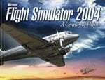
This file contains all of the Software Development Kits released years ago by Microsoft for Flight Simulator 2004: A Century of Flight (FS9). These were released for developers and enthusiasts who want to customize and create add-ons for FS9.
Included are:
1. Autogen SDK - autogen_sdk_setup.exe (5.4MB);
2. Netpipes SDK - netpipes_sdk_setup.exe (545KB);
3. Terrain SDK - terrain_sdk_setup.exe (11MB);
4. Weather Themes SDK - weather_theme_sdk_setup.exe ( 3.7MB);
5. Panels and Gauges SDK - panels_sdk_setup.exe (1.6MB);
6. Traffic Toolbox SDK - traffictoolbox_sdk_setup.exe (1.5MB);
7. ABL - fs2004_sdk_abl_setup.exe (611KB);
8. Aircraft Container SDK - fs2004_sdk_aircraft_container_setup.exe (609KB);
9. ATC Voicepack SDK - fs2004_sdk_atc_voicepack_setup.exe (17.9MB);
10. FSEdit SDK - fs2004_sdk_fsedit_setup.exe (1.3MB);
[also inclued is a version for Japanese FS9 Users: fs2004_sdk_fsedit_japan_setup.exe (1.1MB)];
11. Multiplayer and Flight Instructor SDK - fs2004_sdk_multiplayer_setup.exe (524KB);
12. Make Model SDK - makemdl_sdk_setup.exe (1.1MB);
13. BGLComp SDK - fs2004_sdk_bglcomp2_setup.exe (857KB);
14. gmax Gamepack SDK - fs2004_sdk_gmax_setup.exe (15.5MB);
15. Special Effects SDK - fs2004_sdk_special_effects_setup.exe (693KB);
16. Cabdir SDK - cabdir_sdk_setup.exe (559KB).
Although portions of the SDK may prove useful to Flight Simulator enthusiasts with little or no programming experience, keep in mind that many parts of the SDK assume familiarity with XML, the C programming language, and game development.
Please note: The information in the SDKs is NOT supported by Microsoft Product Support. No support is available for these SDK files!
| Filename: | Software_Development_Kits_SDK_pack.zip |
| License: | Freeware |
| Added: | 22nd August 2012, 20:25:47 |
| Downloads: | 3,623 |
| Author: | Microsoft Corporation, Uploaded by AVSIM |
| Size: | 59.22 MB |
| Category: Flight Simulator X - Scenery | |
| RAF Molesworth |
|
File Description:
At the start of World War II the Air Ministry selected the area as the site for what would become RAF Molesworth. The base was built in 1940 and 1941. The first unit, Royal Australian Air Force 460 Squadron was formed at the base on November 15, 1941 with Vickers Wellington IVs. 460 Squadron departed the field on January 4, 1942. RAF Bomber Command 159 squadron moved in shortly afterwards, however this unit did not remain long, moving to the Middle East on January 12.
Molesworth was one of the early Eighth Air Force stations assigned to the United States Army Air Force (USAAF). In February 1942, General Ira Eaker and four US staff members inspected Molesworth for possible American use, and during 1942 the facility was improved to Class A airfield standard, with all of its runways extended to American specifications for heavy 4-engined bombers. The main runway was lengthened to 2,000 yards and the number of hardstands increased to fifty. It was given USAAF designation as Station 107.
From 16 September 1943 – 18 June 1945, Molesworth served as headquarters for the 41st Combat Bombardment Wing of the 1st Bomb Division.
| Filename: | RAF_Molesworth.zip |
| License: | Freeware |
| Added: | 17th January 2009, 14:00:45 |
| Downloads: | 552 |
| Author: | Scott Berge |
| Size: | 22.77 KB |
| Category: Flight Simulator X - Scenery | |
| LFMI - Istres/Le Tube |
|
File Description:
Welcome to Istres Air Base/BA 125.
Istres is an Air Base use by the French Air Force and is also a base for the helicopter squadron. It has a large repair and is a large training facility.
It's common to see the Alpha jet visiting the BA 125 during their training. Alpha Jet used by the Patrouille de France.
The Air base is large enough to accomodate all type of aircrafts and even up to the B747. It has 1 major Rwy 15/33 of 12303 Ft /3750 m.
I have included the 15C/33C grass rwy for use by ligth G.A aircraft and other Gliders. Put up on a nice landing and Hot dog will be waiting for you down there! ;)
I have developped all aprons, included the ILS rwy 15 and developped the Tower area, increased the amount of parking due to the space available.
Istres has a tremendous amount of parking spot. I have included the chart as well for VFR traffic.
2 Parallel Rwy to the active one, these are closed! do not mistake them with the grass one! ;)
Have fun!
| Filename: | LFMI__IstresLe_Tube.zip |
| License: | Freeware |
| Added: | 12th May 2009, 10:30:16 |
| Downloads: | 2,744 |
| Author: | Daniel Louvet |
| Size: | 4.13 MB |
| Category: Civil Flight Simulators - Looking Glass Flight Unlimited 3 | |
| Outer Terrain GTL Grid Structure Map v2.0 |
|
Images related to this file:
File Description:
This version of my GTL grid structure map includes Andre's new outer terrain area north of Seattle and adds a search facility, which enables you to search for a tile using FU3 world co-ordinates. To find out the world co-ordinates of any OT area simply open Fled, set the top-down view to the latitude/longitude of the area you're interested in and click the latitude/longitude figures that appear in the bottom left hand corner of the screen. The latitude/longitude figures will disappear and be replaced by FU3 world co-ordinates as easting and northing values. Enter these values into my FU3 GTL Map, click the button and the spreadsheet will map these co-ordinates to the correct tile and return the tile name. If you don't know the latitude/longitude of the area you're interested in then you can always obtain this from within the game itself. Just start a flight in the area you're interested in and press Ctrl-z at any time to enter Zoar mode. This will pause the game and display the current latitude/longitude in the top left hand corner of the screen.
| Filename: | Outer_Terrain_GTL_Grid_Structure_Map_v20.zip |
| License: | Freeware |
| Added: | 29th December 2009, 23:16:52 |
| Downloads: | 35 |
| Author: | Jonathan Stonehouse |
| Size: | 198.97 KB |
| Category: Flight Simulator 2004 - Scenery | |
| KGFL - Glens Falls, Floyd Bennett Memorial (v2.2) |
|
Images related to this file:
File Description:
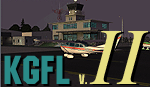
KGFL - Glens Falls, Floyd Bennett Memorial v2.2, located in the foothills of the Adirondack Mountains in upstate NY USA, this facility is owned by Warren County and run by RichAir. Although it has a 5000 ft main rwy, KGFL is a Non-controlled airfield catering to small engine a/c up to a few private jet daily traffic serving 'The Northcountry' New York. KGFL recently received several upgrades including 4 new GA hangars large enough to accommodate the needs of business jets.
All Objects fully designed and completely redone in GMAX using high resolution custom photo-real 32bit textures. Optional DXT textures included. Also includes new AFCAD file, more accurate airport grounds perimeter, satellite photo-real grounds, custom taxiways, taxi-signs and taxi lights, area roads, animated hangar doors, and near area landclass. No AI traffic tracks included with this release, but afcad designed to support several AI. Rwy12 objects required for a few static a/c and parking lot cars. v2.2 Includes mipmapped textures, reduced trees for better performance, and increased, more accurate taxiway light density. This v2.2 package is a full-install.
| Filename: | KGFL__Glens_Falls_Floyd_Bennett_Memorial_v22.zip |
| License: | Freeware, limited distribution |
| Added: | 5th February 2010, 16:52:44 |
| Downloads: | 2,350 |
| Author: | Ed 'Geneer' Cox |
| Size: | 74.81 MB |
| Category: Flight Simulator 2004 - Scenery | |
| Goodspeed Airport (42B) - East Haddam, Connecticut |
|
Images related to this file:
File Description:
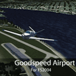
Goodspeed is a privately owned airfield in East Haddam, Connecticut that operates as a public access general aviation facility. The runway is a short 2120 feet and is carefully placed in a shoreline meadow of the Connecticut river. Surrounded by the dense forests and community, the airport is a tight approach, further hampered by the presence of the East Haddam Bridge, which sits under the runway 14 approach. The airport has limited parking facilities for transient aircraft, and it is not common for visiting aircraft to park in the grass in front of the "terminal". Hanger facilities are provided as well. Nearby is the famous Goodspeed Opera House, established back in the 19th century, the house still has operas other performances regularly.
Features:
-High Resolution Ground textures around airport;
-Accurate models of all airport buildings;
-Detailed taxiways and runways;
-Super HD grass and pavement;
-Custom aerial imagery for area, including autogen;
-Full seasonal textures (Spring, Summer, Fall, Winter);
-Various "Easter Eggs";
-Deer (at dusk);
-Christmas Lights (During the Holiday Season);
-Night Textures;
-Runway Lights, obstruction lights;
-And much more!
Created by Dustin Mosher www.dmosher.info
| Filename: | Goodspeed_Airport_42B__East_Haddam_Connecticut.zip |
| License: | Freeware, limited distribution |
| Added: | 4th March 2010, 13:34:02 |
| Downloads: | 685 |
| Author: | Dustin Mosher |
| Size: | 62.8 MB |
| Category: Flight Simulator 2004 - Scenery | |
| Hana Heli-Playground v1.0 |
|
Images related to this file:
File Description:
Hana Airport is a regional airport of the State of Hawaii on the east shore of the island of Maui, 3 NM northwest of the unincorporated town of Hana. The airport covers 119 acres and has one runway. It is primarily a commuter facility used by unscheduled air taxis and general aviation. This scenery is intended as a single/multiplayer helicopter obstacle course where heli pilots can meet to compete, show off, and share their helo skills. Since birdseye (Timm Turner) already did a neat scenery called Hana_Scenery_PHHN (search for "hana" in the HoverControl Downloads), we decided to convert PHHN to a full helicopter training area. Makes a great place for helo pilots to gather to practice and perfect their skills, and challenge other pilots! And keep an eye-out for that Hot Air Balloon, cruising around an altitude of 3000 feet (don't forget to wave at them!).
Another unique thing about this scenery is the neighboring islands (Honolulu Intl/Hickam AFB, Bellows AFB, Lanai City, Kahului, Molokai, etc). If you get frustrated during your heli obstacle course training, just take a heading of 275°, and relax at one of the neighboring islands.
| Filename: | Hana_HeliPlayground_v10.zip |
| License: | Freeware |
| Added: | 9th May 2010, 11:29:39 |
| Downloads: | 524 |
| Author: | Bob Ferguson |
| Size: | 27.79 MB |
| Category: Flight Simulator 2004 - Scenery | |
| Boundary Bay CZBB in British Columbia, Canada |
|
Images related to this file:
File Description:
Boundary Bay is south of Vancouver in British Columbia, close to the US/Canada border. It is the 5th busiest airfield in Canada measured in terms of take offs and landings as there are several training companies based there. The airfield was purchased by Alpha Aviation in 2009 and and modernised for the 2010 Winter Olympics, the main addition being a new terminal. This is an ex-military training base which was built in 1941, and one of the original hangars still survives. The two runways in use now (07/25 5,600' and 12/30 2,750', both of them 100' wide) are reduced asphalted areas of the original runways; the third runway is now an apron for GA parking and has had hangars built along it. There is JetA and 100LL available. The large building at the east end of the north apron is a HQ and maintenance facility for a helicopter company, Heli-one. All of the north apron buildings on the field have been modelled specifically for this scenery, plus the nearby huge greenhouse farm structures which are visible from further away than the airfield is. AI for Boundary Bay will be posted later this week.
| Filename: | Boundary_Bay_CZBB_in_British_Columbia_Canada.zip |
| License: | Freeware, limited distribution |
| Added: | 12th May 2011, 13:30:18 |
| Downloads: | 855 |
| Author: | Roger Wensley |
| Size: | 4.4 MB |
| Category: Flight Simulator 2004 - Scenery | |
| Carp CYRP in Ontario Canada (updated October 2011) |
|
Images related to this file:
File Description:
This version further updates the post of 2006 and the 2009 update with more bespoke buildings for the west GA apron plus the revised fuelling area, and corrected surroundings with large forested areas and a modified airfield grass shape. This is a stand-alone version and does not require you to have downloaded and installed the previous posts; this REPLACES those versions. Carp airfield is fifteen miles west of Ottawa and two miles south of the town of Carp. There are two runways, 10/28 which is asphalt and almost 4,000 feet long and 100 feet wide, and 04/22 which is gravel and 2,000 feet long. The airfield has a fairly large population of general aviation residents and is slowly expanding under new ownership. This version models the large hangar beside the terminal, the "Touch'n Go" aviation warehouse that has opened more recently, and the ramshackle collection of hangars and sheds that make up Westair, the maintenance facility. The nearby pagoda-roof flight school building has in fact now been demolished, but I like it too much to do that, at least until something else has been built on that space.
| Filename: | Carp_CYRP_in_Ontario_Canada__updated_October_2011.zip |
| License: | Freeware, limited distribution |
| Added: | 25th November 2011, 09:25:34 |
| Downloads: | 588 |
| Author: | Roger Wensley |
| Size: | 7.59 MB |
| Category: Flight Simulator X - AFCAD Files | |
| OMAA - Abu Dhabi International Airport - Abu Dhabi, United Arab Emirates |
|
Images related to this file:
File Description:
Abu Dhabi International Airport is an airport in Abu Dhabi, the capital of the United Arab Emirates. The airport is one of the fastest growing airports in the world in terms of passengers, new airline operators and infrastructural development. The airport is now undergoing a US$6.8 billion expansion. As of January 2012, 53 airlines offered service to 85 destinations in 49 countries.
The airport is the second largest in the UAE, serving over 10 million passengers in 2010. It has three operational passenger terminals. Its terminal spaces are dominated by Etihad Airways, which is the United Arab Emirates' second largest air carrier after Emirates.
The new Terminal 3, a US$270 million interim facility, was designed to allow for the airport's passenger growth before the planned opening of the new Midfield Terminal in 2014. Used predominantly by Etihad Airways, the terminal boosted the airport's seven million passenger per year capacity to 12 million. It also added 10 new gates, two of which are Airbus A380 compatible.
Using ADEx 1.51, aeronautical maps and Google Earth this AFCAD is now on par with today's situation.
| Filename: | OMAA__Abu_Dhabi_International_Airport__Abu_Dhabi_U.zip |
| License: | Freeware |
| Added: | 12th January 2013, 22:09:29 |
| Downloads: | 1,695 |
| Author: | Menno C. Robert |
| Size: | 3.62 MB |


© 2001-2026 AVSIM Online
All Rights Reserved
Privacy Policy |