
Where Flight Simulation Enthusiasts Gather from Around the World!
AVSIM Library - Search Results

| Category: Flight Simulator 2002 - Aircraft Repaints, Textures and Modifications | |
| Canadair CL-13 Mk 2 Sabre (F-86E) Royal Hellenic Air Force |

|
File Description:
This is one of the first jet age aircrafts served in Royal Hellenic Air Force, almost 50 years ago (!!!). There are two repaint versions of Royal Hellenic Air Force in the zip package: The first one, represents a Royal Hellenic Air Force Canadair CL-13 Mark 2 Sabre used to fly with 342nd Sqdr. of Royal Hellenic Air Force (RHAF) in Elefsina, Greece with an interception role. The second, represents the aniversary "Alexander the Great" texture, painted in "patriotic" colours, by a gas station owner (!!!) in Thessaloniki - Greece after buying the aircraft (sn. 19294) as scrap and finaly display it as a memorial by his store. This specific aircraft used to fly with 343rd Sqdr. In Nea Anchialos, Greece. The Canadair CL-13 Mark 2 Sabre aircraft (Canadian build F-86E under North American licence) used to be one of the most succesfull aircrafts during the 50'ies and the Korean war. This "CL-13_RHAF_v1.zip" package is full compatible with FS2K2 and FS9 too and contains realistic sound made by Angelos Hatzikatakos, NEW (made by the author) panel, the official checklist and a VERY completed (as always...) flight manual (31 pages) which can be read with Adobe Acrobat. This repaint was based on the original model made by Rey Lopez . The primary panel was made by Ken Mitchell and modified by Nick Karatzides to look more realistic and closer to the Hellenic CL-13 Mk 2 cockpit. A total NEW flight model ("air" file and aircraft.cfg file) have been created by Nick Karatzides and and I test it hard, to ensure that it flies as close as possible like a real fighter! This "CL-13_RHAF_v1.zip" package is for EXPERIENCED FlightSimers and virtual pilots who have a "good feeling" on the stick and do not "kick" the contol stick while flying. The package contains new visual effects, night lighting, fine looking mechanical parts movement, contrails, realistic gears extracting / retracting etc. Repaint and stuff by Nick Karatzides.
| Filename: | Canadair_CL13_Mk_2_Sabre_F86E_Royal_Hellenic_Air_F.zip |
| License: | Freeware |
| Added: | 4th October 2003, 00:15:30 |
| Downloads: | 1,408 |
| Author: | Nick Karatzides |
| Size: | 11.28 MB |
| Category: Flight Simulator 2002 - Aircraft Repaints, Textures and Modifications | |
| Hellenic Air Force Republic Aviation F-84F Thunderstreak |
|
File Description:
This is one of the first jet age aircrafts served in Hellenic Air Force, almost 50 years ago (!!!). There are three (3) repaint versions of Royal Hellenic Air Force in the zip package: The first one, represents an F-84F, as placed in front of 113rd Wing's main entrance as a "gate guard monument". The aircraft was placed there during early '90ies and the idea was captured by Brigadier General Vlachandonis who used to be the 113rd Wing's commander at that time. The second, shows an F-84F, as it was painted from 1957 to 1967. The specific aircraft used to belong to 339th Sqdr.with a white-blue-white stripe painted close to the nose as a squadron's ID mark. Additionaly, the "Mighty Mouse" official Sqdr's badge was placed on the left part of fuselage, just behind the cockpit. The thrird repaint is representing an F-84F, as it was painted from 1971, until the "retirement" on 1984. The aircraft which is presented into this "VietNam typed" repaint version used to belong to 338th Sqdr. operating from Larisa AB. This "F84F_HAF.zip" package is full compatible with FS2K2 and FS9 too and contains realistic sound made by Angelos Hatzikatakos, new panel made by Nick Karatzides, helpfull checklist and a VERY completed (as always...) flight manual (46 pages) which can be read with Adobe Acrobat. This repaint was based on the original model made by Kazunori Ito. A total NEW flight model ("air" file and aircraft.cfg file) have been created by Nick Karatzides and have been tested hard, to ensure that the aircraft flies as close as possible like a real fighter! This "F84F_HAF.zip" package is for EXPERIENCED FlightSimers and virtual pilots who have a "good feeling" on the stick and do not "kick" the contol stick while flying. The package contains new visual effects, night lighting, fine looking mechanical parts movement, contrails, realistic gears extracting / retracting etc.
| Filename: | Hellenic_Air_Force_Republic_Aviation_F84F_Thunders.zip |
| License: | Freeware |
| Added: | 10th March 2004, 03:59:45 |
| Downloads: | 724 |
| Author: | Nick Karatzides, Angelos Hatzikatakos |
| Size: | 12.35 MB |
| Category: Flight Simulator 2004 - AFCAD Files | |
| Savannah/Hilton Head International Airport, Savannah, Georgia (KSAV) |
|
File Description:
This is a AFCAD2 file for the Savannah/Hilton Head International Airport. I tried to make the airport as realistic as possable with what is given to me with FS9. Gates 1 and 3 is Delta Connection from Cincinnatti, New York-LGA, and Dallas/Ft. Worth. Gates 5 and 7 are Delta from Atlanta, Gate 2 &2a are Continental Express (Expressjet) From Houston-Bush, and Newark, Gate 4 is Northwest (Mesaba and Pinnacle) from Detroit, Memphis, and Minneapolis, Gate 6 is Independence Air flights from Washington-Dulles (Make sure you have your Independence Air planes coded to BLR. That is what I have the gate coded to which is correct in real life.). Gate 8 is AirTran flights from Atlanta (I also have TRSX AirTran Jet Connect. They no longer fly, but I have them on my AI so I left it in.). Gates 9 and 11 are USAir (Gate 9 being USAir mainline and CRJ-200 flights from Charlotte, Philly and Pittsburgh and Gate 11 being CRJ-200 flights and Dash 8 flights Charlotte, Boston and New York-LGA.). And finally Gate 10 is United Express (Air Wisconsin) flights from Washington-Dulles and Chicago-O'Hare. At the old terminal I have the FedEx, and Airbourne Express/DHL areas, as well as the GA "terminal". North of that is the 165th Airlift Wing National Guard area with parking for their C130's, F-16's, F15's, and their F-18's. I do not have the jetways on yet, however they are done except for the Delta gates....look for them soon. I hope this is a better representation of the airport. I believe it is. All lights on the Taxiways, Runways, as well as landing lights are REAL TO LIFE. They are taken from the airport digrams themselfs as well as from the website www.fltplan.com. Please, let me know what you think as I am using you as an unofficial beta tester for this file.
| Filename: | SavannahHilton_Head_International_Airport_Savannah.zip |
| License: | Freeware |
| Added: | 6th January 2005, 15:12:51 |
| Downloads: | 1,616 |
| Author: | Jason Landuyt |
| Size: | 6.63 KB |
| Category: Flight Simulator X - Aircraft Repaints, Textures and Modifications | |
| P-47D 324th FG/ 316th FS #86 "Black Sheep" |
|
File Description:
This folder contains a repaint for the Shockwave World War II Fighters P-47D Thunderbolt, representing the aircraft flown by Lt Jerry Wurmser of the 316thnd FS/324th FG, in France and Germany, between 6 march 1945 and the end of the war. He is still alive, and told me: "The name "Black Sheep" was already painted on the plane when it was assigned to me. It previously had been assigned to someone in Britain, and eventually ended up in France after either being shot down or having crashed and then repaired. It had a brand new engine in it when I received it on March 6, 1945. At this time I had already completed 39 missions, and finally was assigned my own airplane. My first flight in it was to break in the new engine, or "slow time" it. This required flying it about for a period of time at very low throttle settings, to break in the new engine. The plane had already seen a lot of action, and the "form 1" contained a long list of malfunctions that was written up by the previous flyers and dates of repairs. Several times I had to sign the "exceptional release" form before going up, acknowledging that I knew and understood what the previous pilot stated what was wrong with it. This plane was a razorback, with the tail assembly out of line, so that I had to apply rudder correction constantly. It got such bad gas mileage that I carried one less bomb and a gas tank instead. I hated that plane. I finally did get a new bubble canopy plane, but by this time the War was over!"
Repaint by Jan Kees Blom, based on two repaint kits, one by John Terrell and one by Shockwave. Included is a 1024 x 1024 bmp repaint, which should work in both FS9 and FSX.
| Filename: | P47D_324th_FG_316th_FS__86_Black_Sheep.zip |
| License: | Freeware |
| Added: | 24th January 2009, 18:52:28 |
| Downloads: | 283 |
| Author: | Jan Kees Blom |
| Size: | 5.05 MB |
| Category: Flight Simulator 2004 - Scenery | |
| 8AK7 - Bullen Point - Alaska North Slope 7 |
|
Images related to this file:
File Description:
The town of Barrow is in the far north of Alaska, and these are coastal villages or radar installations to the west, south, and now east of Barrow. There will be further additions. Bullen Point is a DEW station Air Force base 240 miles east of Barrow and 75 miles east of Oliktok. The runway is just under 4,000 feet of gravel and aligned 05-23; this is approximately at right angles to the default FS9 alignment and how that came about is something I doubt Bill Gates could explain. Most of the DEW buildings have now been removed (including the large hangar, which is unusual) but as I had a layout I made the whole site as it was originally, way back in the days when the north slope was still a wilderness. The AI is one day a C-130, on another a Cessna, and on a third a DC3. When I started this North Slope series it was my intention to create the full monty and make all the oil and gas installations and Deadhorse airport etc. I have come to realise that the oil side is impossible to make. There is so much of it and each bit is as time consuming as Heathrow while the actual airfields are more like Rockcliffe CYRO, so a lot of effort for what is just background to an adjoining airfield. But at the same time, if I make the new airstrips it is impossible NOT to make the oil installations as they are the dominating feature. So no new airstrips, and this is going to be just the 1960's or 1970's, when the oil business was only exploratory and the airfields were for villages or DEW stations, and Harmon Helmerick had his dirt strip on the Colville River estuary and was guiding hunters and fishermen and had just started to help out Sinclair Oil with oil exploration in 1966. Read his book. Download my previous post of his field.
| Filename: | 8AK7__Bullen_Point__Alaska_North_Slope_7.zip |
| License: | Freeware, limited distribution |
| Added: | 15th July 2016, 17:46:54 |
| Downloads: | 280 |
| Author: | Roger Wensley |
| Size: | 2.5 MB |
| Category: Flight Simulator 2004 - Scenery | |
| Iles de la Madeleine CYGR in Quebec Canada |
|
Images related to this file:
File Description:
The Iles de la Madeleine are a group of spit islands linked by bridges in the Gulf of St Lawrence. They are east of New Brunswick, north of Cape Breton Island, west of the Island of Newfoundland, and south of the mainland coast of Quebec. On a southwest to northeast axis they are 40 miles in length and the airport CYGR is pretty much at the midpoint of the southern line of islands. Take a look at the overhead from FS9 to see what I mean. CYGR has two runways, one is aligned 08-26 and is just under 4,400 feet long and 150 feet wide with lighting and PAPI at both ends. The second is aligned 16-34 and is 3,600 feet long and 150 feet wide, without lights or PAPI. Both are asphalt. The apron is not huge, and a newish (in 2010) hangar was built with separate access to the 16-34 runway. There are daily flights by Air Canada and Pascan Aviation included in the AI. The AI also includes some boats and a ferry, and I first used these with my Dutch Harbor scenery, so if you have that already.... This scenery also includes Cindy Hook, a small boat harbour just 2 miles southwest of the airport, and the larger harbour at Cap aux Meules a further 3 miles away that accommodates the daily ferry trips, along with fishing boats etc. Also included here is a further addition to the Homer PAHO scenery in the shape of a boat that is included in the Homer Spit harbour. Just add the contents of the scenery folder to the Homer scenery folder of your Homer installation, and the texture folder contents to the Homer texture folder. This is hopefully the last PAHO addition, and again apologies. If you find an error email me please, and note that my email address has been changed to rogwens at Gmail dot com.
| Filename: | Iles_de_la_Madeleine_CYGR_in_Quebec_Canada.zip |
| License: | Freeware, limited distribution |
| Added: | 28th July 2021, 17:02:18 |
| Downloads: | 189 |
| Author: | Roger Wensley |
| Size: | 26.7 MB |
| Category: Prepar3D V5 - Original Aircraft | |
| Prepar3Dv4/v5 POSKY Boeing 747SPv4 PBR Conversion Base package |
|
Images related to this file:
File Description:
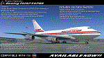
The Project Opensky Boeing 747V4 Classic Series PBR Native Conversion for P3DV4 and V5 is a newly updated conversion of the old top-hit freeware add-on aircraft series that is known to the Flight Simulation Community since FS2002, FS2004, and onwards to FSX and has been loved by thousands of Flight-simmers across the world because of its simple-but-great model, and completely free of charge. But with newer flight simulators on the line under the ESP Flight Simulator Type such as Lockheed Martin Prepar3DV4 and V5, the Project Opensky Boeing 747V4 Classic Series (which was only made for FS9) were slowly falling behind and couldn’t keep up with the current flight simulators today. And now, for the first time in 2022; this newly-updated conversion has surfaced to the public and in the eyes of the flight simulation community. Destined to fly in the current flight simulators of today like Prepar3D V4 and Prepar3D V5, this classic freeware had continued to live on into the new era, bringing nostalgia not only just to those who flown it before in FS2004, but also for a new generation who can relive classic scenes of the Jumbo Jet’s illustrious history through this iconic freeware add-on aircraft series in today’s flight simulator platforms. It finally received an all new makeover! And the permission to convert the models was acquired from the developer who was the mind of the POSKY 747V4 Classic Series: Hiroshi Igami. And he gave our conversion team the green light to do so. Leading to this conversion to surface in the public for the first time. Follow the instructions in the Readme txt file. And read the documentation for more info and the credits on this base package. If you have any questions/comments or any problems while installing this base package, feel free to contact me.
| Filename: | Prepar3Dv4v5_POSKY_Boeing_747SPv4_PBR_Conversion_B.zip |
| License: | Freeware |
| Added: | 1st July 2022, 18:35:03 |
| Downloads: | 447 |
| Author: | Carl Lyndon F. Nepomuceno / Project Opensky |
| Size: | 37.26 MB |
| Category: Prepar3D V5 - Original Aircraft | |
| Prepar3Dv4/v5 POSKY Boeing 747-100v4 PBR Conversion Base package |
|
Images related to this file:
File Description:
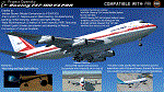
The Project Opensky Boeing 747V4 Classic Series PBR Native Conversion for P3DV4 and V5 is a newly updated conversion of the old top-hit freeware
add-on aircraft series that is known to the Flight Simulation Community since FS2002, FS2004, and onwards to FSX
and has been loved by thousands of Flight-simmers across the world because of its simple-but-great model,
and completely free of charge.
But with newer flight simulators on the line under the ESP Flight Simulator Type such as Lockheed Martin Prepar3DV4 and V5,
the Project Opensky Boeing 747V4 Classic Series (which was only made for FS9) were slowly falling behind and couldn’t keep up
with the current flight simulators today.
And now, for the first time in 2022; this newly-updated conversion has surfaced to the public and in the eyes of the flight
simulation community. Destined to fly in the current flight simulators of today like Prepar3D V4 and Prepar3D V5,
this classic freeware had continued to live on into the new era, bringing nostalgia not only just to those who flown it before in FS2004,
but also for a new generation who can relive classic scenes of the Jumbo Jet’s illustrious history through this iconic freeware add-on
aircraft series in today’s flight simulator platforms. It finally received an all new makeover!
And the permission to convert the models was acquired from
the developer who was the mind of the POSKY 747V4 Classic Series: Hiroshi Igami. And he gave our conversion team the green light to
do so. Leading to this conversion to surface in the public for the first time.
Follow the instructions in the Readme txt file. And read the documentation for more info and the credits on this base package. If you have any questions/comments or any problems while installing this base package, feel free to contact me.
| Filename: | Prepar3Dv4v5_POSKY_Boeing_747100v4_PBR_Conversion_.zip |
| License: | Freeware |
| Added: | 31st December 2021, 16:36:37 |
| Downloads: | 948 |
| Author: | Carl Lyndon F. Nepomuceno / Project Opensky |
| Size: | 30.8 MB |
| Category: Flight Simulator 2004 - Scenery | |
| Airstrips of the Falkland Islands |
|
Images related to this file:
File Description:
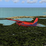
Inspired by Jim Keir's Falkland Islands mesh, coastlines and landclass, herewith a couple of dozen little strips from around the area, to give the opportunity to generate a bit of GA AI (and possibly a few scheduled flights) in an otherwise relatively ignored area in the South Atlantic. Please do note, other than Stanley, most of these airstrips are just that, a cleared strip of land in an otherwise empty landscape, (just as they are in real life), simply to provide a variety of destinations for the occasional aircraft to or from Stanley.
Most of the airfield locations are listed on WikiPedia and the layout confirmed using on-line satellite imagery. Other than the two main airports, none of these airstrips seem to have "official" ICAO codes, so I've generated a selection of alpha-numeric codes in the SF0* configuration, (as Stanley Airport has the ICAO code of SFAL), so the FS9 AI engine has some codes to work with and the airfields can be found on the map. Hopefully these pseudo-codes won't clash with anything else.
As with my other sceneries, the files for each airstrip can be easily identified by the ICAO code, even if the airfield names vary slightly, so you can pick and choose and mix and match to suit any sceneries you already have, should you so wish. There is no requirement for any other download. Each airstrip will exist as a stand-alone entity should you only want a few of them.
Having said that, Paul Denton's AFCAD and scenery for EGYP Mount Pleasant (available on AVSIM and possibly elsewhere) might be considered a worthwhile addition, especially if you want to see the twice-weekly scheduled RAF flights from Brize Norton (via Ascension Island), and the Saturday LATAM flight from Chile. Suitable AFCADs for EGVN Brize Norton and SCCI Punta Arenas may also be required. Appropriate traffic files and aircraft/texture suggestions are provided.
Please read the remainder of this "blurb" in the included text file, there may be a couple of details of interest.
| Filename: | Airstrips_of_the_Falkland_Islands.zip |
| License: | Freeware |
| Added: | 30th March 2025, 18:55:33 |
| Downloads: | 92 |
| Author: | Chris Eve |
| Size: | 295.87 KB |
| Category: Flight Simulator X - Original Aircraft | |
| Project Opensky Boeing 747-100v4 Native Conversion Base package for FSX/P3D |
|
Images related to this file:
File Description:
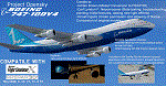
The Project Opensky Boeing 747100V4 Native Conversion for FSX/P3D is the first of the initial release of the POSKY 747V4 Classic Series, and it is a new conversion of the old top-hit freeware add-on aircraft series that is known to the Flight Simulation Community since FS2002, FS2004, and onwards to FSX and has been loved by thousands of Flight-simmers across the world because of its simple-but-great model, and completely free of charge.
But with newer flight simulators on the line under the ESP Flight Simulator Type such as Lockheed Martin Prepar3DV4 and V5,
the Project Opensky Boeing 747V4 Classic Series (which was only made for FS9) were slowly falling behind and couldn’t keep up
with the current flight simulators today.
And now, for the first time in 2020; this conversion has surfaced to the public and in the eyes of the flight simulation community. Destined to fly in the current flight simulators of today like FSX, FSX: Steam Edition, Prepar3D V1 to V4 and Prepar3D V5, this classic freeware had continued to live on into the new era, bringing nostalgia not only just to those who flown it before in FS2004, but also for a new generation who can relive classic scenes of the Jumbo Jet’s illustrious history through this iconic freeware add-on aircraft series in today’s flight simulator platforms. And the permission to convert the models was acquired from the developer who was the mind of the POSKY 747V4 Classic Series: Hiroshi Igami. And he gave our conversion team the green light to do so. Leading to this conversion to surface in the public for the first time.
Follow the instructions in the Readme txt file. And read the documentation for more info and the credits on this base package.
If you have any questions/comments or any problems while installing this base package, feel free to contact me on [email protected]
| Filename: | Project_Opensky_Boeing_747100v4_Native_Conversion_.zip |
| License: | Freeware, limited distribution |
| Added: | 29th September 2020, 21:47:40 |
| Downloads: | 1,191 |
| Author: | Carl Lyndon F. Nepomuceno / Project Opensky |
| Size: | 22.86 MB |


© 2001-2026 AVSIM Online
All Rights Reserved
Privacy Policy |