
Where Flight Simulation Enthusiasts Gather from Around the World!
AVSIM Library - Search Results

| Category: Flight Simulator 2004 - Utilities | |
| GaugeGlow v2.0 |

|
File Description:
GaugeGlow is an easy to use tool that allows you to quickly set or adjust an aircraft's 2D panel lighting and the luminous glow of your MS Flight Simulator aircraft's lumious instruments. The virtual cockpit (VC) lighting is controlled by gauge designer and aircraft modeller, and cannot be modified by GaugeGlow.
GaugeGlow gives you a WYSIWYG (what you see is what you get) view of a sample aircraft panel & instrument with easy to use but sophisticated tools to discover the RGB lighting values to create the right lighting effect for your panel. Before GaugeGlow, a panel designer would have to "estimate" desired RGB values for lighting settings, modify configuration files, and then run Flight Simulator to see if they got it right. With GaugeGlow, you can select colors easily with slider controls, and imediately see the effects on panel and gauge lighting just as it will appear in FS under any lighting conditions.
The licensed registered user will be able to easily open any aircraft's panel, to load existing settings, make changes, then save them. Unregistered you'll have to take the data you see and using your knowledge of the SDK, edit the aircraft's config files to make the actual change in that aircraft's night lighting.
| Filename: | GaugeGlow_v20.zip |
| License: | Shareware, limited functionality |
| Added: | 24th August 2006, 14:24:13 |
| Downloads: | 1,758 |
| Author: | Patrick Waugh (Benchmark Avionics) |
| Size: | 692.17 KB |
| Category: Flight Simulator X - Scenery | |
| EDCB - Ballenstedt Airport - Sachsen-Anhalt, Germany *Version 1* |
|
Images related to this file:
File Description:
The airfield Ballenstedt is located in the eastern foothills of the €œHarz (North German low mountain range) and with twenty thousand aircraft movements per year a relatively highly frequented airport.
The scenery is designed very much in detail. All important objects have been created by me using photos of the original field. Also some clearly visible landmarks are integrated like the large photovoltaic arrangement north of the asphalt runway and the quite large pig farm “Asmusstedt†situated east of the field. An additional important point of reference for glider pilots is the so-called "Gegenstein", a narrow rock on top of the small hill south of the Gliderfield. A retouched photo background, covering all four seasons, completes the scenery.
However, many smaller Objects, like people, cars or static airplanes in this scenery were
taken from three popular freeware libraries for whose use I got the friendly permission of the
authors. If these libraries are not installed , many objects are not visible!
The following libraries are used:
--------------------------------
1. FS-Piloten_Objektlibrary: http://www.fs-piloten.de/thread.php?threadid=1063
2. FSX_FlightPortLib: http://www.flightport.de/libraries/flightport-library/
3. 3d People Library: http://library.avsim.net/download.php?DLID=192454
| Filename: | EDCB__Ballenstedt_Airport__SachsenAnhalt_Germany_V.zip |
| License: | Freeware |
| Added: | 1st May 2016, 21:00:27 |
| Downloads: | 1,366 |
| Author: | Wolfgang Allers |
| Size: | 272.19 MB |
| Category: Flight Simulator 2002 - Scenery | |
| Victorian Airfields - Australia |
|
File Description:
This add-on scenery pack for FS 2002 adds 115 airfields to Victoria plus a few to NSW and South Australia,
totalling to over 120 in all. The 36 airfields listed below include full detail including accurately placed and sized
trees and buildings, static aircraft, fences, cars, roads with cars and streetlights and a variety of other
'eye candy'. The remaining airfields are mostly small minor/private strips and all include runway markers and
a windsock but you'll find a few buildings and other scenery at some of them. Rotorheads will also enjoy flying to the 10 included helipads scattered across the area around Melbourne. This scenery is a 'must have' for anyone who enjoys flying 'Downunder'!
The Following airfields are included in this package in full detail:
LILYDALE, COLDSTREAM, TOORADIN, PAKENHAM, TYABB, SUNBURY , WALLAN, MELTON, BACCHUS MARSH, GEELONG, TORQUAY, CORIO, BARWON HEADS, PORT FAIRY, LAKES ENTRANCE, APOLLO BAY, KYNETON, PHILIP ISLAND, LOCKSLEY, LETHBRIDGE, CERES, BENDIGO GLIDING CLUB, GRAMPIANS AIRFIELD, MILAWA, WENTWORTH, YARRAM, ORBOST, MALLACOOTA, MT BEAUTY, MOONGARA, WERRIBEE AIRSTRIP, BOORT, COBDEN, MEREDITH, WOODVALE, RIDDELLS CREEK
Using this scenery pack will make your flights around these airfields so much more exciting and enjoyable. No more boring old
unpopulated terrain around Victoria, you've got 115 new airfields available to fly from!
| Filename: | Victorian_Airfields__Australia.zip |
| License: | Freeware |
| Added: | 15th August 2003, 19:47:02 |
| Downloads: | 807 |
| Author: | Sebastian Szalai |
| Size: | 10.53 MB |
| Category: Flight Simulator 2004 - Miscellaneous Files | |
| Airline Inventory |
|
File Description:
Not long ago I embarked on a project to streamline my flight simulator's AI setup. I knew I had too many aircraft texture sets that I was not using, too many unnecessary night texture files, installation of defunct airlines, and the like. So, I put together a spreadsheet showing my AI system with all the airlines and additional pieces such as vehicles and ships. This has been a very large and time-consuming project as my AI system has more than 7,000 texture sets, more than 2,200 airline folders, and other assorted AI components. Inside you'll find an Excel spreadsheet with all my airlines (more than 2,200) listed, Birds, Blimp, Corporate Aircraft, Defunct Airlines, Douglas DC-3, Float Planes, Government Aircraft, Helicopters, Medical Aircraft, Military Aircraft, Personal Registration Aircraft, Ships, and Vehicles - all associated with the FS AI system. In addition, I've included the spreadsheet's source text files for those that do not have Microsoft Excel. NOTE: You can download an MS Excel spreadsheet viewer (freeware) from the Microsoft site. Because of copyright restrictions and the size of my AI system, I have not provided links to specific files. However, I think you'll find the data very useful. See the readme file for a list of possible sources and contact information. Frank Bass
| Filename: | Airline_Inventory.zip |
| License: | Freeware |
| Added: | 6th December 2005, 17:45:39 |
| Downloads: | 1,274 |
| Author: | Frank Bass |
| Size: | 229.85 KB |
| Category: Flight Simulator X - Scenery | |
| Remote Tower Base, Washington State USA |
|
File Description:
Remote Tower Base Operations, Washington State - Airport ID: TOWR (FSX). -
OK, all you Rotorheads - This is a fictional version of a very remote Helicopter landing pad on the Olympic Penn.. You must fly a Helo. I created it for my personal enjoyment and now I am releasing to the public as freeware. I hope you enjoy the "eye-candy". There are multiple radio and fire spotting towers in the area to check out. -
At least it gives you something to travel there for. -
This is an extremely challenging spot to land, especially using real Wx. The landing pad is basically a postage stamp. I created it and have a tough time landing here myself, so have fun with this one. -
You may also go directly to this airport by selecting TOWR as your starting airport. I also added a series of images so you can figure out how to get there from somewhere else. If you have my Wynoochie Lake scenery, its only 6 miles from there. (Just a heads-up) -
Designed with the FS X Sdk Scenery function of the Mission builder, Lee Swordy's AFCAD & the Abacus Scenery shortcut tool. -
This scenery is frame rate friendly.
| Filename: | Remote_Tower_Base_Washington_State_USA.zip |
| License: | Freeware |
| Added: | 3rd May 2007, 21:13:18 |
| Downloads: | 758 |
| Author: | Bob Caparoula |
| Size: | 5.85 MB |
| Category: Miscellaneous Files - Miscellaneous Files | |
| FSMMoving Map v1.1.0 |
|
File Description:
FSMMovingMap 1.1.0 - Compatible with both FS2002 and FS2004
FSM Moving Map is a Freeware software with some neat features. With proper road maps, you will be able to find your road (or lack of) in FS environment, or fly at ease using Sectional or terminal charts. The concept is very simple: you, the user define all the maps... once you are flying, FSMMM will try to locate the best map available, and display it on screen. This can be very useful during VFR Flights.
One of our beta user has described it as "flying like the rich people with fancy GPS units sporting colour map displays" - 'nuff said.
On local PC, this map can be used with FS2004 Kneeboard, or with "MovingMap Launcher". This software can also integrate with FlightSim Manager (v2.8 and above), and work over the network using FSM Lanview (so you can fly on one machine while the map runs on a different PC).
You can find the latest version from: http://www.ranainside.com/
Programmer
Rana Hossain
[email protected]
24 February 2005
| Filename: | FSMMoving_Map_v110.zip |
| License: | Freeware, limited distribution |
| Added: | 24th February 2005, 05:00:56 |
| Downloads: | 12,057 |
| Author: | Rana Hossain |
| Size: | 798.33 KB |
| Category: Flight Simulator X - Scenery | |
| ENRA - Mo I Rana Rossvoll Airport - Nordland, Norway |
|
Images related to this file:
File Description:
The Mo i Rana airport, Rossvoll is a North Norwegian airport in the county of Nordland. It is located about ten kilometers northeast of the city Mo i Rana. Operator of the airport is the Norwegian state-owned company Avinor.
The Mo i Rana Airport is currently served only by the Norwegian regional airline Wideroe. Scheduled flights go to an from Bodo, Bronnoysund, Mosjoen, Rorvik, Sandnessjoen and Trondheim.
The FSX scenery:
The environment of the airport is adapted by new landclasses.
The airport has a photo background in two variants, covering all four seasons of spring, summer, autumn and winter.
The buildings in this scenery come from the fantastic XPlane scenery of Bert alias"almosquito" who kindly gave me the permission to convert them for my FSX scenery.
But there are also some objects taken from two very popular freeware libraries.
If these libraries are not installed, several objects are not visible!
The following libraries are used:
1. FS-Piloten_Objektlibrary:
http://www.fs-piloten.de/thread.php?threadid=1063
2. FSX_FlightPortLib
http://www.flightport.de/libraries/flightport-library/
Basically, libraries should be well integrated into the hierarchy of the Scenery.cfg, even below the Add-On-scenery because the Library objects otherwise may not be found by FSX.
| Filename: | ENRA__Mo_I_Rana_Rossvoll_Airport__Nordland_Norway.zip |
| License: | Freeware |
| Added: | 1st August 2015, 21:40:11 |
| Downloads: | 1,513 |
| Author: | Wolfgang Allers |
| Size: | 9.44 MB |
| Category: Flight Simulator 2004 - Scenery | |
| OSM World: Western Europe |
|
Images related to this file:
File Description:
Read Installation instructions carefully, this is a complex scenery package!
This package includes a "Dev Kit" should you wish to expand it to other areas! Please contact me if you wish to do so! This is community effort! If we all contribute, we will hopefully have the entire world covered one day!
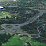
Welcome to OSM World: Western Europe! This is a vector data scenery package covering the western European area. Coastlines, Rivers, lakes, roads, railways, and power lines with detail never before seen! All in an autogen-compatible density! You can see roundabouts, train terminals, harbor areas in a resolution of a point every 10 meters. At this same resolution a vectorial city class places residential (in small and big building variations, depending on surface area) and industrial areas exactly where they are supposed to be. This gives the city areas a resolution far superior to the capacity of FS-2004 default landclass bitmaps, limited to approximately 1 Km x 1 Km squares. OSM World: Western Europe will even give you small roads leading to small towns (even a few houses across)! From big highway intersections, including ramps, to the tiniest rural pathways covering the entire western area! Wherever in Western Europe you fly, there is something to see!
| Filename: | OSM_World_Western_Europe.zip |
| License: | Freeware |
| Added: | 13th October 2014, 00:18:39 |
| Downloads: | 4,140 |
| Author: | Mario Noriega |
| Size: | 274.75 MB |
| Category: Flight Simulator 2004 - Sounds | |
| A300/A310 General Electric CF6-80C2A Series V3.1 Update |
|
File Description:
This is a vital update to the soundset I released a little over a month ago. I replaced all the exterior sounds respectively and updated the inteior howl heard during the early stages of the spool up and the volume of the files that followed. All though I stated that my previous version was the final one I felt that this was completely necessary, expect more and more updates to follow much like Pedro Oliveira's A320 Flight Dynamics which happen to be superb. I personally recommend that you use Corey Ford's latest repaint of which happens to be an excellent American A300 which compliments this update well. I am not an Official HNAC member (Although I wish) nor is this the official HNAC Sound Package this is just the best availible one every created for FS on this plane period. This requires V3 so if you don't have it please download it first before you download this update also do not use this with 767s. If you want a 767 soundset download Devyn Silverstein's latest CF6...B1F package. Lastly I've asked avsim to remove verison 1 and 2 because people were still downloading them (V3 is on another planet 1 & 2 was much too old.) Enjoy this, on to the GE 767!
| Filename: | A300A310_General_Electric_CF680C2A_Series_V31_Upda.zip |
| License: | Freeware |
| Added: | 14th February 2005, 06:17:26 |
| Downloads: | 28,538 |
| Author: | Emil Serafino Jr. - A300/A310 GE Sound Project |
| Size: | 22.97 MB |
| Category: Flight Simulator 2004 - Scenery | |
| New York City Default Bridges and Objects v2.0 |
|
File Description:
I originally planned on "fixing" the George Washington Bridge, which was inadvertantly "sunk" by FSG's 38m mesh, and ended up repositioning and scaling a whole bunch of other default bridges and objects within about 50 miles of NYC. This addon was designed and tested for use with FS 9.1, FSG 38m mesh (available here at AVSIM), and Freeflow NE, UT/USA and USA Roads. It should also work with other road and water packages. I did not create any new scenery, I only repositioned default objects to their correct locations.
This should be the final version for a while. This version was tested with and adds compatibility for Megascenery NY and Aerosoft's Manhattan scenery. I also removed a few more objects that were placed in the water, and moved back to land a bunch of cranes around KEWR that were in the water.
Fixed stuff: All inappropriately placed NYC and Newark bridges (major, not autogen) up to Bear Mountain in the north and south to about the Verrazanno; Belmont Racing track; Shea Stadium; Meadowlands Stadium; World's Fair Tower; US Open Stadium. Added Meadowlands Race track and a few bridges around Newark, moved cranes around KEWR back to land, removed several objects in the water.
| Filename: | New_York_City_Default_Bridges_and_Objects_v20.zip |
| License: | Freeware |
| Added: | 10th November 2005, 16:48:46 |
| Downloads: | 6,557 |
| Author: | Thomas Perry |
| Size: | 558.69 KB |


© 2001-2026 AVSIM Online
All Rights Reserved
Privacy Policy |