
Where Flight Simulation Enthusiasts Gather from Around the World!
AVSIM Library - Search Results

| Category: Flight Simulator 2004 - Scenery | |
| Ocean Stations for Multiplayer Use |

|
File Description:
I've produced this scenery to provide all of the Ocean Stations I know about in the 1950's and 1960's. There is a Coast Guard ship on station (painted in the colors of the USA), an NDB to give you a bearing to the ship, a way to contact the ship using voice (you can get your position relative to the ship this way), and a DME for distances further than the limited 30 NM FS ATC gives you (normal communications would reach about 100 NM). You can also get a weather report, and if you are a seaplane you can be cleared to land. If you are a landplane, I guess this would constitute permission to ditch...
I want to give a big thank you to Mitsuya Hamaguchi (hama) for graciously supplying the ship used in this scenery.
This version uses scenery ships, which will not disappear in multiplayer. There is only a US ship, however. For the AI ship version (with ships of several countries) download OceanStations.zip instead.
| Filename: | Ocean_Stations_for_Multiplayer_Use.zip |
| License: | Freeware, limited distribution |
| Added: | 6th May 2008, 03:51:56 |
| Downloads: | 543 |
| Author: | Tom Gibson |
| Size: | 405.16 KB |
| Category: Flight Simulator X - Scenery | |
| Essweiler Gliderfield, Germany Ver. 1.0 |
|
Images related to this file:
File Description:
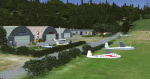
Essweiler is actually a classic glider field, but also engine aircrafts up to 2t are approved.
The field is situated in the region Rheinland-Pfalz/Germany at a hillside eastly of the village Essweiler, approximately 7,5 nautical miles north of the well known US-Airbase Ramstein.
The environment of the airfield is adapted by land classes. Surrounding villages and major roads are initially implemented.
As well the field is covered by a photo background, which includes four different images , each for one of the four seasons: spring, summer, autumn and winter. The buildings in this scenery should match quite good the originals. But also a lot of objects from three very popular freeware libraries are used.
If these libraries are not installed, many objects are not visible!
The following libraries are used:
1. FS-Piloten_Objektlibrary:
http://www.fs-piloten.de/thread.php?threadid=1063
2. FSX_FlightPortLib
http://www.flightport.de/libraries/flightport-library/
3: 3d People Library
http://library.avsim.net/download.php?DLID=192454
| Filename: | Essweiler_Gliderfield_Germany_Ver_10.zip |
| License: | Freeware |
| Added: | 29th November 2016, 19:15:50 |
| Downloads: | 605 |
| Author: | Wolfgang Allers |
| Size: | 168.18 MB |
| Category: Flight Simulator 2004 - Aircraft Repaints, Textures and Modifications | |
| Spanish army and air force textures for aerospatiale superpuma |
|
File Description:
Spanish textures for the Eurocopter AS-332C1 Super Puma. Compatible with FS2002 and FS 2004.
Original helicopter model made by Dirk Fassbender [email protected].
Panel design and flight dynamics by Nick Karatzides [email protected] or [email protected].
Super puma serves in the Spanish Ejército de Tierra (land forces) and in the Spanish Air Force. Four paintschemes are included in this pack: normal low visibility grey for the Spanish Airforce 802 y 803 squadrons, the same scheme with ISAF markings (Afghanistan international troops, Herat base), and green and camo schemes for the FAMET (Fuerzas Aeromóviles del Ejército de Tierra).
You need to have the model with the panel and flight dynamics from avsim (available as as-332c1_haf_v1).
Just drop the folders in the texture folder and overwrite the aircraft config file. Remember to make a
backup copy of your previous aircraft file.
This is freeware. It is strictly forbidden the use of the model or textures as payware, and also to post it
in FSplanet.
All suggestion are welcome.
Alberto García Lledó [email protected]
| Filename: | Spanish_army_and_air_force_textures_for_aerospatia.zip |
| License: | Freeware |
| Added: | 27th September 2007, 17:42:58 |
| Downloads: | 675 |
| Author: | Alberto García Lledó |
| Size: | 4.11 MB |
| Category: Flight Simulator 2004 - AI Aircraft | |
| Microlights- Vol.2 |
|
File Description:
Three more low-polygon count models for AI use in F2004, all tail-draggers, one based on the AirBike, with two seats, the second based on the Weedhopper, the third based on the Affordaplane. I've only included one or two texture sets for each aircraft, but I have included basic repaint templates for the Airbike and the Weedhopper, so you can generate a multitude of brightly-coloured aircraft to your own taste in a few minutes.
Each model includes three LOD models and a reduced-detail shadow model, for improved visual performance, and to this end I have also included updated models for my previous "Microlights for AI" upload (required for the textures if you want these aircraft). Although the model file size will be bigger, because FS only loads the LOD model it requires for the given range of the aircraft, once the aircraft is more than a few hundred feet away from the viewpoint, it will affect the frame-rate less than the originals.
Please see the enclosed text file for further details.
| Filename: | Microlights_Vol2.zip |
| License: | Freeware, limited distribution |
| Added: | 24th June 2007, 21:49:45 |
| Downloads: | 522 |
| Author: | Chris Eve |
| Size: | 607.56 KB |
| Category: Flight Simulator 2004 - Scenery Design | |
| Simple Instructions for Modifying Land Class |
|
File Description:
Simple Instructions for Modifying Land Class
Land classification, or land class (NOT "landclass"), is how Flight Simulator depicts the ground textures. For much of the FS world, the ground is not representative of the real thing, however. There have been complaints because of this from those who do not understand the cause of the problem.
This document explains the basic concepts behind the land class system, why it is inevitably inaccurate for most of the world, and the very easy-to-use tools with which to fix this.
Also includes instructions for modifying water class.
This is an html document for universal compatibility.
You do not have to be a computer programmer in order to change the land class. Anyone can do it quickly and easily.
So, why complain about it? Do something!
Very sorry - no support of any kind is offered for this document. Please consult the AvSim Scenery Design forum for any questions.
| Filename: | Simple_Instructions_for_Modifying_Land_Class.zip |
| License: | Freeware |
| Added: | 6th February 2005, 04:24:20 |
| Downloads: | 5,072 |
| Author: | Luis, scenery design forum |
| Size: | 2.18 MB |
| Category: Flight Simulator 2004 - Aircraft Repaints, Textures and Modifications | |
| Americana de Aviacion Douglas DC-6 |
|
Images related to this file:
File Description:
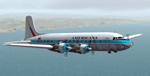
Textures for Tom Gibson's Douglas DC-6 - repainted by Manfred Meyer.
You need to download and install the latest Douglas DC-6 base pack with model, sound and panel from the website calclassic.com.
These textures depict HC-ARK "El Pinguino" (c/n 42865) of Americana de Aviacion. This Ecuadorian Company leased and later bought this plane in 1968 and used it, among others, for flights to the Galapagos Islands.
This DC-6 was the 13. built and originally delivered 1947 to American Airlines as "Flagship Texas" renamed later "Flagship South Carolina". American AL sold her 1960 to Aerolineas Peruanas as OB-OAD-545. From 1964 onwards she was in the hands of some U.S.leasing companies and goes then to Americana of Ecuador. They used the plane until 1970 and then it was broken up at Quito after 1975.
The Lettering "DC-6 EQUIPADO CON RADAR" should be on the nose wheel doors, but unfortunately this is not possible at this FS model. So I put the text on the lower bow near the nose wheel bay.
| Filename: | Americana_de_Aviacion_Douglas_DC6.zip |
| License: | Freeware |
| Added: | 11th September 2014, 22:51:29 |
| Downloads: | 192 |
| Author: | Manfred Meyer |
| Size: | 8.25 MB |
| Category: Flight Simulator 2004 - Utilities | |
| Traffic View Board Version 2.1 |
|
File Description:
Traffic View Board is a new AI view gauge file that will give you an overview of the AI traffic without the need of external programs. This package works like a regular user aircraft and must be installed in the FS "Aircraft" folder. Instead of a regular aircraft model, this model is invisible, and the regular panel is replaced with a traffic board (similar to those found at any airport). When powered on you may choose between "Arrival", "Departure", "In flight" and "On ground". Each flight in the traffic board list represents an AI aircraft in FS2004. By clicking on a flight form the list, that particular aircraft is selected. When activating the "Follow aircraft" button the user aircraft are mapped to the AI aircraft position. This little trick allows you to spot that AI aircraft from any view in FS2004. FS2004 is still "looking" towards the user aircraft, but as the user aircraft are mapped to the AI aircraft FS2004 is "looking" towards the AI aircraft as well.
| Filename: | Traffic_View_Board_Version_21.zip |
| License: | Freeware |
| Added: | 29th October 2004, 22:38:48 |
| Downloads: | 54,514 |
| Author: | Arnt Helge Haland |
| Size: | 479.8 KB |
| Category: Flight Simulator 2004 - Scenery | |
| Himalayas LOD9 Base Mesh, Volume 4 - Kashmir and Jammu |
|
File Description:
Detailed terrain mesh of the Kashmir and Jammu Ranges, N30-39 E76-78. The files in this package are based on Shuttle Radar (SRTM) Version 2 data but with many of the void areas, especially the most significant sections, filled with elevation data generated from topographic maps by Jonathan de Ferranti. While Jonathan's work is unrelated to flight simulation he kindly gave me permission to compile his data for use in FS. The result is a wonderful improvement in detail and accuracy over any existing mesh file, freeware or commercial, based on SRTM or DTED data alone.
Due to the large area of the Himalayas I've compiled the source data as two separate series: the "Himalayan Peaks" series covers prominent mountains and ranges in higher detail and locally overrides any existing LOD9 terrain mesh. In addition, the LOD9 "base mesh" series, with LOD8 and LOD7 "buffer" mesh files, covering the entire Himalayas, is meant for those who do not yet have an add-on terrain mesh of these beautiful mountains.
| Filename: | Himalayas_LOD9_Base_Mesh_Volume_4__Kashmir_and_Jam.zip |
| License: | Freeware, limited distribution |
| Added: | 22nd February 2006, 20:32:50 |
| Downloads: | 7,504 |
| Author: | Holger Sandmann, Jonathan de Ferranti |
| Size: | 29.24 MB |
| Category: Flight Simulator 2004 - Scenery | |
| Himalayas LOD9 Base Mesh, Volume 2 - Southcentral Ranges |
|
Images related to this file:
File Description:
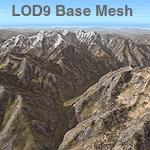
Detailed terrain mesh of the Southcentral Himalayan Ranges, N26-32 E82-90. The files in this package are based on Shuttle Radar (SRTM) Version 2 data but with many of the void areas, especially the most significant sections, filled with elevation data generated from topographic maps by Jonathan de Ferranti. While Jonathan's work is unrelated to flight simulation he kindly gave me permission to compile his data for use in FS. The result is a wonderful improvement in detail and accuracy over any existing mesh file, freeware or commercial, based on SRTM or DTED data alone.
Due to the large area of the Himalayas I've compiled the source data as two separate series: the "Himalayan Peaks" series covers prominent mountains and ranges in higher detail and locally overrides any existing LOD9 terrain mesh. In addition, a LOD9 "base mesh" series, with LOD8 and LOD7 "buffer" mesh files, covering the entire Himalayas, is meant for those who do not yet have an add-on terrain mesh of these beautiful mountains.
| Filename: | Himalayas_LOD9_Base_Mesh_Volume_2__Southcentral_Ra.zip |
| License: | Freeware, limited distribution |
| Added: | 29th May 2010, 09:05:56 |
| Downloads: | 9,450 |
| Author: | Holger Sandmann, Jonathan de Ferranti |
| Size: | 90.25 MB |
| Category: Flight Simulator 2004 - Scenery | |
| Himalayas LOD9 Base Mesh, Volume 5 - Hindu Kush and Pamir |
|
Images related to this file:
File Description:
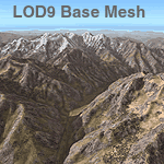
Detailed terrain mesh of the Hindu Kush and Pamir Ranges, N32-40 E70-76. The files in this package are based on Shuttle Radar (SRTM) Version 2 data but with many of the void areas, especially the most significant sections, filled with elevation data generated from topographic maps by Jonathan de Ferranti. While Jonathan's work is unrelated to flight simulation he kindly gave me permission to compile his data for use in FS. The result is a wonderful improvement in detail and accuracy over any existing mesh file, freeware or commercial, based on SRTM or DTED data alone.
Due to the large area of the Himalayas I've compiled the source data as two separate series: the "Himalayan Peaks" series covers prominent mountains and ranges in higher detail and locally overrides any existing LOD9 terrain mesh. In addition, the LOD9 "base mesh" series, with LOD8 and LOD7 "buffer" mesh files, covering the entire Himalayas, is meant for those who do not yet have an add-on terrain mesh of these beautiful mountains.
| Filename: | Himalayas_LOD9_Base_Mesh_Volume_5__Hindu_Kush_and_.zip |
| License: | Freeware, limited distribution |
| Added: | 29th May 2010, 08:57:29 |
| Downloads: | 7,604 |
| Author: | Holger Sandmann, Jonathan de Ferranti |
| Size: | 85.72 MB |


© 2001-2026 AVSIM Online
All Rights Reserved
Privacy Policy |