
Where Flight Simulation Enthusiasts Gather from Around the World!
AVSIM Library - Search Results

| Category: Flight Simulator 2004 - Aircraft Repaints, Textures and Modifications | |
| Updated night lighting for Airbus A320 and A321 |

|
Images related to this file:
File Description:

This an OPTIONAL night light upgrade for the Project Airbus A320 and A321 and includes reshaped and brightened engine landing light reflection. Most important and noticeable upgrade is the wing lights (due to FS limitations, these will turn on with the landing lights, however in real life -depending on airline SOP and pilot preference- these are turned on with the landing lights for takeoff and landing so the effect of doing this is the similar). Wing lights illuminate down wing reflection and the sharklets are also illuminated. I've also now added light reflection on the standard wingtip fence. NOTE: For the FS9 models only but it does work in FSX. A318 and A319 update will come at a later date however, you can simply change the name of the wing and engine texture files to make them work. Textures only, you need the freeware Project Airbus A320 or A321 and any livery you wish to use this on to work.
| Filename: | Updated_night_lighting_for_Airbus_A320_and_A321.zip |
| License: | Freeware |
| Added: | 13th April 2016, 20:23:49 |
| Downloads: | 1,869 |
| Author: | Adam Hamada | Project Airbus |
| Size: | 2.03 MB |
| Category: Flight Simulator 2004 - Scenery | |
| Branson Airport KBBG--New Airport, Scenery, and Flight Plans |
|
Images related to this file:
File Description:

This project adds a new Branson Airport KBBG (Missouri) to FS 2004, which opened in May 2009, and is a privately developed commercial airport. The construction of the airport, which involved the flattening of several Ozark Mountains, is claimed to be the largest earthmoving project in Missouri history. As a result, the airport actually sits on a manmade plateau, surrounded by rolling hills. The airport uses the ICAO identifier BBG, however, the airlines use the IATA code BKG. The airport is served by AirTran, Frontier, and ExpressJet (Branson AirExpress), and is located in hilly terrain. Aircraft equipped with a terrain avoidance warning system may experience system activation on final approach. AFCAD created using Airport Design Editor 9 v1.47.07, and the hilltops were cleared and flattened and roads were added using SBuilder 2.05 revision 06. The terminal and hangar were added and modified from within Airport Design Editor 9. This airport is based on my more detailed FSX version, Branson_Airport_Project.zip.
| Filename: | Branson_Airport_KBBGNew_Airport_Scenery_and_Flight.zip |
| License: | Freeware |
| Added: | 16th August 2010, 20:50:16 |
| Downloads: | 1,732 |
| Author: | Carlyle Sharpe |
| Size: | 3.23 MB |
| Category: Flight Simulator 2004 - Sounds | |
| CFM International CFM56-7 v4 |
|
File Description:
New version of the popular Boeing 737NG soundset, this time exclusively re-built for Project Opensky 737-800. A few changes except the new cfg is a new interior spool sound, making it sound a alot more authentic to the real deal. Also new roll and wind sound to enhance the realism.
I've also added the "hum" you can hear just before the spool kicks. In this verion you can hear it from cockpit as the exterior remains the same.
I've also fixed the spool pitch because i noticed that in the earlier version the spool was a bit off. The POSKY 738 has very powerful engines and take-off thrust should be like 90%. I've built it after a Ryanair video by Christel Jenny Sinsen where i estimate the thrust being around 90%. This by far the most realistic CFM56-7 soundset today and are very close to the real thing. Created with FS Sound Studio. Enjoy!
| Filename: | CFM_International_CFM567_v4.zip |
| License: | Freeware |
| Added: | 15th March 2006, 05:36:10 |
| Downloads: | 30,598 |
| Author: | Steven Persson |
| Size: | 16.91 MB |
| Category: Flight Simulator 2004 - Scenery | |
| Scotports Volume 1 |
|
Images related to this file:
File Description:
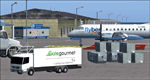
It is well noted that Scottish Airports are very neglected by scenery developers in FS9, mainly the smaller Airports. Therefore I decided to do a little something about it! - Using the wonderful Airport Design Editor (ADE), I have constructed these sceneries from scratch, after deleting all of the disappointing default buildings and objects. The airports included are 99% realistic regarding runways, aprons and taxiways and general airport layout, however there may be a one or two minor discrepancies due to FS limitations. I have also added fictional ILS to runways which don't have ILS in the real world. All scenery objects and textures are by Sidney Schwartz (especially for ADE), of whom, without his long hours of work, none of this would have been possible. Airports in this package are: Campbeltown (EGEC), Eday (EGED), Kirkwall (EGPA), Sumburgh (EGPB), Wick (EGPC), Inverness v2 (EGPE), Islay (EGPI), and Dundee (EGPN). All these airports are served by Loganair.
| Filename: | Scotports_Volume_1.zip |
| License: | Freeware |
| Added: | 3rd November 2011, 19:35:10 |
| Downloads: | 4,351 |
| Author: | Chris Horsfield |
| Size: | 70.7 MB |
| Category: Flight Simulator 2004 - Scenery | |
| Bora Bora Airport, French Polynesia, NTTB |
|
File Description:
The Bora Bora airport is located on one of the Motus, which surround the Island of Bora Bora. The Motus are raised coral reefs which act as break waters, and create the beautiful turquoise lagoons which surround the French Polynesian Islands. This scenery is a complete remake of the original, and is now much more accurate as to what the airport looks like. It contains the main terminal, a fire station attached to the tower with fuel tanks, open air hangar structures, two helipads, and wood stairs taking you down to the boat docks where you are transported to the main island. This is one of the most unique French Polynesian Islands with it's beautiful and interesting mountain structure. Using the terrain mesh by Rolf Keibel and John Applegate will tremendously enhance this part of the world in FS. It is available at Flightsim under the name fpsimesh.zip. Afcad by Ray Smith is also included.
| Filename: | Bora_Bora_Airport_French_Polynesia_NTTB.zip |
| License: | Freeware |
| Added: | 25th April 2004, 01:39:17 |
| Downloads: | 19,357 |
| Author: | Bill Melichar |
| Size: | 3.11 MB |
| Category: Flight Simulator 2004 - Scenery | |
| Himalayan Peaks LOD10 Mesh, Volume 1 - Mt. Everest and Kula Kangri |
|
File Description:
Highly detailed terrain mesh of the Mt. Everest and Kula Kangri areas, N26°-29° E85°-92°. The files in this package are based on Shuttle Radar (SRTM) Version 2 data but with many of the void areas, especially the most significant sections, filled with elevation data generated from topographic maps by Jonathan de Ferranti. While Jonathan's work is unrelated to flight simulation he kindly gave me permission to compile his data for use in FS. The result is a wonderful improvement in detail and accuracy over any existing mesh file, freeware or commercial, based on SRTM or DTED data alone. Due to the large area of the Himalayas I've compiled the source data as two separate series: the "Himalayan Peaks" series covers prominent mountains and ranges in higher detail and locally overrides any existing LOD9 terrain mesh. In addition, a LOD9 "base mesh" series covering the entire Himalayas will be available for those who do not yet have an add-on terrain mesh of these beautiful mountains.
| Filename: | Himalayan_Peaks_LOD10_Mesh_Volume_1__Mt_Everest_an.zip |
| License: | Freeware, limited distribution |
| Added: | 9th February 2006, 22:13:00 |
| Downloads: | 37,043 |
| Author: | Holger Sandmann and Jonathan de Ferranti |
| Size: | 52.01 MB |
| Category: Flight Simulator 2004 - Scenery | |
| "Himalayan Peaks" LOD10 Mesh, Volume 7 - K2 and Karakoram |
|
Images related to this file:
File Description:

Highly detailed terrain mesh of the Karakoram area, N35-37 E73-77. The files in this package are based on Shuttle Radar (SRTM) Version 2 data but with many of the void areas, especially the most significant sections, filled with elevation data generated from topographic maps by Jonathan de Ferranti. While Jonathan's work is unrelated to flight simulation he kindly gave me permission to compile his data for use in FS. The result is a wonderful improvement in detail and accuracy over any existing mesh file, freeware or commercial, based on SRTM or DTED data alone.
Due to the large area of the Himalayas I've compiled the source data as two separate series: the "Himalayan Peaks" series covers prominent mountains and ranges in higher detail and locally overrides any existing LOD9 terrain mesh. In addition, a LOD9 "base mesh" series covering the entire Himalayas will be available for those who do not yet have an add-on terrain mesh of these beautiful mountains.
| Filename: | Himalayan_Peaks_LOD10_Mesh_Volume_7__K2_and_Karako.zip |
| License: | Freeware, limited distribution |
| Added: | 30th May 2010, 09:56:27 |
| Downloads: | 9,475 |
| Author: | Holger Sandmann, Jonathan de Ferranti |
| Size: | 38.58 MB |
| Category: Flight Simulator 2004 - Scenery | |
| "Himalayan Peaks" LOD10 Mesh, Volume 6 - Jammu and Kashmir |
|
Images related to this file:
File Description:
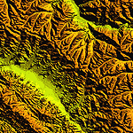
Highly detailed terrain mesh of the Jammu and Kashmir areas, N31-36 E76-78. The files in this package are based on Shuttle Radar (SRTM) Version 2 data but with many of the void areas, especially the most significant sections, filled with elevation data generated from topographic maps by Jonathan de Ferranti. While Jonathan's work is unrelated to flight simulation he kindly gave me permission to compile his data for use in FS. The result is a wonderful improvement in detail and accuracy over any existing mesh file, freeware or commercial, based on SRTM or DTED data alone.
Due to the large area of the Himalayas I've compiled the source data as two separate series: the "Himalayan Peaks" series covers prominent mountains and ranges in higher detail and locally overrides any existing LOD9 terrain mesh. In addition, a LOD9 "base mesh" series covering the entire Himalayas will be available for those who do not yet have an add-on terrain mesh of these beautiful mountains.
| Filename: | Himalayan_Peaks_LOD10_Mesh_Volume_6__Jammu_and_Kas.zip |
| License: | Freeware, limited distribution |
| Added: | 29th May 2010, 08:55:43 |
| Downloads: | 9,664 |
| Author: | Holger Sandmann, Jonathan de Ferranti |
| Size: | 52.19 MB |
| Category: Flight Simulator X - Gauges | |
| BeThere! |
|
File Description:
This package contains the BeThere! gauge. It lets you pause the flight simulator once the aircraft reaches a certain position.
This is useful for long range flights where the pilot wants to leave the flight sim unattended. The procedure is to either load an FS flightplan, switch the navigation mode of the autopilot to GPS and engage the autopilot. Or - with advanced aircraft add-ons - a flightplan is loaded into the FMC and the LNAV mode is set to let the aircraft automatically follow the track. Anyway, the problem is, that the pilot doesn't want to miss the top of descent. So the pilot has to check the computer regularily in order to be there when it becomes interesting again. Or, and that's the idea of this package, the flight sim is automatically paused at a safe position/distance.
Read more about this gauge, how to install and use it, in the readme.txt file included in the package.
| Filename: | BeThere.zip |
| License: | Freeware |
| Added: | 8th February 2007, 15:40:29 |
| Downloads: | 3,405 |
| Author: | Thilo Arndt |
| Size: | 44.46 KB |
| Category: Flight Simulator 2004 - Scenery | |
| "Himalayan Peaks" LOD10 Mesh, Volume 3 - Namcha Barwa |
|
File Description:
Highly detailed terrain mesh of the Namcha Barwa area, N29°-31° E94°-96°. The files in this package are based on Shuttle Radar (SRTM) Version 2 data but with many of the void areas, especially the most significant sections, filled with elevation data generated from topographic maps by Jonathan de Ferranti. While Jonathan's work is unrelated to flight simulation he kindly gave me permission to compile his data for use in FS. The result is a wonderful improvement in detail and accuracy over any existing mesh file, freeware or commercial, based on SRTM or DTED data alone. Due to the large area of the Himalayas I've compiled the source data as two separate series: the "Himalayan Peaks" series covers prominent mountains and ranges in higher detail and locally overrides any existing LOD9 terrain mesh. In addition, a LOD9 "base mesh" series covering the entire Himalayas will be available for those who do not yet have an add-on terrain mesh of these beautiful mountains.
| Filename: | Himalayan_Peaks_LOD10_Mesh_Volume_3__Namcha_Barwa.zip |
| License: | Freeware, limited distribution |
| Added: | 18th February 2006, 23:15:17 |
| Downloads: | 12,186 |
| Author: | Holger Sandmann and Jonathan de Ferranti |
| Size: | 15.09 MB |


© 2001-2026 AVSIM Online
All Rights Reserved
Privacy Policy |