
Where Flight Simulation Enthusiasts Gather from Around the World!
AVSIM Library - Search Results

| Category: Flight Simulator 2004 - Aircraft Repaints, Textures and Modifications | |
| Updated night lighting for Airbus A320 and A321 |

|
Images related to this file:
File Description:

This an OPTIONAL night light upgrade for the Project Airbus A320 and A321 and includes reshaped and brightened engine landing light reflection. Most important and noticeable upgrade is the wing lights (due to FS limitations, these will turn on with the landing lights, however in real life -depending on airline SOP and pilot preference- these are turned on with the landing lights for takeoff and landing so the effect of doing this is the similar). Wing lights illuminate down wing reflection and the sharklets are also illuminated. I've also now added light reflection on the standard wingtip fence. NOTE: For the FS9 models only but it does work in FSX. A318 and A319 update will come at a later date however, you can simply change the name of the wing and engine texture files to make them work. Textures only, you need the freeware Project Airbus A320 or A321 and any livery you wish to use this on to work.
| Filename: | Updated_night_lighting_for_Airbus_A320_and_A321.zip |
| License: | Freeware |
| Added: | 13th April 2016, 20:23:49 |
| Downloads: | 1,874 |
| Author: | Adam Hamada | Project Airbus |
| Size: | 2.03 MB |
| Category: Flight Simulator 2004 - Scenery Design | |
| Franks Updated Scenery Items - Part 1 |
|
File Description:
These files contain GMAX designed scenery items for use in FS2004 utilizing the new FS2004 BGLComp SDK.
The true inspiration for these designs comes from Frank Betts over at Franks Hangar (http://www.flightsimsetc.dhs.org/) who originally designed these items as macros for use with Airport and FSSC programs. Frank was gracious enough to allow me to redesign them in GMAX for use in FS2004 and beyond. While I may have taken some 'artistic license' on a few items, they are basically identical to those designed by Frank. Most use the identical textures designed with Franks macros, but a few additional custom textures were added.
All files also contain the original GMAX source files, so if you feel the need to alter or improve the fies, please feel free to do so. All I ask is that you share your improvements with the FS world as freeware.
This is Part 1 of a series of files that will eventually update all of Franks macros to GMAX files.
| Filename: | Franks_Updated_Scenery_Items__Part_1.zip |
| License: | Freeware |
| Added: | 25th November 2004, 05:20:10 |
| Downloads: | 1,628 |
| Author: | Todd Lucas, Frank Betts |
| Size: | 1.68 MB |
| Category: Flight Simulator X - Scenery | |
| Bella Coola Valley Landscape Enhancements |
|
File Description:
One of the most spectacular watersheds of British Columbia's Midcoast, the Bella Coola Valley looks pretty boring in its default FSX rendition and the oddly shaped default Bella Coola River cuts deep into the terrain. These files provide a terrain mesh made from CDED1 0.75-arcsec data (multi-LOD, with maximum resolution of 38-m grid spacing), updated land class, water class, and seasons files, and accurate placements of lakes, rivers, streams, roads, and bridges. Also added are the glaciers of the Monarch Mountain Icefield as well as several forestry roads and clearcuts in the side valleys. Main roads have vehicle traffic moving in both directions. Coverage area is N51*45'-52*40' and W125*35'-127*25'. These files are fully compatible with other landscape enhancements for FSX, such as FS Genesis North America terrain mesh, Cloud 9's X-class, Adam Mill's ground texture replacements, or Flight1's Ultimate Terrain Canada/Alaska.
| Filename: | Bella_Coola_Valley_Landscape_Enhancements.zip |
| License: | Freeware, limited distribution |
| Added: | 24th February 2007, 08:27:54 |
| Downloads: | 12,655 |
| Author: | Holger Sandmann |
| Size: | 15.68 MB |
| Category: Flight Simulator X - Scenery | |
| Jersey Airport (EGJJ) |
|
File Description:
Jersey Airport (EGJJ) is located on the island of Jersey in the Channel Islands. I live on the island, so this is a pretty accurate representation of the airport. Features include many parkable hangars, accurate control tower, accurate departure lounge, accurate gates, accurate aero club, many static aircraft, many vehicles, car parks, freight terminal, private aviation terminal, fuel farm, fire-station, surrounding trees, perimeter fencing and more. Many night textures and custom AFCAD file included. The airport is at N49 12 28 and W002 11 43. This scenery is for FSX but should also work under FS2004. It may even work in earlier versions of FS but this is untested. This scenery is dedicated to my father who was a pilot in the Royal Air Force and subsequently worked as an Air Traffic Controller at the airport for over 20 years. He sparked my interest in aviation in the first place and since the original airport was released, he has passed away. He's sorely missed.
| Filename: | Jersey_Airport_EGJJ.zip |
| License: | Freeware, limited distribution |
| Added: | 29th October 2006, 03:15:15 |
| Downloads: | 13,876 |
| Author: | Tim Clayton |
| Size: | 3.68 MB |
| Category: Flight Simulator X - Aircraft Repaints, Textures and Modifications | |
| P-40N Warhawk "Little Jeanne" (F-AZKU) |
|
Images related to this file:
File Description:

A repaint only for the payware Flight Replicas P-40N Warhawk. This repaint depicts the restored P-40N 42-105915, "Little Jeanne", registered F-AZKU. This aircraft operated in the Pacific during WWII, with the 7th FS, 49th FG, flown by Lt. Robert Warren. In the 1970's the aircraft was recovered along with several other WWII combat vet aircraft from Tadji Airfield in New Guinea. Displayed for many years in Australia, the aircraft eventually found its way to Murray Griffith and a restoration to airworthy at Precision Aerospace. Finished in its original wartime markings, the aircraft flew again in 2002, registered VH-KTI. The aircraft was operated in Australia until being sold in 2007 to the French Amicale Jean-Baptiste Salis association, based at La Ferte Alais. The aircraft is a regular air show participant at various European air shows, including Duxford's annual "Flying Legends" show and the annual "Meeting Aerien la Ferte Alais".
| Filename: | P40N_Warhawk_Little_Jeanne_FAZKU.zip |
| License: | Freeware |
| Added: | 28th July 2013, 18:32:37 |
| Downloads: | 143 |
| Author: | John Terrell |
| Size: | 8.46 MB |
| Category: Flight Simulator 2004 - Scenery | |
| "Himalayan Peaks" LOD10 Mesh, Volume 3 - Namcha Barwa |
|
File Description:
Highly detailed terrain mesh of the Namcha Barwa area, N29°-31° E94°-96°. The files in this package are based on Shuttle Radar (SRTM) Version 2 data but with many of the void areas, especially the most significant sections, filled with elevation data generated from topographic maps by Jonathan de Ferranti. While Jonathan's work is unrelated to flight simulation he kindly gave me permission to compile his data for use in FS. The result is a wonderful improvement in detail and accuracy over any existing mesh file, freeware or commercial, based on SRTM or DTED data alone. Due to the large area of the Himalayas I've compiled the source data as two separate series: the "Himalayan Peaks" series covers prominent mountains and ranges in higher detail and locally overrides any existing LOD9 terrain mesh. In addition, a LOD9 "base mesh" series covering the entire Himalayas will be available for those who do not yet have an add-on terrain mesh of these beautiful mountains.
| Filename: | Himalayan_Peaks_LOD10_Mesh_Volume_3__Namcha_Barwa.zip |
| License: | Freeware, limited distribution |
| Added: | 18th February 2006, 23:15:17 |
| Downloads: | 12,196 |
| Author: | Holger Sandmann and Jonathan de Ferranti |
| Size: | 15.09 MB |
| Category: Flight Simulator 2004 - Scenery | |
| "Himalayan Peaks" LOD10 Mesh, Volume 4 - Annapurna |
|
Images related to this file:
File Description:
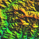
Highly detailed terrain mesh of the Annapurna area, N28-30 E83-85. The files in this package are based on Shuttle Radar (SRTM) Version 2 data but with many of the void areas, especially the most significant sections, filled with elevation data generated from topographic maps by Jonathan de Ferranti. While Jonathan's work is unrelated to flight simulation he kindly gave me permission to compile his data for use in FS. The result is a wonderful improvement in detail and accuracy over any existing mesh file, freeware or commercial, based on SRTM or DTED data alone.
Due to the large area of the Himalayas I've compiled the source data as two separate series: the "Himalayan Peaks" series covers prominent mountains and ranges in higher detail and locally overrides any existing LOD9 terrain mesh. In addition, a LOD9 "base mesh" series covering the entire Himalayas will be available for those who do not yet have an add-on terrain mesh of these beautiful mountains.
| Filename: | Himalayan_Peaks_LOD10_Mesh_Volume_4__Annapurna.zip |
| License: | Freeware, limited distribution |
| Added: | 29th May 2010, 08:59:29 |
| Downloads: | 10,471 |
| Author: | Holger Sandmann, Jonathan de Ferranti |
| Size: | 15.07 MB |
| Category: Flight Simulator 2004 - Scenery | |
| "Himalayan Peaks" LOD10 Mesh, Volume 5 - Garhwal |
|
File Description:
Highly detailed terrain mesh of the Garhwal area, N30°-32° E78°-81°. The files in this package are based on Shuttle Radar (SRTM) Version 2 data but with many of the void areas, especially the most significant sections, filled with elevation data generated from topographic maps by Jonathan de Ferranti. While Jonathan's work is unrelated to flight simulation he kindly gave me permission to compile his data for use in FS. The result is a wonderful improvement in detail and accuracy over any existing mesh file, freeware or commercial, based on SRTM or DTED data alone. Due to the large area of the Himalayas I've compiled the source data as two separate series: the "Himalayan Peaks" series covers prominent mountains and ranges in higher detail and locally overrides any existing LOD9 terrain mesh. In addition, a LOD9 "base mesh" series covering the entire Himalayas will be available for those who do not yet have an add-on terrain mesh of these beautiful mountains.
| Filename: | Himalayan_Peaks_LOD10_Mesh_Volume_5__Garhwal.zip |
| License: | Freeware, limited distribution |
| Added: | 18th February 2006, 23:16:47 |
| Downloads: | 10,142 |
| Author: | Holger Sandmann and Jonathan de Ferranti |
| Size: | 27.72 MB |
| Category: Flight Simulator 2004 - Scenery | |
| Himalayan Peaks LOD10 Mesh, Volume 1 - Mt. Everest and Kula Kangri |
|
File Description:
Highly detailed terrain mesh of the Mt. Everest and Kula Kangri areas, N26°-29° E85°-92°. The files in this package are based on Shuttle Radar (SRTM) Version 2 data but with many of the void areas, especially the most significant sections, filled with elevation data generated from topographic maps by Jonathan de Ferranti. While Jonathan's work is unrelated to flight simulation he kindly gave me permission to compile his data for use in FS. The result is a wonderful improvement in detail and accuracy over any existing mesh file, freeware or commercial, based on SRTM or DTED data alone. Due to the large area of the Himalayas I've compiled the source data as two separate series: the "Himalayan Peaks" series covers prominent mountains and ranges in higher detail and locally overrides any existing LOD9 terrain mesh. In addition, a LOD9 "base mesh" series covering the entire Himalayas will be available for those who do not yet have an add-on terrain mesh of these beautiful mountains.
| Filename: | Himalayan_Peaks_LOD10_Mesh_Volume_1__Mt_Everest_an.zip |
| License: | Freeware, limited distribution |
| Added: | 9th February 2006, 22:13:00 |
| Downloads: | 37,061 |
| Author: | Holger Sandmann and Jonathan de Ferranti |
| Size: | 52.01 MB |
| Category: Flight Simulator 2004 - Scenery | |
| "Himalayan Peaks" LOD10 Mesh, Volume 6 - Jammu and Kashmir |
|
Images related to this file:
File Description:
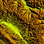
Highly detailed terrain mesh of the Jammu and Kashmir areas, N31-36 E76-78. The files in this package are based on Shuttle Radar (SRTM) Version 2 data but with many of the void areas, especially the most significant sections, filled with elevation data generated from topographic maps by Jonathan de Ferranti. While Jonathan's work is unrelated to flight simulation he kindly gave me permission to compile his data for use in FS. The result is a wonderful improvement in detail and accuracy over any existing mesh file, freeware or commercial, based on SRTM or DTED data alone.
Due to the large area of the Himalayas I've compiled the source data as two separate series: the "Himalayan Peaks" series covers prominent mountains and ranges in higher detail and locally overrides any existing LOD9 terrain mesh. In addition, a LOD9 "base mesh" series covering the entire Himalayas will be available for those who do not yet have an add-on terrain mesh of these beautiful mountains.
| Filename: | Himalayan_Peaks_LOD10_Mesh_Volume_6__Jammu_and_Kas.zip |
| License: | Freeware, limited distribution |
| Added: | 29th May 2010, 08:55:43 |
| Downloads: | 9,677 |
| Author: | Holger Sandmann, Jonathan de Ferranti |
| Size: | 52.19 MB |


© 2001-2026 AVSIM Online
All Rights Reserved
Privacy Policy |