
Where Flight Simulation Enthusiasts Gather from Around the World!
AVSIM Library - Search Results

| Category: Flight Simulator 2004 - AI Flight Plans | |
| Vision Airlines (RBY - Ruby) Flightplans - some 52-week and some "normal". |

|
File Description:
These are fictional flightplans for Vision Airlines (ex Vision Air) of North Las Vegas, USA. There are 2 sets of flightplans, each using a different part of the fleet to the other. One set are plans that operate on the 52-week concept - these contain charters that can be varied every week if you use Matthew Ministry's flightplan swapper routine. The other set fly fixed flights each week (in fact 2 planes fly 24-hour plans, canyon sightseeing) and also include Vision's Boeing fleet that fly military charters via Europe. You can use both sets to get the whole fleet, or either to get a flavour of Vision Airlines. If you want to use just 1 week's charters, you can get the whole fleet but the charters will repeat every week. These plans will add some Dorniers (228, 328TP and 328J) to North Las Vegas (KVGT) and points on Vision's scheduled network, plus the Houston-based 328Jets that fly to Alamogordo. If you use the 52-week system the rest of the fleet will fly charters almost nationwide, limited only by the real-world aircraft's range (so no Miami and no Boston, but KLAX, KPDX and KSEA). They will also operate into many smaller regional and municipal airports.
| Filename: | Vision_Airlines_RBY__Ruby_Flightplans__some_52week.zip |
| License: | Freeware |
| Added: | 12th January 2009, 23:12:57 |
| Downloads: | 760 |
| Author: | Morello Ciliegia |
| Size: | 2.44 MB |
| Category: Flight Simulator 2002 - Scenery | |
| Redding Muni - Redding Ca. KRDD |
|
File Description:
KRDD(Redding Municipal Airport) is located in the beautiful city of Redding Ca. Redding is a city located in Shasta County 150 mile's north of Sacramento on Interstate-5. Redding is known as a gateway for recreation for those visiting this Northern Ca. city, Lake Shasta and Mt Lassen are just a short drive out of town.
As a former resident of Redding I drove past KRDD on a daily basis,on a couple of occasion's I had the opportunity to attend the annual Redding Airshow. The airshow play's host to many of aviations finest stunt pilot's as well as one of many military jet flying team's, the USN Blue Angels have been guest of the airshow many time's. The airshow still runs to this day. KRDD is also a destination city for several major and regional air carriers, HorizonAir and United Skywest are among them.
This scenery I have done as a tribute to the many mile's I have put on driving past it as well as an opportunity to give it some dignity amongst the many airports in MSFS2002. This is also my first airport project I have released.
My hope is that it adds to your FS2002 experience.
| Filename: | Redding_Muni__Redding_Ca_KRDD.zip |
| License: | Freeware |
| Added: | 12th February 2003, 22:43:12 |
| Downloads: | 726 |
| Author: | Randall R Smith |
| Size: | 557.2 KB |
| Category: Flight Simulator 2004 - Flight Plans | |
| Crossing North America Flight Adventures-Package 1 |
|
File Description:
Inspired by Michael Doherty (Difficult & Dangerous Approaches) and David Dossiere (Hopping Round the World) and their flight adventures, I have put together a series of flight plan-adventures where the aircraft used are all available as freeware. A file locator is included with each package so that you can easily find and download the aircraft used. These packages each contain 10 flight adventures and each package begins at the location the previous package ended.
All flightplans are VFR only and are designed so that you can enjoy the outstanding scenery of Alaska, Western Canada, Western and Mountain States of the lower 48, and Mexico.
The adventure, Crossing North America, begins at Pt Hope, Alaska and will conclude in the following months at Cancun, Mexico. The aircraft used are: General Aviation, Vintage, Warbirds, Bush Aircraft, and Propliners. No IFR flightplans or jets!
The flightplans are NOT designed to get you from Alaska to Mexico by the shortest route possible, but are in the spirit of David Dossiere's "Hopping Round the World" adventure flights, in that they take you into as many areas or airports as possible. Looking for some fun, flying low, and enjoying the scenery, then these flight adventures are for you.
| Filename: | Crossing_North_America_Flight_AdventuresPackage_1.zip |
| License: | Freeware |
| Added: | 4th July 2004, 23:01:02 |
| Downloads: | 7,150 |
| Author: | Steve (Bear) Cartwright |
| Size: | 1.03 MB |
| Category: Flight Simulator 2004 - Flight Plans | |
| Crossing North America Flight Adventures-Package 2 |
|
File Description:
Inspired by Michael Doherty (Difficult & Dangerous Approaches) and David Dossiere (Hopping Round the World) and their flight adventures, I have put together a series of flight plan-adventures where the aircraft used are all available as freeware. A file locator is included with each package so that you can easily find and download the aircraft used. These packages each contain 10 flight adventures and each package begins at the location the previous package ended. All flightplans are VFR only and are designed so that you can enjoy the outstanding scenery of Alaska, Western Canada, Western and Mountain States of the lower 48, and Mexico.
The adventure, Crossing North America, begins at Pt Hope, Alaska and will conclude in the following months at Cancun, Mexico. The aircraft used are: General Aviation, Vintage, Warbirds, Bush Aircraft, and Propliners. No IFR flightplans or jets!
The flightplans are NOT designed to get you from Alaska to Mexico by the shortest route possible, but are in the spirit of David Dossiere's "Hopping Round the World" adventure flights, in that they take you into as many areas or airports as possible. Looking for some fun, flying low, and enjoying the scenery, then these flight adventures are for you.
| Filename: | Crossing_North_America_Flight_AdventuresPackage_2.zip |
| License: | Freeware |
| Added: | 4th July 2004, 23:01:15 |
| Downloads: | 5,324 |
| Author: | Steve (Bear) Cartwright |
| Size: | 1.2 MB |
| Category: Flight Simulator 2002 - Scenery | |
| Redding Municipal Airport.. Redding, CA |
|
File Description:
KRDD(Redding Municipal Airport) is located in the beautiful city of Redding Ca. Redding is a city located in Shasta County 150 mile's north of Sacramento on Interstate-5. Redding is known as a gateway for recreation for those visiting this Northern Ca. city, Lake Shasta and Mt Lassen are just a short drive out of town. As a former resident of Redding I drove past KRDD on a daily basis,on a couple of occasion's I had the opportunity to attend the annual Redding Airshow. The airshow play's host to many of aviations finest stunt pilot's as well as one of many military jet flying team's, the USN Blue Angels have been guest of the airshow many time's. The airshow still runs to this day. KRDD is also a destination city for several major and regional air carriers, HorizonAir and United Skywest are among them. This scenery I have done as a tribute to the many mile's I have put on driving past it as well as an opportunity to give it some dignity amongst the many airports in MSFS2002. This is also my first airport project I have released. My hope is that it adds to your FS2002 experience.
| Filename: | Redding_Municipal_Airport_Redding_CA.zip |
| License: | Freeware |
| Added: | 22nd November 2002, 04:37:21 |
| Downloads: | 621 |
| Author: | Randall R Smith |
| Size: | 557.2 KB |
| Category: Flight Simulator 2004 - Utilities | |
| AIRound v1.0 |
|
File Description:
FS2004 AIRound v1.0. This utility displays AI aircraft around user plane in AI map or AI list forms, enables AI aircraft forward, fly by or spot plane views and has its own built-in traffic alert system. In forward view eyepoint is tied to AI aircraft in front of virtual cockpit with ability to change look direction. Fly by view has adjustable parameters and random options. Departure and arrival airports and time, total about 40 ATC, state, control surfaces, radio, etc. AI aircraft parameters are available. AI map has set of scales and can be placed everywhere within 160nm AI aircraft zone around user plane. You can customize AI aircraft appearance on the map by changing mark colors, shapes, sizes and data tag types. Utility has mini panel with small scalable AI map for quick in-flight AI aircraft related analysis. Traffic alert panel helps to avoid collision with AI aircraft. Also it may be used as a navigation gauge in escort missions assisting to find, get closer and follow accompanied AI aircraft. Utility works both in FS windowed and full screen modes and doesn't require any other add-on modules or programs. You have 10 FS sessions for free.
| Filename: | AIRound_v10.zip |
| License: | Shareware, time limited |
| Added: | 12th February 2006, 22:02:49 |
| Downloads: | 5,266 |
| Author: | Valery Stenin |
| Size: | 612.81 KB |
| Category: Prepar3D V1-4 - Missions | |
| C-27 Spartan JTAX Maneuver Caribbean Sea |
|
Images related to this file:
File Description:
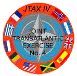
This package is a ficitional campaign with 28 single mission days. The tasks are typical for tactical air transport operations, containing low flying, day- and night ops, airdrops, medevacs... The mission package is designed for the IRIS Battlefield Airlifter (Payware) but may be used also with other aircraft. Here is the basic story: The Royal Airforce sent their new Alenia / Leonardo C-27 Spartan to the Caribbean Sea for the current Joint Transatlantic Exercise (JTAX). You are one of the selected pilots for this campaign. There are two atlantic crossing flights included but mostly short missions within theatre of operation. All locations used are default scenery. Eventually You have to adjust starting positions or waypoints if You are using special scenery within caribbean area. Content: Saved Flights for each mission (P3DV4 standard flights using IRIS Battlefield Airlifter with default liveries) Weather files for each mission (P3DV4 standard flights) P3D Flight plans (Default flight planner) Mission explanation and daily orders (PDF files) Addidional NAV-Logs for the atlantic flights (PDF files). Read the mission documents, load the flights at P3D and fly them as often as You want. The Campaigns use the following airports and locations: EGVN, GVSV, TKPK, MKJP, MKNG, MWCL, MWCB, MWCR, MUGM, MYIG, CYQX, Jamaica area, Cayman islands and Inagua / West Indies.
| Filename: | C27_Spartan_JTAX_Maneuver_Caribbean_Sea.zip |
| License: | Freeware |
| Added: | 1st March 2021, 00:58:13 |
| Downloads: | 121 |
| Author: | Alex Jorda |
| Size: | 21.23 MB |
| Category: Flight Simulator X - Panels | |
| F-111 Aardvark HUD - Navigation/Situation awareness cockpit with RADAR |
|
Images related to this file:
File Description:
FSX Alphasim F-111 Aardvark HUD. Navigation/Situation awareness cockpit.
REVISION 4. UPGRADE. COMPLETE PACKAGE. Adds upgraded dual role air-to-air ground mapping RADAR with target lock up and script on radar and HUD to enable precise intercepts in all weather day or night and new Sound. Massive amount of digital data.
Must have ALPHASIM F-111 Aardvark to build up this complete and separate F-111. Exceptional capability cockpit Comprising:
-Pilot, WSO and virtual panels;
-3 MFD with 19 selectable pages of data;
-NEW RADAR and 3 GPS type moving maps;
-16 Nearest airports page with full Citynames and ICAO entry capable displays in HUD;
-Clipboard, autopilot;
-Autothrottle and TFR;
-Enhanced HUD is selectable in all views including 10 camera views;
-All data clearly readable size;
-Aircraft carrier capable;
-Effects: bombs, missiles, flares, dump and burn, exhaust trail;
-Detailed REVISED 48 pge Flight Manual plus docs folder.
Configuration ensures crisp and extremely precise controlled flight even down to
10 ft AGL. This panel will set a new benchmark of the amount and type of
data provided and its presentation. Possibly the best pilots' aircraft ever.
Simple Panel replacement if previous version already installed.
By Karol Chlebowski.
| Filename: | F111_Aardvark_HUD__NavigationSituation_awareness_c.zip |
| License: | Check within download |
| Added: | 31st December 2009, 03:09:04 |
| Downloads: | 1,072 |
| Author: | Karol Chlebowski |
| Size: | 35.61 MB |
| Category: Flight Simulator 2004 - Miscellaneous Files | |
| UK FS Flight Guide Vol 3 (L - R) |
|
File Description:
UK FS Flight Guide Vol 3 (L - R)
Part of a complete UK & Ireland airport
and helipads flight guide by Alan Trussell
(Consists of 5 parts)
UK FS Flight Guide Vol 1 (A - C)
UK FS Flight Guide Vol 2 (D - K)
UK FS Flight Guide Vol 3 (L - R)
UK FS Flight Guide Vol 4 (S - Z)
Plus - UK Flight Guide Needed Additional Files.
(For use with any photographic scenery for the uk).
(Compatible with FS9 & FSX)
Includes flight cards for 1521 airports & helipads,
Comprehensive airport information for pilots,designers
and enthusiasts.
Also some scenery and placemaker AFCADS
maps,airport lists,flight plan plus nav aids info,
imajes of each airport from the air and ground
plus screenshots by Dennis Williams.
**Please note Microsoft has a max length for file names,but for no good reason also includes the complete file extension path words in this maximum!
For this reason, please download each Zip file directly to your(My Computer/(C) Drive -(In my case),unzip and view from here as well - thus keeping the file extension length as short as possible. Anywhere else and it increases the file extension length such that some files cannot be opened or viewed.
More modern computers may have corrected this problem.**
| Filename: | UK_FS_Flight_Guide_Vol_3_L__R.zip |
| License: | Freeware |
| Added: | 8th January 2017, 07:35:56 |
| Downloads: | 257 |
| Author: | Alan Trussell |
| Size: | 359.03 MB |
| Category: Flight Simulator X - Scenery | |
| LGKF Kefallinia / Cephalonia International Airport, Greece |
|
Images related to this file:
File Description:
LGKF Kefallinia Greece
The island of Kefalonia lies on the west coast of Greece. The nearest airports are LGZA Zakinthos, LGKR Kerkira, and LGPZ Preveza. During the tourist season the island is a very popular destination for flights from Frankfurt, Berlin, Gatwick, Rome and many others.
This scenery has been designed to sit on top of Yiannis Dermitzakis's file - grcoastlines.zip, available here on Avsim. I would also highly recommend Angelo Tassoglou's photoreal scenery called ionianislands.zip, also available here on Avsim.
The scenery has been created using real photographs where possible and has been repositioned in line with satellite imagery. It features many objects painted with Hellenic features and Mediterranean vegetation. It also includes animated flags, windsocks, vehicles, aircrew and road traffic around the airport. Full night lighting is included together with wash lighting of the apron and carparks. The scenery has been sub-divided so that each part can be switched on or off according to user preference. Traffic files are based on real schedules effective to 2013. The scenery has been designed for, and tested with FSXA only. Full installation instructions, settings, hints and tips are included.
Please enjoy and I hope you like my scenery as much as I enjoyed building it.
| Filename: | LGKF_Kefallinia__Cephalonia_International_Airport_.zip |
| License: | Freeware, limited distribution |
| Added: | 23rd December 2012, 23:10:32 |
| Downloads: | 23,229 |
| Author: | George Keogh |
| Size: | 60.33 MB |
© 2001-2026 AVSIM Online
All Rights Reserved
Privacy Policy |