
Where Flight Simulation Enthusiasts Gather from Around the World!
AVSIM Library - Search Results

| Category: Flight Simulator 2002 - Scenery | |
| Aleutian Islands Scenery Enhancement - Part I |

|
File Description:
This scenery enhances the Aleutian Islands in Alaska. Over 80 small, individual
scenery areas have been added to the Aleutians to provide VFR landmarks while
flying this area with World Aeronautical Charts. (WAC)
All cabin and building markers from WAC charts CE-12 and CE-13 are present in
the scenery. It consists mostly of cabins which are spread out through the Aleutians.
Unalaska has been completely enhanced, adding the city, ships, and docks to the default airport. Some floatbases (not covered by Dave's scenery) in the Aleutians now have corresponding cabins and wood docks around them.
This scenery is fully compatible with Dave Erickson's "Alaskan Docks 2" scenery,
and is HIGHLY recommended, as I did not touch any of the areas which are covered by that scenery, except for Unalaska, for which I used a city map to recreate and upgrade. Details in the readme.
| Filename: | Aleutian_Islands_Scenery_Enhancement__Part_I.zip |
| License: | Freeware |
| Added: | 18th November 2002, 04:06:24 |
| Downloads: | 2,911 |
| Author: | Jorge 'eko' Salas |
| Size: | 6.13 MB |
| Category: Flight Simulator X - Utilities | |
| FS Earth 5.2 for Google Earth and FSX |
|
Images related to this file:
File Description:
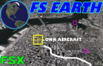
This program acts as a link between Flight Simulator X and Google Earth, letting to follow a flight in real time, over the satellite images generated by Google Earth. Flights can be saved, and many options are available for fine tuning the performance, as well as the map's style (zoom, tilt, orientation). Works on a single computer running FSX and Google Earth all together or, for best experience, can be used on two networked computers running respectively FSX (master) and Google Earth (slave). AI and Multiplayer traffic is also displayed in Google Earth, with course prediction and other information. Requires Flight Simulator X and Google Earth. The program running in trial mode works only around Anchorage, Alaska, (PANC / ANC) for a maximum of five minutes per flight session. Version 5.2 has new aircraft icons & labels and improves the compatibility with Windows Vista. A version for FS2004 is available also.
| Filename: | FS_Earth_52_for_Google_Earth_and_FSX.zip |
| License: | Shareware, time limited |
| Added: | 3rd May 2010, 07:38:23 |
| Downloads: | 2,701 |
| Author: | Luciano Napolitano |
| Size: | 3.46 MB |
| Category: Flight Simulator X - Utilities | |
| FS Earth 4.2 for Google Earth |
|
File Description:
This program acts as an interface between Flight Simulator X and Google Earth, letting to follow a flight in real time, over the satellite images generated by Google Earth. Flights can be saved, and many options are available for fine tuning the performance, as well as the map's style (zoom, tilt, orientation). Works on a single computer running FSX and Google Earth all together or, for best experience, can be used on two networked computers running respectively FSX (master) and Google Earth (slave). AI and Multiplayer traffic is also displayed in Google Earth, with course prediction and other information. Requires Flight Simulator X and Google Earth. The program running in trial mode works only around Anchorage, Alaska, (PANC / ANC) for a maximum of five minutes per flight session. Version 4.2 has improved compatibility with Windows Vista and minor bug fixes. A version for FS2004 is available also. By Luciano Napolitano.
| Filename: | FS_Earth_42_for_Google_Earth.zip |
| License: | Shareware, time limited |
| Added: | 9th March 2007, 13:39:05 |
| Downloads: | 2,213 |
| Author: | Luciano Napolitano |
| Size: | 2.44 MB |
| Category: Flight Simulator 2004 - Scenery | |
| Point Ellis cannery V1, for Holger Sandmann's Tongass Fjord scenery |
|
Images related to this file:
File Description:
This is a revised version of Point Ellis cannery, originally posted in 2007. It is unsurprisingly just east of Point Ellis, on the east side of the southern end of Chatham Strait in southern Alaska. It is marked on the chart of the area, and if you are chartless then there is a piece of the chart here. This scenery is designed specifically for use in the Tongass Fjord scenery, and probably doesn't work with just Ultimate Terrain. The cannery has an identifying code so it will show up on a gps as "PECA". There is no interaction with atc as there are no designated water runways, so the "PECA" on the gps just acts as a waypoint. There will be further posts for use with Tongass Fjords, Misty Fjords, and Glacier Bay, and I still find these scenery areas by Holger and his crew the most satisfying in FS9.
| Filename: | Point_Ellis_cannery_V1_for_Holger_Sandmanns_Tongas.zip |
| License: | Freeware, limited distribution |
| Added: | 6th November 2014, 21:55:48 |
| Downloads: | 237 |
| Author: | Roger Wensley |
| Size: | 3.86 MB |
| Category: Flight Simulator X - Scenery | |
| CYQQ (2010) Version 2 for FS9, FSX and Prepar3D |
|
Images related to this file:
File Description:
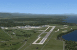
CYQQ (2010) portrays Canadian Forces Base Comox (Vancouver Island, British Columbia, Canada) (CYQQ), the Comox Valley Air Terminal and surrounding area. It is fully compatible with Ultimate Terrain Canada/Alaska for FS2004, Ultimate Terrain X - Canada for FSX and ORBX's FTX NA Blue. CYQQ (2010) includes over 100 "hand-crafted" buildings and other structures and 10 different vintage aircraft on static display, as well as aircraft and traffic files for a realistic AI scenario that causes a variety of military aircraft that come and go. (Use BC Regional AI - also available from this file library - for scheduled traffic.) Civilian AI is now routed so as not to transit military aprons.
Aside from the new approach lighting, generally, this new version is visually identical to its predecessor - even though quite different internally. As well, to the extent possible, it is compatible with Prepar3Dv2.
| Filename: | CYQQ_2010_Version_2_for_FS9_FSX_and_Prepar3D.zip |
| License: | Freeware, limited distribution |
| Added: | 20th June 2014, 11:39:47 |
| Downloads: | 11,036 |
| Author: | Don Grovestine |
| Size: | 33.19 MB |
| Category: Flight Simulator 2004 - Scenery | |
| Vancouver Island and Inner Passage float bases in BC, Canada |
|
File Description:
This is a series of float bases to the east of the northern part of Vancouver Island. They are all zipped together because: first, they are all in the same geographical area and if you like one you may like them all; second it means I only write one set of notes; and third I only upload once. I was looking to fill in the gap between what Holger Sandmann and his cohorts have done with Alaska, and Vancouver and Vancouver Island to the south, and there are these 16 float bases in a stretch of 180 miles between the northern part of Vancouver Island and the mainland coast. And if you leave out the relatively isolated Rivers Inlet to the north then they are all within a 140 mile stretch. Some are on the east coast of Vancouver Island, but most are on islands between the mainland and the island.
| Filename: | Vancouver_Island_and_Inner_Passage_float_bases_in_.zip |
| License: | Freeware |
| Added: | 3rd August 2008, 06:03:09 |
| Downloads: | 1,873 |
| Author: | Roger Wensley & Jim Turner |
| Size: | 6.85 MB |
| Category: Flight Simulator 2004 - Scenery | |
| Bethel Terminal Building correction |
|
Images related to this file:
File Description:
This is the correct substitute terminal building for Bethel PABE. Somehow, and I cannot now remember how it could possibly have happened, the wrong terminal building was included with the posting of an updated version of Bethel. I wrote at the time that the actual Bethel terminal building could not be made as it was too complicated to be made with the little information that was available. I then modified the Alaska terminal building from a previous scenery at Nome and included it in the Bethel scenery, as shown in the screenshots that were included with the posting of Bethel. But, somehow, the terminal from Barrow was wrongly included in the posting that is currently available. If you have the wrong terminal building (see the "wrong" screenshot) then substitute the attached bgl's for your existing ones and get the "correct" terminal as shown in the pic here.
| Filename: | Bethel_Terminal_Building_correction.zip |
| License: | Freeware, limited distribution |
| Added: | 30th July 2021, 04:29:00 |
| Downloads: | 133 |
| Author: | Roger Wensley |
| Size: | 2.16 MB |
| Category: Flight Simulator X - Aircraft Repaints, Textures and Modifications | |
| Spitfire Mk Ia K9998 |
|
Images related to this file:
File Description:
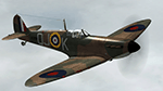
This repaint is for the A2A Wings of Power III Spitfire MkIa. Representing K9998 of 92 Squadron, which flew from Biggin Hill from 9th September 1940 for the duration of the Battle of Britain. Flown by Pilot Officer Geoffrey A Wellum. The youngest pilot to fly in the RAF during the BOB, P/O Wellum gained his first aerial kill in this plane on the 11th September 1940. During which, the plane received bad damage and so, was the last time he flew it. He was awarded the DFC on 5th August 1941.
| Filename: | Spitfire_Mk_Ia_K9998.zip |
| License: | Freeware |
| Added: | 21st October 2016, 03:57:48 |
| Downloads: | 189 |
| Author: | Steve Landau |
| Size: | 34.39 MB |
| Category: Flight Simulator X - Aircraft Repaints, Textures and Modifications | |
| "Reg Pridmore" American Champion Scout Tundra (N160BC) |
|
Images related to this file:
File Description:
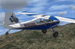
Repaint for the RealAir Scout 2007 package (Required). N160BC is a unique aircraft in that it sports the personal logo of Reg Pridmore, 3-time AMA Motorcycle racing champion and now owner/instructor of CLASS motorcycle racing school in Santa Paula CA. This is his personal aircraft which is based out of KSZP. The logo on the tail was designed by Reg and his wife. Created and uploaded with the gracious permission of Mr. Pridmore (full story in README). Fly her with a Smoooooth hand just like Reg would do!
| Filename: | Reg_Pridmore_American_Champion_Scout_Tundra_N160BC.zip |
| License: | Freeware |
| Added: | 16th March 2016, 09:25:58 |
| Downloads: | 153 |
| Author: | E. J. "Stoopy" Petre |
| Size: | 3.45 MB |
| Category: Prepar3D V1-4 - Scenery | |
| Alghero (SS) Italy N40.33.28 E8.19.06 |
|
File Description:
Alghero (SS) Italy N40.33.28 E8.19.06 is one of the main of Sardinia is one of the gateways to the Island, thanks to the airport located near Fertilia and its port, the capital of the Riviera del Corallo, in the waters of its work is the largest quantity of the precious red coral of the highest quality, so that a coral branch is inserted in the coat of arms of the city. Important VFR point for approaching airport Fertilia.
Within the downloaded package you will find readme files for scenery installation. Good fly VFR. Pasquale Marrulli.
| Filename: | Alghero_SS_Italy_N403328_E81906.zip |
| License: | Freeware |
| Added: | 6th November 2017, 16:46:07 |
| Downloads: | 276 |
| Author: | Pasquale Marrulli |
| Size: | 2.67 KB |


© 2001-2026 AVSIM Online
All Rights Reserved
Privacy Policy |