
Where Flight Simulation Enthusiasts Gather from Around the World!
AVSIM Library - Search Results

| Category: Flight Simulator 2004 - Aircraft Repaints, Textures and Modifications | |
| PBY Catalina Giovanni Bordé |

|
File Description:
This textures shows the only surviving Catalina in Colombia. It was purchased from de Colombian Air Force (FAC) and restored by the private pilot Giovanni Borde. Sounds easy, but because of unfair situations and envy, it tooks him 13 years to fly the Catalina since he purchased the remains.
Borde flew it over jungles and rivers transporting people and cargo.
The plane was grounded (1996) by the police under irregular conditions (envy the principal) All the charges were withdrawed en after 1.680 days.
The Catalina is still at the Villavicencio airport in good shape and flyable if overhauled.
The only pilot licensed to fly a Catalina in Colombia was Bordé. He died in 2003.
| Filename: | PBY_Catalina_Giovanni_Bord.zip |
| License: | Freeware |
| Added: | 5th August 2005, 21:00:31 |
| Downloads: | 506 |
| Author: | FS9 Model by Mike Stone. Textures by Mauricio Rozo |
| Size: | 1.76 MB |
| Category: Flight Simulator X - Flight Plans | |
| St Tummy Goumy Asylum |
|
File Description:
You have come to Africa for two reasons: Test your new Autogyro ( uagyro.zip)
and photograph some animals in the plains......But, General Bakuze
Mungatta, President of the Country has "kindly" asked you to take some "Tranquilizer
Syrum" to his brother up in St. Tummy Goumy Asylum. You say "yes", looking
at the nice smile of the president, and fly to the asylum, deliver the Syrum, spend an afternoon there with the
lovely 28 year old "directoress" of the place, have something to eat at "Fukunga´s Fried Fish Restaurant" and next morning fly back and take great photos of Giraffes, Zebras and Elephants..happy landings! More Adventure
to come in the dark continent.
| Filename: | St_Tummy_Goumy_Asylum.zip |
| License: | Freeware |
| Added: | 26th September 2007, 09:22:54 |
| Downloads: | 609 |
| Author: | Gera Godoy C |
| Size: | 344.22 KB |
| Category: Flight Simulator X - Missions | |
| The Most Dangerous Airports: The Apls 4 |
|
Images related to this file:
File Description:
You are an experienced pilot who is hired to fly medical supplies to various resorts in the area. You have just finished delivering medical supplies to Meribel airport, which was the first part of this mission, the second part which you are flying now, will take you through same amazing terrain, which you know very well. You are requested by a well know photographer, which you have agreed to take along for the ride, to plot a beautiful route, weather permitting. After dropping the medical supplies you are to fly to Le Versoud to end your medical supply run for this month. Remember it is getting pretty windy, which makes it all the more challenging.
| Filename: | The_Most_Dangerous_Airports_The_Apls_4.zip |
| License: | Freeware |
| Added: | 3rd November 2009, 20:00:08 |
| Downloads: | 1,167 |
| Author: | Robbie Albers |
| Size: | 830 KB |
| Category: Flight Simulator 2004 - Flight Plans | |
| Piper Traffic GA_Archer_Europe |
|
Images related to this file:
File Description:
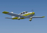
Twelve more "semi-photographic" Piper Archer repaints together with flight plans over Europe. All flights are VFR and take place between stock FS2004 airports with AI capability in Switzerland. The planes should only fly during daylight hours (per approx spring/autumn) and rest one whole day (24+ hrs) per week at a "home" airport. Aircraft fly with local reg for ATC in the following countries: Austria, Belgium, Croatia, Denmark, France, Germany, Greece, Ireland, The Netherlands, Norway, Portugal, Spain, Sweden, Switzerland the United Kingdom. Improved prop textures and animation.
See also AI_Piper_Euro_0.zip for more Archers with flight plans. Textures only; you must have the AI Piper Archer III by Pavel Toman, download details are in the readme.
| Filename: | Piper_Traffic_GA_Archer_Europe.zip |
| License: | Freeware |
| Added: | 20th February 2011, 21:05:55 |
| Downloads: | 755 |
| Author: | David Griffiths |
| Size: | 3.2 MB |
| Category: Flight Simulator 2004 - Original Aircraft | |
| Voisin Hydro-Canard |
|
File Description:
This aircraft type became a popular sight at aerial demonstration meets around the globe. Despite its marginal controllability, the Voisin set many records, and is largely responsible for creating an interest in aviation amongst all Europeans. Aircraft designer Henry Farman (responsible for the Farman observation aircraft of World War I), had his earliest flight experiences in Voisin aircraft. Perhaps the most famous man to ever fly a Voisin was the world renowned escape artist and magician, Harry Houdini, who became the first recorded pilot to ever successfully fly an aircraft in Australia. This plane has a VC, XML animations, custom airfile, and the animated pilot's scarf blows in the wind. happy flyin!
| Filename: | Voisin_HydroCanard.zip |
| License: | Freeware, limited distribution |
| Added: | 18th January 2005, 19:24:42 |
| Downloads: | 2,576 |
| Author: | Joe Binka |
| Size: | 1.43 MB |
| Category: Flight Simulator 2004 - Flight Plans | |
| U.S. Territories - Low Altitude |
|
Images related to this file:
File Description:
FS2004 Low Altitude Flight Plan for the U.S. Territories - This package includes 9 individual FS2004 flight plans for current IFR, VFR and Slow Speed Routes in the US. Territories of Guam and Puetro Rico. These are great routes for B-52, F-111, B-1B, B-2 A6, A4, Vulcan and any fighter or bomber enthusiasts. Of course you can fly the route with any aircraft of your choice. Also included in this package is Karol Chlebowski's TFR guage. This gauge will greatly enhance your ability to fly these challenging routes and are a great companion of the flight plans. Another option is to download Version 2.0 of my FS9 mini panel which has all this functionality and more.
| Filename: | US_Territories__Low_Altitude.zip |
| License: | Freeware |
| Added: | 20th September 2011, 13:58:27 |
| Downloads: | 191 |
| Author: | Bill McClellan |
| Size: | 1.21 MB |
| Category: Flight Simulator 2004 - Scenery | |
| Bethel: St Mary's area airfields in southwest Alaska close to the Yukon River |
|
Images related to this file:
File Description:
This presumes you have already installed Bethel PABE and Bethel Local Airfields. In the Yukon River area of Alaska to the north of Bethel there are small villages, served by flights from both Bethel and the nearer St Mary's PASM. St Mary's has a gravel runway like the other villages, but has a larger population and airport services including maintenance and fuel. This, plus the saving of an average one hundred miles of flying by a Cessna 205 when compared with flights from Bethel, means it acts as a distribution centre fed from Bethel by larger aircraft. Go to "http://vfrmap.com/" for free vfr maps of the area (see the attached). The ten village airfields included here are all to the north and west of St Mary's: Hooper Bay PAHP, Chevak VAK, Cape Romanzof PACZ (closed air force field servicing a radar station), Scammon Bay SCM, Sheldon Point SXP, Alakanuk AUK, Emmonak PAEM, Kotlik 2A9, Mountain Village MOU, and of course St Mary's PASM itself. With these airfields not everything is as it appears to be. For instance, Hooper Bay is not a new and modernised airfield, despite the asphalt runway and apron; the current version has dispensed with the aging asphalt and gone back to gravel. I have tended to go for the 2005 or so versions, which sometimes means a small runway amid or close to the housing; Kotlik was an early renewal for reasons of safety as much as anything else and has had (since 2003?) a new and longer runway located outside of the town. The second batch of airfields will be to the east of St Mary's.
| Filename: | Bethel_St_Marys_area_airfields_in_southwest_Alaska.zip |
| License: | Freeware, limited distribution |
| Added: | 29th April 2019, 17:07:24 |
| Downloads: | 226 |
| Author: | Roger Wensley |
| Size: | 11.53 MB |
| Category: Flight Simulator 2002 - Scenery | |
| New 300-m (LOD7) Terrain Mesh of British Columbia and Southeast Alaska #4 |
|
File Description:
Mid-resolution (300-m) terrain mesh for the entire province of British Columbia (950,000 square km) and the Alaska panhandle southeast of N60 W139. Made from 250m-resolution source data without oversampling. Easy on frame rates and hard drive space. It transforms the rounded mountains of the default terrain mesh into a much more realistic representation of the diverse topography of this beautiful corner of the world. Experience the spectacular scenery between Vancouver and Atlin, Juneau and Fort St. John, and Mount Robson to Clayoquot Sound. Fourteen independent mesh tiles allow you to select the region(s) you like best. Several high-resolution add-on meshes will be uploaded separately. By Holger Sandmann. Part 4 of 4: All areas between 48 and 51 degrees North. Note: this part contains updated read-me.txt and .pdf files - please use these instead of the ones distributed with the first three parts!
| Filename: | New_300m_LOD7_Terrain_Mesh_of_British_Columbia_and.zip |
| License: | Freeware, limited distribution |
| Added: | 17th January 2003, 20:22:07 |
| Downloads: | 3,677 |
| Author: | Holger Sandmann |
| Size: | 6.34 MB |
| Category: Flight Simulator 2002 - Scenery | |
| New 300-m (LOD7) Terrain Mesh of British Columbia and Southeast Alaska #3 |
|
File Description:
Mid-resolution (300-m) terrain mesh for the entire province of British Columbia (950,000 square km) and the Alaska panhandle southeast of N60 W139. Made from 250m-resolution source data without oversampling. Easy on frame rates and hard drive space. It transforms the rounded mountains of the default terrain mesh into a much more realistic representation of the diverse topography of this beautiful corner of the world. Experience the spectacular scenery between Vancouver and Atlin, Juneau and Fort St. John, and Mount Robson to Clayoquot Sound. Fourteen independent mesh tiles allow you to select the region(s) you like best. Several high-resolution add-on meshes will be uploaded separately. By Holger Sandmann. Part 3 of 4: All areas between 51 and 54 degrees North.
| Filename: | New_300m_LOD7_Terrain_Mesh_of_British_Columbia_and.zip |
| License: | Freeware, limited distribution |
| Added: | 17th January 2003, 20:22:57 |
| Downloads: | 3,412 |
| Author: | Holger Sandmann |
| Size: | 5.82 MB |
| Category: Flight Simulator 2002 - Scenery | |
| New 300-m (LOD7) Terrain Mesh of British Columbia and Southeast Alaska #2 |
|
File Description:
Mid-resolution (300-m) terrain mesh for the entire province of British Columbia (950,000 square km) and the Alaska panhandle southeast of N60 W139. Made from 250m-resolution source data without oversampling. Easy on frame rates and hard drive space. It transforms the rounded mountains of the default terrain mesh into a much more realistic representation of the diverse topography of this beautiful corner of the world. Experience the spectacular scenery between Vancouver and Atlin, Juneau and Fort St. John, and Mount Robson to Clayoquot Sound. Fourteen independent mesh tiles allow you to select the region(s) you like best. Several high-resolution add-on meshes will be uploaded separately. By Holger Sandmann. Part 2 of 4: All areas between 54 and 57 degrees North.
| Filename: | New_300m_LOD7_Terrain_Mesh_of_British_Columbia_and.zip |
| License: | Freeware, limited distribution |
| Added: | 17th January 2003, 20:23:55 |
| Downloads: | 3,487 |
| Author: | Holger Sandmann |
| Size: | 5.9 MB |


© 2001-2026 AVSIM Online
All Rights Reserved
Privacy Policy |