
Where Flight Simulation Enthusiasts Gather from Around the World!
AVSIM Library - Search Results

| Category: Flight Simulator 2004 - Scenery | |
| Alaska North Slope 4: Lonely Air Force Station (AK71) |

|
Images related to this file:
File Description:
The town of Barrow is in the far north of Alaska, and these are coastal villages or radar installations to the west, south, and now east of Barrow. There will be further additions. Lonely Air Force Station AK71 is 80 miles east of Barrow and on the coast. It was, and at first sight appears still to be, a DEW station until you are close enough to see that the gravel apron is deteriorating. There is a gravel runway around 5,000 feet long, a large hangar, the DEW buildings, radar under the domes, the remains of huge line-of-sight communications reflectors, and oil tanks. Some DEW sites are not worth a visit; others are surprisingly intact and this is one of those. The AI takes place three days a week and is a C130, in which case the DEW site is still functioning or under mothball maintenance, a chartered Reeve Aleutian in which case the site is closed and they are documenting wildlife, and a Cessna with a group of the curious.
| Filename: | Alaska_North_Slope_4_Lonely_Air_Force_Station_AK71.zip |
| License: | Freeware, limited distribution |
| Added: | 20th June 2016, 08:02:18 |
| Downloads: | 306 |
| Author: | Roger Wensley |
| Size: | 2.32 MB |
| Category: Flight Simulator 2004 - Scenery | |
| Nikolski (IKO), Nelson Lagoon (Z73), & Perryville (AK5) - Alaska, USA |
|
Images related to this file:
File Description:
These are villages in Alaska, spread out east and west of Dutch Harbor in the Aleutians and the peninsula, served by Grant Aviation regional flights from Dutch Harbor, Cold Bay, or King Salmon.
Nikolski is 115 miles west of Dutch Harbor at the western end of Umnak Island, which is just west of Unalaska, the large island adjacent to Dutch Harbor. Nikolski is small, with a population of perhaps only 20 now, and the main claim to fame is the wrecked Reeve Aleutian DC3 at the end of the runway. The runway is 3,500 feet of gravel aligned 08-26. Nelson Lagoon is on the north shore of the peninsula, 55 miles north of Sand Point and on a long spit of land that curves around to make the lagoon. There is no access except by boat or plane for the population of around 50. The airfield is a mile east of the village with a gravel runway 08-26, 4,000 feet long. Perryville is on the south shore of the peninsula, 65 miles east of Sand Point. The population is around 115, and the airfield is southwest of the town with the 3,500 feet of gravel runway aligned 02-20 beside the shore. There is a hangar on the apron, but no terminal building.
| Filename: | Nikolski_IKO_Nelson_Lagoon_Z73__Perryville_AK5__Al.zip |
| License: | Freeware, limited distribution |
| Added: | 14th March 2015, 13:27:53 |
| Downloads: | 255 |
| Author: | Roger Wensley |
| Size: | 11.45 MB |
| Category: Flight Simulator 2004 - Scenery | |
| Dutch Harbour PADU in Alaska PLUS AI Air & Sea |
|
Images related to this file:
File Description:
This is a revised and much-added-to update of my earlier Dutch Harbor post, adding more Air & Sea AI. It is complete in itself and does not require you to have previously installed the original. New parking is for a civilian freighter, a Coast Guard C-130, and Coast Guard helicopters that fly from St Paul Island.
There is also a daily flight from Dutch Harbor to Akutan that will be by the amphibious Goose as there is no land runway at Akutan [more posts follow].
The official airport name is Unalaska, but a seat booked with airlines will be to Dutch Harbor, known from the tv series as a fishing centre with major fish and crab processing plants. In town the largest company is Unisea, taking up all of what was once Expedition Island and the adjacent shoreline. The out-of-town expansion is taking place along the shore of Captains Bay to the southwest, and here the largest is Westward with the uniform green roof for the plant and the residential buildings for seasonal workers.
The airport has just over 3,900 feet of 100 feet wide asphalt, aligned 30/12, lit, and between sea and hill with two aprons at the southeast end. There is no control tower at the airport, so don't be surprised when you are required to contact Cold Bay USAF for landing permission. Runway 30 has at its threshold a road; when a plane is landing or taking off traffic is stopped by barriers and lights. To encourage full use of the runway the fence is made up of plastic rods that bend on impact instead of chainlink topped with barbed wire that will turn a light plane upside down.
| Filename: | Dutch_Harbour_PADU_in_Alaska_PLUS_AI_Air__Sea.zip |
| License: | Freeware, limited distribution |
| Added: | 7th August 2012, 20:56:03 |
| Downloads: | 1,529 |
| Author: | Roger Wensley |
| Size: | 13.4 MB |
| Category: Flight Simulator 2004 - Scenery | |
| Lake Hood LHD and Z41 in Anchorage Alaska UPDATED |
|
Images related to this file:
File Description:
This is an updated version that is complete in itself and which greatly upgrades Lake Hood Airstrip Z41 and also makes minor modifications to LHD. Lake Hood is right next door and to the north of Ted Stevens Anchorage International Airport, and there is a second airfield on the north side of the lake called Lake Hood Airstrip. The airstrip is coded Z41, the International is PANC, and Lake Hood itself is LHD. You will need Ultimate Terrain Alaska Canada for this to work, and you should also download and install Anchorage International (verson 4?) by William Morgan of FRFStudio. LHD/Z41 includes a fair proportion of the 780 float planes that are based there and which make Lake Hood the largest and busiest float plane base in the world, averaging 190 flights per day during the year and a lot more than that per day during the summer months. There is fuel at two places on the lake, and a lot of maintenance help available. The documentation showing the VFR routes to Lake Hood is also included in the Lake Hood VFR procedures folder, and basically, if you listen to the ATC chatter, planes either route via the Ball Park or the Gravel Pit, which gets abbreviated to something like "You want the park or the gravel?" which wouldn't mean a whole lot to an unrehearsed stranger. Unfortunately FS doesn't reach that level of sophistication, but you can still take the right route. There is a google marked map showing the locations of the checkpoints.
| Filename: | Lake_Hood_LHD_and_Z41_in_Anchorage_Alaska_UPDATED.zip |
| License: | Freeware, limited distribution |
| Added: | 18th July 2010, 08:16:48 |
| Downloads: | 981 |
| Author: | Roger Wensley |
| Size: | 9.25 MB |
| Category: Flight Simulator X - Aircraft Repaints, Textures and Modifications | |
| Skywagon C185, "Call of the Wild", Big Lake, Alaska |
|
Images related to this file:
File Description:
This is a repaint of the Carenado's excellent C185B/F Skywagon. These textures represent a Skywagon B wheeled variant and a Skywagon F amphibian variant. THESE ARE TEXTURES ONLY! You need Carenado's payware package
| Filename: | Skywagon_C185__Call_of_the_Wild__Big_Lake_Alaska.zip |
| License: | Freeware, limited distribution |
| Added: | 28th April 2010, 13:55:47 |
| Downloads: | 728 |
| Author: | Russel R. Smith, Carenado |
| Size: | 18.83 MB |
| Category: Flight Simulator 2004 - Aircraft Repaints, Textures and Modifications | |
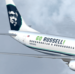
| Alaska Airlines Super Bowl 2014 Boeing 737-900ER (N453AS) |
|
Images related to this file:
File Description:
FS2004 737-900/ER Series. Developed by Tenkuu Developers Studio (TDS). Model features high resolution textures, dynamic flexing wings, nose gear steering, rudder lock, ground spoilers, low speed aileron locks at high speed, fully animated control surfaces, fully independent suspension, trim animation, opening passenger doors, rolling wheels, animated thrust reversers with reverser block doors, detailed textures, full night lighting, ground service vehicles and more. Package contains model and all files necessary for immediate flight. Model design by Hiroshi Igami. Flight dynamics design by Nick Wilkinson and David Biggar. Master textures by Kyle Schurb.
| Filename: | Alaska_Airlines_Super_Bowl_2014_Boeing_737900ER_N4.zip |
| License: | Freeware |
| Added: | 9th February 2014, 02:15:37 |
| Downloads: | 518 |
| Author: | Stian Svensen | Tenkuu Developers Studio (TDS) |
| Size: | 11.25 MB |
| Category: Flight Simulator 2004 - Aircraft Repaints, Textures and Modifications | |
| Alaska Airlines "Normal & Lei" Boeing 737-800 (N552AS/N584AS) |
|
Images related to this file:
File Description:
FS2004 737-800 Series. Developed by Tenkuu Developers Studio (TDS). Model features high resolution textures, dynamic flexing wings, nose gear steering, rudder lock, ground spoilers, low speed aileron locks at high speed, fully animated control surfaces, fully independent suspension, trim animation, opening passenger doors, rolling wheels, animated thrust reversers with reverser block doors, detailed textures, full night lighting, ground service vehicles and more. Package contains model and all files necessary for immediate flight. Model design by Hiroshi Igami. Flight dynamics design by Nick Wilkinson and David Biggar. Master textures by Kyle Schurb.
| Filename: | Alaska_Airlines_Normal__Lei_Boeing_737800_N552ASN5.zip |
| License: | Freeware, limited distribution |
| Added: | 16th January 2014, 13:59:22 |
| Downloads: | 851 |
| Author: | Ben Fluth / Tenkuu Developers Studio (TDS) |
| Size: | 22.56 MB |
| Category: Flight Simulator 2004 - Scenery | |
| Alaska South Slope 7; Kobuk OBU & Dahl Creek DCK |
|
Images related to this file:
File Description:
There are four main northwestern Alaska towns which are serviced by Alaska Airlines, and from which local flights spread out. The northernmost is Barrow. Southwest of Barrow is Kotzebue, then Nome, and the furthest south is Bethel (not yet made). This is a continuation of the series for the flights from Kotzebue, 170 miles to the east where Kobuk is on the bank of the Kobuk River, and Dahl Creek is 2 miles to the north. Kobuk is a small village on the Kobuk River, like Ambler and Shungnak, but with a population of only around 150. The river is the reason for the existance of the villages as it served (and still does) as both a source of food and a transport route. The airfield is just beside the village, with a runway around 4,500 feet of lit gravel and aligned 09-27, with PAPI on both ends. There are scheduled flights by Era (now renamed Ravn) and by Bering Air, both of them originating in Kotzebue and routing east to Ambler, Shungnak, Kobuk, and then back again. The AI includes these flights along with Everts Air and GA. The FS9 airfield has been relocated by approximately a mile to the correct position, and the elevation accordingly adjusted. The Dahl Creek strip is publicly owned, with no maintenance and a deteriorating gravel runway that has not long to survive. This probably does not work properly without Ultimate Terrain Alaska Canada as the village is now on the river bank. I am presuming that you have downloaded and installed Nome PAOM, along with the instructions on how to adjust Ultimate Terrain Alaska Canada to get the most realistic results. If you are not making the UT adjustments then you may be seeing duplicated roads, as I am including new local dirt or gravel roads to connect village to airfield etc to get the best overall result; I will not be making alternate versions.
| Filename: | Alaska_South_Slope_7_Kobuk_OBU__Dahl_Creek_DCK.zip |
| License: | Freeware, limited distribution |
| Added: | 13th October 2016, 18:10:08 |
| Downloads: | 233 |
| Author: | Roger Wensley |
| Size: | 2.94 MB |
| Category: Flight Simulator 2004 - Scenery | |
| Alaska South Slope 2 - Noorvik ORV in AK US |
|
Images related to this file:
File Description:
The town of Kotzebue is in the far northwest of Alaska, and these are villages to the north and the east of Kotzebue on the South Slope of the Brooks Range of mountains. There will be further additions. Noorvik is a small village (population now around 670) on the bank of the Kobuk River, around 50 miles east of Kotzebue. The new airfield is 1 mile south of the village; there is a short runway immediately south of the town that is now closed but is not marked as such and appears to be usable; this will still be listed in FS9 when you are presented with a choice of runways but is not connected in any way to the new airfield so ignore it. The new ORV runway has 4,000 feet of lit gravel aligned 06-24. There are scheduled flights by Era (now renamed Ravn) and by Bering Air, both of them originating in Kotzebue and routing east to Noorvik, Kiana, Ambler, Shungnak, Kobuk, and then back again. The AI includes these flights (eventually) plus perhaps an Everts Air cargo flight and GA.
| Filename: | Alaska_South_Slope_2__Noorvik_ORV_in_AK_US.zip |
| License: | Freeware, limited distribution |
| Added: | 4th September 2016, 18:20:02 |
| Downloads: | 220 |
| Author: | Roger Wensley |
| Size: | 3.95 MB |
| Category: Flight Simulator X - Scenery | |
| PANC - Stevens Anchorage Intl, Alaska (ILS fix for 7R) |
|
Images related to this file:
File Description:
This airport scenery was designed only for FSX: There is one version with the Crosswind runway operating where all 3 runways will be used for takeoff/landing and one version as the default airport runway operation: Alaska airlines terminal completely rebuilt, taxiways and taxi signs updated to the latest charts, the ILS for runway 7R now operating correctly, assigned parking as per their website with extra parking, extra fuel trucks, support vehicle roads rebuilt and many other scenery improvements and objects added, airport views are from the roof of the control tower (when in tower view) please view the readme before installation
| Filename: | PANC__Stevens_Anchorage_Intl_Alaska_ILS_fix_for_7R.zip |
| License: | Freeware, limited distribution |
| Added: | 4th January 2017, 05:47:48 |
| Downloads: | 41,410 |
| Author: | Ray Smith |
| Size: | 2.48 MB |
© 2001-2026 AVSIM Online
All Rights Reserved
Privacy Policy |