
Where Flight Simulation Enthusiasts Gather from Around the World!
AVSIM Library - Search Results

| Category: Flight Simulator X - Scenery | |
| Snow Dog Tours, Ketchikan Alaska |

|
File Description:
Snow Dog Tours is a fictional "BUSH" Charter Service operating in Alaska. This is the first of a 5 part series covering Alaska. This scenery package comes complete with re-paints, custom objects, custom effects, custom textures and cover the following airports and seaplane bases; Ketchikan International, Wrangell, Johson Petersburg, Kake, Annette Island, Sitka, Murphys Pullout, Peninsula Point, Ketchikan Harbor, MEtlakata, Tamgas Harb or, Hydaburg, Waterfall, Craig, Klawock, Steamboat Bay, Port Alice, Nichen Cove, Tokeen, Bell Island Hot Springs, Yes Bay Lodge, Meyers Chuck, Thorne Bay, Kasaan, Hollis, Loring, Wrangell, Coffman Cove, Cape Pole, North Whale, Port Protection, Point Baker, Roundtree, Kake, Saginaw, Port Walter, Warm Spring Bay, Sitka, False Island, Chatham, Angoon, Entrance Island, Tenakee and Taku Harbor. If you liked my "Caribbean SeaPlane Tours"....This is the Alaskan Adventure.
| Filename: | Snow_Dog_Tours_Ketchikan_Alaska.zip |
| License: | Freeware, limited distribution |
| Added: | 5th April 2008, 00:46:10 |
| Downloads: | 5,228 |
| Author: | Chris Carel |
| Size: | 31.29 MB |
| Category: Flight Simulator 2004 - Scenery | |
| Bethel PABE in southwest Alaska |
|
Images related to this file:
File Description:
There are four main northwestern Alaska towns which have good airports and are serviced by Alaska Airlines. From these airports local flights connect to nearby villages, "nearby" in Alaska meaning up to 200 miles away. The northernmost is Barrow. Southwest of Barrow is Kotzebue, then Nome, and the furthest south is this one, Bethel. The town of Bethel has a population of just over 6,000 and is 50 miles from the sea on the Kuskowim River, that splits and forks into many tributaries. Bethel Airport is close to the town and provides the only contact with the rest of Alaska, as there is no connecting highway system. There are scheduled flights by Alaska Airlines, ERA (now called Ravn) and Grant Aviation, plus others such as Ryan Air. There are cargo flights by Everts, Northern, and Lynden, and redistribution onwards to nearby villages by the smaller locally-based planes; all of these are included in the AI. There are two main runways, one just under 6,400 feet and another just under 3,900 feet, both of them aligned 19-1. The third runway is around 1,800 feet and mainly gravel, aligned 11-29. Parking at PABE is on three aprons, the northern for smaller commercial planes of Grant, ERA, Ryan etc, the central for larger planes of Alaska, Northern, Everts, and Lynden, and the southern for a large collection of GA; each apron has further hangars for maintenance companies and smaller operators. There is also another separate apron for the local military and Coastguard. There is not much photographic information available for PABE, and I have never been there; as a result it was impossible to make detailed photographic textures for some of the buildings. However, for most hangars I have made textures of at least the right colour etc based on the information I assembled and if it is green with white trim and side windows then that is how it now appears here. The exceptions are the Alaska Airlines terminal building which has complicated curved elements, and the two military hangars and workshops where I had to settle for an Alaska terminal building from another airport and the same for the military. There are numerous small villages in the vicinity of Bethel, all of them being beside either a river tributary or the coast. There are two Google Earth screenshots to show the villages that are served by the flights from Bethel and that are (mostly) included in the AI. Some of these airfields were not included in FS9 but AI will still operate in and out of Bethel. The smaller area screenshot shows the villages that are close to Bethel, and of these eight I have so far made six and they are included in this post: Napaskiak PKA, Napakiak WNA, Kwethluk KWT, Atmautluak 4A2, Nunapitchuk 16A, and Kasigluk Z09. I will work my way through the rest of the area.
| Filename: | Bethel_PABE_in_southwest_Alaska.zip |
| License: | Freeware, limited distribution |
| Added: | 8th March 2019, 00:37:58 |
| Downloads: | 309 |
| Author: | Roger Wensley |
| Size: | 32.02 MB |
| Category: Flight Simulator 2004 - Scenery | |
| Glacier Bay National Park, Alaska |
|
File Description:
Add-on meshes can greatly improve the detail of the FS terrain but often conflict with the inaccurate placement of the other default FS landscape elements, particularly in coastal and mountainous areas. This project showcases new methods and software that allow for semi-automated development of FS landscapes from accurate source data. The files completely replace the default FS landscape of Southeast Alaska's Glacier Bay National Park and the adjacent Lynn Canal area between Juneau and Skagway (N58-60 W134-138), including shorelines, islands, and lakes, as well as glaciers, landclass, man-made features, and a LOD9 (76-m) terrain mesh. Optional AI floatplane traffic at four seaplane bases is included. A LOD10 (38-m) mesh of the same area is available as a separate optional download. FS2002 users please use fs8glbay.zip instead.
| Filename: | Glacier_Bay_National_Park_Alaska.zip |
| License: | Freeware, limited distribution |
| Added: | 16th February 2004, 03:40:31 |
| Downloads: | 17,196 |
| Author: | Holger Sandmann, Jim Keir |
| Size: | 10.43 MB |
| Category: Flight Simulator 2004 - Scenery | |
| PADK - Adak - Aleutians, Alaska - USA |
|
Images related to this file:
File Description:
Adak is near the western end of the Aleutian chain of islands in Alaska. The closed naval air base buildings are mostly still there and once housed over 6,000; the population is now much reduced to around 320, involved in fishing and a fish processing plant, organising caribou hunts for the tourism industry, running the airport, etc. The runways are long and wide (both are over 7,000 feet) and aligned 23-05 (with an ils) and 18-36. There are flights from Anchorage on Thursdays and Sundays by Alaska Airlines (a 737) and occasional charters from Dutch Harbor by Grant Aviation, 445 miles east of Adak. The Ai included here contains these flights. There are revisions included for Dutch Harbor PADU which provide parking for more Grant planes, as Grant are now also running flights to Akun Island, east of Dutch Harbor; more Aleutian posts to follow.
| Filename: | PADK__Adak__Aleutians_Alaska__USA.zip |
| License: | Freeware, limited distribution |
| Added: | 13th January 2015, 23:32:44 |
| Downloads: | 562 |
| Author: | Roger Wensley |
| Size: | 7.59 MB |
| Category: Flight Simulator 2004 - Original Aircraft | |
| Alaska Airlines Boeing 737-900 |
|
File Description:
Project OpenSky team proudly presents the Boeing 737-900. This is the fourth model release as part of our 737NG series. They contain all the features from the 737-600/700/800 released earlier this year. Model features: A refined dynamic wing flex system that respond to turbulence. Fully Animated control surfaces, pushback truck with animated ground crew, opening doors & cargodoors, accurate FDE, highly detailed textures, and lots more that you'll just have to find! Soundset can be downloaded separately. WORKS ONLY IN FS2004.
| Filename: | Alaska_Airlines_Boeing_737900.zip |
| License: | Freeware, limited distribution |
| Added: | 30th July 2006, 20:06:58 |
| Downloads: | 8,354 |
| Author: | Project Opensky | Corey Ford |
| Size: | 6.6 MB |
| Category: Flight Simulator X - Scenery | |
| JZZ - Koliganek Airport - Alaska, USA |
|
Images related to this file:
File Description:
Koliganek Airport (IATA: KGK, ICAO: PAJZ, FAA LID: JZZ) is a state-owned, public-use airport located one nautical mile (1.85 km) east of the central business district of Koliganek,in the Dillingham Census Area of the U.S. state of Alaska. Scheduled airline service to Dillingham Airport is provided by Peninsula Airways (PenAir).The airport opened in 1997.
Increased length of runway 9/27 from 3,000 feet to 3,300 feet.Added runway 17/35 (3,300 feet and 75 feet wide). Changes were based on 2011 construction plans.
Created with Airport Design Editor 9x by ScruffyDuck Software using current FAA documentation and Google Earth measurements, this package offers a replacement for FSX's stock airport. All these enhancements are as close to the real airport as I can get with stock library objects and custom buildings.
| Filename: | JZZ__Koliganek_Airport__Alaska_USA.zip |
| License: | Freeware |
| Added: | 25th December 2014, 01:15:29 |
| Downloads: | 598 |
| Author: | Wayne Roberts |
| Size: | 214.91 KB |
| Category: Flight Simulator X - Scenery | |
| A85 - Kwigillingok Airport - Alaska, USA |
|
Images related to this file:
File Description:
Kwigillingok Airport (IATA: KWK, ICAO: PAGG, FAA LID: GGV, formerly A85) is owned by the Native Village of Kwigillingok and is a public-use airport located one mile (two kilometres) northwest of the central business district of Kwigillingok, in the Bethel Census Area of the U.S. state of Alaska. There is also a nearby seaplane landing area known as Kwigillingok Seaplane Base (FAA LID: KWK).Runway 15/33 was increased from 1,835 feet and 40 feet wide to 3,300 feet and 60 feet wide. Runway 4/22 was added along with custom models. All changes were made based on the 2014 construction plans.
Created with Airport Design Editor 9x by ScruffyDuck Software using current FAA documentation and Google Earth measurements, this package offers a replacement for FSX's stock airport. All these enhancements are as close to the real airport as I can get with stock library objects and custom buildings.
| Filename: | A85__Kwigillingok_Airport__Alaska_USA.zip |
| License: | Freeware |
| Added: | 5th January 2015, 00:26:44 |
| Downloads: | 710 |
| Author: | Wayne Roberts |
| Size: | 358.61 KB |
| Category: Flight Simulator X - Scenery | |
| KWT - Kwethluk Airport - Alaska, USA |
|
Images related to this file:
File Description:
Kwethluk Airport has one gravel surfaced runway (18/36) measuring 3,198 by 75 ft. (975 by 23 m). The airport was relocated from its former site at coordinates 60°48.26'N 161°26.72'W which had a 1,750 by 35 ft runway (6/24) and a 5,000 x 500 ft seaplane landing area. The construction plans for 2005 moved the aircraft parking area to Runway 18/36 and removed runway 6/24.
Created with Airport Design Editor 9x by ScruffyDuck Software using current FAA documentation and Google Earth measurements, this package offers a replacement for FSX's stock airport. All these enhancements are as close to the real airport as I can get with stock library objects and custom buildings.
| Filename: | KWT__Kwethluk_Airport__Alaska_USA.zip |
| License: | Freeware |
| Added: | 31st December 2014, 01:32:07 |
| Downloads: | 595 |
| Author: | Wayne Roberts |
| Size: | 248.57 KB |
| Category: Flight Simulator 2004 - AFCAD Files | |
| PAKT Ketchikan International, Alaska, USA |
|
Images related to this file:
File Description:
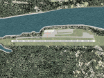
Googlyafcad A&F Data file for Ketchikan International based on Google Earth satellite
data - a small but relatively busy airport located in one of the wettest parts of
Alaska, USA. Ketchikan is Alaska's fifth largest city, with its economy based on
salmon fishing.
For some curious reason the facilities provided in Flight Simulator 2004 omit a crucial
taxiway at the west end of the airport, causing all traffic to taxi from the opposite
end. These files redress this issue, and also provide realistic levels of parking for
commercial and general aviation traffic, allowing you and your "AI" traffic to land,
taxi, park and take off in a realistic manner. The layout has been cunningly designed
to fit both with the Flight Simulator default scenery and version 2 of Alan Wright's
enhanced scenery (paktv2.zip on AVSIM) and is compatible with both in every respect.
Apart from conventional and water-based general aviation aircraft Ketchikan International
is regularly served by commercial flights of Alaska Airlines and by smaller operators
such as Alaska Central Express, Everts Air Alaska and LAB Flying Service. [File re-uploaded at request of AVSIM]
| Filename: | PAKT_Ketchikan_International_Alaska_USA.zip |
| License: | Freeware |
| Added: | 29th May 2010, 09:28:41 |
| Downloads: | 1,268 |
| Author: | John Hinson |
| Size: | 206.01 KB |
| Category: Flight Simulator 2004 - AFCAD Files | |
| Juneau International Airport, Alaska (PAJN) |
|
File Description:
A new file from me. I am back with Juneau International. This file has exactly 133 parking spots to add traffic. All airlines are represented at their proper place at the airport. More uploaded everyday.
| Filename: | Juneau_International_Airport_Alaska_PAJN.zip |
| License: | Freeware |
| Added: | 24th August 2006, 20:26:33 |
| Downloads: | 1,076 |
| Author: | Jason Landuyt |
| Size: | 106.22 KB |


© 2001-2026 AVSIM Online
All Rights Reserved
Privacy Policy |