
Where Flight Simulation Enthusiasts Gather from Around the World!
AVSIM Library - Search Results

| Category: Flight Simulator 2004 - AFCAD Files | |
| Norman Y. Mineta - San José International Airport , California (KSJC) |

|
File Description:
This AFCAD of San Jose's International airport is as accurate as humanly possible given the default FS9 scenery limitations. Five total gates are missing due to lack of space. Two for American, Two for Southwest and One for United. All other gates are present with gate assignments and locations in their proper places. I've also added and colored the proper taxiways (concrete or asphalt) as per the real SJC taxiways. I've lived and spotted in San Jose for 25 years and decided that SJC needed a proper AFCAD. All taxiways, gate locations and assignments are accurate as of Feb. 1st 2005.
Notes: This AFCAD was designed for the autogen static scenery to be set at normal. If set at anything higher, it places unrealistic buildings on the United ramp. Also, there are no GA gates and the GA taxiways (off RWY30L) were disabled. This was intended primarily for jet operation.
| Filename: | Norman_Y_Mineta___San_Jos_International_Airport__C.zip |
| License: | Freeware, limited distribution |
| Added: | 1st February 2005, 21:12:23 |
| Downloads: | 965 |
| Author: | Jaxan Prier |
| Size: | 6.96 KB |
| Category: Flight Simulator X - Utilities | |
| FS Earth 5.0 for Google Earth |
|
File Description:
This program acts as an interface between Flight Simulator X and Google Earth, letting to follow a flight in real time, over the satellite images generated by Google Earth. Flights can be saved, and many options are available for fine tuning the performance, as well as the map's style (zoom, tilt, orientation). Works on a single computer running FSX and Google Earth all together or, for best experience, can be used on two networked computers running respectively FSX (master) and Google Earth (slave). AI and Multiplayer traffic is also displayed in Google Earth, with course prediction and other information. Requires Flight Simulator X and Google Earth. The program running in trial mode works only around Anchorage, Alaska, (PANC / ANC) for a maximum of five minutes per flight session. Version 5.0 has improved compatibility with latest releases of Google Earth and several additional improvements. A version for FS2004 is available also.
| Filename: | FS_Earth_50_for_Google_Earth.zip |
| License: | Shareware, time limited |
| Added: | 19th July 2007, 00:46:27 |
| Downloads: | 1,104 |
| Author: | Luciano Napolitano |
| Size: | 2.44 MB |
| Category: Flight Simulator 2004 - Scenery | |
| Petaluma , California (O69) Scenery |
|
File Description:
This is a scenery upgrade for Petaluma Airport, California (O69). This is part Five of a series of small airstrip and minor airfield scenery enhancements which are based on real world data from Google Earth.
This is a more complex scenery than previous ones. You can see from the Google earth image that a golf course runs alongside the airport (appropriately called the Rabbit Run!). I have tried to include this with a golf course landclass polygon, also the airfield base seems mainly a red soil and this is reflected in the airbase poly. Built using EZ_Scenery, Lee Swordy's AFCAD and SBuilder. You must have rwy12 and EZ scenery libraries installed for the buildings to show. Both libraries of objects are free;
EZ Library is available from this URL http://www.abacuspub.com/pub/AbacusEZLibraries.exe
rwy12 from Avsim and additional EZ Custom libraries from Avsim. Search under Scenery design.
| Filename: | Petaluma__California_O69_Scenery.zip |
| License: | Freeware |
| Added: | 23rd March 2006, 23:09:07 |
| Downloads: | 719 |
| Author: | Kim Gowney |
| Size: | 629.87 KB |
| Category: Flight Simulator 2004 - Scenery | |
| KHAF - Half Moon Bay Airport - San Mateo County, California - USA |
|
Images related to this file:
File Description:
FS2004 Scenery - Half Moon Bay Airport (IATA: HAF, ICAO: KHAF, FAA LID: HAF) is a county-owned public use airport in San Mateo County, California, United States. It is located five nautical miles (9 km) northwest of the central business district of Half Moon Bay, California. The airport is on the Pacific Coast, south of San Francisco. The Half Moon Bay Airport is located approximately 20 miles south of San Francisco. It was constructed by the California State Highway Department for the U.S. Army in 1942 as an auxiliary airfield for Salinas Army Air Base. Following the end of World War II, San Mateo County acquired the airport from the Navy in 1947. The airport has served a variety of roles over the years and is currently an important business, transportation and emergency service asset to the community. For your flying pleasure by John B. Loney, Jr.
| Filename: | KHAF__Half_Moon_Bay_Airport__San_Mateo_County_Cali.zip |
| License: | Freeware, limited distribution |
| Added: | 5th August 2015, 18:58:17 |
| Downloads: | 318 |
| Author: | John B. Loney, Jr. |
| Size: | 11.87 MB |
| Category: Flight Simulator X - Aircraft Repaints, Textures and Modifications | |
| Sabena (Circa 1960) Douglas DC-6 |
|
Images related to this file:
File Description:
The first European operator of the Douglas DC-6 was the Belgian airline Sabena. The first of five DC-6s, which was registered OO-AWA (see Jens B. Kristensen's FSX Douglas DC-6 (dc6_v20x.zip)), was delivered on 15 July 1947. It was introduced on the Brussels-New York service in August 1947. Of course theDC-6s also operated on the Brussels-Leopoldville (now Kinshasa) route, the "lifeline" to the former Belgian colony Congo. From 1953 on they were joined by nine slightly larger DC-6Bs and one DC-6A. Except for OO-AWB which crashed in 1955, the "short" DC-6 had a remarkably long career with Sabena, incl. being leased to Air Congo. The last example was sold in 1965. Original textures by Jens B. Kristensen. Repaint by Maarten Brouwer.
These are textures only. You will require Jens B. Kristensen's FSX Douglas DC-6 (dc6_v20x.zip).
| Filename: | Sabena_Circa_1960_Douglas_DC6.zip |
| License: | Freeware, limited distribution |
| Added: | 1st July 2012, 17:14:07 |
| Downloads: | 141 |
| Author: | Maarten Brouwer |
| Size: | 1.02 MB |
| Category: Flight Simulator 2004 - Scenery | |
| Repost of Dryden Regional CYHD in Ontario Canada |
|
File Description:
This repost is first to deal with some lighting problems on the runways (though I still couldn't get rid of the taxiway lights that head off across the grass) and also to provide the right AFCAD file.
Dryden is in northwest Ontario on the shore of Wabigoon Lake. The airfield is some five miles northeast of the town. It has two runways, one 2,000 feet long and sand, the other 11/29 and 6,000 feet of asphalt 150 feet wide. There is a terminal building, a hangar for Thunder Airlines, and some GA hangars at and near the western apron, and in the Summer there is a flock of fire-fighting Canadair CL415 amphibs at the eastern apron together with the Ministry of Natural Resources Ontario fire fighting headquarters establishment, accomodation, and maintenance facilities. Among others Bearskin Airlines fly there, a wonderful punning name.
| Filename: | Repost_of_Dryden_Regional_CYHD_in_Ontario_Canada.zip |
| License: | Freeware |
| Added: | 15th February 2009, 15:34:49 |
| Downloads: | 597 |
| Author: | Roger Wensley |
| Size: | 4.51 MB |
| Category: Flight Simulator X - Utilities | |
| FS Earth 5.2 for Google Earth and FSX |
|
Images related to this file:
File Description:
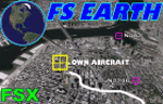
This program acts as a link between Flight Simulator X and Google Earth, letting to follow a flight in real time, over the satellite images generated by Google Earth. Flights can be saved, and many options are available for fine tuning the performance, as well as the map's style (zoom, tilt, orientation). Works on a single computer running FSX and Google Earth all together or, for best experience, can be used on two networked computers running respectively FSX (master) and Google Earth (slave). AI and Multiplayer traffic is also displayed in Google Earth, with course prediction and other information. Requires Flight Simulator X and Google Earth. The program running in trial mode works only around Anchorage, Alaska, (PANC / ANC) for a maximum of five minutes per flight session. Version 5.2 has new aircraft icons & labels and improves the compatibility with Windows Vista. A version for FS2004 is available also.
| Filename: | FS_Earth_52_for_Google_Earth_and_FSX.zip |
| License: | Shareware, time limited |
| Added: | 3rd May 2010, 07:38:23 |
| Downloads: | 2,701 |
| Author: | Luciano Napolitano |
| Size: | 3.46 MB |
| Category: Flight Simulator X - Utilities | |
| FS Earth 4.2 for Google Earth |
|
File Description:
This program acts as an interface between Flight Simulator X and Google Earth, letting to follow a flight in real time, over the satellite images generated by Google Earth. Flights can be saved, and many options are available for fine tuning the performance, as well as the map's style (zoom, tilt, orientation). Works on a single computer running FSX and Google Earth all together or, for best experience, can be used on two networked computers running respectively FSX (master) and Google Earth (slave). AI and Multiplayer traffic is also displayed in Google Earth, with course prediction and other information. Requires Flight Simulator X and Google Earth. The program running in trial mode works only around Anchorage, Alaska, (PANC / ANC) for a maximum of five minutes per flight session. Version 4.2 has improved compatibility with Windows Vista and minor bug fixes. A version for FS2004 is available also. By Luciano Napolitano.
| Filename: | FS_Earth_42_for_Google_Earth.zip |
| License: | Shareware, time limited |
| Added: | 9th March 2007, 13:39:05 |
| Downloads: | 2,213 |
| Author: | Luciano Napolitano |
| Size: | 2.44 MB |
| Category: Flight Simulator 2004 - AFCAD Files | |
| Syamsudin Noor, Banjarmarsin, Indonesia (WAOO/BDJ) |
|
File Description:
Googlyafcad A&F Data file for WRBB Banjarmasin/Syamsudin Noor/Ulin in Kalimantan, Indonesia based on Google Earth satellite data. Unfortunately, Microsoft have provided very limited facilities at this important Indonesian domestic airport, served by over twenty-five flights a day by Adam Air, Airfast, Bali International, Batavia Air, Bouraq, Garuda, Indonesia Air Transport, Lion Airlines, Mandala Airlines, Merpati Nusentara
and Sriwijaya Air jets and smaller craft. This upgrade redresses the subject by supplementing the GA parking with gates so that you, and your "AI" traffic can land, taxi, park and take off realistically. Whilst this file improves the layout of the airport, it is not a full scenery upgrade and does not attempt correct building locations, landclass, taxiway signs or those stupid over-sized filling stations that Microsoft loves to put in annoying places. Regrettably the satellite data currently available is not of sufficient quality to do so.
| Filename: | Syamsudin_Noor_Banjarmarsin_Indonesia_WAOOBDJ.zip |
| License: | Freeware |
| Added: | 17th March 2007, 11:06:39 |
| Downloads: | 1,075 |
| Author: | John Hinson |
| Size: | 59.7 KB |
| Category: Flight Simulator 2004 - Scenery | |
| Snowden Farm CF39, in Ontario Canada |
|
Images related to this file:
File Description:
Another airfield close to Highway 11, further south towards Lake Simcoe. Snowden Farm is a bit over five miles south of Huntsville and east of of highway 11. The grass runway 12/30 is just over 2,000 feel long and sandwiched between Penfold Lake to the north, and on the south side a large pond with a creek that connects to the much larger Mary Lake to the east. There is a hangar and a shed at the eastern end of the runway. There is one airfield scenery file, and two landclass files to provide the grassed area and the large pond and creek. I presume that the pond was just a little too small to register with Ultimate Terrain. The scenery might work without Ultimate Terrain but I haven't tested it, and for sure without it Penfold Lake and probably Mary Lake won't appear.
| Filename: | Snowden_Farm_CF39_in_Ontario_Canada.zip |
| License: | Freeware, limited distribution |
| Added: | 5th February 2010, 03:51:07 |
| Downloads: | 296 |
| Author: | Roger Wensley |
| Size: | 837.43 KB |


© 2001-2026 AVSIM Online
All Rights Reserved
Privacy Policy |