
Where Flight Simulation Enthusiasts Gather from Around the World!
AVSIM Library - Search Results

| Category: Flight Simulator X - Original Aircraft | |
| HMS Bounty for FSX - VERSION 1.1 |

|
Images related to this file:
File Description:
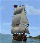
HMS Bounty for FSX - VERSION 1.1 - Built Specifically for FSX - (separate package required for FS9) by Milton Shupe, Nigel Richards, Rob Barendregt, Sasha Rieger, and Rob Ibey. Helmsman by Craig "Full" Richardson.
HMS Bounty 18th Century Tall Ship square rigger completely wind driven, individually animated and controlled sails, animated flags with direction and wind speeds, animated helm, and Sail Management Window to control all ship functions. Ship responds to wind speeds and direction with yaw, keeling, and pitch depending on sails deployed and yard arm positions. Ambient sounds, variable wind and gale storm sounds, ship's bell, "Salute", anchor weigh/drop all add to immersion.
WILL NOT WORK IN FS9 as it contains FSX native texture formatting and FSX specific sim interfaces. (Separate FS9 package available). BIG NOTE: The latest version of FSUIPC is Required for the HMS Bounty to work. Note: Realism settings should be set to "Hard" for best Wind Effects (Will not work on "Easy" realism in FSX).
Version 1.1 upgrades:
1) Even more realistic wind effects on yaw and roll based on the confluence of sails deployed, wind speeds and direction relative to ship heading, yard arms angle to the wind, and ground speed.
2) Tugboat function added.
3) Corrected lights positions.
4) Documentation updates.
| Filename: | HMS_Bounty_for_FSX__VERSION_11.zip |
| License: | Freeware |
| Added: | 9th May 2015, 00:30:01 |
| Downloads: | 1,067 |
| Author: | Milton Shupe, Nigel Richards, Rob Barendregt |
| Size: | 67.9 MB |
| Category: Flight Simulator 2004 - Aircraft Repaints, Textures and Modifications | |
| Aerial Transit DC-6A / C-118A |
|
Images related to this file:
File Description:
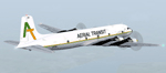
Textures for Tom Gibson's Douglas DC-6A - repainted by Manfred Meyer.
You need to download and install the latest Douglas DC-6A CB-16 base pack with model(use the model with Propspinners), sound and panel from the website calclassic.com.
These textures depict N96BL (c/n 43574) of Aerial Transit. Harold Bellomy and Charles Lawson founded 1963 the Bellomy & Lawson Company in Miami FL, buying DC-6 aircrafts an convert them to pure freighters. They run Challenge Air Transport and sold this airline 1982. Then they started 1983 a part 121 operation under the trading name "Aerial Transit" and ceased operations in 1991. The DC-6 aircrafts of aerial Transit, flying throughout the Caribbean and Central America and were often leased out to other operators of the region. N96BL was built 1952 as C-118A and delivered to the USAF as 51-3827. In 1976 bought by Bellomy & Lawson and registered as N3492F the aircraft served with Challenge AT and re-registered as N96BL from october 1983 until 1991 with Aerial Transit. Aerial Transits DC-6 always looking a little bit shabby and when flying this aircraft, keep in mind it has no pressurisation and no superchargers. So if you are forced to go above 10 000 ft take some oxygen bottles with you!
| Filename: | Aerial_Transit_DC6A__C118A.zip |
| License: | Freeware |
| Added: | 11th October 2014, 20:28:43 |
| Downloads: | 267 |
| Author: | Manfred Meyer |
| Size: | 4.23 MB |
| Category: Flight Simulator X - Scenery | |
| SKBO - El Dorado International Airport (2013) |
|
File Description:
El Dorado International Airport (IATA: BOG, ICAO: SKBO) is an international airport located in Bogota, Colombia. It is the largest Latin America airport in terms of cargo movements with 593,946 tons (2010) and the third in terms of
passenger traffic, only behind Sao Paulo-Guarulhos International Airport and Mexico City's Benito Juarez International Airport, transporting 18,934,203 passengers in 2010; as well as the largest airport in Colombia and the main
international and domestic air gateway in the country, serving as an important hub for Avianca, Copa Airlines Colombia, Aires, Satena, EasyFly and other cargo companies.
This file has the right coordinates, with the apron and characteristics of the airport with the new international terminal just builed in 2012. The runways were reoriented to the correct direction, runway were resized the gates placed on correct location and number, CATAM was placed
(Colombian Air force and Colombian National Army) and Colombia National Police and Colombian National Armada were assigned a correct apron. All the jet ways including the ones of the executive terminal are working. There is a copy
of all the airport charts required to navigate in and out of this airport which are courtesy of: Areonatica Civil de Colombia and the originals can be found at www.aerocivil.gov.co/ under Informacion Aeronautica click AIP; on AIP
click Aerodromos then click at SKBO.
This work is dedicated to West Wind Airlines.
| Filename: | SKBO__El_Dorado_International_Airport_2013.zip |
| License: | Freeware |
| Added: | 16th February 2013, 00:10:34 |
| Downloads: | 11,244 |
| Author: | Anwar Gonzalez |
| Size: | 19.16 MB |
| Category: Flight Simulator 2004 - Scenery | |
| Kaltag KAL in Alaska |
|
Images related to this file:
File Description:
Kaltag is a small village on the west bank of the Yukon River, around 65 miles east of the coast at Unalakleet and about 40 miles south of where the river turns from north-south to east-west, east being upstream towards the distant Fairbanks. The population is just under 200 and living from fishing and the land. The airfield is close by and has a gravel runway aligned 21-3 and just under 5,000 feet long. Apart from the airfield itself, and it's buildings, this scenery modifies the local land class, adds village buildings while reducing the village size to reality, and creates a new airfield background. Kaltag is located on the edge of three different airlines coverage areas, and is served by Bering Air from the northwest, ERA from the southwest, and also by Wright Air from Fairbanks in the east. These are included in the AI.
A note here about my scenery making. This is post number 507 and there will not be many more to follow this as I am almost at the end of the photos I either took or found for scenery purposes. There is a limit to what can be located online and I have already been making use of the little there is; eg Unalakleet. So, if you are near an airport (preferably Canadian or Alaskan) and have a camera..... Let me know.
| Filename: | Kaltag_KAL_in_Alaska.zip |
| License: | Freeware, limited distribution |
| Added: | 20th August 2019, 19:04:35 |
| Downloads: | 103 |
| Author: | Roger Wensley |
| Size: | 3.57 MB |
| Category: Flight Simulator X - Utilities | |
| Gate A Nator Pre Flight Planning tool 2.1 |
|
Images related to this file:
File Description:
Gate A Nator is a freeware pre-flight tool for FSX and Prepar3D that allows to customize a flight plan before starting a flight simulation session. Can set departing Gate position and can load flight plans from FSX/FS2004, Prepar3D, LEVELD, PMDG, Quality Wings and Flight Sim Commander, or from an ICAO route, and using Airac cycles (FSBuild2 format) to read navaids from. Installation package installs Airac Cycle 1904, that can be after updated from Navigraph. Gate/parking database is auto created and updated from FSX or Prepar3D scenery base.
It supports file save and export to FS2004, FSX, Prepar3D, LEVELD, PMDG, Quality Wings, Flight Sim Commander, XPlane 11 and Aerosoft Airbus/X extended.
Complete instructions guide is included in the help file.
| Filename: | Gate_A_Nator_Pre_Flight_Planning_tool_21.zip |
| License: | Freeware |
| Added: | 29th April 2019, 17:10:54 |
| Downloads: | 216 |
| Author: | Alessandro Antonini |
| Size: | 21.37 MB |
| Category: Flight Simulator X - Aircraft Repaints, Textures and Modifications | |
| Eastern Airlines Boeing 757-200 |
|
Images related to this file:
File Description:

This is a repaint on the TDS (Tenkuu Developers Studio) Boeing 757-200 RR model, in the final Eastern Airlines livery, registration N504EA. Textures only. The textures are saved in 32 bit format for quality graphics. Includes custom Eastern Cabin and Ground Support Equipment and personnel. Subtle weathering, customer correct window layout and other new details including photo real refuel station under right wing as well as the refueling access panel and new wing textures. Winglets are added if you want to use them. A special thanks to Luis Castro for the winglet night lighting and the photoreal wing tops and flaps and Nick Chinn for the refueling station photos from a real Delta 757 that helped me enhance these textures even more.By:Joe DeGregorio
| Filename: | Eastern_Airlines_Boeing_757200.zip |
| License: | Freeware |
| Added: | 1st October 2018, 18:46:40 |
| Downloads: | 390 |
| Author: | Joe DeGregorio - TDS |
| Size: | 16.55 MB |
| Category: Flight Simulator X - Scenery | |
| Vancouver Extras |
|
Images related to this file:
File Description:
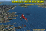
Vancouver Extras. A lot of new objects like high rise helipads (an aerial map showing their locations), more helipads on docks at the waters edge, many ships in port and out at sea including a carrier with escorts. The carrier has 3 Jayhawks and 1 RAC Bell 412 on it. Cruise ships, cargo ships and a super tanker.
Most of the objects are north of the city on the shoreline and the addition of several marinas with docks/boats. Also an area with cranes, vehicles and a shipping container yard with lots of other stuff.
Add the download "Indian Arm Float Base.zip" and really spruce up the area.
Designed to enhance your FSX world and make your flights more interesting.
Please enjoy! savageagle
| Filename: | Vancouver_Extras.zip |
| License: | Freeware |
| Added: | 24th July 2010, 09:06:13 |
| Downloads: | 3,618 |
| Author: | Tim Durham |
| Size: | 8.55 MB |
| Category: Flight Simulator 2004 - Scenery | |
| Gustavo Rojas Pinilla International Airport (SKPS) 2011 |
|
File Description:
Gustavo Rojas Pinilla International Airport (IATA: ADZ, ICAO: SKSP) is the leading airport in the archipelago of San Andres, Providencia and Santa Catalina, which has enough capacity to receive large aircraft, due to a number of
charter flights and seasonal in different parts of America and Europe.
This file has the right coordinates, with the apron and characteristics of the airport. The runways were reoriented to the correct direction, runway were re-sized the gates placed on correct location and number, FAC was placed
(Colombian Air force and Colombian National Army) all the airport charts required to navigate in and out of this airport can be found at www.aerocivil.gov.co/ under Informacion Aeronautica click AIP; on AIP
click Aerodromos then click at SKSP.
| Filename: | Gustavo_Rojas_Pinilla_International_Airport_SKPS_2.zip |
| License: | Freeware |
| Added: | 23rd August 2011, 02:27:32 |
| Downloads: | 1,364 |
| Author: | Anwar Gonzalez |
| Size: | 6.29 KB |
| Category: Flight Simulator X - Flight Plans | |
| Set of three VFR Low Altitude FSX Flight Plans |
|
Images related to this file:
File Description:
Set of three VFR Low Altitude Flight Plans in Florida, Australia, and South Korea. Installation and Usage instructions are inside each individual folder. These are great routes for B-52, F-111, B-1B, B-2 A6, A4, Vulcan and any fighter or bomber enthusiasts. Of course you can fly the routes with any aircraft of your choice. Included in this package are two spectacular gauges by Karol Chlebowski for TFR flying and Pave Tack which includes many advanced features for bombing, navigation and reconnaissance. These two gauges will greatly enhance your ability to fly these challenging routes and are a great companion of the flight plans. Another option to download Version 2.1
of my mini panel which has all this functionality and more.
| Filename: | Set_of_three_VFR_Low_Altitude_FSX_Flight_Plans.zip |
| License: | Freeware |
| Added: | 1st August 2011, 08:32:24 |
| Downloads: | 329 |
| Author: | Bill McClellan |
| Size: | 4.77 MB |
| Category: Flight Simulator X - Scenery | |
| GPS Enabled Oil Rig Platform |
|
File Description:
An FSX Oil rig placed at the correct real life coordinates about 100+ miles from Aberdeen and Peterhead. The landing pod has GPS facilities and a code of RIG1 Meaning you can start at the pod and/or fly to it by entering RIG1 into the GPS Direct To. A Cargo Ship sails from the tidal Aberdeen Harbour at 06:18 Local time and heads for Peterhead which is an hour away. It joins another Cargo ship there and the two set sail for the Piper alpha rig some 5 hours away. Sailings are twice a day and can be followed by boat plane. The rig landing pod is excellent for landing practice in a helicopter and especially with the built in GPS coordinates.
| Filename: | GPS_Enabled_Oil_Rig_Platform.zip |
| License: | Freeware |
| Added: | 20th November 2011, 00:43:58 |
| Downloads: | 574 |
| Author: | Steve Brooks |
| Size: | 6.26 KB |


© 2001-2026 AVSIM Online
All Rights Reserved
Privacy Policy |