
Where Flight Simulation Enthusiasts Gather from Around the World!
AVSIM Library - Search Results

| Category: Flight Simulator 2004 - Aircraft Repaints, Textures and Modifications | |
| Delta Air Lines (Dali) Boeing 757-232 N661DN |

|
Images related to this file:
File Description:
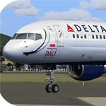
This is a textures only release for the QualityWings Ultimate 757 Collection. The model is Payware and can be obtained at www.qwsim.com. Instructions for installation are contained within the download. This repaint is tested to work with the quality wings livery manager and textures are 32bit for highest quality. This file should work in FSX but has not been tested. The Dali moustache has been added to ship 661 to help promote an exhibit at the High museum of Art in Atlanta in 2010
| Filename: | Delta_Air_Lines_Dali_Boeing_757232_N661DN.zip |
| License: | Freeware, limited distribution |
| Added: | 13th August 2010, 22:46:54 |
| Downloads: | 1,393 |
| Author: | Stephen Groom | Quality Wings |
| Size: | 10.1 MB |
| Category: Flight Simulator 2004 - Scenery | |
| Metro Field MTF in Fairbanks Alaska |
|
Images related to this file:
File Description:
Metro Field is more of a float plane "pond" than a field, close to and northeast of Fairbanks International Airport in Alaska. There is a gravel strip alongside the water, but the "strip" is actually a gravel road that functions as a runway when required. And if that sounds familiar it is also pretty much the description for nearby Chena Marina, though Metro is nowhere near as busy. This is one of four float plane bases around Fairbanks. You will definitely need Ultimate Terrain Alaska Canada.
| Filename: | Metro_Field_MTF_in_Fairbanks_Alaska.zip |
| License: | Freeware, limited distribution |
| Added: | 21st August 2010, 03:27:58 |
| Downloads: | 373 |
| Author: | Roger Wensley |
| Size: | 986.7 KB |
| Category: Flight Simulator 2004 - Scenery | |
| Cross Country Short Hops |
|
Images related to this file:
File Description:
Cross Country Short Hops. This scenery package contains 13 airports from the east coast to the west coast of the USA. The longest leg is 229 nm and the shortest leg is 136 nm. Start from either the east coast (Montauk Airport, KMTP) or the west coast (Little River Airport, O48 (now known as KLLR)). Eleven of the 13 airports are new designs. Two airports are previous releases and are included here. Tested in default FS9 and with Ultimate Terrain. By John B. Loney, Jr.
| Filename: | Cross_Country_Short_Hops.zip |
| License: | Freeware, limited distribution |
| Added: | 9th February 2011, 20:45:27 |
| Downloads: | 580 |
| Author: | John B. Loney, Jr. |
| Size: | 2.69 MB |
| Category: Flight Simulator 2004 - Scenery | |
| Pocono Mountains Municipal Airport |
|
Images related to this file:
File Description:
FS2004 Scenery - Pocono Mountains Municipal Airport (KMPO) serves Mount Pocono and Monroe County, PA and is owned by Pocono Mtns Muni Arpt Auth. The airport has more than one runway. The longest is a paved runway extending 5001 feet. The facility is at an elevation of 1916 feet at a distance of about 2 miles from Mount Pocono. Includes the runway 13/31 which was extended to 5,001 ft x 75 ft. Tested in Ultimate Terrain and Default FS. By John B. Loney, Jr.
| Filename: | Pocono_Mountains_Municipal_Airport.zip |
| License: | Freeware, limited distribution |
| Added: | 22nd February 2011, 23:02:23 |
| Downloads: | 388 |
| Author: | John B. Loney, Jr. |
| Size: | 813.69 KB |
| Category: Flight Simulator 2004 - Miscellaneous Files | |
| Florida Tour |
|
File Description:
FS2004 Florida Tour. Here are a set of 11
VFR flight plans to explore the state of
Florida, based on the excellent FREEflow
Ultimate Florida scenery for FS9 ( ffflv1.2.zip
& ffflv1.3_ai.zip). The flight plans
are designed to fly over some of the very
interesting points in the State: Lakeland,
Tampa, Clearwater, St. Petersburg, The Keys,
Miami, Disney World, Cape Canaveral,
Jacksonville, the Panhandle, Pensacola,
and Tallahassee. Each flight ranges from
about 30 to 60 minutes in duration. This
package contains the flight plans, and
documentation.
| Filename: | Florida_Tour.zip |
| License: | Freeware, limited distribution |
| Added: | 5th August 2005, 21:01:43 |
| Downloads: | 2,651 |
| Author: | Paul Schwerdtfeger |
| Size: | 4.66 MB |
| Category: Flight Simulator 2004 - Scenery | |
| 3 Northern Ontario Airports: Kenora (CYQK), Wawa (CYXZ) and Marathon (CYSP) - CanUk Scenery |
|
File Description:
Kenora, Wawa and Marathon airports offer destinations in Northern Ontario and are intended to be used with Flight Ontario's Thunder Bay2 and Toronto sceneries. Ultimate Terrain compatible. Zip file includes 3 separate scenery folders so you can choose which of the sceneries you would like to install. Created in GMAX, these sceneries are fairly accurate representations of their real world counterparts. Custom landclass, automated hanger doors, photoreal buildings, 3-D taxiway lights, custom AFCAD2 and static vehicles included. Please see ReadMe for proper installation.
| Filename: | 3_Northern_Ontario_Airports_Kenora_CYQK_Wawa_CYXZ_.zip |
| License: | Freeware, limited distribution |
| Added: | 19th September 2005, 21:50:30 |
| Downloads: | 4,900 |
| Author: | Adam Bentley and David Madge |
| Size: | 14.5 MB |
| Category: Flight Simulator 2004 - AFCAD Files | |
| E. Venizelos Athens Intl, LGAV |
|
File Description:
Very realistic AFCAD2 file for HST's LGAV scenery. Includes:
- Relocation of airlines using LGAV to match real life gate operations (Schengen/Extra Schengen)
- Expansion of GA parking utilizing real parking stands G01 - G20 (works great with Ultimate GA AI packages!)
- Addition of parking stands F01, F03, F05, F07, F09 and F11 used by GA and cargo GA
- Addition of Veravia (GRV) and Hellas Star (HST) parking codes
- Several minor fixes that were causing improper aircraft taxiing behaviour
To be used ONLY with HSP LGAV
| Filename: | E_Venizelos_Athens_Intl_LGAV.zip |
| License: | Freeware |
| Added: | 18th October 2005, 18:02:21 |
| Downloads: | 3,316 |
| Author: | Kostis Prassas |
| Size: | 134.07 KB |
| Category: Flight Simulator 2004 - Scenery | |
| Alpine-Casparis Municipal Airport, Alpine, Texas (E38) |
|
File Description:
Alpine-Casparis Municipal Airport,(E38), owned and operated by the City of Alpine, is a public-use general aviation airport located in Brewster County, Texas. The airport, which is situated approximately two miles northwest of Alpine, operates two asphalt runways: Runway 01/19, which measures 6,003 feet in length and 75 feet in width; and Runway 05/23, measuring 5,018 feet in length and 60 feet in width. This scenery is compatible with both FS9 Default and Ultimate Terrain. By John B. Loney, Jr.
| Filename: | AlpineCasparis_Municipal_Airport_Alpine_Texas_E38.zip |
| License: | Freeware, limited distribution |
| Added: | 20th September 2008, 20:46:44 |
| Downloads: | 626 |
| Author: | John B. Loney, Jr. |
| Size: | 874.17 KB |
| Category: Flight Simulator 2004 - AI Flight Plans | |
| Japanese Air Self Defense Force AI Traffic 2005 Part 1 BGLs |
|
File Description:
These files will add JASDF traffic throughout Japan. It is a good cross section of the JASDF forces. 28 Bases, 300 Aircraft, 653 legs
This file contains Traffic BGL and AFCAD BGLs for the 2005 JASDF Traffic Package. FS2004 only.
| Filename: | Japanese_Air_Self_Defense_Force_AI_Traffic_2005_Pa.zip |
| License: | Freeware, limited distribution |
| Added: | 10th April 2005, 17:32:36 |
| Downloads: | 5,164 |
| Author: | Dexter Eadie |
| Size: | 164.86 KB |
| Category: Flight Simulator 2004 - Scenery | |
| LILG - Vergiate |
|
Images related to this file:
File Description:
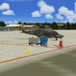
Vergiate airport scenery made with custom object and texture. It contain Afcad, photoreal,complete airport and Ai traffic file.
For AI traffic download AI aircraft separately ( read Readme file).
Vergiate Airport scenery are parto of Phoenix AI Military Traffic Project.
| Filename: | LILG__Vergiate.zip |
| License: | Freeware |
| Added: | 2nd December 2012, 00:27:50 |
| Downloads: | 1,312 |
| Author: | Gianluca Giovannini |
| Size: | 18.39 MB |


© 2001-2026 AVSIM Online
All Rights Reserved
Privacy Policy |