
Where Flight Simulation Enthusiasts Gather from Around the World!
AVSIM Library - Search Results

| Category: Flight Simulator 2004 - Scenery | |
| Hana Heli-Obstacle Course v2.0 |

|
Images related to this file:
File Description:
Hana Airport is a regional airport of the State of Hawaii on the east shore of the island of Maui, 3 NM northwest of the unincorporated town of Hana. The airport covers 119 acres and has one runway. It is primarily a commuter facility used by unscheduled air taxis and general aviation. This scenery is intended as a single/multiplayer helicopter obstacle course where heli pilots can meet to compete, show off, and share their helo skills. Since birdseye (Timm Turner) already did a neat scenery called Hana_Scenery_PHHN (search for "hana" in the HoverControl Downloads), we decided to convert PHHN to a full helicopter training area. Makes a great place for helo pilots to gather to practice and perfect their skills, and challenge other pilots! And keep an eye-out for that Hot Air Balloon, cruising around an altitude of 3000 feet (don't forget to wave at them!). Another unique thing about this scenery is the neighboring islands (Honolulu Intl/Hickam AFB, Bellows AFB, Lanai City, Kahului, Molokai, etc). If you get frustrated during your heli obstacle course training, just take a heading of 275 degrees, and relax at one of the neighboring islands. We also added an Easter Egg - If you set your FS calendar to July 21st, you'll see a large ridge fire up in the hills. Load Jordan Moore's Erickson S64E (http://www.hovercontrol.com/) & try your skills at water bombing!
| Filename: | Hana_HeliObstacle_Course_v20.zip |
| License: | Freeware |
| Added: | 7th December 2010, 03:28:47 |
| Downloads: | 474 |
| Author: | Greg Spellmen & Bob Ferguson |
| Size: | 58.56 MB |
| Category: Flight Simulator 2004 - Scenery | |
| Hana Heli-Obstacle Course v3.0 |
|
File Description:
Hana Airport is a regional airport of the State of Hawaii on the east shore of the island of Maui, 3 NM northwest of the unincorporated town of Hana. The airport covers 119 acres and has one runway. It is primarily a commuter facility used by unscheduled air taxis and general aviation. This scenery is intended as a single/multiplayer helicopter obstacle course where heli pilots can meet to compete, show off, and share their helo skills. Since birdseye (Timm Turner) already did a neat scenery called Hana_Scenery_PHHN (search for "hana" in the HoverControl Downloads), we decided to convert PHHN to a full helicopter training area. Makes a great place for helo pilots to gather to practice and perfect their skills, and challenge other pilots! And keep an eye-out for that Hot Air Balloon, cruising around an altitude of 3000 feet (don't forget to wave at them!).
Another unique thing about this scenery is the neighboring islands (Honolulu Intl/Hickam AFB, Bellows AFB, Lanai City, Kahului, Molokai, etc). If you get frustrated during your heli obstacle course training, just take a heading of 275 degrees, and relax at one of the neighboring islands. We also added an Easter Egg - If you set your FS calendar to July 21st, you'll see a large ridge fire up in the hills. Load Jordan Moore's Erickson S64E (http://www.hovercontrol.com/) & try your skills at water bombing!
| Filename: | Hana_HeliObstacle_Course_v30.zip |
| License: | Freeware |
| Added: | 28th August 2011, 17:53:18 |
| Downloads: | 466 |
| Author: | Greg Spellmen, Bob Ferguson |
| Size: | 95.52 MB |
| Category: Flight Simulator X - Aircraft Repaints, Textures and Modifications | |
| Centurion Cargo "Frank Fine" McDonnell-Douglas MD-11F (N985AR) |
|
Images related to this file:
File Description:
Centurion Cargo is a privately owned company founded in 2001. Based at
Miami International Airport, it currently operates a fleet of ten MD-11F,
and has an impressive 550,000 square foot warehouse, divided into two
different sections, a 159,000 square foot cooler and 391,000 square foot
Dry Cargo Area. The Centurion Cargo Center is by far the largest privately
owned all cargo airline facility in North America.
Centurion is one of the leading cargo airlines operating to and from
Latin America and is No. 1 in the handling of live animals and perishable
goods. Centurion has recently expanded its network to include 4 weekly flights
from Amsterdam, The Netherlands. We also offer worldwide charter, handling, and
security services among others.
FSX McDonnell-Douglas MD-11F repaint textures for the real world
Centurion Cargo N985AR "Frank Fine", but with the freeware version's Pratt and
Whitney engines. She is named after the late Miami aviation pioneer Frank Fine,
who started in aviation as Agro Air Associates and later lead both Fine Air
and Arrow Air. For the freeware SMS Overland MD-11 with P&W 4460 engines, which
you must have previously installed in FSX. I installed the freeware
(SMS-MD-11_Dutch_Package.zip) with VC which works well with this repaint.
Also includes engine exhaust smoke coordinates which you can add to
your "aircraft.cfg" if you wish. Screenshots enclosed. Easy installation.
Repaint by Tom Tiedman.
| Filename: | Centurion_Cargo_Frank_Fine_McDonnellDouglas_MD11F_.zip |
| License: | Freeware |
| Added: | 20th July 2013, 07:19:42 |
| Downloads: | 254 |
| Author: | Tom Tiedman / SMS Overland |
| Size: | 8.28 MB |
| Category: Flight Simulator X - Scenery Design | |
| (Version 2.0) KEFD -Ellington 2025 Refresh FSX (Circa 2006-2010)- Johnson Space Center Houston |
|
Images related to this file:
File Description:
Version 2.0 covers landclass across the entire greater Houston area, with a large increase in LOD. This version significantly tightens up and improves the landclass from version 1.0, and adds a vast amount of scenery objects that brings the Bay Area-KEFD area into the modern era. This improves and adds a highly accurate runway 17 approach with accurate placement of buildings and scenery around the year 2011-modern day. In addition, includes several new files including a new airport/helipad via Houston Clear lake regional airport, T41 La Porte Municipal and surrounding shipping ports, Kemah Boardwalk, and a giant improvement to Johnson Space Center Houston. Rundway 35 and Runway 22 landclass is significantly increased, and more accurate as well. You can fly an accurate VFR approach or set up an ILS for any one of KEFD's runways with ease with this improvement.List of Version 2.0 additions and changes: - I added a ton of scenery objects and tightened up the landclass at Johnson Space Center Houston- NASA Control Center--- Added Talon Park with T38s (via static objects)--- Added Gemeni V rocket and 747 for the shuttle transporter--- And a whole bunch of vegetation, new buildings, and tour buses.- Added Kemah boardwalk and several boat docks- Removed a TON of highrise textures and replaced with medium and large city suburb landclass.- Added Clear Lake regional Hospital with helipad and surrounding scenery by Walter Reed Park- Added El Jardin or "Bayport Container port" with several scenery objects and significantly tightened up landclass.-- Looks great when setting up ILS approach for RWY 22- Tightened up Bay Area BLVD landclass, "adding" University of Houston Clear Lake"-- UHCL was semi already present, just made it more pronounced.- Made Red Bluff road landclass super recognizable!-- Red Bluff road is used to set up VFR approach and or field break for RWY 22 and RWY 17 R.----- Its common to see private jets and the USAF doing a break along Red Bluff road.- Added First Baptist Church, and water tower to Pasadena Convention center- Made Fairmont Parkway pronounced with landclass- Added Houston Port Authority at Morgan's Point--- Another Landmark for the RWY 22 ILS approach, NASA religiously uses this to line up the 10 mile ILS.- Tightened up landclass at Village Grove East and along Fairmont Parkway- Added a TON of scenery objects and landclass corrections for approach of RWY 17 L and 17 R.---- Added Home Depot, Lowes, Walmart Super center, Guitar center etc.---- added South Main Baptist Church--- Bondy Jr High, Turner Elementary, and Pasadena Memorial High School--- Added Saint Luke's Hospital--- Added Hampton Inn Suites and HCA rehab hospital--- Added a ton to the container facility behind best buy and storage facility--- Added smaller churches on RWY 17 approach--- Added a ton of scenery at the base of RWY 17 R, i.e., concrete plant, containers, trucks-- Added gas stations on the corner of beltway 8 and genoa red bluff-- Significantly changed and tightened up landclass at the base of RWY 22 and RWY 17 L and 17 R-- Made several roads and Beltway pronounced------ This decision looks AWESOME at night, really adds demarcation to the roads.**All of this makes the RWY 17 approach super recognizable** RWY 22 approach landclass is much more accurate.- Significantly changed and tightened up landclass near southbelt ellington and interstate 45.- Added Grace Church-- I wanted to do San Jacinto College south, but seemed over kill at that point.- SIGNIFICANTLY tightened up landclass for RWY 35 approach and near baybrook mall.-- Along I45- Added TDECU stadium at the University of Houston Main Campus---- So you can practice flybys for Cougar games!- Added the Battleship at San Jacinto Monument- I also "borrowed" T41 La Porte Municipal's tower camera to make a SWEET view of KEFD.- I included landclass for Sealy Texas this time, as well as my significant enhancements of Austin, Texas greater area as well (optional, but recommended!)---------------------------------------------------------------------------Version 1.0 originally added:- Added the Johnson Space Center Houston, which is now greatly enhanced and blended.- San Jacinto Community College-Central- Pasadena Convention Center- Pasadena Water Treatment Facility- NASA Bouncy Lab- Pasadena Shopping center, now greatly enhanced and blended.- Baybrook Mall and other shopping spots.- Significant Landclass improvements across the entire greater Houston Area File also includes landclass and scenery improvements for the greater Austin, Texas Area (optional), KIAH, KDWH, and Sealy, Texas. Each of these projects combined covers roughly 15,000 square miles of landclass improvement. Allowing you to fly entirely from Houston to Austin, or Houston to San Antonio in accurate landclass. -Enjoy!DJN
| Filename: | Version_20_KEFD_Ellington_2025_Refresh_FSX_Circa_2.zip |
| License: | Freeware |
| Added: | 12th October 2025, 16:15:47 |
| Downloads: | 65 |
| Author: | Dan Nelson |
| Size: | 277.28 MB |
| Category: Prepar3D V1-4 - Scenery | |
| TNCC - Curaçao International Airport |
|
File Description:
This is my first scenary, any problem or sugestion send-me an e-mail ([email protected]). The scenery was made using the Airport Design Editor, SketchUp 2017 an others.
Curaçao International Airport (IATA: CUR, ICAO: TNCC), (Dutch: Hato Internationale luchthaven) also known as Hato International Airport (formerly Dr. Albert Plesman International Airport), is the only airport for the island of Curaçao.
The airport is located on the north coast of Curaçao, 12 kilometres (7.5 mi) from the capital Willemstad. Curaçao International Airport services flights from the Caribbean region, South America, North America and Europe and has the third longest commercial runway in the Caribbean region after Rafael Hernández Airport in Puerto Rico and Pointe-à -Pitre International Airport in Guadeloupe.
The airport serves as a main base for Divi Divi Air, Jetair Caribbean as well as EZAir; it formerly served as a main base for ALM, KLM, DCA, DAE and Insel Air.
Located on the Dutch Caribbean island of Curaçao, connects Europe, the Americas and the Caribbean. Curaçao International Airport is served by several airlines.
The Curaçao International Airport has one of the longest runways in the Caribbean, accommodating up to a Boeing 747. In the early fall of 2014, Curaçao International Airport opened a new General Aviation Center offering premier service in a separate building with a private entrance and exit and special amenities.
| Filename: | TNCC__Curaao_International_Airport.zip |
| License: | Freeware |
| Added: | 8th March 2021, 19:00:36 |
| Downloads: | 551 |
| Author: | Eduardo Puelker |
| Size: | 7.24 MB |
| Category: Flight Simulator X - Scenery | |
| Mid West Victoria v2 for ORBX v2. 14 airports. YARA YSWL YMBU YSTA YDOD YWYF YBIR YHPN YKER YSLK YSWH YNHL YHSM YWKB |
|
Images related to this file:
File Description:
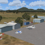
'Mid Western Victoria v2' is made to match ORBX Australia v2 scenery. Use 'Mid West Victoria update' for ORBX v1 or no ORBX. NOTE this is an UPDATE with Horsham replacing Hamilton in the instructions (it is Horsham in the actual scenery). There are 14 airports starting at Ararat and extending up to the Murray at Swan Hill. YARA Ararat YSWL Stawell YMBU Maryborough YSTA Saint Arnaud YDOD Donald YWYF Wycheproof YBIR Birchip YHPN Hopetoun YKER Kerang YSLK Sealake YSWH Swanhill YNHL Nhill YHSM Horsham YWKB Warracknabeal. A lot of airports but this is several hundred hours of effort over many months. ORBX has done these as they have done every airport included with FSX in Australia to a reasonable standard. If I had not already done them for ORBX V1 I would not have bothered. However these are better than ORBX because the surroundings have been modified to match real life. Towns have been added or shifted. Forests cut down or added. Race courses, sewage treatment ponds and other stuff added. Local obstacles (towers etc) added. There are 6 custom terminal buildings accurate to real life. Included is an AI traffic file that covers airports that dont already have AI. These files are for Flight Simulator X. Made using Airport Design Editor using some objects borrowed from Robert Budd's excellent Baccus Marsh and 'Static aircrafts' by Jean-Pierre Fillion. REQUIRED The scenery is designed to interface with ORBX FTX_AU V2 scenery for Australia (payware).
| Filename: | Mid_West_Victoria_v2_for_ORBX_v2_14_airports_YARA_.zip |
| License: | Freeware |
| Added: | 2nd May 2020, 23:11:14 |
| Downloads: | 255 |
| Author: | Colin Jeffery |
| Size: | 10.49 MB |
| Category: Flight Simulator X - Scenery | |
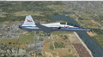
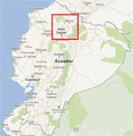
| North Central Ecuador v3, including SEQM (SEQU) and SEIB |
|
Images related to this file:
File Description:
FSX/P3D Version 3 of this scenery is a completely new build of SEQM from the ground up. The entire complex is rendered using FSX objects along with the new highway that connects to the highway infrastructure with AI road traffic. The airport is now at a mean altitude that better blends with the newly included NASA SRTM GL1 30m mesh for the region. The tower is at the correct altitude. Buildings use more accurate footprints, new models, floating jetways, and updated landclass, and work seamlessly with the roads added by FTX Global/Vector. Lakes are corrected within roughly 100 square miles. Although the Ibarra/Atahualpa (SEIB) airport no longer exists, there is an option to add it back. Startup files are included to fly from the lakes and the Ibarra/Atahualpa (SEIB) airport. As a “bonusâ€, SEQU was restored in this version, because much of the footprint of the airport still remains as part of its conversion to a park. As such, a custom and fully functional SEQU is included for users who would like to revisit the old airport. AI Traffic can be restored at SEQU by simply using the "Reversed SEQU-SEQM AI Traffic" option. Scenery was created using Airport Design Editor X v1.76.6715, SBuilderX 3.13, and the FSX Object Placement Tool. Scenery objects were added and modified from stock FSX scenery to resemble as closely as possible the actual airport. Bill Leaming's Ramp Lights for P3D/FSX illuminate the aprons.
| Filename: | North_Central_Ecuador_v3_including_SEQM_SEQU_and_S.zip |
| License: | Freeware |
| Added: | 22nd March 2020, 22:13:37 |
| Downloads: | 4,089 |
| Author: | Carlyle Sharpe |
| Size: | 29.44 MB |
| Category: Prepar3D V1-4 - Scenery | |
| KCVG - Cincinnati - Northern Kentucky USA International Airport For Prepar3Dv4 |
|
Images related to this file:
File Description:
This is an enhancement of the default P3Dv4 airport. There are custom made terminal buildings included to replace the ones included in the default scenery; all aircraft gates are included and have been correctly coded using Airport Design Editor 1.76.6715, according to the latest terminal map information; all jetways and scenery objects will display, provided scenery complexity in P3Dv4 is set at normal or higher; autogen objects have been prevented from displaying on the airport grounds; the magnetic variation has been changed to the correct current value; Runway 18R-36L has been changed to 18C-36C and a new runway 18R-36L has been added, along with ILS,RNAV, and GPS approaches; a new airport vehicle network has been built; extra fuel trucks have been added throughout the airport; the tower view has been changed to display from the roof of the control tower; all taxiway designators are correct and all taxiway signs are correctly placed and named; There is the option to open all runways to AI traffic; there is a large and highly detailed cargo area for DHL; and there are two files included for GSX L2 users to enable them to have custom GSX L2 SODE jetways displayed. This airport has only been tested in P3Dv4, and is not guaranteed to work in earlier versions. Please refer to the README FIRST.txt file to insure proper installation of all files.
| Filename: | KCVG__Cincinnati__Northern_Kentucky_USA_Internatio.zip |
| License: | Freeware, limited distribution |
| Added: | 6th April 2019, 03:57:13 |
| Downloads: | 1,388 |
| Author: | Patrick Finch |
| Size: | 4.26 MB |
| Category: Flight Simulator X - Utilities | |
| FSX SDK Toolbox |
|
File Description:
The FSX SDK ToolBox is a handy application for those of us who need to delve again and again into the SDK for Microsoft's new release of Flight Simulator X. It's basically an in-house tool used by TweakFS and we thought it would be nice to make it available to other FS developers as well as the general simming community. Quick links to frequently-accessed key FSX folders such as the Main FSX, ApplicationData and MyDocuments folders are also included, as are direct links to major FSX configuration files like fsx.cfg, scenery.cfg, dll.xml, exe.xml files and many more. It also includes an integrated GUID generation tool that can create single or multiple GUID lists for use with Cameras and Missions.
Mmain Features: 1) FSX SDK Browser, 2) Web Browser, 3) Browser supports HTML, DOC, RTF, TXT, XML & PDF documents, 4) The browser will also support images: JPG, GIF, PNG, SWF and BMP, 5) Direct Folder Links to Several Key FSX folders, 6) Ability to add unlimited Custom Folder Links, 7) Code Editor with File Explorer and Syntax Highlighting, 8) Direct Links to 16 Key FSX files (e.g. DLL.XML, SimConnect.Cfg, etc), 9) Ability to add unlimited Custom File Links, 10) Tool to Quickliy Enable/Disable Key FSX files (DLL.XML, EXE.XML, SimConnect.XML), 11) Tool for generating single and multiple GUIDs (for Cameras and Missions) 12) Six Themes to choose from (Win XP, Vista, Mac OS, MSN, MP 10 and Longhorn).
| Filename: | FSX_SDK_Toolbox.zip |
| License: | Freeware |
| Added: | 14th December 2007, 02:09:17 |
| Downloads: | 3,789 |
| Author: | TweakFS (Fermin Fernandez) |
| Size: | 1.04 MB |
| Category: Flight Simulator X - Scenery | |
| ZGGG Guangzhou Baiyun Int'l Airport 2017 |
|
File Description:
Guangzhou Baiyun International Airport (ZGGG) is the major airport of Guangzhou, China. Located in Guangzhou's Baiyun District, it opened on August 5, 2004, but has gone through major changes since FSX was created. The default version only has one terminal and two runways and is slightly out of place from the actual location. I placed the airport in its real location based upon the charted latitude and longitude of the airport reference point. Guangzhou Baiyun Int'l Airport now has three runways. The third runway opened in February 2015. The centerpiece is the new Terminal 2, faithfully rendered here as much as possible. The terminal footprint and gates are accurate. The 3D terminal itself is a simple Sketchup project with generic textures (including night textures). The scenery converted and placed using MCX's amazing Convert and Place Wizard. I added the FBO ramp and the FEDEX Cargo Ramp Aprons and added some hangars to both locations, all default FSX buildings, so no additional library downloads are required. The new runway (now called 02R/20L) was added with Airport Design Editor. The old runway 02R/20L was renamed to the current runway 02L/20R and the old runway 02L/20R was renamed to the current runway 01/19. All taxiways are accurately drawn and designated with taxisigns using the latest AIRAC 1712 Jeppesen chart for ZGGG. All six ILS approaches are rendered as well as ADE would let me.
| Filename: | ZGGG_Guangzhou_Baiyun_Intl_Airport_2017.zip |
| License: | Freeware |
| Added: | 26th November 2017, 22:43:37 |
| Downloads: | 1,082 |
| Author: | Randy Tyndall |
| Size: | 490.4 KB |
© 2001-2026 AVSIM Online
All Rights Reserved
Privacy Policy |