
Where Flight Simulation Enthusiasts Gather from Around the World!
AVSIM Library - Search Results

| Category: Flight Simulator 2004 - Scenery Design | |
| Airport Restaurants 1.1 scenery object library |

|
Images related to this file:
File Description:
[Version 1.1 adds thumbnail images and proper installation instructions for users of Sbuilder. If you have installed the previous version of this object library and are not using Sbuilder to place objects in your scenery, you do not need to install version 1.1.]
You'll finally have a place to get one of those $150 hamburgers when you arrive at your destination. This is a collection of Gmax restaurant scenery objects for use with FS9. They are intended for smaller airports that don't have the usual food court inside the terminal building. Some of the restaurants have an aviation theme, some don't. Most of them are also available with the signage removed so you can use them as small terminal buildings or whatever else you want. Also included are some outdoor chairs, tables and table umbrellas, and a variety of vending machines. Should work with just about any payware or freeware program that is able to place scenery library objects in FS9, including RWY12, Instant Scenery, EZ-Scenery, Airport Design Editor, etc.
| Filename: | Airport_Restaurants_11_scenery_object_library.zip |
| License: | Freeware |
| Added: | 9th November 2009, 15:20:37 |
| Downloads: | 3,129 |
| Author: | Sidney Schwartz |
| Size: | 7.43 MB |
| Category: Prepar3D V1-4 - Scenery | |
| TNCA - Queen Beatrix International Airport - Aruba |
|
File Description:
The scenery was made using the Airport Design Editor, ModelConverterX, FSEarthTiles, SketchUp 2017 an others.
Queen Beatrix International Airport (Dutch: Internationale luchthaven Koningin Beatrix; Papiamento: Aeropuerto Internacional Reina Beatrix), colloquially known as Aruba Airport (IATA: AUA, ICAO: TNCA), is an international airport located in Oranjestad, Aruba. It has flight services to the United States, several countries in the Caribbean, the northern coastal countries of South America, Canada, as well as some parts of Europe, notably the Netherlands.
It is named after Beatrix of the Netherlands, who was Queen of the Netherlands from 1980 to 2013.
The airport offers United States border preclearance facilities. A terminal for private aircraft opened in 2007. The airport used to serve as the hub for bankrupt airline Air Aruba, which was for many years an international airline. Before Aruba's separation from the Netherlands Antilles in 1986 it was also one of three hubs for ALM Antillean Airlines as well as a home base for Tiara Air until 2016.
This scenario was only tested on P3Dv4.5.
History - fron Wikipedia.com
| Filename: | TNCA__Queen_Beatrix_International_Airport__Aruba.zip |
| License: | Freeware |
| Added: | 8th May 2021, 17:39:28 |
| Downloads: | 673 |
| Author: | Eduardo Puelker |
| Size: | 3.78 MB |
| Category: Flight Simulator X - AFCAD Files | |
| CYDF - Deer Lake Regional Airport / Deer Lake, Newfoundland and Labrador, Canada (v1.1) |
|
Images related to this file:
File Description:
CYDF - Deer Lake Regional Airport / Deer Lake, Newfoundland and Labrador, Canada (v1.1)
This airport update was made with the latest version of ADE (Airport Design Editor) and made for FSX as a replacement for the stock (default) airport. I've made several changes to the airport which are listed below. All these enchancements are as close to the real airport as I can get with stock library objects. I've used satellite images, terminal photos and maps throughout the whole process so building locations are as accurate as possible. Happy landings in the beautiful Canada!
Features:
*Expanded parking apron
*Main terminal building with commercial aircraft parking
*Seperate parking aprons for GA traffic
*Hangars and other airport buildings
*Airport vehicles and objects throughout the airport
*Parking lot with static vehicles
*Airport fire station with fire truck
*De-icing vehicle/runway plow
*Helipads
*Fuel tanks
*Runway lengthened to 8,000ft as per recent upgrade (v1.1)
*Vehicle paths corrected (v1.1)
(For more information on Endeavourai please visit our site at endeavourai.com or our forums at http://endeavourai.boards.net/)
| Filename: | CYDF__Deer_Lake_Regional_Airport__Deer_Lake_Newfou.zip |
| License: | Freeware |
| Added: | 9th August 2012, 17:15:43 |
| Downloads: | 626 |
| Author: | Jaison Diaz / Endeavour ai |
| Size: | 66.97 KB |
| Category: Flight Simulator X - Scenery | |
| RAF Balderton |
|
File Description:
RAF Balderton is a former Royal Air Force station located 2.0 miles (3.2 km) south of Newark-on-Trent, sandwiched between the now extinct Great Northern Railway (GNR) Bottesford-Newark line and the A1 road in Nottinghamshire, England.
Opened in 1942, it was used by both the Royal Air Force and United States Army Air Forces. During the war it was used primarily as a troop carrier transport airfield and after for munitions storage before it was closed in 1957.
With the facility released from military control, Balderton was returned to agriculture, the runway concrete disappearing as hardcore under the AI road improvements of the 1960s. At that time, the developed Al was routed west of the original road, over the eastern perimeter track of the airfield, before coming back to the east to bypass Balderton village and Newark.
Gypsum open-pit mining has also taken its toll where quarrying has completely obliterated the airfield, with single track roads all that remain of the runway and perimeter track, and the occasional concrete runway end or pile of rubble.
Today the remains of the airfield are located on private property being used as agricultural fields.
| Filename: | RAF_Balderton.zip |
| License: | Freeware |
| Added: | 17th February 2016, 23:32:44 |
| Downloads: | 233 |
| Author: | Terry Boissel |
| Size: | 759.04 KB |
| Category: X-Plane - Scenery | |
| BR SP SBGP - Gaviao Peixoto Embraer Airport v1.0.0 |
|
Images related to this file:
File Description:
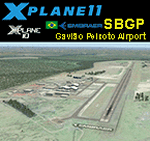
This is an X-Plane 11 and X-Plane 10 scenery package for Embraer Unidade Gavião Peixoto Airport (ICAO: SBGP, no IATA code) is a private airport located in a rural area near Gavião Peixoto and Araraquara, in Brazil. It is owned and operated by Embraer and used as for testing civil and military aircraft. Additionally, this scenery also includes a grass airstrip (SJAW Fazenda Citrica Airfield), a rural citrical farm facility for agricultural aviation. You can try landing there with your favorite prop aircraft. It's located around 1nm or 2nm northeast of SBGP airport. It includes corrected aprons, ramps, gates, taxiways, lighting system, Araraquara city buildings, ortho-photoscenery for the airfield area, and (XP11 only) airport ground services (like push back). This scenery was tested and is operational (as of March 18, 2017) in "X-Plane 11 Public Beta #15 64 bit", Windows 10 Home. It was also tested and is also operational (as of March 18, 2017) in "X-Plane 10.51 64 bit", Windows 10 Home. Only the default X-Plane 11 libraries, by Laminar Research, are needed. No third party libraries are used.
| Filename: | BR_SP_SBGP__Gaviao_Peixoto_Embraer_Airport_v100.zip |
| License: | Freeware |
| Added: | 19th March 2017, 08:13:27 |
| Downloads: | 95 |
| Author: | Rui Mesquita |
| Size: | 21.63 MB |
| Category: Flight Simulator 2002 - AFCAD Files | |
| Denver International Airport KDEN with WestWind Terminal Overlay |
|
File Description:
This is a 4 part (base and 3 overlays) FS2002 facility file for KDEN. This file can be used with the WestWind Training Center scenery file available from http://www.flywestwind.com/Scenery/denverterm.htm. The base file is named KDEN1BB.txt, is for non-express/non-regional commercial aircraft,
not of the WestWind livery, uses runways 35L for departures and 35R for arrivals, and has 8 heavy gates, 14 medium gates, and 20 small gates. The first overlay is named KDEN2BB.txt, is for express/regional commercial aircraft, not of the WestWind livery, uses runway 26 for departures and arrivals, and has 19 small gates. The second overlay is named KDEN3BB.txt, is for general aviation aircraft, uses runway 7 for departures and arrivals, and has 7 parking spaces. The third overlay is named KDEN4BB.txt, is for all commercial aircraft of the WestWind livery only, uses runway 16 for departures and arrivals, and has 1 heavy gate and 13 small gates. You do not have to utilize the WestWind overlay if you do not want to, it will not affact the scenery and the remainder of the airport will work fine if you simply ignore it.
| Filename: | Denver_International_Airport_KDEN_with_WestWind_Te.zip |
| License: | Freeware |
| Added: | 18th November 2002, 00:15:30 |
| Downloads: | 458 |
| Author: | Boyd Barker |
| Size: | 78.13 KB |
| Category: Flight Simulator 2004 - Scenery | |
| Hana Heli-Playground v1.0 |
|
Images related to this file:
File Description:
Hana Airport is a regional airport of the State of Hawaii on the east shore of the island of Maui, 3 NM northwest of the unincorporated town of Hana. The airport covers 119 acres and has one runway. It is primarily a commuter facility used by unscheduled air taxis and general aviation. This scenery is intended as a single/multiplayer helicopter obstacle course where heli pilots can meet to compete, show off, and share their helo skills. Since birdseye (Timm Turner) already did a neat scenery called Hana_Scenery_PHHN (search for "hana" in the HoverControl Downloads), we decided to convert PHHN to a full helicopter training area. Makes a great place for helo pilots to gather to practice and perfect their skills, and challenge other pilots! And keep an eye-out for that Hot Air Balloon, cruising around an altitude of 3000 feet (don't forget to wave at them!).
Another unique thing about this scenery is the neighboring islands (Honolulu Intl/Hickam AFB, Bellows AFB, Lanai City, Kahului, Molokai, etc). If you get frustrated during your heli obstacle course training, just take a heading of 275°, and relax at one of the neighboring islands.
| Filename: | Hana_HeliPlayground_v10.zip |
| License: | Freeware |
| Added: | 9th May 2010, 11:29:39 |
| Downloads: | 524 |
| Author: | Bob Ferguson |
| Size: | 27.79 MB |
| Category: Flight Simulator X - Scenery | |
| RAF Molesworth |
|
File Description:
At the start of World War II the Air Ministry selected the area as the site for what would become RAF Molesworth. The base was built in 1940 and 1941. The first unit, Royal Australian Air Force 460 Squadron was formed at the base on November 15, 1941 with Vickers Wellington IVs. 460 Squadron departed the field on January 4, 1942. RAF Bomber Command 159 squadron moved in shortly afterwards, however this unit did not remain long, moving to the Middle East on January 12.
Molesworth was one of the early Eighth Air Force stations assigned to the United States Army Air Force (USAAF). In February 1942, General Ira Eaker and four US staff members inspected Molesworth for possible American use, and during 1942 the facility was improved to Class A airfield standard, with all of its runways extended to American specifications for heavy 4-engined bombers. The main runway was lengthened to 2,000 yards and the number of hardstands increased to fifty. It was given USAAF designation as Station 107.
From 16 September 1943 – 18 June 1945, Molesworth served as headquarters for the 41st Combat Bombardment Wing of the 1st Bomb Division.
| Filename: | RAF_Molesworth.zip |
| License: | Freeware |
| Added: | 17th January 2009, 14:00:45 |
| Downloads: | 552 |
| Author: | Scott Berge |
| Size: | 22.77 KB |
| Category: Civil Flight Simulators - Looking Glass Flight Unlimited 3 | |
| Outer Terrain GTL Grid Structure Map v2.0 |
|
Images related to this file:
File Description:
This version of my GTL grid structure map includes Andre's new outer terrain area north of Seattle and adds a search facility, which enables you to search for a tile using FU3 world co-ordinates. To find out the world co-ordinates of any OT area simply open Fled, set the top-down view to the latitude/longitude of the area you're interested in and click the latitude/longitude figures that appear in the bottom left hand corner of the screen. The latitude/longitude figures will disappear and be replaced by FU3 world co-ordinates as easting and northing values. Enter these values into my FU3 GTL Map, click the button and the spreadsheet will map these co-ordinates to the correct tile and return the tile name. If you don't know the latitude/longitude of the area you're interested in then you can always obtain this from within the game itself. Just start a flight in the area you're interested in and press Ctrl-z at any time to enter Zoar mode. This will pause the game and display the current latitude/longitude in the top left hand corner of the screen.
| Filename: | Outer_Terrain_GTL_Grid_Structure_Map_v20.zip |
| License: | Freeware |
| Added: | 29th December 2009, 23:16:52 |
| Downloads: | 35 |
| Author: | Jonathan Stonehouse |
| Size: | 198.97 KB |
| Category: Flight Simulator 2004 - Scenery | |
| Goodspeed Airport (42B) - East Haddam, Connecticut |
|
Images related to this file:
File Description:

Goodspeed is a privately owned airfield in East Haddam, Connecticut that operates as a public access general aviation facility. The runway is a short 2120 feet and is carefully placed in a shoreline meadow of the Connecticut river. Surrounded by the dense forests and community, the airport is a tight approach, further hampered by the presence of the East Haddam Bridge, which sits under the runway 14 approach. The airport has limited parking facilities for transient aircraft, and it is not common for visiting aircraft to park in the grass in front of the "terminal". Hanger facilities are provided as well. Nearby is the famous Goodspeed Opera House, established back in the 19th century, the house still has operas other performances regularly.
Features:
-High Resolution Ground textures around airport;
-Accurate models of all airport buildings;
-Detailed taxiways and runways;
-Super HD grass and pavement;
-Custom aerial imagery for area, including autogen;
-Full seasonal textures (Spring, Summer, Fall, Winter);
-Various "Easter Eggs";
-Deer (at dusk);
-Christmas Lights (During the Holiday Season);
-Night Textures;
-Runway Lights, obstruction lights;
-And much more!
Created by Dustin Mosher www.dmosher.info
| Filename: | Goodspeed_Airport_42B__East_Haddam_Connecticut.zip |
| License: | Freeware, limited distribution |
| Added: | 4th March 2010, 13:34:02 |
| Downloads: | 685 |
| Author: | Dustin Mosher |
| Size: | 62.8 MB |
© 2001-2026 AVSIM Online
All Rights Reserved
Privacy Policy |