
Where Flight Simulation Enthusiasts Gather from Around the World!
AVSIM Library - Search Results

| Category: Flight Simulator 2004 - Scenery | |
| Yuba Co-Oroville Muni |

|
File Description:
FS2004 Scenery - Yuba County Airport (IATA: MYV, ICAO: KMYV) is a public airport located three miles (4.8 km) southeast of Marysville, serving Yuba County, California, USA. The airport has two runways and is mostly used for general aviation. Oroville Municipal Airport (IATA: OVE, ICAO: KOVE) is a public airport located 3 miles (5 km) southwest of the city of Oroville in Butte County, California, USA. Oroville Municipal Airport covers 920 acres and has two runways. This airport is about 23nm NW of Yuba Co. An 18 hole golf course is located right next to the facility for you "Fly-in Golfers". EZ Scenry libraries require, some are included. By John B. Loney, Jr. and Robert Lacy.
| Filename: | Yuba_CoOroville_Muni.zip |
| License: | Freeware, limited distribution |
| Added: | 28th August 2007, 03:37:55 |
| Downloads: | 734 |
| Author: | John B. Loney, Jr. and Robert Lacy |
| Size: | 2.61 MB |
| Category: Flight Simulator 2004 - Scenery | |
| Lima/Allen County (OH) Regional Airport (KAOH) |
|
File Description:
Built in 1963, it replaced KLIA which was located Northwest of Lima near the village of Elida. It features ILS approach capability, a full-service repair facility, and two runways. 10/28 is 6,000' x 150' asphalt, while 14/32 is a combination asphalt & sod (I couldn't duplicate this with ADE9X, so it's paved as well). I was able to include a rotating beacon in this package (and might offer as an upgrade to previous sceneries). The buildings aren't a true match, but far better than the default mess. Also, rwy 10/28 has been brought up to date; I've lengthened it to 6,000 ft and re-numbered it from the "09/27" found in Fs9.
| Filename: | LimaAllen_County_OH_Regional_Airport_KAOH.zip |
| License: | Freeware |
| Added: | 20th February 2011, 20:45:44 |
| Downloads: | 203 |
| Author: | Stephen Plumb |
| Size: | 947.41 KB |
| Category: Flight Simulator 2004 - Scenery | |
| 42VA - Virginia Beach Airport & Museum (v1.1) |
|
Images related to this file:
File Description:

42VA - Virginia Beach Airport & Museum V1.1, located in Virginia Beach, VA USA.
This facility is a private airport used by the Fighter Factory to maintain, display and fly vintage and replica aircraft, mainly from the World War 2 era. The art deco building, grass landing strip, checkered water tower and hangars are home to one of the world's largest private collection of vintage aircraft.
Most objects using custom photo-real 32bit textures designed in GMAX. Optional DXT3 textures included. Also includes new AFCAD file, more accurate airport grounds perimeter, area roads, animated hangar doors, and area landclass. No AI traffic included with this release, but AI functionality designed into AFCAD. By EdGeneer Cox.
| Filename: | 42VA__Virginia_Beach_Airport__Museum_v11.zip |
| License: | Freeware, limited distribution |
| Added: | 5th February 2010, 16:39:44 |
| Downloads: | 1,599 |
| Author: | Ed Geneer Cox |
| Size: | 30.59 MB |
| Category: Flight Simulator 2004 - Scenery | |
| Cabo Rojo (MDCR), Dominican Republic |
|
File Description:
This file is intended to COMPLETELY replace the older versions of scenery designed for Cabo Rojo (cabo_rojo.zip). This file, written in xml language and compiled using the new FS2004 SDK's should be compatible with all near-future versions of MSFS (or at least thats what they promise - LOL).
Once installed, you will see Cabo Rojo Airport, along with its paved runway and all the airport buildings.
In addition you will find a little "surprise experiment", located to the east of the airport, the Dominican R/C Airfield, a small radio-control aircraft facility. This "airport" will show up on your GPS, but is intended only for the RC AI Traffic files that are included in this download.
| Filename: | Cabo_Rojo_MDCR_Dominican_Republic.zip |
| License: | Freeware, limited distribution |
| Added: | 3rd March 2005, 17:01:33 |
| Downloads: | 2,118 |
| Author: | Todd Lucas |
| Size: | 5.75 MB |
| Category: Flight Simulator X - Scenery | |
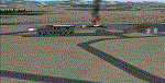
| Greater Kankakee KIKK |
|
Images related to this file:
File Description:
FSX Scenery - Greater Kankakee Airport (IATA: IKK, ICAO: KIKK, FAA LID: IKK) is a public airport located three miles (5 km) south of the central business district of Kankakee, in Kankakee County, Illinois, United States. The airport was opened in 1962 and continues to operate as a general aviation facility serving the Kankakee area and South Chicago. It is 60 miles (97 km) south of Chicago and 75 miles (121 km) north of Champaign, Illinois. It is the largest Airport between the Chicago Midway Airport and the Champaign Airport. Greater Kankakee is a general aviation airport, consisting of mostly private aircraft with a mix of corporate and business aircraft usage. Created by John B Loney Jr.
| Filename: | Greater_Kankakee_KIKK.zip |
| License: | Freeware, limited distribution |
| Added: | 20th March 2012, 01:36:22 |
| Downloads: | 646 |
| Author: | John B. Loney, Jr. |
| Size: | 4.09 MB |
| Category: Flight Simulator X - Scenery | |
| Helena Regional Airport (KHLN) |
|
Images related to this file:
File Description:
Welcome to Helena Regional Airport for FSX! All the structures are custom. Airport vehicles use
the proper vehicle paths and do not use taxiways. The Rocky Mountain Emergency Services fire training
facility is depicted and there is a training session in progress. Be sure to visit Mustard Mickey's
before your travels take you through the scenic Montana wilderness. Stop by Vetter Aviation and thank
Brent for his over two decades of service to the aviation industry.
As with all my work the structures are original work. Some are accurate, some are workups based on what
I think they might look like.
Three scenery complexity levels are used (normal,dense, and very dense). More eye candy appears with each
increase.
| Filename: | Helena_Regional_Airport_KHLN.zip |
| License: | Freeware, limited distribution |
| Added: | 6th December 2019, 17:13:13 |
| Downloads: | 402 |
| Author: | Brett Delana |
| Size: | 6.29 MB |
| Category: Flight Simulator X - Scenery | |
| KUTS - Huntsville Airport - Texas, USA |
|
Images related to this file:
File Description:
FSX Scenery - Bruce Brothers Huntsville Regional Airport, also known as Huntsville Municipal Airport, (IATA: HTV, ICAO: KUTS, FAA LID: UTS), is a city owned, public use airport located two nautical miles (4 km) northwest of the central business district of Huntsville, a city in Walker County, Texas, United States. It is included in the National Plan of Integrated Airport Systems for 2011-2015, which categorized it as a general aviation facility. Although most U.S. airports use the same three-letter location identifier for the Federal Aviation Administration (FAA) and International Air Transport Association (IATA), this airport is assigned UTS by the FAA and HTV by the IATA. For your flying pleasure by John B. Loney, Jr.
| Filename: | KUTS__Huntsville_Airport__Texas_USA.zip |
| License: | Freeware, limited distribution |
| Added: | 7th September 2015, 22:30:00 |
| Downloads: | 459 |
| Author: | John B. Loney, Jr. |
| Size: | 8.64 MB |
| Category: Flight Simulator X - Scenery | |
| Yuba Co-Oroville Muni |
|
File Description:
FSX Scenery - Yuba County Airport (IATA: MYV, ICAO: KMYV) is a public airport located three miles (4.8 km) southeast of Marysville, serving Yuba County, California, USA. The airport has two runways and is mostly used for general aviation. Oroville Municipal Airport (IATA: OVE, ICAO: KOVE) is a public airport located 3 miles (5 km) southwest of the city of Oroville in Butte County, California, USA. Oroville Municipal Airport covers 920 acres and has two runways. This airport is about 23nm NW of Yuba Co. An 18 hole golf course is located right next to the facility for you "Fly-in Golfers". EZ Scenry libraries require, some are included. By John B. Loney, Jr. and Robert Lacy.
| Filename: | Yuba_CoOroville_Muni.zip |
| License: | Freeware, limited distribution |
| Added: | 11th May 2010, 21:36:46 |
| Downloads: | 1,304 |
| Author: | John B. Loney, Jr. |
| Size: | 9.77 MB |
| Category: Flight Simulator X - Aircraft Repaints, Textures and Modifications | |
| De Havilland Canada DHC-6 Twin Otter CIRPAS #236 |
|
Images related to this file:
File Description:

This folder contains a repaint for the Aerosoft Twin Otter Extended, in the colors of 762256 (c/n 496). Formerly N83NX, this aircraft is registered with the US Navy, but flying for the Center for Interdiciplinary Remotely-Piloted Aircraft Studies (CIRPAS), a research center at the Naval Postgraduate School in Monterey, California. The CIRPAS Twin Otter is an instrumented twin-engine turboprop aircraft. It supports individual scientists as well as teams of scientists from various Universities and Laboratories who are interested in lower-tropospheric phenomena and air/sea interaction. Payload may be selected from a large suite of state of the art meteorological, aerosol, and cloud particle sensors, while additional equipment collaborating scientists may wish to include can be integrated as well. Twin Otter mission have been sponsored by ONR, NSF, DOE, NOAA, NASA, CARB, and NRL.
Instruments may be installed in racks inside the cabin where a well characterized community inlet delivers ambient air samples, or in pods either suspended by wing-mounted pylons or mounted on a hard point on the cabin roof. Optical ports and windows are on the airplane’s belly and in the cabin roof.
CIRPAS staff calibrates and maintains the facility payload and provides fully reduced, synchronized, and coherent data sets to the collaborating scientists.
The Twin Otter is based at the CIRPAS Marina Facility, but has been deployed to various locations in North, South, and Central America and Asia. Repaint by Jan Kees Blom, based on the paintkit by Aerosoft.
| Filename: | De_Havilland_Canada_DHC6_Twin_Otter_CIRPAS_236.zip |
| License: | Freeware |
| Added: | 14th July 2018, 16:51:20 |
| Downloads: | 218 |
| Author: | Jan Kees Blom |
| Size: | 16.23 MB |
| Category: Flight Simulator 2004 - AI Flight Plans | |
| Simmons Army Airfield Complete AI Package |
|
File Description:
Military AI Works is proud to bring you the Simmons Army Airfield Complete AI Package for FS2004. Simmons AAF is located in southern North Carolina adjacent to the Home of the Airborne and Special Operations Forces, Fort Bragg. Simmons AAF is the main aviation support facility for Fort Bragg and supports the various units stationed there. This package depicts several of those aviation units that operate various types of rotary and fixed wing aircraft out of Simmons AAF. This package is also the first to feature Nick Black's BRAND NEW CH-47D AI model. Credits: Models by Nick Black, Dee Waldron and Henry Tomkiewicz, Repaints by Graham King, FDE/Effects by Mike MacIntyre and Mike Guenthner, Flightplans, AFCADs and Callsigns by Desmond Burrell
| Filename: | Simmons_Army_Airfield_Complete_AI_Package.zip |
| License: | Freeware, limited distribution |
| Added: | 10th January 2009, 05:10:05 |
| Downloads: | 4,266 |
| Author: | Desmond Burrell, Military AI Works (MAIW) |
| Size: | 10.76 MB |
© 2001-2026 AVSIM Online
All Rights Reserved
Privacy Policy |