
Where Flight Simulation Enthusiasts Gather from Around the World!
AVSIM Library - Search Results

| Category: Flight Simulator 2004 - Scenery | |
| Van Nuys Airport |

|
File Description:
FS2004 Scenery -Van Nuys Airport, CA (KVNY) serves Van Nuys and Los Angeles County and is owned by Los Angeles Dept Of Arpts. The airport has more than one runway. The longest is a runway extending 8001 feet. The facility is at an elevation of 799 feet at a distance of about 3 miles from Van Nuys. More than 100 businesses are located on the 730-acre airport, including six major fixed-base operators and numerous aviation service companies. Created with EZ Scenery. Choice of full version or Lite version. PLEASE READ THE README FILE FOR DETAILS! By John B. Loney, Jr.
| Filename: | Van_Nuys_Airport.zip |
| License: | Freeware, limited distribution |
| Added: | 1st July 2007, 20:50:44 |
| Downloads: | 3,079 |
| Author: | John B. Loney, Jr. |
| Size: | 1.06 MB |
| Category: Flight Simulator 2004 - Scenery | |
| Joplin Regional Airport |
|
Images related to this file:
File Description:
FS9 Scenery - Joplin Regional Airport (IATA: JLN, ICAO: KJLN) is a public airport located four miles (6 km) north of the central business district (CBD) of Joplin, a city in Jasper County, Missouri, USA. The airport covers 970 acres (393 ha) and has three runways. It offers commercial airline service subsidized by the Essential Air Service program. Joplin Regional Airport is owned by the City Of Joplin. The longest runway is a paved runway extending 6503 feet. The facility is at an elevation of 981 feet. This scenery was created using Instant Scenery by John B. Loney, Jr.
| Filename: | Joplin_Regional_Airport.zip |
| License: | Freeware, limited distribution |
| Added: | 30th December 2009, 21:53:28 |
| Downloads: | 619 |
| Author: | John B. Loney, Jr. |
| Size: | 1019.39 KB |
| Category: Flight Simulator 2004 - Scenery | |
| Athens Ben Epps Airport |
|
File Description:
FS2004 Scenery-Athens-Ben Epps Airport (KAHN) serves Athens and Clarke County and is owned by Clarke County. The airport has more than one runway. The longest is a paved runway extending 5522 feet. The facility is at an elevation of 808 feet at a distance of about 3 miles from Athens. The airport is named for Georgia's first aviator, Ben T. Epps Sr., who began building and flying airplanes in Athens in 1907 and opened Ben Epps Airport in 1917. Scenery created using FSDS2, Rwy12, Lago's FSE, with AFCAD2 and Traffic Tools. FSDS2 textures included with download. By John B. Loney, Jr.
| Filename: | Athens_Ben_Epps_Airport.zip |
| License: | Freeware |
| Added: | 4th December 2005, 03:37:31 |
| Downloads: | 1,658 |
| Author: | John B. Loney, Jr. |
| Size: | 796.36 KB |
| Category: Flight Simulator X - AI Flight Plans | |
| Emirates Flight Training Academy Summer 2018 FP |
|
Images related to this file:
File Description:

Emirates Flight Training Academy Summer 2018 FP - Emirates Flight Training Academy is a pilot-training school based in United Arab Emirates. Founded in 2017, it is a subsidiary of multinational aviation corporation, The Emirates Group *** Airline : Emirates Flight Training Academy - Country : United Arab Emirates - Callsign : EMIRATES - ICAO : UAE (EFTA used for parkings in AFCAD/ADE file) *** Source : absolutely no data available; sole pictures are those of delivery flights; then FP are purely fictional, around some UAE airports *** Note : EFTA facility is located in the southern area of OMDW; they have their own runway and apron (see readme)
repaints see readme
| Filename: | Emirates_Flight_Training_Academy_Summer_2018_FP.zip |
| License: | Freeware |
| Added: | 2nd November 2018, 23:36:33 |
| Downloads: | 284 |
| Author: | Christian Muenier |
| Size: | 372.28 KB |
| Category: Flight Simulator X - Scenery | |
| KCVO / OR52 - Corvallis-Venell Airports |
|
Images related to this file:
File Description:
FSX Scenery - Corvallis Municipal Airport (IATA: CVO, ICAO: KCVO, FAA LID: CVO) is a city owned, public use airport located four nautical miles (5 mi, 7 km) southwest of the central business district of Corvallis, a city in Benton County, Oregon, United States. It is included in the National Plan of Integrated Airport Systems for 2011-2015, which categorized it as a general aviation facility. Venell Airport (FAA LID: OR52) is a private airport located at the southern end of Corvallis Municipal Airport in Benton County, Oregon, USA. For your flying pleasure by John B. Loney, Jr.
| Filename: | KCVO__OR52__CorvallisVenell_Airports.zip |
| License: | Freeware, limited distribution |
| Added: | 30th August 2015, 17:49:24 |
| Downloads: | 769 |
| Author: | John B. Loney, Jr. |
| Size: | 22.99 MB |
| Category: Flight Simulator X - Scenery | |
| Lismore Regional Airport |
|
File Description:
LIsmore Regional Airport for FSX (YLIS)
This is an updated version of the original FS9 scenery. Lismore airport, situated in northern NSW close to Byron Bay and Ballina, operates 52 weekly flights on Rex airlines to Sydney and has a large maintenance facility and a number of GA hangers. The terminalis modernistic in design and has a display of Aboriginal artwork.
This scenery includes land class and water class and a photobackground blended to the normal textures. All buildings are modelled with photo textures taken at the airport and accurate to real life measurement and placement.
John Ross
| Filename: | Lismore_Regional_Airport.zip |
| License: | Freeware, limited distribution |
| Added: | 2nd November 2007, 13:47:10 |
| Downloads: | 1,745 |
| Author: | John Ross |
| Size: | 5.59 MB |
| Category: Flight Simulator 2004 - Scenery | |
| Studio F Simulations/MAIW Charleston AFB/Int'l Airport v1.1 |
|
Images related to this file:
File Description:

This project was developed to enhance and personalize the existing freeware scenery for MAIW Charleston AFB/KCHS . This package is a complete install. Nothing else is needed for the scenery to work.
Enhancements include:
A brand new, built from scratch, representation of the main passenger terminal and custom enhancements to the Boeing Dreamliner factory also located inside the facility. It comes completely integrated with the existing MAIW scenery which includes the military side of the airport. Also available are two sets of AI flight plans which bring the Air Force Base and the Dreamliner factory to life.
| Filename: | Studio_F_SimulationsMAIW_Charleston_AFBIntl_Airpor.zip |
| License: | Freeware |
| Added: | 17th July 2020, 18:12:30 |
| Downloads: | 1,152 |
| Author: | Studio F Simulations/MAIW |
| Size: | 98.16 MB |
| Category: Flight Simulator 2004 - Scenery | |
| Kindley Field Bermuda 1955-1962 |
|
File Description:
Kindley Field, on the British Overseas Territory of Bermuda, was built as a joint RAF/USAAF facility during the Second World War. Subsequently the RAF area became the civilian terminal while Kindley Air Force Base was operated by the USAF between 1948 and 1970. It was primarily a staging post between the US and Western Europe for land-based planes unable to cross the Atlantic non-stop, very like Ernest Harmon in Newfoundland and the civilian Gander, and like Harmon it closed when the jet age made such bases redundant. Prior to that it hosted no combat units, but the 59th and then 53rd Weather Reconnaissance Squadrons, the 'Hurricane Hunters', were based there, and also from 1 February 1956 to 15 June 1963 the 303rd ARS Stratotankers were present to support Strategic Air Command and other refueling requirements. After 1970 it became a US Navy facility primarily concerned with tracking Soviet submarines, and was closed at the end of the Cold War. This scenery represents Kindley between 1955 and 1962 and has custom made scenery by Dan French and ai military traffic by Al Von Pingel to add to the downloadable California Classic civilian and MATS traffic available at Tom Gibson's site. Like Harmon and Gander, it was one of the most important airfields of its time.
| Filename: | Kindley_Field_Bermuda_19551962.zip |
| License: | Freeware |
| Added: | 3rd December 2022, 13:10:38 |
| Downloads: | 153 |
| Author: | Ken Lawson, Al Von Pingel, Dan French |
| Size: | 30.31 MB |
| Category: Flight Simulator X - Missions | |
| S.F.Bay Tour |
|
Images related to this file:
File Description:
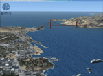
This mission is a sightseeing tour that covers the San Francisco Bay Area. For the best experience, fly the mission with the cockpit in the "mini-mode" (From the default virtual cockpit hit F10, then hit "W" three times). It's not necessary to fly directly into the waypoint markers, they are only for reference. Follow the mission waypoint markers and compass headings and enjoy the flight. To install the program, unzip the files to a directory of your choice and double click the S.F. Bay Tour installer icon. Mission editing done with the fantastic FS Add-On Mission Editor.
| Filename: | SFBay_Tour.zip |
| License: | Freeware |
| Added: | 23rd May 2010, 02:01:04 |
| Downloads: | 1,129 |
| Author: | Wes Jones |
| Size: | 12.38 MB |
| Category: Flight Simulator X - AFCAD Files | |
| LGKR Corfu Airport, Greece |
|
File Description:
This re-design was made using ADE (Airport Design Editor). As this is my first attempt to re-design an airport I need to thank scruffyduck and other simmers who helped me get over a few problems. I have enlarged the parking apron and the terminal building and corrected the parking allocations. Although this re-design is not totally accurate I have got as close as I can using Google Earth and a Jeppessen chart and my local knowledge. LGKR has no ILS system but I have added one for simmers who prefer to use it.
| Filename: | LGKR_Corfu_Airport_Greece.zip |
| License: | Freeware |
| Added: | 1st January 2013, 14:19:44 |
| Downloads: | 682 |
| Author: | Mike Major |
| Size: | 5.83 KB |


© 2001-2026 AVSIM Online
All Rights Reserved
Privacy Policy |