
Where Flight Simulation Enthusiasts Gather from Around the World!
AVSIM Library - Search Results

| Category: Flight Simulator 2004 - AFCAD Files | |
| Tallahassee Regl (KTLH) |

|
File Description:
KTLH with gates, cargo and GA parking - rw 9/27 set as main and has ILS added for 9. No attempt to render a realistic facility was made and heavy taxiway modification has been done along with other changes such as a added VOR/DME at the field. This file is intended to enhance AI traffic and should bring this airport up to a semi-realistic state in that respect.
| Filename: | Tallahassee_Regl_KTLH.zip |
| License: | Freeware |
| Added: | 3rd April 2004, 23:22:56 |
| Downloads: | 1,115 |
| Author: | Don Janusz |
| Size: | 6.44 KB |
| Category: Flight Simulator 2004 - Scenery | |
| South Point Hawaii |
|
File Description:
Morse Field AFS was an AAF Base located on the southernmost tip of the Big Island of Hawaii during WW2, serving as a refueling stop for aircraft being ferried from the U.S. mainland to the south pacific. Operational until 1947, this historically interesting facility serves as a great stopover on those long transpac flights in your heavy piston equipment. Well researched, much custom scenery throughout, although frame-rate friendly.
| Filename: | South_Point_Hawaii.zip |
| License: | Freeware |
| Added: | 14th September 2005, 14:22:34 |
| Downloads: | 2,280 |
| Author: | Juliana Lo |
| Size: | 1.41 MB |
| Category: Flight Simulator 2004 - Scenery Design | |
| Ship Collection, a Rwy12 Object Placer Library |
|
Images related to this file:
File Description:
For users of Rwy12 Object Placer only. This collection of 50 ships
represents port facility vessels, tankers, container ships and other
commercially used ships. All ships have been done in Gmax and with
low polygon count, so they have only a small affect on framerate. You
can place them anywhere on the water surfaces of your sceneries.
By Winfried Orthmann. Converted to Rwy12 format by Seev Kahn - Rwy12 team.
| Filename: | Ship_Collection_a_Rwy12_Object_Placer_Library.zip |
| License: | Freeware |
| Added: | 27th January 2005, 01:50:32 |
| Downloads: | 9,280 |
| Author: | Winfried Orthmann, Team Rwy12 |
| Size: | 1.42 MB |
| Category: Flight Simulator 2004 - Scenery | |
| University-Oxford Airport |
|
File Description:
FS2004 Scenery-University-Oxford Airport (KUOX) serves Oxford and Lafayette County and is owned by University Of Mississippi. The paved runway extends for 4700 feet. The facility is at an elevation of 451 feet at a distance of about 2 miles from Oxford. Created with FSDS3, EZ Scenery, Rwy12 and Lago's FSE. Modified AFCAD2 file and Traffic Tools employed. Choice of two scenery variants. Read readme for details.
| Filename: | UniversityOxford_Airport.zip |
| License: | Freeware |
| Added: | 15th January 2006, 00:58:35 |
| Downloads: | 783 |
| Author: | John B. Loney, Jr. |
| Size: | 765 KB |
| Category: Flight Simulator X - Scenery | |
| YDWU Dalwallinu, Western Australia - Nugadong Airport |
|
File Description:
YDWU Dalwallinu - Nugadong Airport. This represents the newly updated airfield.
"10-03-2011 - March update for Nugadong Airport RedevelopmentWe are pleased to announce that the project to redevelop the Nugadong Airport is progressing well. Originally there were three areas that required upgrade; Airstrip Reseal, Installation of Animal Proof Fencing, and the construction of a Patient Transfer Facility. However, after successful negotiations with funding bodies we were abile to restructure the project to include the installation of a Taxiway & Apron. We are also pleased to announce that the project is on track to achieve it's May deadline. This is an exciting upgrade to existing community infrastructure and please feel free to visit the facility to have a look at the changes for yourself. Further updates on this, and other projects, will be released in the coming weeks and on completion." www.dalwallinu.wa.gov.au/news/PROJECT%20UPDATE.
REQUIRES blencowe_librarykit_309494.zip (Available HERE)
| Filename: | YDWU_Dalwallinu_Western_Australia__Nugadong_Airpor.zip |
| License: | Freeware |
| Added: | 25th February 2013, 23:47:28 |
| Downloads: | 251 |
| Author: | Alan Blencowe |
| Size: | 2.33 MB |
| Category: Navigation and ATC - Navigation | |
| Los Angeles ARTCC charts from AIRAC 0505 - Volume 3 of 5 |
|
File Description:
This collection of US Terminal Procedures has been assembled to provide a complete set of charts for flight simulation use within the Los Angeles ARTCC region, on behalf of VATSIM's Los Angeles ARTCC (ZLA), whose website can be found at http://www.laartcc.org
**THIS IS VOLUME 3 OF 5** Charts are in Adobe PDF format.
Volume 3 = ZLA_AIRAC0505_CA_OUTLYING.ZIP
Features procedure charts for all appropriate California airports outside the combined Southern California Terminal Radar Approach Control facility "SoCAL", but under the limited ATC responsibility of the Los Angeles Center facility, and includes amongst others:
KSBA - Santa Barbara Airport (Class C)
KPSP - Palm Springs Airport (TRSA)
KBFL - Bakersfield Meadows Field (Class D)
KCMA - Camarillo Airport (Class D)
KOXR - Oxnard Airport (Class D)
KSMX - Santa Maria Public / Hancock Field (Class D)
KSBP - San Luis County Regional (Class D)
KMHV - Mohave Airport (Class D)
KVCV - Victorville Airport (Class D)
KTRM - Jacqueline Cochran Regional Airport
L35 - Big Bear Airport
16 other California outlying fields in LA Center airspace.
| Filename: | Los_Angeles_ARTCC_charts_from_AIRAC_0505____Volume.zip |
| License: | Freeware |
| Added: | 15th May 2005, 18:05:53 |
| Downloads: | 498 |
| Author: | Mark Coldwell |
| Size: | 27.18 MB |
| Category: Flight Simulator 2004 - Scenery | |
| Beaver Creek CYXQ 1.1 |
|
Images related to this file:
File Description:
Version 1.1 adds the missing door on the ground side of the terminal building. It is complete and does not require that you already have the previous version.
Beaver Creek CYXQ is a small airport in the northern Canada Yukon Territory, near the Alaskan border. There is a customs facility located on the Alaska Highway adjacent to the airport. There is an NDB located on the field, but no published instrument approaches. The single gravel runway is 3740'long.
This scenery was completely redone and features a custom photoreal terminal and custom runway/taxiway lights. The adjacent customs facility is included but is not based on the real one as I had no photos to work from. The custom runway lights are always on, even during the day...sorry, this is an FS9 limitation.
This scenery was designed for use with Ultimate Terrain and was not tested in the default scenery. It may or may not work in FSX.
| Filename: | Beaver_Creek_CYXQ_11.zip |
| License: | Freeware |
| Added: | 6th November 2010, 22:31:24 |
| Downloads: | 912 |
| Author: | Sidney Schwartz & Peter Ham |
| Size: | 447.05 KB |
| Category: Fly! II - Scenery | |
| Gettaway Island Beta V1 |
|
File Description:
Need a Holiday (Vacation)? This is for you. Though its my Beta test, I thought of you all and wanted to share. Its a basic Island made with 3ds Max and Photoshop. Included is one log cabin for you to stay in. One grass landing strip for your plane, 737s,757s,777s not recomended, lol. Add the Island with Terramodels or the Fly2 Built in scenery editor.
| Filename: | Gettaway_Island_Beta_V1.zip |
| License: | Freeware |
| Added: | 27th November 2004, 17:16:28 |
| Downloads: | 66 |
| Author: | Steve Brown, F2FDesign |
| Size: | 321.81 KB |
| Category: Flight Simulator X - Scenery | |
| LFQB -Troyes Barberey |
|
Images related to this file:
File Description:
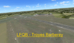
Scenery LFQB Troyes Barberey V1.0 for FSX
Tested with SP2 Acceleration + UTX Europe.
V1.0: Initial version
This file modifies the airfield Troyes Barberey in FSX. It was made with ADE (Airport Design Editor), SbuilderX and Whisplacer.
Thank you to the respective authors and Patrick Renaudin for its objects.
Troyes is a French commune, located in the Aube ( which it is the prefecture) in the Champagne-Ardenne region.
| Filename: | LFQB_Troyes_Barberey.zip |
| License: | Freeware |
| Added: | 31st July 2010, 22:38:31 |
| Downloads: | 1,923 |
| Author: | Stephane Gouzon |
| Size: | 19.32 MB |
| Category: Flight Simulator X - AFCAD Files | |
| W81 - Crewe Municipal Airport |
|
File Description:
W81 - Crewe Municipal Airport is located in Crewe, VA
Added aprons, aircraft parking and buildings. Deleted buildings that were in vicinity of runway.
Created with Airport Design Editor by ScruffyDuck Software using current FAA documentation and Google Earth measurements, this package offers a replacement for FSX's stock airport. All these enhancements are as close to the real airport as I can get with stock library objects.
| Filename: | W81__Crewe_Municipal_Airport.zip |
| License: | Freeware |
| Added: | 13th November 2012, 18:54:02 |
| Downloads: | 130 |
| Author: | Wayne Roberts |
| Size: | 135 KB |
© 2001-2026 AVSIM Online
All Rights Reserved
Privacy Policy |