
Where Flight Simulation Enthusiasts Gather from Around the World!
AVSIM Library - Search Results

| Category: Flight Simulator X - Scenery | |
| VABB - Mumbai Chhatrapati Shivaji Intl Airport - Mumbai, India |

|
File Description:
This scenery covers almost the whole of Mumbai, adds tall apartments and buildings, the airport itself is loaded with objects: airport buildings, airport vehicles, new taxiways...etc. The airport is made using Google satellite images of 2013. Only for FSX, not tested in other FS systems.
| Filename: | VABB__Mumbai_Chhatrapati_Shivaji_Intl_Airport__Mum.zip |
| License: | Freeware |
| Added: | 2nd November 2014, 15:31:16 |
| Downloads: | 5,144 |
| Author: | Ladhani Ramesh |
| Size: | 7.57 MB |
| Category: Flight Simulator 2004 - AFCAD Files | |
| LIPZ - Venezia Tessera Intl. Airport "Marco Polo" - v2.0 |
|
Images related to this file:
File Description:
Afcad of LIPZ (Venice Tessera "Marco Polo") airport for FS9 default scenery.
In order to make the scenery as close as possible to the real airport the layout is based on the newest Jeppesen parking chart of LIPZ, on the Aeronautical Information Publication Italy and on photos of the real airport.
The previous version was v1.4; instead of naming this version v1.5, I named it v2.0 because the entire airport had been redesigned from the begining in order to achieve a new level of realism. When I decided to redesign the entire airport, the idea that I had in mind was to make it more like a full scenery as real as it gets using FS stock buildings and objects than only a plain afcad.
Main features that have been added since v1.4 (released on April 19th, 2007):
- since October 2009 a new tower is operative on LIPZ to better manage the ground traffic on the apron, I added it trying to make the environment look as close as possible to the real one;
- more than 95% of the buildings of the real world airport have their place in the scenery using FS stock buildings;
- static objects and vehicles have been added;
- pole lights and antenas have been added;
- parking gates and ramps have been adjusted;
- airline parking codes have been updated.
For more afcads made by me visit my website www.skycolors.com.
| Filename: | LIPZ__Venezia_Tessera_Intl_Airport_Marco_Polo__v20.zip |
| License: | Freeware |
| Added: | 6th March 2010, 23:05:28 |
| Downloads: | 1,042 |
| Author: | Claudio Adriano Dobre / SKYCOLORS.com |
| Size: | 206.9 KB |
| Category: Flight Simulator X - AFCAD Files | |
| Cross Keys Airport (17N), NJ |
|
File Description:
Located 01 miles S of Cross Keys, New Jersey on 280 acres of land, Cross Keys Airport is a small General Aviation field privately owned by Cross Keys Airport Inc. In addition to servicing GA flights, the airport also hosts a paintball field and a sky diving operation to the north of the field. For this reason, all aircraft must remain south of the runway at all times. Any aircraft with a wingspan larger than 40 feet will need to park in the turf area west of the main apron - smaller GA aircraft can pick a spot from any of the open tiedown areas. 100LL (Blue) Fuel is available by stopping next to the fuel tank on the main apron. Although it doesn't exist in real life, a patch of concrete to the west of the main apron made for a good helipad, so I included one. It is not lit at night. Trees in the surrounding forest are summer trees ONLY.
Scenery constructed with use of Google Maps images, and vague recollection by the author who went sky diving there once.
This scenery is meant to be used in conjunction with MegaScenery Earth New Jersey/Delaware 004. It is not required, but apron use is minimized to allow satellite scenery to show through as much as possible, and objects are placed based on the MSE textures - lack of it may make scenery look out of place.
| Filename: | Cross_Keys_Airport_17N_NJ.zip |
| License: | Freeware |
| Added: | 7th October 2010, 03:27:53 |
| Downloads: | 246 |
| Author: | Drew Sikora |
| Size: | 719.13 KB |
| Category: Flight Simulator X - AFCAD Files | |
| Newark Liberty International Airport (EWR), NJ (Beta) |
|
File Description:
Located 03 miles S of Newark, New Jersey on 2027 acres of land, Newark Liberty International Airport is a major regional hub. Currently, this airport is fully modeled to match MegaScenery Earth ground textures. It is functional to the point where I feel comfortable releasing it, however it is a far cry from "complete". As a primarily General Aviation pilot, I do not have much use for this airport, however I do fly over it from time to time and prefer to see it blend in with MSE textures properly. If you are a frequent user of KEWR and its facilities, please consult the Known Issues section of the ReadMe to decide whether you wish to install this version. It might be worth adding it as a layer you can turn on when you're not using the airport but will be flying in the area and want it to blend in properly. I do plan to further develop this airport if I end up using it more often in the future.
Scenery constructed with use of satellite images/streetview and personal reference.
This scenery is meant to be used in conjunction with MegaScenery Earth New York 005. It is not required, but apron use is minimized to allow satellite scenery to show through as much as possible, and objects are placed based on the MSE textures - lack of it may make scenery look out of place.
| Filename: | Newark_Liberty_International_Airport_EWR_NJ_Beta.zip |
| License: | Freeware |
| Added: | 28th November 2010, 02:05:25 |
| Downloads: | 2,957 |
| Author: | Drew Sikora |
| Size: | 3.34 MB |
| Category: Flight Simulator X - AFCAD Files | |
| Windward Farms Airport (4NJ0), NJ |
|
File Description:
Located 02 miles NW of Rosemont, New Jersey, Windward Farms Airport is a private turf strip. Like most small private turf strips this one can prove to be slightly challenging when it comes to taking off and landing - especially in a crosswind. The runway threads between two separate stands of trees to either side, and 1/4 of the Runway 11 left side is hedged by small trees and bushes. While the published dimensions for this strip are 3500x150 feet, in reality the usable runway space is really 3000x100 feet due to vegetation. This airport as rendered in FSX does not have an actual runway surface, so when you land you will be landing on actual terrain. There isn't a noticeable slope but it can be bumpy so use caution! Edge lighting is provided for the runway, although night landings/takeoffs are not recommended. There are no services provided by this airfield. After landing why not taxi over to the hangar and feed the sheep grazing in the pasture?
Scenery constructed with use of satellite images/streetview/aerial photos - the author has not been there in person.
This scenery is meant to be used in conjunction with MegaScenery Earth New York 007. It is not required, but apron use is minimized to allow satellite scenery to show through as much as possible, and objects are placed based on the MSE textures - lack of it may make scenery look out of place.
| Filename: | Windward_Farms_Airport_4NJ0_NJ.zip |
| License: | Freeware |
| Added: | 1st February 2011, 10:29:23 |
| Downloads: | 201 |
| Author: | Drew Sikora |
| Size: | 563.16 KB |
| Category: Flight Simulator X - AFCAD Files | |
| Stallone Airport (9NJ5), NJ |
|
File Description:
Located 01 miles SE of Harrisonville, New Jersey, Stallone Airport is a private turf strip 1350' in length. However it should be noted that the actual length from the road to the trees on the opposite end of the runway is actually only around 900'. It is tightly hemmed in by trees so if you are landing on Runway 29 you may want to use Slew to turn your plane around to remove the risk of bumping into a tree instead. If you land on Runway 11 you can cross the road to turn around in the field opposite the runway. The windsock can be seen from both runways. Power lines run along the heights of the trees as well for the Runway 29 approach, on the same side as the trees though so not really any additional worry there. No transient services are available. There is no hard surface runway so make sure your terrain mesh slider is set as high as possible for a suitably bumpy ground experience.
Scenery constructed with use of satellite images/streetview/aerial photos - the author has not been there in person.
This scenery is meant to be used in conjunction with MegaScenery Earth New Jersey/Delaware 004. It is not required, but apron use is minimized to allow satellite scenery to show through as much as possible, and objects are placed based on the MSE textures - lack of it may make scenery look out of place.
| Filename: | Stallone_Airport_9NJ5_NJ.zip |
| License: | Freeware |
| Added: | 5th April 2011, 07:34:54 |
| Downloads: | 170 |
| Author: | Drew Sikora |
| Size: | 332.91 KB |
| Category: Flight Simulator X - AFCAD Files | |
| Peaslees Airstrip Airport (NJ25), New Jersey |
|
File Description:
Located 01 miles SW of Clarksboro, New Jersey on 8 acres of land, Peaslees Airstrip is a private turf field 2207' in length. The hard surface runway has been removed to allow for landings on terrain, so have your terrain mesh set as high as possible. The surrounding area of rural farmland and houses has been filled in to provide an encompassing ground environment with as few breaks to the horizon as possible. There are no services at this airport - if you arrive there is room past the hangar to park and tie down although no tie downs are available in real life, thus you can only start from this airport on the runway. The windsock is located approximately midfield of the runway, as in real life. A second hangar has been constructed nearby the current one, but MSE textures do not reflect this and it was not included. This airport is not lit and daytime VFR operations only are recommended.
Scenery constructed with use of satellite images/streetview/aerial photos - the author has not been there in person.
This scenery is meant to be used in conjunction with MegaScenery Earth New Jersey/Delaware 004. It is not required, but apron use is minimized to allow satellite scenery to show through as much as possible, and objects are placed based on the MSE textures - lack of it may make scenery look out of place.
| Filename: | Peaslees_Airstrip_Airport_NJ25_New_Jersey.zip |
| License: | Freeware |
| Added: | 20th August 2011, 19:56:22 |
| Downloads: | 160 |
| Author: | Drew Sikora |
| Size: | 1 MB |
| Category: Flight Simulator 2004 - Scenery | |
| LIMN Cameri, Italy (v2) - closed Army area Babini |
|
Images related to this file:
File Description:

This scenery is complementary to the Cameri_V2's main one. It has been revised with complete new ground that solves the previous flickering problems, built up mainly with existing objects and through Generic Building system.
Historical Infos: the 31th Armored Brigade 'Curtatone' that was born after the reorganization of the Italian Army on 21th October 1975 and was incorporated into the 131th Armored Division 'Centauro', part of the 3th Corpo d'Armata of Milan, that also regiment the Mechanized Brigades 'Goito' e 'Legnano'. It got his name in honour of the Curtatone's historical battle, fought on 29th May 1848, during the first independent war between the royal Italian army and the Austrian one. The 'Curtatone' Brigade was placed with all their units in Piemonte area, as Novara, Vercelli and Bellinzago Novarese (this scenery place). On the November 1st 1986, the Curtatone Brigade was dissolved following the cleaning of the divisional level, and in its place the 31th Armored Brigade 'Centauro' was created.
Contents: several buildings by Generic Building system, few others by existing objects, one GMax custom made; military vehicles inside the area, as trucks, jeeps, cars and an armored cars patrol; lights on patrol zone and all over the boundaries; entrance gates by GMax, boundary by fences for the complete areas, connecting with the airport one; several trees all over the scenery. You can find separate further Cameri complementary scenery as airport Museum
| Filename: | LIMN_Cameri_Italy_v2__closed_Army_area_Babini.zip |
| License: | Freeware |
| Added: | 20th October 2011, 00:24:43 |
| Downloads: | 1,699 |
| Author: | Aldo Della Vedova, Daniele Lanfranchi |
| Size: | 4.46 MB |
| Category: Flight Simulator X - Scenery | |
| Mid West Victoria v2 for ORBX v2. 14 airports. YARA YSWL YMBU YSTA YDOD YWYF YBIR YHPN YKER YSLK YSWH YNHL YHSM YWKB |
|
Images related to this file:
File Description:
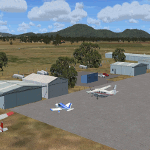
'Mid Western Victoria v2' is made to match ORBX Australia v2 scenery. Use 'Mid West Victoria update' for ORBX v1 or no ORBX. NOTE this is an UPDATE with Horsham replacing Hamilton in the instructions (it is Horsham in the actual scenery). There are 14 airports starting at Ararat and extending up to the Murray at Swan Hill. YARA Ararat YSWL Stawell YMBU Maryborough YSTA Saint Arnaud YDOD Donald YWYF Wycheproof YBIR Birchip YHPN Hopetoun YKER Kerang YSLK Sealake YSWH Swanhill YNHL Nhill YHSM Horsham YWKB Warracknabeal. A lot of airports but this is several hundred hours of effort over many months. ORBX has done these as they have done every airport included with FSX in Australia to a reasonable standard. If I had not already done them for ORBX V1 I would not have bothered. However these are better than ORBX because the surroundings have been modified to match real life. Towns have been added or shifted. Forests cut down or added. Race courses, sewage treatment ponds and other stuff added. Local obstacles (towers etc) added. There are 6 custom terminal buildings accurate to real life. Included is an AI traffic file that covers airports that dont already have AI. These files are for Flight Simulator X. Made using Airport Design Editor using some objects borrowed from Robert Budd's excellent Baccus Marsh and 'Static aircrafts' by Jean-Pierre Fillion. REQUIRED The scenery is designed to interface with ORBX FTX_AU V2 scenery for Australia (payware).
| Filename: | Mid_West_Victoria_v2_for_ORBX_v2_14_airports_YARA_.zip |
| License: | Freeware |
| Added: | 2nd May 2020, 23:11:14 |
| Downloads: | 255 |
| Author: | Colin Jeffery |
| Size: | 10.49 MB |
| Category: Flight Simulator X - Scenery | |
| North Central Ecuador v3, including SEQM (SEQU) and SEIB |
|
Images related to this file:
File Description:
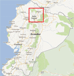
FSX/P3D Version 3 of this scenery is a completely new build of SEQM from the ground up. The entire complex is rendered using FSX objects along with the new highway that connects to the highway infrastructure with AI road traffic. The airport is now at a mean altitude that better blends with the newly included NASA SRTM GL1 30m mesh for the region. The tower is at the correct altitude. Buildings use more accurate footprints, new models, floating jetways, and updated landclass, and work seamlessly with the roads added by FTX Global/Vector. Lakes are corrected within roughly 100 square miles. Although the Ibarra/Atahualpa (SEIB) airport no longer exists, there is an option to add it back. Startup files are included to fly from the lakes and the Ibarra/Atahualpa (SEIB) airport. As a “bonusâ€, SEQU was restored in this version, because much of the footprint of the airport still remains as part of its conversion to a park. As such, a custom and fully functional SEQU is included for users who would like to revisit the old airport. AI Traffic can be restored at SEQU by simply using the "Reversed SEQU-SEQM AI Traffic" option. Scenery was created using Airport Design Editor X v1.76.6715, SBuilderX 3.13, and the FSX Object Placement Tool. Scenery objects were added and modified from stock FSX scenery to resemble as closely as possible the actual airport. Bill Leaming's Ramp Lights for P3D/FSX illuminate the aprons.
| Filename: | North_Central_Ecuador_v3_including_SEQM_SEQU_and_S.zip |
| License: | Freeware |
| Added: | 22nd March 2020, 22:13:37 |
| Downloads: | 4,107 |
| Author: | Carlyle Sharpe |
| Size: | 29.44 MB |


© 2001-2026 AVSIM Online
All Rights Reserved
Privacy Policy |