
Where Flight Simulation Enthusiasts Gather from Around the World!
AVSIM Library - Search Results

| Category: Flight Simulator 2004 - AFCAD Files | |
| A&F Data For South Australia airfields v2 |

|
Images related to this file:
File Description:
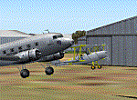
This updated set of 76 AFCAD2 files are for use with the free add-on scenery from Roger Leupold (fs9sav1.zip) are not suitable for the default FS2004 airfields. Version 2 incorporates corrected ICAO codes using the excellent listing made available by Mal Lloyd. The files will allow the scenery (designed for FS2002) to become more useable in FS2004. They will allow you to plan routes, and take off and land at some 76 airfields featuring in the scenery, with ATC routing you appropriately. AI aircraft can now land, taxi, park and take off in the correct locations, and you can introduce your own AI traffic, too, if you wish. Every airfield has at least one parking space (even the tiniest airstips) but airfields featuring hangers and other scenery have more. [File re-uploaded at request of AVSIM]
| Filename: | AF_Data_For_South_Australia_airfields_v2.zip |
| License: | Freeware |
| Added: | 26th May 2010, 19:14:18 |
| Downloads: | 435 |
| Author: | John Hinson |
| Size: | 84.15 KB |
| Category: Flight Simulator X - AFCAD Files | |
| Eagles Nest Airport (31E), NJ |
|
File Description:
Located 02 miles N of West Creek, New Jersey on 80 acres of land, Eagles Nest Airport is a small single strip that hosts several single engine aircraft. No services are provided to transient aircraft, tie down spots are available on the tarmac adjacent to Runway 14. AI paths have been added to this airport in case you would like to direct any GA AI there. Trees are summer ONLY.
Scenery constructed with use of satellite images/streetview, the author has not been there in person.
This scenery is meant to be used in conjunction with MegaScenery Earth New Jersey/Delaware 003. It is not required, but apron use is minimized to allow satellite scenery to show through as much as possible, and objects are placed based on the MSE textures - lack of it may make scenery look out of place.
| Filename: | Eagles_Nest_Airport_31E_NJ.zip |
| License: | Freeware |
| Added: | 15th October 2010, 20:43:02 |
| Downloads: | 345 |
| Author: | Drew Sikora |
| Size: | 496.59 KB |
| Category: Flight Simulator X - AFCAD Files | |
| Pemberton Airport (3N7), NJ |
|
File Description:
Located 01 miles NW of Pemberton, New Jersey on 14 acres of land, Pemberton Airport is a private airstrip. Tie down areas are available at the Runway 22 end. The single parking space is a tie down - do not use if your aircraft's wingspan is greater than 50 feet. Note that the actual listing for this airport in real world databases is 3NJ1. Trees are summertime ONLY.
Scenery constructed with use of satellite images/streetview, the author has not been there in person.
This scenery is meant to be used in conjunction with MegaScenery Earth New Jersey/Delaware 002. It is not required, but apron use is minimized to allow satellite scenery to show through as much as possible, and objects are placed based on the MSE textures - lack of it may make scenery look out of place.
| Filename: | Pemberton_Airport_3N7_NJ.zip |
| License: | Freeware |
| Added: | 23rd November 2010, 22:32:59 |
| Downloads: | 184 |
| Author: | Drew Sikora |
| Size: | 1.12 MB |
| Category: Flight Simulator X - AFCAD Files | |
| Marlboro Airport (2N8), NJ |
|
File Description:
Marlboro Airport in Matawan, NJ was closed in 2002. The runway has been modified to reflect its closed status and all taxiways, buildings, etc have been stripped to show satellite textures. FSX doesn't simulate old broken down runways possibly breaking your landing gear so if you still want to hit that with a Touch and Go I'm sure the virtual FAA won't notice.
Scenery constructed with use of satellite images/streetview, the author has not been there in person.
This scenery is meant to be used in conjunction with MegaScenery Earth New Jersey/Delaware 001. It is not required, but apron use is minimized to allow satellite scenery to show through as much as possible, and objects are placed based on the MSE textures - lack of it may make scenery look out of place.
| Filename: | Marlboro_Airport_2N8_NJ.zip |
| License: | Freeware |
| Added: | 24th October 2010, 18:52:50 |
| Downloads: | 178 |
| Author: | Drew Sikora |
| Size: | 197.29 KB |
| Category: Flight Simulator 2004 - Scenery | |
| Los Angeles Virtual Terminal 2009 |
|
File Description:
The LAX Vterminal was originally released to a select few virtual airlines. These were West Express,
Atlantic Sun, Empora Virtual, City Bird, Arizona Pacific, and Family Virtual Airlines. The terminal
contains three concourses, forty-three (43) gates, and eight overflow parking spots. Parking assignments
have not been assigned to any of the gates, so you will need to go through and do so.
The terminal was created by Michael Wood and Nick O'Dell. It was designed to fit the needs of virtual
airlines, in order to return parking spots in the main terminal to their real world owners. This
scenery is frame rate friendly, and will not take up a lot of space on your hard drive. Included in
this file are AFCAD's for the default and OceanFlight scenery.
Enjoy our scenery, and look for more scenery projects coming in the near future.
| Filename: | Los_Angeles_Virtual_Terminal_2009.zip |
| License: | Freeware, limited distribution |
| Added: | 11th March 2009, 08:40:06 |
| Downloads: | 563 |
| Author: | Nick O'Dell, Michael Wood |
| Size: | 232.46 KB |
| Category: Flight Simulator 2004 - Scenery | |
| The Greater Toronto Area for Ultimate Terrain 1.2 Part 1 |
|
File Description:
Part 1 of Flight Ontario's scenery for the Greater Toronto Area for Ultimate Terrain. The scenery is bounded by Detroit in the west, Kingston in the east, Huntsville in the north and Buffalo in the south and features: * all-season scenery * custom water textures * completely modelled Toronto Airports...CYTZ (Toronto Island) and CYZD (Downsview-home to Bombardier Aerospace and the Canadair Regional Jet and Dash-8, and the Toronto Aerospace Museum) * Niagara Helicopters CPQ3 (NEW) *custom autogen for the GTA * Custom landclass for southern Ontario * prominent features around Hamilton include the Burlington Skyway,lift bridge and steel mills * the Welland Canal is featured with lift bridges from Pt Weller to Pt Colborne * the Niagara area includes two hydro generating plants with reservoirs * compatibility with SimFlyers CYYZ.
This scenery is downloadable in two parts and both parts are essential.
| Filename: | The_Greater_Toronto_Area_for_Ultimate_Terrain_12_P.zip |
| License: | Freeware |
| Added: | 31st December 2005, 18:39:52 |
| Downloads: | 13,893 |
| Author: | Jim Kanold - Flight Ontario |
| Size: | 62.05 MB |
| Category: Prepar3D V1-4 - Scenery | |
| Kuusamo airport - EFKS |
|
Images related to this file:
File Description:
Kuusamo airport (EFKS) is located in North-East of Finland. Kuusamo is well known for its ski-resort Ruka which is located just 30km North of Kuusamo city. Kuusamo airport is main hub for Finnair but other airlines fly also in there mainly in winter season. You have to experience the beauty of Lapland and breathtaking views on this amazing approach! This scenery is light enhancement of Kuusamo Airport (EFKS) which includes Photoreal scenery of 15cm/pix, hand placed autogen, correct airport parkings and markings and correct terminal and building placements. This scenery is compatible for FSX, Prepar3D v3 AND Prepar3D v4!
Note: For the best experience I suggest you to download Tatu Kantomaa´s Postcards from Lapland which can be found from Fsnordic website. But Postcards from Lapland is not required for this scenery to work.
| Filename: | Kuusamo_airport__EFKS.zip |
| License: | Freeware, limited distribution |
| Added: | 5th July 2017, 17:54:07 |
| Downloads: | 1,963 |
| Author: | Joona Toivola |
| Size: | 37.64 MB |
| Category: Flight Simulator 2004 - Scenery | |
| Siofok Kiliti-Sagvar LHSK |
|
File Description:
Freeware Scenery of Siófok Kiliti-Ságvár airport.This airport is used for general aviation, at Lake Balaton, has grass runway. Only for Flight simulator 2004.
This scenery itself has a large addition to the default LHSK, which only has a runway, this addon has a correct afcad with taxiways, and apron. Also a quite correct, airport with objects,hangars,cars,people,etc…Also added the ILS, and PAPI for runway 33, as in real.I have also included a landclass to change the default „fields” at the place of the city, into a city. This scenery, was made for an aerobatic event ont he IVAO network, so an aerobatic box is also added, above the Lake Balaton. You can remove this box at anytime, via the instructions below. Hope you enjoy this scenery, and will have fun with it.
| Filename: | Siofok_KilitiSagvar_LHSK.zip |
| License: | Freeware, limited distribution |
| Added: | 27th February 2006, 00:36:24 |
| Downloads: | 705 |
| Author: | David Zoltan |
| Size: | 1.3 MB |
| Category: Prepar3D V1-4 - AFCAD Files | |
| Ninoy Aquino Int'l Airport(RPLL) AFCAD 2021 |
|
File Description:
This is the new AFCAD file of RPLL. Since default RPLL scenery has a lot of errors from one of the the real world, I edited the taxiway, gates, aprons and make it current. This is for P3d v4, I don't guarantee it works fine on other flight simulators, but re-compiling this for them is welcomed. Feel free to edit this for more precision, but clarify the original editor. No commercial use is allowed.
[How to install]
1. Place the bgl file into addon scenery/scenery folder.
2. Make sure you applied it on 'scenery library' page.
[Note]
1. I didn't put some GA spots near to domestic terminal, it's because Navigraph Chart doesn't provide sufficient information of them.
2. Taxisigns are added randomly according to the taxiway designator, so It might different from the real airport.
| Filename: | Ninoy_Aquino_Intl_AirportRPLL_AFCAD_2021.zip |
| License: | Freeware |
| Added: | 29th January 2021, 17:59:29 |
| Downloads: | 849 |
| Author: | Hwang Juho |
| Size: | 21.04 KB |
| Category: Flight Simulator X - Scenery | |
| Grise Fiord Airport CYGZ |
|
File Description:
Grise Fiord, NWT Canada scenery - CYGZ (FSX).
This is a fictitious rendition of the actual and VERY REMOTE Airport at Grise Fiord in the Canadian NWT - CYGZ.
Grise Fiord is the most northerly community in Canada.
Only operators with considerable experience should use this aerodrome at all. Bring your Twin Otter. There are places to fly your helocopters too. (Explore the oil rigs or see if you can land on one of the destroyers passing by).
See the whales!
See: http://www.copanational.org/PlacesToFly/airport_view.php?pr_id=13&ap_id=288
For great photo's of the area: http://www.arcticcircle.ca/Baffin/Grise/
Virtual improvements have finally come to this area where the ice never melts.
This is freeware. I hope you enjoy it.
Designed with the FS X Sdk Scenery function of the Mission builder and the Abacus Scenery shortcut tool.
This scenery is frame rate friendly.
| Filename: | Grise_Fiord_Airport_CYGZ.zip |
| License: | Freeware |
| Added: | 26th January 2007, 02:37:13 |
| Downloads: | 1,520 |
| Author: | Bob Caparoula |
| Size: | 2.47 MB |


© 2001-2026 AVSIM Online
All Rights Reserved
Privacy Policy |