
Where Flight Simulation Enthusiasts Gather from Around the World!
AVSIM Library - Search Results

| Category: Flight Simulator 2004 - AFCAD Files | |
| FlyTampa San Francisco (KSFO) v2 |

|
Images related to this file:
File Description:
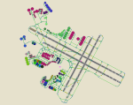
This AFCAD2 is for use with FlyTampa KSFO only. It must not be used with any other scenery, or the default KSFO. This file has been built from scratch and features accurate Taxiway naming, accurate parking and a Tower View. All gates and cargo ramps are assigned to the correct airlines, the United Airlines maintenance areas are included and feature "In Hangar" parking. United Express ramps are also included. An extensive GA area is now featured, capable of holding aircraft ranging from a C172 upto a B767. Finally, the US Coast Guard station has 3 parking positions. All runways are active and are all available for use at the same time, thanks to the crosswind runway activation technique.
This file replaces the AFCAD that was released in 2005, and provides up to date gate assignments as of April 2010. Previous Version had 3336 downloads. Enjoy!
| Filename: | FlyTampa_San_Francisco_KSFO_v2.zip |
| License: | Freeware |
| Added: | 17th April 2010, 13:52:48 |
| Downloads: | 2,144 |
| Author: | Lee Brompton |
| Size: | 57.46 KB |
| Category: Flight Simulator 2004 - Scenery | |
| Guaymaral Airport SKGY 2011 |
|
File Description:
Guaymaral Airport (IATA: GAA, ICAO: SKGY) is an airport located in Bogota, Colombia, in the area from which its name was taken, which is located to the north-west of the city, and limits with the towns of Cota and Chia. The airport handles primarily general aviation traffic, type A and B, only VFR. It's the base for private and commercial pilot training schools like Aeroandes and Aeroclub de Colombia.
This file has the right coordinates, with the apron and characteristics of the airport. The runways were reoriented to the correct direction, runway were resized the gates placed on correct location, Colombia National Police was
assigned a correct apron. All the airport charts required to navigate in and out of this airport which are courtesy of: Areonatica Civil de Colombia can be found at www.aerocivil.gov.co/ under Informacion Aeronautica click AIP; on AIP
click Aerodromos then click at SKGY.
| Filename: | Guaymaral_Airport__SKGY_2011.zip |
| License: | Freeware |
| Added: | 6th November 2011, 21:14:52 |
| Downloads: | 565 |
| Author: | Anwar Gonzalez |
| Size: | 12.07 KB |
| Category: Flight Simulator X - Scenery | |
| Guaymaral Airport SKGY 2011 |
|
File Description:
Guaymaral Airport (IATA: GAA, ICAO: SKGY) is an airport located in Bogota, Colombia, in the area from which its name was taken, which is located to the north-west of the city, and limits with the towns of Cota and Chia. The airport
handles primarily general aviation traffic, type A and B, only VFR. It's the base for private and commercial pilot training schools like Aeroandes and Aeroclub de Colombia.
This file has the right coordinates, with the apron and characteristics of the airport. The runways were reoriented to the correct direction, runway were resized the gates placed on correct location, Colombia National Police was assigned a correct apron. All the airport charts required to navigate in and out of this airport which are courtesy of: Areonatica Civil de Colombia can be found at www.aerocivil.gov.co/ under Informacion Aeronautica click AIP; on AIP click Aerodromos then click at SKGY.
| Filename: | Guaymaral_Airport__SKGY_2011.zip |
| License: | Freeware |
| Added: | 6th November 2011, 21:15:42 |
| Downloads: | 1,773 |
| Author: | Anwar Gonzalez |
| Size: | 12.06 KB |
| Category: Flight Simulator X - Scenery | |
| PABT PATA UTO 6A8 (Alaska) Upgrades |
|
Images related to this file:
File Description:
This scenery upgrades PABT, PATA, UTO and 6A8 in Alaska. Upgrades include taxiways, hangers, airport buildings, aircraft and ground vehicles, helipads and other objects. It also updates the 2 water runways at PABT as start points which in FSX they aren't start points. The water runway area is updated with marina objects, a float plane dock, float plane support shops and buildings and a private residence with a private dock for boats and float planes. The helipads were an addition because I use Flight 1's heli-traffic and have helo traffic flying back and forth. Future upgrades to several of the small airports in the area will include AI helo and bush plane traffic. Read the text file for info and installation instructions. 4 pictures are included of each airports upgrades. Please enjoy these upgrades and check the Avsim library for future upgrades coming soon. Savageagle.
| Filename: | PABT__PATA__UTO__6A8__Alaska__Upgrades.zip |
| License: | Freeware |
| Added: | 17th November 2011, 07:57:51 |
| Downloads: | 1,629 |
| Author: | Tim Durham |
| Size: | 835.17 KB |
| Category: Flight Simulator 2004 - Scenery | |
| Hat Island CWHI in Nunavut, Canada |
|
Images related to this file:
File Description:
This was a DEW line I Station on Hat Island; the island is around 4 miles square and just under 50 miles southeast of Jenny Lind Island. The station was closed in 1963 and has now been totally dismantled and removed, a fairly easy task given the size. The runway is still there and is a shade over 3,000 feet of gravel 100' wide. There are no lights, signage, or windsock. A North Warning System station was built in 1991 on the site of the I Station, just north of the runway. Most of these DEW line stations are not particularly impressive or even interesting. However, you can bet that any pilot flying regularly in the north along the coast knows where all these runways are, in case one of them suddenly becomes his favourite in the whole world just after the sudden silence.
| Filename: | Hat_Island_CWHI_in_Nunavut_Canada.zip |
| License: | Freeware, limited distribution |
| Added: | 15th November 2012, 13:55:41 |
| Downloads: | 197 |
| Author: | Roger Wensley |
| Size: | 1.08 MB |
| Category: Flight Simulator X - Scenery | |
| CYHU Montreal/St-Hubert Airport v1.0 |
|
Images related to this file:
File Description:
Montreal/Saint-Hubert Airport is located 16 km (9.9 mi) east of downtown Montreal.
In operation since 1928, it was Montreal's first and only airport until the construction of Montreal-Pierre Elliott Trudeau International Airport. As of 2011, it is Canada's busiest general aviation airport, and is ranked as Canada's 6th busiest airport by aircraft movements.
What is included in this scenery:
- The airport runways and taxiways had been redone, Taxiway R has been added to better reflect the reality that the default version of FSX;
-All buildings and hangar of the airport;
-All buildings Helicraft (CTG2) and areas for helicopters, static helicopters;
-The new commuter train station;
-Streetlights on 116 highway and Clairevue blvd;
-Several static aircraft and service vehicles and cars parked along the road to the airport;
-Canadian Space Agency;
-The ski resort of St-Bruno;
-All signs track in 3D;
| Filename: | CYHU_MontrealStHubert_Airport_v10.zip |
| License: | Freeware, limited distribution |
| Added: | 29th March 2013, 06:38:12 |
| Downloads: | 5,027 |
| Author: | Pierre Gallant, Jean-Pierre Fillion |
| Size: | 21.31 MB |
| Category: Flight Simulator 2004 - Scenery | |
| Point Ellis cannery V1, for Holger Sandmann's Tongass Fjord scenery |
|
Images related to this file:
File Description:
This is a revised version of Point Ellis cannery, originally posted in 2007. It is unsurprisingly just east of Point Ellis, on the east side of the southern end of Chatham Strait in southern Alaska. It is marked on the chart of the area, and if you are chartless then there is a piece of the chart here. This scenery is designed specifically for use in the Tongass Fjord scenery, and probably doesn't work with just Ultimate Terrain. The cannery has an identifying code so it will show up on a gps as "PECA". There is no interaction with atc as there are no designated water runways, so the "PECA" on the gps just acts as a waypoint. There will be further posts for use with Tongass Fjords, Misty Fjords, and Glacier Bay, and I still find these scenery areas by Holger and his crew the most satisfying in FS9.
| Filename: | Point_Ellis_cannery_V1_for_Holger_Sandmanns_Tongas.zip |
| License: | Freeware, limited distribution |
| Added: | 6th November 2014, 21:55:48 |
| Downloads: | 239 |
| Author: | Roger Wensley |
| Size: | 3.86 MB |
| Category: Flight Simulator 2004 - Scenery | |
| PADK - Adak - Aleutians, Alaska - USA |
|
Images related to this file:
File Description:
Adak is near the western end of the Aleutian chain of islands in Alaska. The closed naval air base buildings are mostly still there and once housed over 6,000; the population is now much reduced to around 320, involved in fishing and a fish processing plant, organising caribou hunts for the tourism industry, running the airport, etc. The runways are long and wide (both are over 7,000 feet) and aligned 23-05 (with an ils) and 18-36. There are flights from Anchorage on Thursdays and Sundays by Alaska Airlines (a 737) and occasional charters from Dutch Harbor by Grant Aviation, 445 miles east of Adak. The Ai included here contains these flights. There are revisions included for Dutch Harbor PADU which provide parking for more Grant planes, as Grant are now also running flights to Akun Island, east of Dutch Harbor; more Aleutian posts to follow.
| Filename: | PADK__Adak__Aleutians_Alaska__USA.zip |
| License: | Freeware, limited distribution |
| Added: | 13th January 2015, 23:32:44 |
| Downloads: | 565 |
| Author: | Roger Wensley |
| Size: | 7.59 MB |
| Category: X-Plane - Scenery | |
| WW32 Susi Air Nevere v1.0.0 |
|
Images related to this file:
File Description:
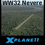
This is an X-Plane 11 scenery for Nevere Airstrip (WW32) in Nevere, Papua, Indonesia. This is one of the destinations for "PT ASI Pujiastuti Aviation", operating as Susi Air, an Indonesia airlines established in late 2004 by Mrs. Susi Pudjiastuti. This scenery was tested and is operational (as of January 08, 2017) in "X-Plane 11 Public Beta #5 64 bit", Windows 10 Home. It was also tested but is partially operational (as of January 08, 2017) in "X-Plane 10.51 64 bit", Windows 10 Home. The XP10.51 mesh presents no river, hence there is no water for the sealane water runway 11/29 to work properly. It will look weird because of the absence of teh river. Despite this issue with the rwy 11/29, the other two runways (10/28 dirty and 02/20 grass) both work nicely and are very much usable.
| Filename: | WW32_Susi_Air_Nevere_v100.zip |
| License: | Freeware |
| Added: | 9th January 2017, 15:02:07 |
| Downloads: | 60 |
| Author: | Rui Mesquita |
| Size: | 2.9 MB |
| Category: Prepar3D V1-4 - Scenery | |
| YPPH - Perth Intl Airport - Western Australia |
|
File Description:
This is Ray Smith's scenery file "fsx_ypph_rs.zip". Ray has given me permission to make his file available for Prepar3D v(x). This is a very accurate rendition for YPPH international airport with two optional files made only for Prepar3D: one version with the Crosswind runway activated and in full operation where both runways will be used for takeoff/landing and one version as the default airport runway operation: assigned parking updated as per their website including gates for the A380, the new Virgin terminal at the international terminal 1 and Domestic 2 also included, Terminals 3 and 4 completely rebuilt/replaced, new control tower, taxiways and taxi signs updated to the latest charts, lighted helipad, support vehicle roads rebuilt and many other scenery improvements included, airport views are from the roof of the control tower (when in tower view) please view the readme before installation.
| Filename: | YPPH__Perth_Intl_Airport__Western_Australia.zip |
| License: | Freeware |
| Added: | 15th April 2017, 06:15:30 |
| Downloads: | 17,583 |
| Author: | Robert Catherall |
| Size: | 2.65 MB |


© 2001-2026 AVSIM Online
All Rights Reserved
Privacy Policy |