
Where Flight Simulation Enthusiasts Gather from Around the World!
AVSIM Library - Search Results

| Category: Flight Simulator 2004 - Gauges | |
| Satellite Assisted Landing System Version 9 |

|
File Description:
FS2004 Gauge: Satellite Assisted Landing System, v9 (SALS). Using satellite data, this gauge provides glidepath/glideslope guidance into all runways inside the FS world. Approach heading and glideslope indicators are displayed during the landing phase in a fashion similar to those used with ILS and requires the same piloting techniques to keep the needles centered. Because SALS has the ability to guide an aircraft to both ends of a runway, every airport including grass strips and seaplane bases can be accessed with a high level of landing precision. In case of missed approaches, backcourse guidance is provided during climbout. Panel or separate window installation. Includes SALS icon gauge and Word doc with illustrated design parameters. By Glenn Copeland
| Filename: | Satellite_Assisted_Landing_System_Version_9.zip |
| License: | Freeware |
| Added: | 4th June 2006, 04:26:10 |
| Downloads: | 7,798 |
| Author: | Glenn Copeland |
| Size: | 222.23 KB |
| Category: Flight Simulator 2004 - Flight Plans | |
| PMDG SIDSTARS Cincinnati/Northern Kentucky (KCVG) |
|
File Description:
Procedures based on current cycle (0704 12Apr-10May) FAA Digital Aeronautical Information and published charts, including all three 18/36 runways. All arrivals and departures are provided with NOATC enumerations for routing without ATC vectors as well as the "as published" procedures requiring an ATC service (such as VATSIM). The vectors-only Cincinnati departure is excluded (it has no routes) but I have created four NOATC departures for commonly used departure gates (APE DQN MIE & RIKLE). All STARs are included, each one with four runway selections for use in lieu of ATC vectors. All approaches are also included. The text header of the file is copied into a readme with details on each procedure. For PMDG only.
| Filename: | PMDG_SIDSTARS_CincinnatiNorthern_Kentucky_KCVG.zip |
| License: | Freeware, limited distribution |
| Added: | 26th April 2007, 23:31:46 |
| Downloads: | 223 |
| Author: | Dan Downs |
| Size: | 12.39 KB |
| Category: Flight Simulator 2004 - AI Aircraft | |
| KR2 for AI |
|
File Description:
Ken Rand's lightweight two-seater for AI use in FS2004. Built with FSDS v3.51, there is a relatively low polygon-count main model, with several LOD models and a reduced-detail shadow for optimal fps. Not a short-field aircraft, it's quite streamlined and there are no flaps, so the stall speed is quite high for a small 'plane, 45kts. An interesting feature of this aircraft (and it's predecessor, the KR1), is that the undercarraige is only about 17" tall, so the aircraft sits very close to the ground. Sorry, the model does bounce a little on touchdown ... put it down to an inexperienced pilot ;-)
Another slightly unusual shape for your taxiways and runways ... enjoy.
| Filename: | KR2_for_AI.zip |
| License: | Freeware, limited distribution |
| Added: | 6th October 2007, 13:55:16 |
| Downloads: | 235 |
| Author: | Chris Eve |
| Size: | 171.01 KB |
| Category: Flight Simulator 2004 - AFCAD Files | |
| Outagamie County Regional Airport, Appleton, WI (KATW) |
|
File Description:
A lot has changed since my last upload of my home airport and now that I work there, I can provide the Flight Simulator community a 95% accurate layout of the airport. Many of these changes include, the expansion of the newly built south GA ramp where eventually the FBO will be moved to, repositioning of the DHL/ABX ramp, addition of the Land And Hold Short (LAHSO)lines on all runways for events such as EAA AirVenture, hold short lines for exiting the non-movement area of all ramps, access road around the entire field and taxiway sign corrections and additions for taxiways Lima, Kilo, and Mike. Tested for FS2004 but should also work for FSX.
| Filename: | Outagamie_County_Regional_Airport_Appleton_WI_KATW.zip |
| License: | Freeware, limited distribution |
| Added: | 9th April 2008, 21:58:27 |
| Downloads: | 487 |
| Author: | Cody Gustafson |
| Size: | 8.74 KB |
| Category: Flight Simulator 2004 - Scenery | |
| Weaver MT54 Montana USA |
|
Images related to this file:
File Description:
I made this because I downloaded and tried the Glacier Park scenery by Blue Sky Scenery and then discovered that the airfield runways are not always correctly positioned or aligned. So I moved the Weaver runway over and added a couple of buildings. That's it, almost the same as I did for Whitefish. If I find some more airfields in this area with similar problems then I'll do more of the same. Weaver is a private field 4 miles south of Glacier Park International at 2,929 feet ASL and around 45 miles south of the Canadian border. There are no large towns close by; the nearest would be Missoula, which is some 90 miles further south.
| Filename: | Weaver_MT54__Montana_USA.zip |
| License: | Freeware, limited distribution |
| Added: | 26th May 2010, 03:18:46 |
| Downloads: | 203 |
| Author: | Roger Wensley |
| Size: | 14.23 MB |
| Category: Flight Simulator 2004 - Scenery | |
| Lima/Allen County (OH) Regional Airport (KAOH) |
|
File Description:
Built in 1963, it replaced KLIA which was located Northwest of Lima near the village of Elida. It features ILS approach capability, a full-service repair facility, and two runways. 10/28 is 6,000' x 150' asphalt, while 14/32 is a combination asphalt & sod (I couldn't duplicate this with ADE9X, so it's paved as well). I was able to include a rotating beacon in this package (and might offer as an upgrade to previous sceneries). The buildings aren't a true match, but far better than the default mess. Also, rwy 10/28 has been brought up to date; I've lengthened it to 6,000 ft and re-numbered it from the "09/27" found in Fs9.
| Filename: | LimaAllen_County_OH_Regional_Airport_KAOH.zip |
| License: | Freeware |
| Added: | 20th February 2011, 20:45:44 |
| Downloads: | 203 |
| Author: | Stephen Plumb |
| Size: | 947.41 KB |
| Category: Flight Simulator X - Scenery | |
| St Petersburg, FL - Albert Whitted Airport (KSPG) |
|
Images related to this file:
File Description:
This airport is located on the downtown waterfront in St. Petersburg, FL. New custom scenery
includes the Pier, Mahaffey Theatre, Salvador Dali Museum, Al Lang Field, Tropicana Field
and other scenery outside the airport bounderies as well as the new general aviation
terminal on the field. Generic floating buildings have been replaced with custom and
library objects. Landclass changes, roads, rework of runways, taxiways and aprons,
placement of library objects and a library of new airport buildings are included. Scenery
in this package is based on Virtual Earth (Bing) and Google Earth imagery. FSX included
only two aircraft parking spaces at this airport, so parking has been added, and a file
is included adding GA AI traffic if desired.
| Filename: | St_Petersburg_FL__Albert_Whitted_Airport_KSPG.zip |
| License: | Freeware |
| Added: | 27th May 2011, 03:54:48 |
| Downloads: | 1,508 |
| Author: | Art Poole |
| Size: | 2.95 MB |
| Category: Flight Simulator 2004 - Scenery Design | |
| ILS Approach Editing Tutorial |
|
File Description:
This is a little tutorial (illustrated text in PDF format) on creating ILS approaches using ADE9x and getting them to work with flightsim ATC. It also contains a few notes on flying ILS approaches.
The reason I created this tutorial is that I had such a heck of time getting this to work (adding ILS approaches for runways that had none in the past, and getting ATC to use them), so I thought I might as well try to spare others following the same path some of the troubles and headaches I went through.
The tutorial is specifically addressed to FS2004, but almost everything in it should also apply to FSX.
| Filename: | ILS_Approach_Editing_Tutorial.zip |
| License: | Freeware |
| Added: | 21st November 2011, 17:26:13 |
| Downloads: | 770 |
| Author: | Ken Leedham |
| Size: | 223.42 KB |
| Category: Flight Simulator X - Scenery | |
| Central Massachusetts Airports |
|
Images related to this file:
File Description:
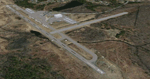
This package contains 25 airports in central Massachusetts. These airports are intended to be used with FSX and the free addon - TileProxy. TileProxy provides real-time photorealistic satellite imagery in place of the stock auto generated FSX scenery or any other scenery package.
The package includes sixteen (16) stock FSX airports which have been modified (re-located runways, buildings, taxiways, etc.) to more accurately re-position them with the real-world scenery. In addition, there are two (2) unlisted airports which are not available in FSX. These airports are existing real private airports. There are also seven (7) "abandoned" airports included (i.e. airports that no longer exist). These airports were active in the 1920s-1970s.
| Filename: | Central_Massachusetts_Airports.zip |
| License: | Freeware |
| Added: | 2nd July 2013, 06:01:25 |
| Downloads: | 426 |
| Author: | John Greenwood |
| Size: | 5.15 MB |
| Category: Flight Simulator X - Scenery | |
| WA67 - Green Mountain Airport - Vancouver, Washington |
|
Images related to this file:
File Description: This is a revision of an airport originally included in my Oregon GA package.
This is a complete airport and can be installed alone, or you can add this
to the original and overwrite the older files. A member of the community
alerted me to elevation discrepancies; I had been using a 3rd party mesh when I
made this airport, which masked the discrepancy. This version will work
universally and also includes corrected approaches wherein I removed the default
ones and aligned these correctly to the current runway position; I added custom
runways lights to more accurately reflect reality and also made several relevant
detail changes.
| Filename: | WA67__Green_Mountain_Airport__Vancouver_Washington.zip |
| License: | Freeware, limited distribution |
| Added: | 6th January 2014, 16:28:32 |
| Downloads: | 638 |
| Author: | Rick Keller |
| Size: | 146.81 MB |


© 2001-2026 AVSIM Online
All Rights Reserved
Privacy Policy |