
Where Flight Simulation Enthusiasts Gather from Around the World!
AVSIM Library - Search Results

| Category: Flight Simulator X - Scenery | |
| Limnos - Greece |

|
Images related to this file:
File Description:
Limnos-Skyros Dn
AS REAL AS IT GETS.
This is a highly detailed photorealistic scenery of the islands of Limnos, Samothraki,
Agios Efstratios and Skyros WITH NIGHT TEXTURES.
Default FSX airports of the islands (LGLM and LGSY) were redone, (runways added)
positioned to their exact location and some buildings and trees were added in the airport vicinities
Aprons added, parking spots, air and vehicle traffic.
The scenery also includes autogen objects, vegetation and road trafic near the airports.
| Filename: | Limnos__Greece.zip |
| License: | Freeware |
| Added: | 24th November 2016, 17:36:47 |
| Downloads: | 814 |
| Author: | Angelo Tassoglou |
| Size: | 51.28 MB |
| Category: Flight Simulator 2004 - AFCAD Files | |
| Schwechat Vienna Austria (LOWW) |
|
File Description:
This file is a version for the default airport with 86 gates/parking/cargo parking concrete areas around the airport realigned with the buildings runways/taxiways/aprons now have improved lighting and the faulty taxiway A10 now corrected and for the heli pilots i have added a helipad which also has lighting airport views are from the roof of the control tower (only when you are in TOWER view)fully tested with Ultimate Traffic but not required.
| Filename: | Schwechat_Vienna_Austria_LOWW.zip |
| License: | Freeware |
| Added: | 10th January 2004, 19:32:26 |
| Downloads: | 3,108 |
| Author: | Ray Smith |
| Size: | 10.25 KB |
| Category: Flight Simulator X - Scenery | |
| Opa Locka, FL Airport (KOPF) |
|
Images related to this file:
File Description:
This scenery includes the old control tower (inactave), a temporary control tower (active) and a new control tower (inactive, near completion). Generic floating buildings have been replaced with custom and library objects. Landclass changes, roads, rework of runways, taxiways and aprons, placement of library objects and a library of new airport buildings are included. Military parking is included at the Coast Guard facility. Scenery in this package is based on Virtual Earth (Bing) and Google Earth imagery.
| Filename: | Opa_Locka_FL_Airport_KOPF.zip |
| License: | Freeware |
| Added: | 7th April 2011, 00:15:39 |
| Downloads: | 2,302 |
| Author: | Art Poole |
| Size: | 2.83 MB |
| Category: Flight Simulator X - Scenery | |
| San Jose International Airport [KSJC] |
|
Images related to this file:
File Description:
Welcome to San Jose International Airport [KSJC] for FSX!
The Gateway airport for Silicon Valley sits in Santa Clara at the south end of the San Francisco Bay.
The runways have been adjusted to their current length. Runway 11/29 is gone and is now
taxiway W1. A new taxiway (W) was added for western exits from 12R/30L
The VOR has been updated to the current configuration.
All the buildings (with the exception of the tower) are custom.
| Filename: | San_Jose_International_Airport_KSJC.zip |
| License: | Freeware, limited distribution |
| Added: | 9th March 2020, 18:17:07 |
| Downloads: | 790 |
| Author: | Brett Delana |
| Size: | 16.61 MB |
| Category: Flight Simulator X - Scenery | |
| KLEX - Bluegrass Airport - Lexington, Kentucky - USA |
|
Images related to this file:
File Description:
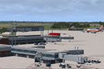
This FSX (only) scenery is for Bluegrass Airport in Lexington, KY. Custom built terminal, hangars, Bluegrass Aviation Museum, TAC Air FBO, control tower, and appropriate landclass. Additional models provide scenery for Keeneland Racetrack and Calumet Farm on the approach to Rwy 22. The airport design features the newly separated runways and general aviation area. For additional enjoyment, a number of landmark buildings are modelled in downtown Lexington and the University of Kentucky campus.
By Dan French.
| Filename: | KLEX__Bluegrass_Airport__Lexington_Kentucky__USA.zip |
| License: | Freeware, limited distribution |
| Added: | 10th September 2015, 01:04:56 |
| Downloads: | 1,398 |
| Author: | Dan French |
| Size: | 9.06 MB |
| Category: Flight Simulator 2004 - Scenery | |
| Nursery Corner Farm Field CF13 near Ottawa in Ontario, Canada |
|
Images related to this file:
File Description:
Nursery Corner is a tree nursery around 12 miles southwest of Rideau Valley Airpark CPL3 (which did not appear in FS9, probably because it was then mainly used by gliders, but is a post of mine and downloadable) and 6 miles south of Hicks Farm, a recent post. CPL3 is 15 miles south of Ottawa Airport, tucked into a right angle bend of the Rideau River. Ultimate Terrain puts the river into place and I am not sure how CPL3 works without UT as the river is close by. Fly west from CPL3 along the river and Hicks Farm will be on the south side; fly south parallel to the roads, cross a small river, and in an area which has place names like Hutchins Corners and Pattersons Corners will be the farm field with two grass runways at right angles among the nursery rows of trees. The runways are 36/18 1,700 feet and 27/09 2,000 feet. The single T hangar houses what looked like a Citabria.
| Filename: | Nursery_Corner_Farm_Field_CF13_near_Ottawa_in_Onta.zip |
| License: | Freeware, limited distribution |
| Added: | 11th February 2010, 00:53:28 |
| Downloads: | 248 |
| Author: | Roger Wensley |
| Size: | 14.1 MB |
| Category: Flight Simulator X - Utilities | |
| FSX/P3D Quick ILS Utility Ver 3.1.5 **UPDATE ** |
|
Images related to this file:
File Description:
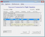
This utility was written to simplify the process of finding the ILS frequency when ATC assigns an ILS approach. Operation is simple. Enter the ICAO, click the Search button and a list of all runways, runway lengths and runway ILS frequencies for that ICAO are displayed. Here's the quick part... Just double click on a runway and the ILS frequency will instantly be set in the Nav1 radio. You can also start Flight Simulator, load a flightplan and then start Quick ILS. It will automatically read the flightplan and then display the destination airport's runway data. Again, just double click on the assigned runway to set the Nav1 radio for the ILS approach. ILS data aside, General Aviation fans may want to use Quick ILS to get information about possible destination airports. Enter an ICAO and you can quickly view the runways available, their length, the surface (ie grass, gravel, paved...) and the runway headings. Version 3.1.5 adds the ILS ID to the display. Freeware by Dave Westbury.
| Filename: | FSXP3D_Quick_ILS_Utility_Ver_315_UPDATE_.zip |
| License: | Freeware |
| Added: | 12th August 2014, 10:25:51 |
| Downloads: | 3,582 |
| Author: | Dave Westbury |
| Size: | 457.35 KB |
| Category: Flight Simulator X - Scenery | |
| Hawaiian Airports Part 2 |
|
Images related to this file:
File Description:
Hawaiian Airports Part 2
This scenery features the airports at PHJR John Rodgers Field, PHBK Barking Sands, NPS Ford Island and PHNG Kaneohe Bay. All runways, aprons, taxiways and buildings have been repositioned to their correct locations, and include custom textures based on photographs of the real airports. The scenery features many animated objects including people, aircraft, animals, waves, cars, trucks and many more. Full night textures with light maps are included.
All the scenery files have been sub-divided so they can be switched on or off according to user preference. It has been designed for, and tested in DX9 and FSXA only. The airports include sloped flattens so they can also be used with high density mesh. These airports have long runways and can easily cater for the 'heavies', PHJR now acts as a backup to the main airort at PHNL Honolulu. Runway 04 at PHNG is a real challenge, and requires a 90 degree turn under the mountains.
Please enjoy, and I hope you like my scenery as much as I enjoyed building it.
| Filename: | Hawaiian_Airports_Part_2.zip |
| License: | Freeware, limited distribution |
| Added: | 27th January 2015, 09:03:22 |
| Downloads: | 8,354 |
| Author: | George Keogh |
| Size: | 152.19 MB |
| Category: Flight Simulator X - Scenery | |
| RAF Hutton Cranswick |
|
File Description:
RAF Hutton Cranswick opened in January 1942 as a fighter airfield within No. 12 Group RAF. Unusually for the time its three runways were concrete "from new", many airfields (particularly fighter airfields) were initially built with grass runways which were later upgraded to concrete.
Many squadrons rotated through the airfield including 610, 19, 308 (City of Kraków), 316 (City of Warsaw), 195, 306 (City of Torun), 302 (City of Poznan), 315 (City of Deblin), 234, 168 and No. 170 Squadron RAF. From December 1943, the Anti-Aircraft Co-operation 291 Squadron was formed at the airfield for target towing and similar uses.
Whilst in use by 291 other fighter squadrons continued to rotate through including 401, 403, 412, 441, 442, 443 (all flying Supermarine Spitfires) and 439 using Hawker Typhoons. The final unit to operate from Hutton Cranswick was No. 124 Squadron RAF using Spitfire IXs.
The station closed in 1946 and has reverted back to farm land, an industrial site now stands were the tech site was situated and the tower became a house.
Source:Wikipedia
| Filename: | RAF_Hutton_Cranswick.zip |
| License: | Freeware |
| Added: | 27th February 2017, 15:12:55 |
| Downloads: | 128 |
| Author: | Terry Boissel |
| Size: | 4.95 MB |
| Category: Flight Simulator X - Scenery | |
| John F. Kennedy International Airport (KJFK) New York |
|
Images related to this file:
File Description:
This is an accurate and up-to-date version of JFK Intl Airport with two optional files and made only for FSX users, do not use in P3D: There is one version with the Crosswind runways activated and in full operation where all 4 runways will be used for takeoff/landing and one version as the default airport runway operation: assigned parking now updated as per their website including gates for the A380, runway 4L/22R now at its new length of 3682m, the new terminal extension updated for Terminal 4 concourse B, and allocated only for Delta connection, Terminal 5 and 8 have also been remodeled, taxiways and taxi signs updated to the latest charts, the freeway traffic that crosses taxiways A and B now ends before these taxiways, Autogen around the water edges of the airport removed, support vehicle roads rebuilt and many other scenery improvements and objects added, airport views are from the roof of the control tower (when in tower view) please view the readme before installation.
| Filename: | John_F_Kennedy_International_Airport_KJFK_New_York.zip |
| License: | Freeware, limited distribution |
| Added: | 4th May 2018, 04:47:55 |
| Downloads: | 53,482 |
| Author: | Ray Smith |
| Size: | 5.49 MB |


© 2001-2026 AVSIM Online
All Rights Reserved
Privacy Policy |