
Where Flight Simulation Enthusiasts Gather from Around the World!
AVSIM Library - Search Results

| Category: Prepar3D V1-4 - Scenery | |
| EHAM - Amsterdam Schiphol Airport, The Netherlands |

|
File Description:
This is Ray Smith's FSX file. Ray has given me permission to modify his file for P3Dv4 and is a very accurate version of Schiphol Airport with two optional files: one version with the Crosswind runways activated and in full operation where all six runways will be used for takeoff/landing and one version as the default airport runway operation. Assigned parking as per their website with extra parking including gates for the A380, where there are dual jetways the static jetways are set to "Very Dense". Taxiways and taxi signs updated to the latest charts, retention ponds and drainage canals added, aviation museum removed which has now moved to Lelystad Airport, fire brigade practice ground and airport support building included, extra fuel trucks, support vehicle roads rebuilt and many other scenery objects and improvements added.
| Filename: | EHAM__Amsterdam_Schiphol_Airport_The_Netherlands.zip |
| License: | Freeware |
| Added: | 26th February 2018, 22:01:39 |
| Downloads: | 36,134 |
| Author: | Robert Catherall |
| Size: | 4.16 MB |
| Category: Flight Simulator X - Scenery | |
| LFPO - Orly Intl Airport - Paris, France |
|
Images related to this file:
File Description:
This is a reasonably accurate version of Orly airport to reflect the changes that are taking place with two optional files made only for FSX: one version with the Crosswind runways activated and in full operation where all 3 runways will be used for takeoff\landing and one version as the default airport runway operation, assigned parking as per their website with extra parking, the south terminal rebuilt with the new extension and gates added, the VIP terminal also included, new control tower, all approaches updated to the latest charts including the DME "POY" on frequency 112.150, taxiways and taxi signs also updated to the latest charts, extra fuel trucks, support vehicle roads rebuilt and many other scenery objects and improvements added, airport views are from the roof of the control tower (when in tower view) please view the readme before installation.
| Filename: | LFPO__Orly_Intl_Airport__Paris_France.zip |
| License: | Freeware, limited distribution |
| Added: | 7th August 2017, 04:09:13 |
| Downloads: | 42,421 |
| Author: | Ray Smith |
| Size: | 4.4 MB |
| Category: Flight Simulator X - Scenery | |
| PTAM - Mokapu - Oahu, Hawaii, USA |
|
File Description:
PTAM is quite a large airport located in beautiful Mokapu, on O'ahu in Hawaii, just over the mountains from Honolulu. It was designed to be a universal testing ground for new aircraft or flight training since the facilities are more than prepared for any scenario. From the varying length runways, full instrument approaches and navigational beacons, to the impressive nearby terrain, PTAM replaces the completely closed and unused airbase XBEL, or Bellows AFB. If you were to visit Bellows AFB in real life today you wouldn't find much except some old runways with plants poking through, some sporadic housing, a tennis court (?!), and a nearby golf course (as per Google Imagery circa late 2011). The flat land that was once used for an airbase combined with beautiful mountains and beaches makes this a prime location for new airport!
| Filename: | PTAM__Mokapu__Oahu_Hawaii_USA.zip |
| License: | Freeware |
| Added: | 14th May 2016, 11:50:13 |
| Downloads: | 757 |
| Author: | Christopher Murphy |
| Size: | 796.93 KB |
| Category: Flight Simulator X - Scenery | |
| Calgary Intl Airport (CYYC) Alberta, Canada with new Terminal |
|
Images related to this file:
File Description:
This scenery is for CYYC with two optional files and made only for FSX: one version with the Crosswind runways operating where all 4 runways will be used for takeoff and landing and one version as the default airport runway operation: assigned parking as per their website with extra parking, the new international terminal added, concourse D and Concourse E, a new midfield control tower, Sunwest Aviation has now moved to its new location with its buildings and hangar also included, i have also coded the parking spots for Sunwest for those using their flight plans, taxiways and taxi signs updated to the latest charts, lighted helipad, extra fuel trucks, support vehicle roads rebuilt and many other scenery improvements and objects added, airport views are from the roof of the new control tower (when in tower view), please view the readme before installation.
| Filename: | Calgary_Intl_Airport_CYYC_Alberta_Canada_with_new_.zip |
| License: | Freeware, limited distribution |
| Added: | 12th November 2016, 18:56:35 |
| Downloads: | 42,403 |
| Author: | Ray Smith |
| Size: | 2.7 MB |
| Category: Miscellaneous Files - General Utilities | |
| Flight plan management table |
|
File Description:
THe Flight management table is an excel file which will help you to monitor weights and time of your flight plan.
You can insert the following info:
-Departure
-Arrival
-Callsign
-Flight number
-Route distance
-Number of pax
-Cost index
-Cruise altitude
-Block fuel, taxi fuel, trip fuel, extra fuel, reserve fuel
You can also manage time by inserting simulation date, start time, cockpit preparation time and many more.
The file also gives you an advice if you make a mistake and will calculate the fuel you have to burn if you have to perform an emergency landing but you are above the max landing weight.
The excel file will then calculate zero fuel weight, gross weight, takeoff and landing weights based on the "active aircraft management table".
It will also calculate off and on block time as well as takeoff and landing time.
You can use this file with any aircraft by adding tamplates to it or using one that is already in the file. At present the tamplates available are:
X plane
-Flight Factor A320 Ultimate
-Zibo mod B738
-IXEG B733
-Aerobask Eclipse 550NG
Prepar3d/Flight sim X
-PMDG B738 NGX
-Majestic Dash 8 Q400
Creating a new tamplate is easy. All you need to do is having weights info about the aircraft you wish to add in hand.
The file is under development which means that I am going to add new feature to it.
A good breefing is the first step for a good flight.
| Filename: | Flight_plan_management_table.zip |
| License: | Freeware |
| Added: | 9th August 2018, 14:21:41 |
| Downloads: | 336 |
| Author: | Luca Tessieri |
| Size: | 17.92 KB |
| Category: Flight Simulator X - Scenery | |
| LJLJ - Jozef Puchnik International Airport - Ljubljana, Slovenia |
|
Images related to this file:
File Description:
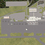
Decent representation of Slovenian airport named after Jozef Pucnik,
located near the village Spodnji Brnik, some 15 miles north of Slovenia's capital Ljubljana.
The scenery is packed with many features: custom landclass in the walley underlying the approach paths to both runways(12 and 30),
custom airport layout as found after last reconstruction of aprons and taxiways, corrected approaches (so IFR AI traffic in case of a missed approach to runway 30 is no longer turning right crashing into the 8000ft mountains just North of the airport). All airport buildings are placed into their correct
locations and shapes, even if only default generic buildings and library objects were used.
You will also notice airport has 3 runways(AFCAD on steroids),when there is actually
only one in reality and only one is also visible in the simulation.
This was done in order to enable different categories of AI aircraft using different intersections
for departure and the only way possible to recreate this was to use overlayed runways of different lenght.
There are also some surprises hidden in the scenery, but we will leave them for you to discover.
Music titles used in the scenery are published with kind permission of the author, Mr.Slavko Avsenik.
Released as freeware but with limited distribution.
LJLJ2012 by SST - Slovenia Scenery Team
| Filename: | LJLJ__Jozef_Puchnik_International_Airport__Ljublja.zip |
| License: | Freeware, limited distribution |
| Added: | 10th June 2012, 15:30:05 |
| Downloads: | 3,476 |
| Author: | SST - Slovenia Scenery Team |
| Size: | 11.35 MB |
| Category: Flight Simulator 2004 - Miscellaneous Files | |
| Tips and Tricks - Number 15 |
|
Images related to this file:
File Description:

Tips and Tricks - Number 15. In this issue there are several very useful Tips, which have been shared by our readers. Also included are the usual assortment of "How-To's", links to useful sites, and much, much more. In addition there is a "from the e-mailbag" department where we try to answer a question of general interest submitted by a reader. Two "Bonus" files, which you are sure to enjoy, have been added also. Updated indexes by John Burford in .xls (Excel) and .pdf formats for the entire series are included. As usual, I have attempted to include something of value for everyone, regardless of your experience level.
Compiled in .doc and .pdf formats for your flying enjoyment by David "Opa" Marshall.
| Filename: | Tips_and_Tricks__Number_15.zip |
| License: | Freeware |
| Added: | 8th November 2009, 20:07:21 |
| Downloads: | 7,221 |
| Author: | David "Opa" Marshall |
| Size: | 4.19 MB |
| Category: Flight Simulator 2004 - Scenery | |
| Northeast Philadelphia Airport |
|
File Description:
FS2004 Scenery-Northeast Philadelphia Airport (KPNE) serves Philadelphia and Philadelphia County and is owned by the City Of Philadelphia. The airport has more than one runway. The longest is a paved runway extending 7000 feet. The facility is at an elevation of 121 feet at a distance of about 10 miles from Philadelphia.Modular construction using FSDS2, Rwy12, Lago's FSE, Traffic Tools and AFCAD2. Both runways active.
| Filename: | Northeast_Philadelphia_Airport.zip |
| License: | Freeware |
| Added: | 20th November 2005, 07:12:58 |
| Downloads: | 1,484 |
| Author: | John B. Loney, Jr. |
| Size: | 2.27 MB |
| Category: Flight Simulator 2004 - Miscellaneous Files | |
| Tutorial: working with Textured Polygons in SBuilder |
|
File Description:
The third Tutorial using Sbuilder. This one looks at using Textured Polygons to create airport ground features. It uses the project file created in the first tutorial as the basis and replaces the land class runways and airfield with ones made using textured polys. I also cover flattens and a bit about creating slopes.
All feedback and suggestions much appreciated. Support available at www.scruffyduck.plus.com
| Filename: | Tutorial__working_with_Textured_Polygons_in_SBuild.zip |
| License: | Freeware, limited distribution |
| Added: | 12th December 2005, 22:34:46 |
| Downloads: | 1,860 |
| Author: | Jon Masterson |
| Size: | 1.42 MB |
| Category: Flight Simulator 2004 - Flight Plans | |
| FSPilot Tour of Army Air Corps Bases |
|
File Description:
This flightplan requires the freeware Autopilot/EFIS/Flight Planner software, FSPilot, available here at Avsim (fspilot_142.zip). Flight plan takes in the Army Air Corps bases of Middle Wallop, Netheravon and Upavon as well as the GA airfields at Thruxton and Old Sarum. Designed with Gary Summons' UK 2000 scenery in mind, it works with default scenery but most of the bases are runways only.
| Filename: | FSPilot_Tour_of_Army_Air_Corps_Bases.zip |
| License: | Freeware |
| Added: | 18th April 2006, 04:02:23 |
| Downloads: | 276 |
| Author: | John May |
| Size: | 201.13 KB |


© 2001-2026 AVSIM Online
All Rights Reserved
Privacy Policy |