
Where Flight Simulation Enthusiasts Gather from Around the World!
AVSIM Library - Search Results

| Category: Prepar3D V5 - AI Aircraft | |
| AI Aerolitoral AI Malcontent Embraer ERJ-145 Fleet Pack |

|
Images related to this file:
File Description:

Those are the textures of the predecesor of Aeromexico Connect airline called "Aerolitoral" with the Embraer ERJ-145, with the next registrations: HB-JAV, HB-JAX, XA-ALI, XA-BLI, XA-CLI, XA-DLI, XA-ELI, XA-FLI, XA-GLI, XA-HLI, XA-ILI (With Full White Colors Included), XA-JLI, XA-KLI, XA-LLI, XA-MLI (With Unititled Included), XA-NLI, XA-OLI, XA-PLI, XA-QLI, XA-RLI, XA-SLI, XA-TLI (With Unititled Included), XA-ULI, XA-VLI, XA-WLI, XA-XLI, XA-YLI, XA-ZLI.The airline was established in 1988 as Servicios Aéreos Litoral, to later become a subsidiary of Aeroméxico on December 1, 1990. It started with a fleet of 4 NAMC YS-11 aircraft in 1988 (XA-ROL, XA-ROV, XA-RPU, and XA-RRG) and was originally based in Veracruz.In November 2007, Aeroméxico announced that Aerolitoral was going to become Aeroméxico Connect once the Embraer EMB-190 arrived, and so it did. The airline changed its corporate name, image, and introduced a new philosophy of complementing Aeroméxico on some domestic and international flights, instead of only feeding the airline's hubs.The model is AI Malcontent (AIM) Embraer ERJ-145 Basepack. This is my website: https://el-mundo-de-los-aviones-ai-traffic.jimdosite.com. I hope you enjoy it!.
| Filename: | AI_Aerolitoral_AI_Malcontent_Embraer_ERJ145_Fleet_.zip |
| License: | Freeware |
| Added: | 27th June 2025, 13:04:15 |
| Downloads: | 21 |
| Author: | Jesus Gibran Soriano Solleiro |
| Size: | 207.37 MB |
| Category: Flight Simulator X - Aircraft Repaints, Textures and Modifications | |
| FSX/P3D TAI DC-3 1962 |
|
Images related to this file:
File Description:
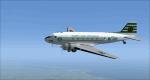
This is a repaint of the DC-3 in TAI (Transports Aeriens Intercontinentaux) colors. The freeware DC-3/C-47 v3 by Manfred Jahn is needed for this repaint. In 1946 the French government allowed the creation of some independent air carriers. On June 1 of that year TAI (Transports Aeriens Internationaux) was formed, and was based in Orly, France. Flights began on July 1, with a Junkers Ju-52. The following year they purchased 7 ex KLM DC-4s, along with 3 Bristol 170 freighters. In 1954 DC-6Bs started to replace the DC-4s. Their route network serviced mainly Africa, the Far East, the French Pacific territories, and Australasia. Prior to 1956 their network wa mainly in Africa, and Asia. On May 6, 1960, a partnership was formed with Air France, whereby TAI flew the South Pacific leg of the state carrier’s around the world service via New Caledonia and Tahiti. Later, on September 4 1960, TAI began a Douglas DC-8-32 service from Paris to Darwin via Athens, Teheran, Karachi, Bangkok, Phnom Penh, and Saigon, and on September 12, it inaugurated a route from Sydney to Los Angeles via Noumea, Nandi, Papeete, and Honolulu with the DC-8. On September 14 1961, TAI agreed, in principle, to a future merger with Union Aeromaritime de Transport (UAT). The two airlines integrated their schedules in 1962 and the amalgamation of TAI and UAT was completed on October 1, 1963, resulting in a new airline: UTA (Union de Transports Aeriens). This DC-3, F-BGXN, flew for TAI from 1956 to 1959. Textures are DXT5. This repaint was tested on FSX-SE and should work on FSX & P3D v1-3.
| Filename: | FSXP3D_TAI_DC3_1962.zip |
| License: | Freeware |
| Added: | 19th March 2019, 17:01:24 |
| Downloads: | 186 |
| Author: | Ted Giana |
| Size: | 8.29 MB |
| Category: Flight Simulator 2004 - Scenery | |
| Alaska South Slope 7; Kobuk OBU & Dahl Creek DCK |
|
Images related to this file:
File Description:
There are four main northwestern Alaska towns which are serviced by Alaska Airlines, and from which local flights spread out. The northernmost is Barrow. Southwest of Barrow is Kotzebue, then Nome, and the furthest south is Bethel (not yet made). This is a continuation of the series for the flights from Kotzebue, 170 miles to the east where Kobuk is on the bank of the Kobuk River, and Dahl Creek is 2 miles to the north. Kobuk is a small village on the Kobuk River, like Ambler and Shungnak, but with a population of only around 150. The river is the reason for the existance of the villages as it served (and still does) as both a source of food and a transport route. The airfield is just beside the village, with a runway around 4,500 feet of lit gravel and aligned 09-27, with PAPI on both ends. There are scheduled flights by Era (now renamed Ravn) and by Bering Air, both of them originating in Kotzebue and routing east to Ambler, Shungnak, Kobuk, and then back again. The AI includes these flights along with Everts Air and GA. The FS9 airfield has been relocated by approximately a mile to the correct position, and the elevation accordingly adjusted. The Dahl Creek strip is publicly owned, with no maintenance and a deteriorating gravel runway that has not long to survive. This probably does not work properly without Ultimate Terrain Alaska Canada as the village is now on the river bank. I am presuming that you have downloaded and installed Nome PAOM, along with the instructions on how to adjust Ultimate Terrain Alaska Canada to get the most realistic results. If you are not making the UT adjustments then you may be seeing duplicated roads, as I am including new local dirt or gravel roads to connect village to airfield etc to get the best overall result; I will not be making alternate versions.
| Filename: | Alaska_South_Slope_7_Kobuk_OBU__Dahl_Creek_DCK.zip |
| License: | Freeware, limited distribution |
| Added: | 13th October 2016, 18:10:08 |
| Downloads: | 233 |
| Author: | Roger Wensley |
| Size: | 2.94 MB |
© 2001-2026 AVSIM Online
All Rights Reserved
Privacy Policy |