
Where Flight Simulation Enthusiasts Gather from Around the World!
AVSIM Library - Search Results

| Category: Flight Simulator X - Scenery | |
| KDAW - Skyhaven Airport - Rochester, NH |

|
File Description:
By request, here is an improved version of the stock Skyhaven Airport. I adjusted and added aprons,roads and
taxiways to more closely match real life. I replaced many default buildings and added additional buildings.
I also added several buildings in the area, such as churches, barns, houses, a motel and water tower. I added
static vehicles, aircraft, lightpoles, fences and other filler objects.
This is an interesting airport and I owe thanks to Bob Folsom (Helldiver) for requesting it and for all the
pictures and information he sent me, and for testing and providing great feedback.
| Filename: | KDAW__Skyhaven_Airport__Rochester_NH.zip |
| License: | Freeware |
| Added: | 30th January 2009, 03:40:10 |
| Downloads: | 747 |
| Author: | Jim Cook |
| Size: | 8.48 KB |
| Category: Flight Simulator 2002 - Scenery Design | |
| LWMDraw4 |
|
File Description:
LWMDraw4 -- FS2002 Scenery Design
LWMDraw4 is developed to be an easy to use and helpful
time saving tool for placing free design shapes or photoreal
default type water areas such as lakes "with effects" onto
the FS2002 terrain surface generating a "ready to assemble"
LWMSource.asm file. Features include the addition of default
type FS2002 roads/lines/shorelines, Polygons, and LandClass
with the generation of a separate VTPSource.asm file as well.
Includes many additional features, a new tabbed interface,
and more options explained within the detailed Help menu
along with Quick Start Guide menu for fast placement.
Freeware by Ken Nelson
| Filename: | LWMDraw4.zip |
| License: | Freeware, limited distribution |
| Added: | 16th May 2010, 23:27:23 |
| Downloads: | 974 |
| Author: | Ken Nelson |
| Size: | 1.77 MB |
| Category: Flight Simulator X - Scenery | |
| Palmer USCG Helobase.zip |
|
Images related to this file:
File Description:
A fictitous USCG helo base located east of Palmer Municipal airport in Alaska. The scenery has a water runway, float plane dock, a repair area with a usable ramp up to a dry dock and repair hanger. Added two new bridges, two cargo docks, 9 helipads with one as a start point and many other additions to enhance your FS world. Test your skills as you fly in and taxi up to the ramp, then up to the dry dock without over shooting it and ending in the repair hanger. Lots of candies on the base for your flying pleasure. By savageagle......AW702_savag
| Filename: | Palmer_USCG_Helobasezip.zip |
| License: | Freeware |
| Added: | 26th May 2010, 03:35:08 |
| Downloads: | 602 |
| Author: | Tim Durham |
| Size: | 4.97 MB |
| Category: Flight Simulator 2004 - Aircraft Repaints, Textures and Modifications | |
| Vision Airlines Boeing 737-800 |
|
Images related to this file:
File Description:
Vision Airlines Boeing 737-800 w/ Winglets. repaint for the PMDG Boeing 737-800.
Vision Airlines, formerly Vision Air, is an airline headquartered in North Las Vegas, Nevada, United States. The airline operates flights for their tour business of the Grand Canyon, Marble Canyon, Hoover Dam, and Monument Valley out of North Las Vegas airport utilizing Dornier 228 and Dornier 328 aircraft. In addition, during the summer months, Vision Airlines transports white water rafters to various destinations along the Colorado River.
Vision Airlines also operates a charter division that utilizes Boeing 737, Boeing 767, Dornier 228 and Dornier 328 aircraft.
| Filename: | Vision_Airlines_Boeing_737800.zip |
| License: | Freeware |
| Added: | 3rd July 2010, 00:11:03 |
| Downloads: | 227 |
| Author: | Ernesto Alvarez |
| Size: | 8.46 MB |
| Category: Flight Simulator X - Scenery | |
| Katies Lagoon |
|
Images related to this file:
File Description:
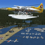
katies Lagoon is fictitous and located east of Kalispell on the north shore of Flathead Lake. it has a float plane dock, marinas, cabin rentals, a water runway and NDB with a frequency of 224.0 with a range of 55 nautical miles. Shows on GPS and has start points. Includes a landable helipad and many objects throughout the area. It's a lagoon, campground and ATV park. There will be a version 2 coming soon which will upgrade areas for RV's and ATV's. Read the text file and PLEASE enjoy! Designed with a clean install of FSX and to enhance your FSX world. Savageagle.
| Filename: | Katies_Lagoon.zip |
| License: | Freeware |
| Added: | 17th August 2010, 00:46:34 |
| Downloads: | 301 |
| Author: | Tim Durham |
| Size: | 705.42 KB |
| Category: Flight Simulator X - Scenery | |
| Tobago TTCPx Patch Ver. 1.2 ( Rev. 7 ) |
|
Images related to this file:
File Description:
Unofficial LatinVFR Tobago TTCP for FSX Expansion Pack. This freeware patch contents: a new photoreal scenery with seasons to local airport area ( day and night for winter/fall and summer/spring seasons ); a new land and water classification in the entire island of Tobago; a correction of the entire island terrain including a better flatten around the airport area; more buildings, objects, vegetation and life around on the island of Tobago ( FSX default fictitious objects ); more road traffic over the photoreal area; and other minor fixes. System Requirements: LatinVFR Tobago TTCP v1.1 for FSX and Microsoft Flight Simulator X SP2 or Acceleration.
| Filename: | Tobago__TTCPx_Patch_Ver_12__Rev_7_.zip |
| License: | Freeware |
| Added: | 19th August 2010, 22:54:02 |
| Downloads: | 843 |
| Author: | Gladson Moreira |
| Size: | 30.76 MB |
| Category: Flight Simulator 2004 - Scenery | |
| Forggensee, v2 part 2 |
|
Images related to this file:
File Description:
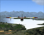
This AI-Package contains several pretty nice AI-Airplanes: Grumman-Albatross HU16,
Grumman-Goose G21, Dornier Do-24K, Junkers Ju-52 and a Bell-47G2 Helicopter on
floats , performing "Touch and Goes" on Water-Runway 21 as well as various beautiful
AI-Boats and two good looking female windsurfer cruising back and force at the lake.
All the attached outstanding AI-Objects have been created by well known designers
(see briefing below). My part was just to prepare them to work with the improved
Forggensee Scenery V2 Part 1.
There is some amazing traffic on the lake, have a look and have fun!
| Filename: | Forggensee_v2_part_2.zip |
| License: | Freeware |
| Added: | 14th April 2011, 02:26:52 |
| Downloads: | 868 |
| Author: | Klaus Jone |
| Size: | 11.12 MB |
| Category: Flight Simulator X - AFCAD Files | |
| Guntersville Municipal Airport 8A1 |
|
File Description:
Guntersville Municipal Airport 8A1, also known as Joe Starnes Field, is an airport located three miles northeast of Guntersville, Alabama. The scenery adds the new runway 7-25 and closes the old runway 3-21. It also adds the water runway 6W-24W, and the new tarmac with a small amount of hangers. The buildings are placed as close to real world locations as I could get using Google Earth. Only generic FSX objects were used for ease of distribution. The file has been tested with Ultimate terrain and MegaSceneryEarth Alabama can be edited with ADE
| Filename: | Guntersville_Municipal_Airport_8A1.zip |
| License: | Freeware |
| Added: | 6th July 2017, 18:32:00 |
| Downloads: | 91 |
| Author: | Brad Banister |
| Size: | 5.94 KB |
| Category: Prepar3D V1-4 - Scenery | |
| Como Italy N45°48'36.9 "E9°05'10.1" |
|
Images related to this file:
File Description:
Como Italy N45°48'36.9 "E9°05'10.1" This marvelous city is located on the southern end of the western branch of Lake Como, in a small basin surrounded by wooded hills about 40 km from Milan. The famous tourist resort has a water-jet operating with icao LILY from which it is possible to take off with a floatplane for a sightseeing tour on Lake Como to admire the beautiful lakefront villas. Important VFR point for approaching airport Milano Linate.
Within the downloaded package you will find readme files for scenery installation. Good fly VFR. Pasquale Marrulli.
| Filename: | Como_Italy_N4548369_E905101.zip |
| License: | Freeware |
| Added: | 16th December 2017, 17:25:36 |
| Downloads: | 348 |
| Author: | Pasquale Marrulli |
| Size: | 6.16 KB |
| Category: Flight Simulator 2004 - Scenery Design | |
| BFU_North Update |
|
File Description:
Update: This allows FS9 to list 'BFU_North' in the Go to Airport's list with its available starting points.
In addition to the above, this bgl adds local radio communications for BFU_North airspace (ATC) and the start/approach points for Rwy's 29 and 11, a water start, and several parking options. The pages of the GPS are also more complete with pertinent info.
You must have already installed "BFU North" by Naji Chehabeddine. filename: bfunorth.zip
BFU North is an original FS2002 scenery that is compatible with FS2004.
**This update is for FS2004 only. Do not use this update (AF2_BFUN.bgl) in FS2002.**
| Filename: | BFU_North_Update.zip |
| License: | Freeware, limited distribution |
| Added: | 21st March 2004, 22:45:02 |
| Downloads: | 797 |
| Author: | Brent Hricziscse |
| Size: | 2.23 KB |


© 2001-2026 AVSIM Online
All Rights Reserved
Privacy Policy |