
Where Flight Simulation Enthusiasts Gather from Around the World!
AVSIM Library - Search Results

| Category: Flight Simulator 2002 - Flight Plans | |
| Crater Lake Flight |

|
File Description:
You downloaded that beautiful Crater Lake National Park 10m scenery, then couldn't find the lake? This flight start will put you on the beach at the southern edge of the lake in the default C208 Caravan amphibian, ready to taxi into the water and take off. Should also work with the FS2002 default scenery, and probably FS2K.
| Filename: | Crater_Lake_Flight.zip |
| License: | Freeware |
| Added: | 7th July 2002, 00:55:46 |
| Downloads: | 652 |
| Author: | Mick Morrissey |
| Size: | 32.84 KB |
| Category: Flight Simulator 2002 - Scenery | |
| Gibraltar |
|
File Description:
Gibraltar is located in southern Spain although it is part of the United Kingdom. I added a more detailed rock of Gibraltar overlooking the Strait of Gibraltar. In this version 2, I adden more buildings and fixed the water surrounding the area. Designed useing photos and personal experiances. This scenery includes full night lighting. Created with FSSC.
| Filename: | Gibraltar.zip |
| License: | Freeware |
| Added: | 24th January 2004, 23:30:50 |
| Downloads: | 1,798 |
| Author: | Michael Magner |
| Size: | 491.91 KB |
| Category: Flight Simulator 2002 - Scenery | |
| Sion (LSGS) For Suisse 2002 |
|
File Description:
Sion (LSGS) is one of the fifth biggest international airport of Switzerland, with a concrete runway of 2 km (6500 ft) and a military area. The scenery (totaly new) includes photorealistic hangars (included new hangars of Heliswiss), seasonal and night texture, "les gouilles" - small lakes with animated water, surrounding city (Valeyres and Tourbillon), runway sings, AFCAD file, ground vehicles.
| Filename: | Sion_LSGS_For_Suisse_2002.zip |
| License: | Freeware |
| Added: | 5th January 2003, 15:06:12 |
| Downloads: | 3,994 |
| Author: | Daniel Gauthier |
| Size: | 4.03 MB |
| Category: Flight Simulator 2004 - Scenery Design | |
| Coast-Line-Maker V2.2 (FS2002/FS2004 compatible) |
|
File Description:
Utility for easy manipulation of FS2002/FS2004 roads and coastlines.
Features a graphic-oriented design screen, allowing easy placement of line segments; requires no user knowledge of programming or assembler files. Auto aligns line segments with land/water polygons and automatically generates VTP/LWM assembler files. This is an upgrade to COASTLM2.ZIP (required) and adds compatibility with FS2004.
| Filename: | CoastLineMaker_V22_FS2002FS2004_compatible.zip |
| License: | Freeware, limited distribution |
| Added: | 25th August 2003, 15:53:32 |
| Downloads: | 3,488 |
| Author: | Iain R. Murray |
| Size: | 106.97 KB |
| Category: Fly! II - TerraScene | |
| Marblehead Global Tile (Rendered) |
|
File Description:
This is a TerraScene 2.1 global tile for the area of the Marblehead Peninsula in Ohio, including all of global tile 197,160. This scenery includes Canadian coastal areas and islands (created from less detailed DCW data), and updated landmarks, water, and highways. DEX files to add Put in Bay and Kelleys Island airports are also included.
| Filename: | Marblehead_Global_Tile_Rendered.zip |
| License: | Freeware |
| Added: | 5th April 2003, 09:29:01 |
| Downloads: | 165 |
| Author: | Randall Rocke |
| Size: | 136.67 MB |
| Category: Flight Simulator 2004 - Scenery | |
| Paugan & Mercier Dams on the Gatineau River in Quebec Canada |
|
Images related to this file:
File Description:
This will not work without Ultimate Terrain, as the rivers and lakes just won't be there. The Paugan and Mercier Dams are on the Gatineau River in Quebec, north of Ottawa. Both of them are for power generation, rather than water conservation; the Paugan power generation building sits at the bottom of the sluiceway below the dam and appears far larger than the dam itself; there is a separate overflow sluice system nearby. The Paugan Dam is around 30 miles north up the river from Ottawa and the Mercier a further 70 miles. The Mercier holds back a huge and irregularly shaped volume of water known as the Reservoir Baskatong, with numerous branching arms and islands, and you will recognise where the dam must be long before you see it.
| Filename: | Paugan__Mercier_Dams_on_the_Gatineau_River_in_Queb.zip |
| License: | Freeware, limited distribution |
| Added: | 3rd May 2010, 00:11:21 |
| Downloads: | 273 |
| Author: | Roger Wensley |
| Size: | 421.81 KB |
| Category: Flight Simulator 2004 - Scenery | |
| Mackenzie River close to Tulita CZFN in Northwest Territories Canada |
|
Images related to this file:
File Description:
I discovered, while testing another airfield near the Mackenzie River, that along the side of the Mackenzie adjacent to Tulita, and for a considerable distance, there was a cliff of water. I have no idea if my version of Ultimate Terrain has developed a fault or if this has been caused by the installation of a terrain mesh that now argues with UT for some unknown reason. Whatever, it was impossible to leave it as it was. I have included a screenshot of the cliff further upstream. To avoid the cliff of water I have flattened that area of the Mackenzie River and the adjacent river banks and both the town and the airfield to a height above sea level of 400 feet. This does not reflect the real life situation but is the lesser of two optical evils. I have included a screenshot of the flattened area. If you do not have a problem then you do not need this. If you too have a cliff of water then you might want to try this. It does not completely get rid of the problem, but it does get rid of it in the area visible when landing or taking off at Tulita.
| Filename: | Mackenzie_River_close_to_Tulita_CZFN_in_Northwest_.zip |
| License: | Freeware, limited distribution |
| Added: | 1st August 2021, 22:27:01 |
| Downloads: | 75 |
| Author: | Roger Wensley |
| Size: | 573.48 KB |
| Category: Flight Simulator 2004 - Scenery | |
| "Sky King Flying Crown" Version 2 |
|
Images related to this file:
File Description:
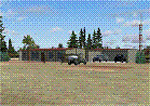
Updated version of Bill Lyon's Sky King FS2002 scenery.
| Filename: | Sky_King_Flying_Crown_Version_2.zip |
| License: | Freeware |
| Added: | 1st May 2010, 05:37:45 |
| Downloads: | 397 |
| Author: | Ed Moore and Paul Young |
| Size: | 3.57 MB |
| Category: Flight Simulator X - Scenery | |
| Old Rhinebeck Aerodrome |
|
Images related to this file:
File Description:
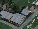
Old Rhinebeck Aerodrome Scenery FSX/P3D
This scenery package represents Old Rhinebeck Aerodrome, Rhinebeck NY as it existed August - September 2013. It faithfully represents all hangars, outbuildings and objects at the Aerodrome. It includes photo-real textures, an AI New Standard biplane in the pattern, vintage aircraft flight line, seasonal and night textures and a detailed manual of the settings an options that will provide the best performance.
| Filename: | Old_Rhinebeck_Aerodrome.zip |
| License: | Freeware |
| Added: | 3rd November 2013, 19:47:24 |
| Downloads: | 1,215 |
| Author: | Ed Wells, Golden Age Simulations |
| Size: | 370.76 MB |
| Category: Prepar3D V1-4 - Original Aircraft | |
| Sikorsky S-44 Flying Boat for FSX/P3Dv3&4 (FSX Native) |
|
File Description:
George Diemer's Sikorsky S-44 Flying Boat upgraded to FSX Native. (By Permission of the original author)
| Filename: | Sikorsky_S44_Flying_Boat_for_FSXP3Dv34_FSX_Native.zip |
| License: | Freeware |
| Added: | 17th June 2018, 15:54:26 |
| Downloads: | 201 |
| Author: | George Diemer and Ed Akridge |
| Size: | 103.08 MB |


© 2001-2026 AVSIM Online
All Rights Reserved
Privacy Policy |