
Where Flight Simulation Enthusiasts Gather from Around the World!
AVSIM Library - Search Results

| Category: Flight Simulator X - AFCAD Files | |
| Rudys Airport (25N), NJ |

|
File Description:
Located near Newfield, New Jersey, Rudys Airport is a privately-owned turf airstrip. Trees close to the runway on one end and water on the other can provide for a challenging approach. The turf strip is 2364x100 with a heading of 08/26. Trees are summertime ONLY.
Scenery constructed with use of satellite images/streetview, the author has not been there in person.
This scenery is meant to be used in conjunction with MegaScenery Earth New Jersey/Delaware 004. It is not required, but apron use is minimized to allow satellite scenery to show through as much as possible, and objects are placed based on the MSE textures - lack of it may make scenery look out of place.
| Filename: | Rudys_Airport_25N_NJ.zip |
| License: | Freeware |
| Added: | 22nd October 2010, 15:51:59 |
| Downloads: | 153 |
| Author: | Drew Sikora |
| Size: | 683.52 KB |
| Category: Flight Simulator 2004 - Scenery | |
| Surge Narrows CAG9 in British Columbia, Canada |
|
Images related to this file:
File Description:
Surge Narrows is a float base serving a small village on Read Island, one of the many islands squeezed between Vancouver Island and the mainland at this northern end. At this island passengers are delivered by amphibious Grumman Goose from Port Hardy, the main airport of the northern half of Vancouver Island with daily scheduled flights onward to and from Vancouver International. The AI was included with the post of Port Hardy. Regrettably, the amphibious Goose behaves as if it is on land and moves on the water with it's wheels extended; there is no way around this. This scenery is a modification of a post made some years ago that did nor support AI.
| Filename: | Surge_Narrows_CAG9_in_British_Columbia_Canada.zip |
| License: | Freeware, limited distribution |
| Added: | 28th November 2018, 22:43:57 |
| Downloads: | 104 |
| Author: | Roger Wensley |
| Size: | 931.04 KB |
| Category: Flight Simulator 2004 - Original Aircraft | |
| Noorduyn Norseman on Floats |
|
File Description:
The Noorduyn Norseman was built from 1935 until 1959. The have been used all over the world in both civil and military roles. The famous US Band Leader and composer Glen Miller disapeared in a Noresman over the English Channel durring WWII. They have been used primarily for bush planes on both wheels and floats. Most of them being used in Canada. The Noorduyn company continues to this day in Montreal building aircraft interiors. Made with FSDS 2.6. Includes custom panel bitmap by Ken Mitchel. Includes 3 paint schemes, Canadian, USAF and Bush Flying Unlimited. Full moving parts including Water rudders and opening doors. Features a fully funtional VC. Dynamics based on Fred Banting's DH Beaver.
| Filename: | Noorduyn_Norseman_on_Floats.zip |
| License: | Freeware, limited distribution |
| Added: | 7th October 2003, 17:36:24 |
| Downloads: | 7,982 |
| Author: | Brian Gladden |
| Size: | 2.17 MB |
| Category: Flight Simulator 2004 - Scenery | |
| Bush Flying Unlimited, Quebec |
|
File Description:
This scenery is located about 55 Nautical miles WNW of Quebec City on a nice lake. It has two gravel runways, a dock for floats, a main lodge and several small cabins. Also there is a barn with an old tractor to keep the grass mowed and the old Dodge Pickup to run errands in. A fuel tank is provided for fuel. There are lots of Gerrish's trees around too. An NDB is provided to help find the place. there is also a water runway with start locations. Runway 15-33 is 2000 feet long and 9-27 is 1800 feet long.
IMPORTANT NOTE!!! Requires Gerrish's Trees Library for FS2000/02/04 - Release 3/ trees_v3.zip... available at AVSIM.COM
| Filename: | Bush_Flying_Unlimited_Quebec.zip |
| License: | Freeware, limited distribution |
| Added: | 17th July 2004, 23:38:21 |
| Downloads: | 4,488 |
| Author: | Brian Gladden, Joe Binka |
| Size: | 3.49 MB |
| Category: Flight Simulator 2004 - Scenery Design | |
| Update of Turbigo's Power Station - VFR LIMC Malpensa, Italy |
|
Images related to this file:
File Description:
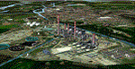
This scenery has been revised with complete new ground that solves the previous flickering problems; some objects, buildings and trees have been added. It DOES NOT INCLUDE any airport. Scenery requests Tree_v3 library; a special re-mesh file has been included, for users of special meshes (i/e Ragot Alps or Lod11)
Infos: the Turbigo's power station is placed approx 8 miles South LIMC Malpensa international airport of Milan, on the usual approach way for runways 35L and 35R.
content: new complete image of the ground; power station blocks 1, 2 & 3 with related 4 stacks with lights & smokes; boilers, esp, some ductworks & pipes, oil tanks, water treatment basins, bridges, some buildings and trees
| Filename: | Update_of_Turbigos_Power_Station__VFR_LIMC_Malpensa_Italy.zip |
| License: | Freeware |
| Added: | 25th September 2011, 14:39:16 |
| Downloads: | 1,801 |
| Author: | Aldo Della Vedova & Daniele Lanfranchi |
| Size: | 3.05 MB |
| Category: Flight Simulator 2004 - Scenery | |
| Europe SRTM mesh part 05: Poland |
|
File Description:
Europe SRTM LOD9 mesh part 5 of 13: Covers all parts of Poland north of 50'N. This Europe SRTM project was optimized for the lowest HDD space use: Each part matching exactly the boundaries of its neighbors, you'll have a complete coverage of Europe without gap or overlapping scenery.
Based on SRTM Data v1 and v2 (3 arcsec, 90m) and sampled to LOD9 resolution (90m). Each SRTM tile was carefully checked and repaired with Blackart v4.02: water areas are now flattened (lighter mesh), and SRTM voids were treated taking advantage of Blackart's sophisticated interpolation algorithm. When required, biggest voids were patched with oversampled SRTM 30 arcsec data and/or manual input.
| Filename: | Europe_SRTM_mesh_part_05_Poland.zip |
| License: | Freeware, limited distribution |
| Added: | 23rd December 2009, 10:34:50 |
| Downloads: | 17,176 |
| Author: | Yohann Baptiste |
| Size: | 35.01 MB |
| Category: Flight Simulator 2004 - Scenery | |
| Europe SRTM mesh Part 11: Southern Italy |
|
File Description:
Europe SRTM LOD9 mesh part 11 of 13: Covers southern Italy, Sardinia, Corsica and parts of Croatia and Bosnia.
This Europe SRTM project was optimized for the lowest HDD space use: Each part macthing exactly the boundaries of its neighbors, you'll have a complete corevage of Europe without gap or overlapping scenery. Based on SRTM Data v1 and v2 (3 arcsec, 90m) and sampled to LOD9 resolution (76m). Each SRTM tile was carefully checked and repaired with Blackart v4.02: water areas are now flattened (lighter mesh), and SRTM voids were treated taking advantage of Blackart's sophisticated interpolation algorithm. When required, biggest voids were patched with oversampled SRTM 30 arcsec data and/or manual input.
| Filename: | Europe_SRTM_mesh_Part_11_Southern_Italy.zip |
| License: | Freeware, limited distribution |
| Added: | 20th October 2005, 11:17:43 |
| Downloads: | 14,242 |
| Author: | Yohann Baptiste |
| Size: | 27.86 MB |
| Category: Flight Simulator 2004 - Scenery | |
| Ketchikan PAKT in southern Alaska plus float planes 5KE and the town |
|
Images related to this file:
File Description:
This is Ketchikan PAKT in southern Alaska, 45 miles north of the Canadian border and 220 miles south of Juneau. It is the closest major Alaskan airport to the lower 48 and most flights from or to Seattle pass through Ketchikan en route. The airport is on the southern side of the stretch of water known as The Narrows and the town is on the northern side, with ferries connecting the two. The town side was somewhat modified as part of one of the three Misty Fjords sceneries, so there were already some marinas and docked cruise liners etc before I started this. In addition, Ketchikan Airport had been partly made way back in 2006, and further modified in 2007; I say "partly" as there is in fact no way to accurately make PAKT within the limitations of FS9 as there is a 50 or 60 feet difference in elevation between runway and apron, and the taxiways are actually ramps up from the apron to the ends of the runway. This has a knock-on effect on the float plane and ferry docks on the water below the airport. I can see why the Misty Fjord sceneries avoided it. This scenery retains the original buildings from the Alan Wright scenery. It also includes the modification made by John Hinson, who created the second taxiway to the western end of the runway; FS9 had not included this as the original airport started operations with only one taxiway in place. There are new vehicles on the apron (fuel etc), new apron markings and some parking modifications to enable AI with Boing 737, DC6, Beechcraft 1900, and GA, plus runway and taxiway signage, windsocks, some car parking, freight items, etc. There is a road and covered bridges down to the docks and ferry, and the town side of the water has been modelled to include other float plane docks along with waterfront buildings, including the ship repair facility with it's dry dock (actually a floating dock that lifts ships out of the water) and the Alaskan Ferry Terminal wharf etc. The ferry forms a part of the AI, generously permitted by FSAddon and originally a part of the payware Tongass Fjords package, as are the AI aircraft also included here. There are new waterside buildings that stretch from the ship repair yard, past the shopping plaza and onward to the stationary cruise liners (that were part of the Tongass payware scenery) including float docks for the float plane companies that are based in Ketchikan, plus a new AI liner. The AI is a further adaptation of the already posted CF36 AI and PAKN AI, as listed in the AI folder. Due to the surrounding hills there may be some interference with AI float aircraft, depending on the wind direction, though I have watched succesful Beaver landings with the wind from the east. The combined AI for float planes creates a float plane take off or landing at, on average, 20 minute intervals; this is still well short of the actual busy summertime period.
| Filename: | Ketchikan_PAKT_in_southern_Alaska_plus_float_plane.zip |
| License: | Freeware, limited distribution |
| Added: | 12th February 2017, 23:27:59 |
| Downloads: | 1,243 |
| Author: | Roger Wensley |
| Size: | 47.11 MB |
| Category: Flight Simulator 2004 - Scenery | |
| VGCB Cox's Bazar, Bangladesh |
|
File Description:
Googly scenery for VGCB Cox's Bazar, Bangladesh, a small domestic airport
serving the fishing town of the same name in the Bay of Bengal, to the
south of Chittagong. It boasts extensive sandy beaches which has allowed
tourism development. The unusual name comes from Captain Hiram Cox of the
British East India Company who was appointed Superintendent of the outpost
in the late 1700s. The airport, which was originally a Pakistan Air Force
base, sees domestic flights (mostly to/from Dhaka) operated by Hawker
Siddeley 748s, de Havilland Dash 8s and Fokker Fellowship aircraft of Biman
Bangladesh Airlines, GMG Airlines, United Airways and Zoom Airlines.
Flight Simulator 2004 has made no provision for traffic with only a runway
provided and this scenery seeks to redress the situation.
The scenery does not purport to be ultra-accurate. Based on high quality
satellite imagery from Google Earth, the layout is proportionally correct but the
added airport features, such as buildings, are built from default Microsoft objects
and add-on libraries so will not look exactly like the real thing.
You are not obliged to download and install any additional scenery libraries,
but to enjoy this scenery in its entirety, you may wish to. It will work fine,
with or without.
| Filename: | VGCB_Coxs_Bazar_Bangladesh.zip |
| License: | Freeware |
| Added: | 14th April 2008, 21:13:08 |
| Downloads: | 1,354 |
| Author: | John Hinson |
| Size: | 67.71 KB |
| Category: Flight Simulator 2004 - Aircraft Repaints, Textures and Modifications | |
| Vought F4U-1A Corsair "Planes of Fame" |
|
File Description:
This is a repaint only for the Aeroplane Heaven Early Corsair and Megapack releases. This repaint depicts Vought F4U-1A Corsair Bu #17799 owned and operated by the Planes of Fame Museum, Chino, CA. This aircraft is actually the oldest Corsair currently flying. While it is known that this aircraft went to the Pacific, its combat assignment and record is not known. Based on its serial number, which places it right between several Black Sheep Squadron Corsairs, there is a chance it was part of the historic group. It was owned by MGM between 1960 and 1970, being used as a movie prop. Ed Maloney purchased the aircraft in 1970 and it has been with the Planes of Fame Museum ever since. The aircraft was also one of several Corsairs that were used in the TV series "Baa Baa Black Sheep." Its current paint scheme is that of what would have been a very rare paint scheme on a Corsair during WWII. Because the actual airplane is fitted with a D model canopy this repaint is meant to be installed into the D model folder though shows up under the F4U-1A designation.
| Filename: | Vought_F4U1A_Corsair_Planes_of_Fame.zip |
| License: | Freeware |
| Added: | 20th July 2007, 14:02:36 |
| Downloads: | 374 |
| Author: | John Terrell |
| Size: | 3.35 MB |


© 2001-2026 AVSIM Online
All Rights Reserved
Privacy Policy |