
Where Flight Simulation Enthusiasts Gather from Around the World!
AVSIM Library - Search Results

| Category: Flight Simulator 2004 - Miscellaneous Files | |
| Nick's Prop Dust with Control Gauges |

|
File Description:
Prop aircraft users are in for a real treat. This gauge/effects package automatically senses the terrain the aircraft is in contact with or flying over and changes the dust and water effects for the aircrafts prop/rotor wash based on dirt, dry mud or clay, snow, rain, water, ice, sand, gravel and short grass. In addition the real time surface conditions are also sensed. In example, a dry asphalt or concrete runway will produce no dust, however, the same runway with snow conditions present will automatically produce a throttle controlled snow blowing effect. The 25 included effects files and 5 gauges have been tuned to reflect a realistic representation of the dust/mist produced by different types of aircraft taking off or touching down on different terrains and surface conditions. The effects are properly influenced by cross wind conditions and reverse pitch is also supported. Effects files and gauges are included for large and small, single engine, multi-engine, amphibians, helicopters and massive scale military and commercial transports. It requires editing/adding lines in the aircraft.cfg and panel.cfg files. The README files include very complete and comprehensive instructions including a quick and easy copy/paste file for all the Microsoft prop aircraft and tutorial on making custom gauges from the ones provided.
By Nick Needham
| Filename: | Nicks_Prop_Dust_with_Control_Gauges.zip |
| License: | Freeware |
| Added: | 8th December 2003, 17:07:07 |
| Downloads: | 7,298 |
| Author: | Nick Needham |
| Size: | 1.22 MB |
| Category: Flight Simulator X - Helicopters | |
| Fire Rescue Boeing CH-47D Chinook |
|
File Description:
This is a repaint of the Boeing CH-47D Chinook helicopter in U.S. Forest Service Fire Rescue livery N10HE. These are textures only and require the original model (available by downloading either the Hellenic Army Aviation or U.S. Armed Forces Chinook). In the U.S. Forest Service, the Chinook is often called upon for firefighting duties. These include transporting and para-dropping firefighters and equipment as well as using a large bucket to drop water directly onto forest fires. The Chinook is also used in search and rescue operations. Special thanks to Delizisis Thanasis and Delizisis Panagiots for their original textures used as paint templates.
| Filename: | Fire_Rescue_Boeing_CH47D_Chinook.zip |
| License: | Freeware, limited distribution |
| Added: | 24th January 2007, 15:50:28 |
| Downloads: | 2,925 |
| Author: | Mike Lanza |
| Size: | 1.17 MB |
| Category: Flight Simulator 2004 - Scenery Design | |
| EZ-Object Library Part 2 - Fast Food resturants |
|
File Description:
FS2004 FlightLevel390 EZ-Object Library part2
Contains a mixture of 4 low polygon Fast Food Resturants with seperate signage.Dominos Pizza,Sonic,Waffle House & Pizza Hut.
DXT3 day textures with night lighting.Optimized for good FPS.
These objects can be used in your own freeware scenery enhancements and will also be needed for FL390's upcoming KBTRv2 Scenery release.
A seperate 3rd part containing Inland River barges,and a few other goodies will follow this upload soon.Part 3 will also be needed for our KBTRv2 Scenery and Galveston Bay/Houston Ship Channel Water Scenery as part 3 will contain the barges and other objects that will be needed.
Not tested in FS X.
| Filename: | EZObject_Library_Part_2__Fast_Food_resturants.zip |
| License: | Freeware |
| Added: | 24th May 2007, 03:20:43 |
| Downloads: | 1,827 |
| Author: | FlightLevel390/Joe DeGregorio |
| Size: | 3.58 MB |
| Category: Flight Simulator X - Scenery | |
| Hawaii - Niihau |
|
Images related to this file:
File Description:
Niihau, the westernmost of the inhabited Hawaiian Islands, is privately owned and used primarily to raise cattle. It's small population works the ranch. Because it is so isolated, it is the last of the Hawaiian Islands where Hawaiian is the primary language.
Niihau has no airport of its own. You get there by taking off from Kauai and flying west. I'd recommend using Port Allen (PAK). Unless visibility is limited, you can see Niihau across the water from the airport. Just take off and fly a heading of 270 degrees. However, a saved flight which places you just off Niihau's shore is included in the package should you need it.
| Filename: | Hawaii__Niihau.zip |
| License: | Freeware |
| Added: | 15th December 2009, 23:19:34 |
| Downloads: | 2,526 |
| Author: | Richard Sorochak |
| Size: | 36.49 MB |
| Category: Flight Simulator X - Scenery | |
| Grand Forks Int'l Airport v1.1 |
|
Images related to this file:
File Description:
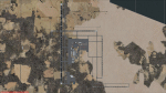
This scenery addon updates Grand Forks International Airport (KGFK) for FSX only. This is an updated version of the original scenery addon KGFK10 that contained the newly constructed runway. This update includes several bug fixes, such as removal of duplicate taxiway signs and other objects. It also includes updated local scenery to more closely match the actual airport. Local bodies of water used as visual checkpoints have also been added. All instrument approaches have been updated for currency, to include correct waypoint names and procedures. Several missing instrument approaches have also been added. The airport was updated using Airport Design Editor. By Raymond Mills.
| Filename: | Grand_Forks_Intl_Airport_v11.zip |
| License: | Freeware |
| Added: | 20th October 2010, 22:34:31 |
| Downloads: | 996 |
| Author: | Raymond Mills |
| Size: | 15.85 KB |
| Category: Flight Simulator X - Scenery | |
| The Dry Tortugas Photo Scenery |
|
Images related to this file:
File Description:
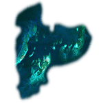
Where are the Dry Tortugas? Should you be wondering, at the western end of the Florida Keys. Located 68 miles west of Key West, they are accessible only by boat and of course via your favorite seaplane.
Source Data: National Agriculture Imagery Program (NAIP) Orthoimagery, 1 meter per pixel resolution. The scenery package also corrects the MS-FSX Island and Lighthouse position errors overlooked by UTX-USA and UTX-TAC.
For your finest virtual experience it is highly recommended you download, install and use with: South Florida and The Bahamas Water Class scenery. (S-FL_Bahamas_WC.zip)
Enjoy your flight and don't forget your Scuba Gear or the sunscreen! - Wally-Bob
| Filename: | The_Dry_Tortugas_Photo_Scenery.zip |
| License: | Freeware, limited distribution |
| Added: | 23rd August 2014, 11:08:17 |
| Downloads: | 918 |
| Author: | Walter Roberts |
| Size: | 50.9 MB |
| Category: Flight Simulator 2004 - Scenery | |
| Pitcairn Islands - Complete Scenery |
|
File Description:
This project is a complete & much more accurate scenery rendition of the Pitcairn Islands archipelago than the default scenery in FS2004.
The scenery includes all 4 islands redesigned, with detailed coastlines, Landclass with the only settlement, Adamstown represented, and accurate Waterclass representing the shallow reef banks bright colors.
A fictional AFCAD for each island was also made, with all 4 having a water landing area either along the coast or inside the lagoons. Ducie Island has a small sand strip as well.
Some scenery objects were added, mostly on Pitcairn Island, to recreate both the island's jetty & the Old Radio/Weather station.
Enjoy everyone!
| Filename: | Pitcairn_Islands__Complete_Scenery.zip |
| License: | Freeware, limited distribution |
| Added: | 5th August 2019, 06:36:31 |
| Downloads: | 285 |
| Author: | Leonardo Santos |
| Size: | 12.15 MB |
| Category: Flight Simulator X - Scenery | |
| Aerodromo de Tela - MHTE |
|
Images related to this file:
File Description:
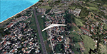
Tela Airport (Spanish: Aeropuerto de Tela) (IATA: TEA, ICAO: MHTE) is an airport serving Tela, a town in the Atlántida Department on the northern coast of Honduras. In 2009, plans were laid to lengthen the runway from 1,346 metres (4,416 ft) to 1,600 metres (5,200 ft) and possibly to construct a new terminal building. There are hills southeast of the runway. Northeast approach and departure are over the water. The La Mesa VOR-DME (Ident: LMS) is located 31.0 nautical miles (57.4 km) southwest of the airport. The Bonito VOR-DME (Ident: BTO)is located 35.4 nautical miles (65.6 km) east of the airport.
| Filename: | Aerodromo_de_Tela__MHTE.zip |
| License: | Freeware |
| Added: | 25th January 2021, 02:29:26 |
| Downloads: | 210 |
| Author: | Luis Flores |
| Size: | 87.71 MB |
| Category: Flight Simulator 2004 - Scenery Design | |
| Bird Collection, a Rwy12 Object Placer Library |
|
File Description:
For users of Rwy12 Object Placer only. The 5 static birds, in
20 different shapes and formations, are all done in 3D with
gmax and in a low polygon count for frame rate efficiency.
The idea to make the static birds came from the "AI Canada
Geese" by Joe Binka (many thanks to him), but contrary to his
V formation that moves as AI traffic, the static birds
give you a sense of movement by flying by at low speed. The
birds are crash sensitive, so don't try to hunt them with your
aircraft. Some of the birds can be placed on the ground or water
and others in the air.
| Filename: | Bird_Collection_a_Rwy12_Object_Placer_Library.zip |
| License: | Freeware |
| Added: | 31st January 2005, 14:25:29 |
| Downloads: | 7,467 |
| Author: | Seev Kahn |
| Size: | 1.56 MB |
| Category: Flight Simulator 2002 - Scenery Design | |
| Fuel Barge |
|
File Description:
Fuel Barge. This is actually inspired from an Email I got from Curt Jardey who described this barge and well I hope it is somewhat close anyway ;-). It's a fuel Island of sorts that sits out in the water a bit so you can pull up from all directions to fuel. There is an Avgas and Jp fuel pump with retractable hose's at opposite ends of the barge. It lights at night. Curt kind of figured it was fed thru an underground line for the fuel and electricity. He has actually seen these fuel barges before. Hey, See what you can do with it!
| Filename: | Fuel_Barge.zip |
| License: | Freeware |
| Added: | 3rd December 2002, 01:38:34 |
| Downloads: | 465 |
| Author: | Frank Betts |
| Size: | 218.21 KB |


© 2001-2026 AVSIM Online
All Rights Reserved
Privacy Policy |