
Where Flight Simulation Enthusiasts Gather from Around the World!
AVSIM Library - Search Results

| Category: Navigation and ATC - Navigation | |
| Papua New Guinea charts for FSMMM |

|
Images related to this file:
File Description:
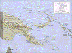
Re-upload. What these are: calibration files for use with Rana Hossain's freeware program FSM Moving Map (FSMMM) and the PNG Charts hosted by the AVSIM file library. What these are not: the charts themselves. In order to use the charts, you will need to download three additional files, which are much larger than this one: png_charts_1.zip (35mb), png_charts_2.zip (35mb), and png_charts_3.zip (36mb). Why not package everything together? To minimize file size. The original image files, which are quite large, were uploaded to AVSIM and calibrated for the payware program FSMap by David Wilson-Okamura. Within a few days, downloaders started asking how to use the charts with the freeware program FSMMM. New charts (which are quite large to store and download) weren't needed, just new calibration files (which are quite small). These were created by TERRY CARR, who is the hero of this download. To use the charts with FSMMM, first download all four of the files listed here, including this one. You don't need to download FSMMM again if you already have that installed.) Unzip all of them into the folder where you keep your FSMMM charts. Then run FSMMM and use the mass import feature. If you don't know how to do that, please read the manual or, if that doesn't help, Google is your friend.
| Filename: | png_charts_fsmmm.zip |
| License: | Freeware |
| Added: | 5th June 2010, 05:21:06 |
| Downloads: | 539 |
| Author: | Terry Carr, David Wilson-Okamura |
| Size: | 12 KB |
| Category: Flight Simulator 2004 - Miscellaneous Files | |
| Enroute Charts Manual-Greek Language v1 |
|
File Description:
This is a continuation of the Charts reading manual(ID80103). This is a manual written to help the new flightsimmers on the subject: How to read the enroute charts(low and high) IN GREEK LANGUAGE. It contains examples and photos from the DAFIF charts but the standards are the same, so it can be used to read an enroute chart made by several companies. Safe landings.
| Filename: | enroute_manual.zip |
| License: | Freeware, limited distribution |
| Added: | 18th May 2006, 21:40:51 |
| Downloads: | 552 |
| Author: | Nannos Evagelos |
| Size: | 2.42 MB |
| Category: Flight Simulator 2004 - Miscellaneous Files | |
| Holger's Glacier Bay Instrument Approach Charts |
|
File Description:
This is a collection of instrument approach plates for the area encompassed by Holger Sandman's outstanding Glacier Bay scenery (available here at Avsim.com as freeware) located in the northern third of southeast Alaska. These IAPs serve communities where no previous instrument approach existed, utilizing either GPS or NDB as the primary navaid.
| Filename: | glacier_bay_iaps.zip |
| License: | Freeware |
| Added: | 9th April 2007, 10:35:14 |
| Downloads: | 1,978 |
| Author: | Brian Nuss |
| Size: | 1.89 MB |
| Category: Flight Simulator 2002 - Miscellaneous Files | |
| Anchorage South and Seaward Sectional Charts |
|
File Description:
The northern coast of the Gulf of Alaska is a paradise for Bush pilots. You´ll find many small interesting airstrips and exciting glacier formations up here, especially when you use some third party mesh and landclass files. While it can be used "as is" without any other software, it will develop its full potential if used as moving map with SimSystem´s FSFlightMax or FSGarmin. It wouldn´t have been possible without Richard Harvey and his love to flightsimming, so please consider this file to be "donationware" and make a however small contribution to the Richard Harvey Endowed Scholarship.
| Filename: | Anchorage_South_and_Seaward_Sectional_Charts.zip |
| License: | Check within download |
| Added: | 24th March 2003, 02:02:27 |
| Downloads: | 2,483 |
| Author: | Uwe Rademacher |
| Size: | 19.79 MB |
| Category: Flight Simulator 2004 - Miscellaneous Files | |
| Israel Charts Kneeboard - Update 1/10 |
|
File Description:
Kneeboard maps for all major air ports & fields in Israel, CVFR maps, ATS routes & important frequencies. Based on the kneeboard by Ran Finkels. Updated to AIP 01/10 8th April 2010.Based on Kneeboard keys replacement with Israel CVFR maps (Download #46824)
| Filename: | Israel_Charts_Kneeboard__Update_110.zip |
| License: | Freeware |
| Added: | 17th April 2010, 19:39:52 |
| Downloads: | 213 |
| Author: | Liaz Kamper |
| Size: | 23.4 MB |
| Category: Flight Simulator 2002 - Miscellaneous Files | |
| Terrain Maps of the 50 States for Use with FSFlightMax as WAC Charts |
|
File Description:
Terrain maps of the 50 states for use with FSFlightMax as WAC charts.
Unzip the charts you want to use to your FlightMax\Data folder.
| Filename: | Terrain_Maps_of_the_50_States_for_Use_with_FSFligh.zip |
| License: | Freeware |
| Added: | 4th February 2005, 15:39:00 |
| Downloads: | 1,019 |
| Author: | Bob Schantz |
| Size: | 5.48 MB |
| Category: Flight Simulator 2004 - Aircraft Repaints, Textures and Modifications | |
| Embraer Speed Charts (ERJ135, ERJ145, E170, E190) |
|
File Description:
Colletion of speed chart for the Embraer's ERJ135, ERJ145, E170 and E190, so that you can correctly set up their FMS.
| Filename: | emb_135_145_170_190_-_speed_charts.zip |
| License: | Freeware |
| Added: | 10th December 2009, 15:17:33 |
| Downloads: | 5,420 |
| Author: | Rui Mesquita |
| Size: | 169 KB |
| Category: Flight Simulator 2004 - Utilities | |
| Italian Airport Charts and Procedures Series 1 |
|
File Description:
These files are to use with THE NEW CHARTMAP program.
Please before, download THE NEW CHARTMAP program (the_new_chartmap.zip) and after this zip file. After download this zip file (SERIES 1), unzip all inside the AIRPORTS FOLDER of the NEW CHARTMAP PROGRAM.
| Filename: | italian_airports_charts_and_procedures_series_1.zip |
| License: | Freeware |
| Added: | 30th January 2010, 09:43:12 |
| Downloads: | 1,796 |
| Author: | Carlo Chiappisi |
| Size: | 92.94 MB |
| Category: Flight Simulator 2004 - Utilities | |
| Italian Airport Charts and Procedures Series 3 |
|
File Description:
These files are to use with THE NEW CHARTMAP program. Please, before download THE NEW CHARTMAP program (the_new_chartmap.zip) and after this zip file. After download this zip file, unzip all inside the AIRPORTS FOLDER of the NEW CHARTMAP PROGRAM. NOT FOR USE IN REAL AVIATION
| Filename: | italian_airports_charts_and_procedures_series_3.zip |
| License: | Freeware |
| Added: | 31st January 2010, 21:35:00 |
| Downloads: | 2,120 |
| Author: | Carlo Chiappisi |
| Size: | 87.97 MB |
| Category: Flight Simulator X - Miscellaneous Files | |
| FS2Crew 2010 PMDG 747 Flow & Checklist Charts |
|
File Description:
This documents contain flows for the PMDG 747 with FS2Crew Voice Commander Edition.
Included are FlowCharts (Normal & Abnormal), Checklists, Example Briefings and the Open Office Source Files (When you make changes to the documents)
The documents include Actions, ATC, Checklists and Phrases used for voice communication with FS2Crew.
It's intended to be a help and reference when using this software.
The color code:
BLACK = Actions
GREEN = ATC
RED = Phrases used for Fs2Crew
BLUE = PMDG Checklist
There are two Versions Available for print:
A4
A5
In the Open Office Source Files Folder you find the RAW Open Office files. Feel free to edit it.
Its Open Source. Edit it. Publish a new version. Sell it. Do what you want.
Documents are based on:
- FS2Crew Manual
- PMDG Flow Manual
- PMDG Checklists;
Let me know if you find any mistakes or errors, or maybe you have some suggestions.
| Filename: | 747_fs2crew.zip |
| License: | Freeware |
| Added: | 10th May 2011, 03:57:15 |
| Downloads: | 1,842 |
| Author: | Christian Braun |
| Size: | 3.11 MB |
© 2001-2025 AVSIM Online
All Rights Reserved