
Where Flight Simulation Enthusiasts Gather from Around the World!
AVSIM Library - Search Results

| Category: Flight Simulator 2004 - Aircraft Repaints, Textures and Modifications | |
| SAHSA Boeing 737-200 (HR-SHO) |

|
Images related to this file:
File Description:
These are textures only for the Boeing 737-200 by Erick Cantu in the 1991 SAHSA livery. You need the original model installed in order to use these textures. SAHSA was the international airline of Honduras from 1945 tru 1994. It served several destinations in North, Central and South America from its hub in Tegucigalpa, Honduras. This particular repaint is representing the Boeing 737-2A3 registered as HR-SHO. SAHSA served the cities of Tegucigalpa, San Pedro Sula, Roatan, and La Ceiba in Honduras; and the international destinations were Miami, Houston, New Orleans, Belize, Guatemala, San Salvador, Managua, San Jose, Panama, San Andres (Colombia), and Grand Cayman. You need the original 737-200 model by Erik Cantu prior to install (found here at AVSIM)
| Filename: | SAHSA_Boeing_737200_HRSHO.zip |
| License: | Freeware |
| Added: | 3rd January 2012, 03:29:08 |
| Downloads: | 155 |
| Author: | Oscar Elvir Vasquez, Kittyhawk Studios |
| Size: | 1021.72 KB |
| Category: Flight Simulator 2004 - Aircraft Repaints, Textures and Modifications | |
| TAN Honduras Boeing 737-200 (HR-TNR) |
|
Images related to this file:
File Description:
This work is dedicated to all the people who flew with TAN, and for all of us that would like to see the five stars flying again to and from Honduras. TAN was the international airline of Honduras since 1948 thru 1990 when it merged with SAHSA. It served several destinations in North and Central America from its hub in Toncontin International Airport in Tegucigalpa, Honduras. HR-TNR was the first Boeing 737 to come to Honduras in June 1974, accuired from PLUNA Uruguay. It flew as HR-TNR until 1991, where he was re-registered as HR-SHO with SAHSA. It was sold in 1996 to WestJet, Canada as C-GWJO.These are just textures for Erick Cantu's model. This model is fully hand painted.
| Filename: | TAN_Honduras_Boeing_737200_HRTNR.zip |
| License: | Freeware |
| Added: | 5th January 2012, 16:52:07 |
| Downloads: | 108 |
| Author: | Oscar Elvir Vasquez, Kittyhawk Studios |
| Size: | 1.08 MB |
| Category: Flight Simulator X - Scenery | |
| The Thames Barrier - England |
|
Images related to this file:
File Description:
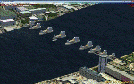
This scenery adds the Thames Barrier to Orbx EU England Regional scenery package. Compatible with both FSX & P3D. The Thames Barrier is the world's second-largest movable flood barrier (after the Oosterscheldekering in the Netherlands) and is located downstream of central London, United Kingdom. Its purpose is to prevent London from being flooded by exceptionally high tides and storm surges moving up from the sea. It needs to be raised (closed) only during high tide; at ebb tide it can be lowered to release the water that backs up behind it. Not tested with default FSX or any other setup. You must have Orbx EU England regional scenery to use the compiled scenery files as intended. By Bryan Wallis aka fltsimguy.
| Filename: | The_Thames_Barrier__England.zip |
| License: | Freeware, limited distribution |
| Added: | 27th January 2013, 01:08:30 |
| Downloads: | 1,341 |
| Author: | Bryan Wallis |
| Size: | 584.23 KB |
| Category: Flight Simulator X - Scenery | |
| KFRR - Front Royal-Warren County Airport - Front Royal - Virginia, USA |
|
Images related to this file:
File Description:
Front Royal-Warren County Airport (IATA: FRR[2], ICAO: KFRR, FAA LID: FRR) is a county owned, public use airport located three nautical miles (6 km) west of the central business district of Front Royal, a town in Warren County, Virginia, United States. It is included in the National Plan of Integrated Airport Systems for 2011-2015, which categorized it as a general aviation facility.
This is a complete re-work of the airport based on Google Maps. Created with Airport Design Editor by ScruffyDuck Software using current FAA documentation and Google Earth measurements, this package offers a replacement for FSX's stock airport. All these enhancements are as close to the real airport as I can get with stock library objects and custom buildings.
| Filename: | KFRR__Front_RoyalWarren_County_Airport__Front_Roya.zip |
| License: | Freeware |
| Added: | 1st October 2014, 14:01:40 |
| Downloads: | 369 |
| Author: | Wayne Roberts |
| Size: | 232.02 KB |
| Category: Flight Simulator 2004 - Aircraft Repaints, Textures and Modifications | |
| American Airlines "Allegheny" Airbus A319 |
|
Images related to this file:
File Description:

Allegheny Airlines was one of several airlines that make up present day American Airlines. Based in Pittsburgh, Allegheny (which also included Lake Central and Mohawk Airlines) changed its name to USAir in 1979 to gain a more national presence following deregulation. Piedmont and PSA were later integrated in the late 80s, and the name was changed to US Airways in 1997. During the America West merger in 2006, one aircraft (N745VJ) was painted in the 1970s Allegheny livery. The titles were changed to "American" with the merger in 2014. This is one of several Retro jets representing former carriers that make up present day American Airlines. Textures only for the great Project Airbus model; the base pack is available here on AVSIM: pa319_basepack_fs9_2014-09-08.zip. Enjoy!
| Filename: | American_Airlines_Allegheny_Airbus_A319.zip |
| License: | Freeware |
| Added: | 3rd November 2014, 03:20:02 |
| Downloads: | 956 |
| Author: | Joe Shimmel / Project Airbus |
| Size: | 7.11 MB |
| Category: Flight Simulator X - Scenery | |
| KLUA - Luray Caverns Airport - Luray, Virgina, USA |
|
Images related to this file:
File Description:
Luray Caverns Airport (ICAO: KLUA, FAA LID: LUA, formerly W45) is a public use airport located two nautical miles (4 km) west of the central business district of Luray, a town in Page County, Virginia, United States. The airport is owned by the Town of Luray and Page County.It is included in the National Plan of Integrated Airport Systems for 2011-2015, which categorized it as a general aviation airport.
Added taxiways and aircraft parkng along with custom buildings. Created with Airport Design Editor by ScruffyDuck Software using current FAA documentation and Google Earth measurements, this package offers a replacement for FSX's stock airport. All these enhancements are as close to the real airport as I can get with stock library objects and custom buildings.
| Filename: | KLUA__Luray_Caverns_Airport__Luray_Virgina_USA.zip |
| License: | Freeware |
| Added: | 29th November 2014, 14:11:35 |
| Downloads: | 315 |
| Author: | Wayne Roberts |
| Size: | 339.07 KB |
| Category: Flight Simulator X - Scenery | |
| IGT - Nightmute Airport - Alaska, USA |
|
Images related to this file:
File Description:
The airport islocated southeast of the central business district of the vellage of Nightmute.Nightmute is located on Nelson Island near Toksook Bay. The two villages connect by snowmachine trail in winter.
Runway 2/20 was changed to 3/21. Changed the length of Runway 3/21 from 50 feet wide and a legth of 1,600 feet to 75 feet wide and 3,200 feet long.Added Runway 11/29 along with custom models.Changes are based on construction plans dated 2005.
Created with Airport Design Editor by ScruffyDuck Software using current FAA documentation and Google Earth's measurements, this package offers a replacement for FSX's stock airport. All these enhancements are as close to the real airport as I can get with stock library objects and custom buildings.
| Filename: | IGT__Nightmute_Airport__Alaska_USA.zip |
| License: | Freeware |
| Added: | 3rd February 2015, 09:12:14 |
| Downloads: | 671 |
| Author: | Wayne Roberts |
| Size: | 197.17 KB |
| Category: Flight Simulator X - Scenery | |
| LGLS - Lousoi Airfield **Fictional** |
|
Images related to this file:
File Description:
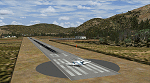
An imaginary airfield in north central Peloponnese Greece named after the elevated mountain plain where it would be situated. LGLS Lousoi airfield has a 1,000m runway at elevation of 3,186ft surrounded by mountains.
The aiport is equiped with NDB, ILS DME, PAPIs and night lighting for instrument approaches; approach chart included.
As bonus two imaginary helipads LGKK Kleitoria and LGPP Planitero are added in the nearby two villages.
All are infrastructure I wish they existed in the area since I drive there often for vacations in Planitero and always wondered how it would be if I could fly there. Planitero sits at the south footings of Chelmos mountain, the highest peak in the area. No AI traffic plans included.
| Filename: | LGLS__Lousoi_Airfield_Fictional.zip |
| License: | Freeware, limited distribution |
| Added: | 15th April 2015, 01:07:43 |
| Downloads: | 139 |
| Author: | Kyprianos Biris |
| Size: | 1.87 MB |
| Category: Flight Simulator 2004 - Scenery | |
| S98 - Vista Field - Washington, USA |
|
Images related to this file:
File Description:
FS9 Scenery - Vista Field (IATA: VSK, FAA LID: S98) was a public use airport located in Benton County, Washington, United States. The airport was located three nautical miles (6 km) northwest of the central business district of the City of Kennewick and was owned by the Port of Kennewick. It was also known as Vista Field Airport. Several shipping carriers operated out of the airport. There had been controversy in recent years over whether or not to continue to operate the airport or to shut it down, however it was officially closed on December 31, 2013. Vista Field is back, at least in FS9, with a hi-def runway by Donald Miller. For your flying pleasure by John B. Loney, Jr. and Donald Miller.
| Filename: | S98__Vista_Field__Washington_USA.zip |
| License: | Freeware, limited distribution |
| Added: | 19th September 2015, 21:33:58 |
| Downloads: | 235 |
| Author: | John B. Loney, Jr. |
| Size: | 20.53 MB |
| Category: Flight Simulator X - Scenery | |
| S98 - Vista Field - Washington, USA |
|
Images related to this file:
File Description:
FSX Scenery - Vista Field (IATA: VSK, FAA LID: S98) was a public use airport located in Benton County, Washington, United States. The airport was located three nautical miles (6 km) northwest of the central business district of the City of Kennewick and was owned by the Port of Kennewick. It was also known as Vista Field Airport. Several shipping carriers operated out of the airport. There had been controversy in recent years over whether or not to continue to operate the airport or to shut it down, however it was officially closed on December 31, 2013. Vista Field is back, at least in FS9, with a hi-def runway by Donald Miller. For your flying pleasure by John B. Loney, Jr. and Donald Miller.
| Filename: | S98__Vista_Field__Washington_USA.zip |
| License: | Freeware, limited distribution |
| Added: | 19th September 2015, 21:34:03 |
| Downloads: | 345 |
| Author: | John B. Loney, Jr. |
| Size: | 18.01 MB |


© 2001-2026 AVSIM Online
All Rights Reserved
Privacy Policy |