
Where Flight Simulation Enthusiasts Gather from Around the World!
AVSIM Library - Search Results

| Category: Flight Simulator 2004 - Scenery | |
| CJN4 Assiniboia Saskatchewan, Canada |

|
Images related to this file:
File Description:

Assiniboia Airport is located 11 km (7 miles) north of the town of Assiniboia in south central Saskatchewan, Canada. The airport is situated on the site of the wartime aerodrome built as part of the British Commonwealth Air Training Plan.
CJN4 Assiniboia was constructed using GMAX. It includes photo-real custom models of all the buildings at the airport, runway signs, refueling facilities, weather station, vehicles, runway and taxiway lighting and a rotating beacon. It also includes custom ground textures to replicate the crumbling decommissioned runways and cracked tarmac. The scenery replicates the pilot activated ARCAL lighting of airfield approach lights, edge lights, runway and taxiway lights.
| Filename: | CJN4_Assiniboia_Saskatchewan_Canada.zip |
| License: | Freeware |
| Added: | 4th September 2010, 19:13:59 |
| Downloads: | 1,054 |
| Author: | Gregory Putz |
| Size: | 9.11 MB |
| Category: Flight Simulator 2004 - Scenery | |
| Homer Airport PAHO |
|
Images related to this file:
File Description:
FS2004 Scenery - Homer Airport (IATA: HOM, ICAO: PAHO, FAA LID: HOM) is a state-owned public-use airport located two nautical miles (4 km) east of the central business district of Homer, a town in the Kenai Peninsula Borough of the U.S. state of Alaska.
Homer Airport covers an area of 1,040 acres (421 ha) at an elevation of 84 feet (26 m) above mean sea level. It has one runway designated 3/21 with a 6,701 x 150 ft (2,042 x 46 m) asphalt pavement, and a facility for floatplanes on nearby Beluga Lake (5BL). This package consists of PAHO only. By John B. Loney, Jr.
| Filename: | Homer_Airport_PAHO.zip |
| License: | Freeware, limited distribution |
| Added: | 21st December 2010, 04:21:22 |
| Downloads: | 1,678 |
| Author: | John B. Loney, Jr. |
| Size: | 7.73 MB |
| Category: Flight Simulator 2004 - Scenery | |
| Old Lima, Ohio Municipal Airport (KLIA) |
|
Images related to this file:
File Description:
Opened; 1933. Closed; 1980. Built in 1933, it first consisted of 3 sod runways, with a single hangar located in the Northwest corner. It later (around 1960) sported a single paved east-west runway (9/27, 3,500 ft) and two sod strips, with one running parallel to the North of the paved runway. In addition, it had a small office/terminal, a main service hangar, and 3 long T-hangars. It's "golden years" were from 1953-63, when Lake Central Airlines ran DC-3 service connecting Lima to Columbus, Cincinnati, and Pittsburgh. To view the entire scenery, you'll need two Sidney Schwartz libraries - details in readme.
| Filename: | Old_Lima_Ohio_Municipal_Airport_KLIA.zip |
| License: | Freeware |
| Added: | 19th February 2011, 15:55:16 |
| Downloads: | 95 |
| Author: | Stephen Plumb |
| Size: | 5.9 KB |
| Category: Flight Simulator X - Aircraft Repaints, Textures and Modifications | |
| Messerschmitt Bf108 Taifun - Polish triple pack, 1947-52 |
|
Images related to this file:
File Description:
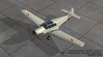
This is the v.3 and final version of the skinpack dedicated to the Messerschmitt Bf108 Taifun in Polish, post-WW2 service. The paintschemes are for the payware Bf108 Taifun by Classics Hangar and represent the three color variations:
- Bf 108 Taifun, wk.no. 5226, reg.SP-AIO of the Central Aviation League, 1947-48
- Bf 108 Taifun, wk.no. 5226, former SP-AIO, which was repainted and put into 9th Independent Liaison Squadron, 1948.
- Bf 108 Taifun, wk.no. 2278, 9th Independent Liaison Squadron, 1948-52.
Compared to the V.2 relase, I again tweaked the colours a little bit and added one more paintscheme.
| Filename: | Messerschmitt_Bf108_Taifun__Polish_triple_pack_194.zip |
| License: | Freeware |
| Added: | 12th June 2011, 16:13:00 |
| Downloads: | 208 |
| Author: | Classics Hangar, Lukasz Kubacki |
| Size: | 25.29 MB |
| Category: Flight Simulator X - Scenery | |
| 3U2 Johnson Creek Airport |
|
File Description:
"Johnson Creek Airport (FAA LID: 3U2) is a grass airstrip located in Central Idaho three miles (5 km) south of Yellow Pine, a village in Valley County, Idaho, United States. It is managed by the Idaho Division of Aeronautics of the Idaho Transportation Department. A caretaker resides at the field, and as a result, the turf runway is well cared for. Johnson Creek is in the category of backcountry airstrips, and is popular with pilots who enjoy airplane camping." - Wikipedia
This FSX rendition includes volumetric grass, static aircraft, 1 meter/pixel photoscenery, 10 meter mesh, full autogen annotation, and is color corrected and blended into the surrounding scenery.
| Filename: | 3U2_Johnson_Creek_Airport.zip |
| License: | Freeware, limited distribution |
| Added: | 22nd July 2012, 20:11:57 |
| Downloads: | 899 |
| Author: | Orion Lyau |
| Size: | 12.69 MB |
| Category: Flight Simulator X - AFCAD Files | |
| UUEE - Sheremetyevo International - Moscow, Russia |
|
Images related to this file:
File Description:
UUEE - Sheremetyevo International - Moscow, Russia
Sheremetyevo International Airport is an international airport located in the Moscow Oblast, Russia, 29 km (18 mi) north-west of central Moscow. It is a hub for the passenger operations of the Russian international airline Aeroflot, and one of the three major airports serving Moscow along with Domodedovo International Airport and Vnukovo International Airport. It is now the 2nd largest airport in Russia after Domodedovo. In 2010, the airport handled 19,329,000 passengers and 184,488 aircraft movements.
Using ADEx 1.52, aeronautical maps and Google Earth the default AFCAD has been completely reworked to reflect today's situation including gate assignments.
| Filename: | UUEE__Sheremetyevo_International__Moscow_Russia.zip |
| License: | Freeware |
| Added: | 16th November 2012, 18:38:22 |
| Downloads: | 1,866 |
| Author: | Menno C. Robert |
| Size: | 4.61 MB |
| Category: Flight Simulator X - Aircraft Repaints, Textures and Modifications | |
| North American AT-6 Harvard (G-BTXI) |
|
Images related to this file:
File Description:
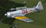
This is a repaint for the freeware Warwick "Wozza" Carter AT-6G Texan. This repaint depicts the restored Harvard Mk.IIB RCAF Ser. FE695, G-BTXI, registered to The Fighter Collection. Based at Duxford, England, the aircraft is painted in the same colors it wore while serving across Eastern and Central Ontario, Canada, from December 1942 until November 1945. The color scheme is known as an "Empire Air Training Scheme". This repaint includes all new exterior textures (including specular and bump maps), new engine and modified wheel well textures, and new and modified cockpit textures throughout. This repaint requires the files t6texmod.zip and fsds_t-6update.zip to be installed first.
| Filename: | North_American_AT6_Harvard_GBTXI.zip |
| License: | Freeware |
| Added: | 27th June 2013, 16:55:56 |
| Downloads: | 313 |
| Author: | John Terrell |
| Size: | 8.5 MB |
| Category: Flight Simulator X - Scenery | |
| CJX - Crooked Creek Airport - Alaska, USA |
|
Images related to this file:
File Description:
Crooked Creek Airport (IATA: CKD, FAA LID: CJX) is a public airport located two miles (3 km) south of the central business district of Crooked Creek, in the U.S. state of Alaska.
Increased runway length from 2,029 feet to 3,300 feet and width from 60 feet to 75 feet. Changes were made based on 2010 construction plans.
Created with Airport Design Editor 9x by ScruffyDuck Software using current FAA documentation and Google Earth measurements, this package offers a replacement for FSX's stock airport. All these enhancements are as close to the real airport as I can get with stock library objects and addition of custom models.
| Filename: | CJX__Crooked_Creek_Airport__Alaska_USA.zip |
| License: | Freeware |
| Added: | 23rd October 2014, 11:00:32 |
| Downloads: | 353 |
| Author: | Wayne Roberts |
| Size: | 244.27 KB |
| Category: Flight Simulator X - Scenery | |
| RAF Horsham St Faith - Norfolk, England |
|
File Description:
RAF Horsham St Faith is a former Royal Air Force station near Norwich, Norfolk, England which was operational from 1939 to 1963. It was then developed as Norwich International Airport.
The airfield was first developed in 1939 and officially opened on 1 June 1940 as a bomber station. It had been built pre-war and had five C-type hangars, permanent brick and tiled buildings with central-heating and a high standard of domestic accommodation.
RAF Horsham St. Faith was a front-line RAF station for many years, and its squadrons participated in many post-war exercises. The station was deactivated on 1 August 1963.
| Filename: | RAF_Horsham_St_Faith__Norfolk_England.zip |
| License: | Freeware |
| Added: | 9th February 2016, 11:17:44 |
| Downloads: | 225 |
| Author: | Terry Boissel |
| Size: | 1.98 MB |
| Category: Prepar3D V1-4 - Scenery | |
| Cocos Islands Australia N5.31.46 W87.03.28 and Island sharks S11.48.79 E96.46.90 |
|
File Description:
Cocos Islands Australia N5.31.46 W87.03.28 Islands on the Pacific Ocean off the coast of Central America were
discovered by the Scottish captain John Clunies-Ross landed in the Cocos Islands in 1825, Today they are under the
Australian domination. The archipelago has ICAO YPCC airport, in the scenario were added airport infrastructure
and the Islands sharks S11.48.79 E96.46.90 have a seairport and is a island only occasionally lived by scuba divers to
visit the seabed that is particularly inhabited by sharks. Important VFR point for approaching airport YPCC.
Within the downloaded package you will find readme files for scenery installation. Good fly VFR. Pasquale Marrulli.
| Filename: | Cocos_Islands_Australia_N53146_W870328_and_Island_.zip |
| License: | Freeware |
| Added: | 21st May 2018, 22:36:15 |
| Downloads: | 360 |
| Author: | Pasquale Marrulli |
| Size: | 1.48 MB |


© 2001-2026 AVSIM Online
All Rights Reserved
Privacy Policy |