
Where Flight Simulation Enthusiasts Gather from Around the World!
AVSIM Library - Search Results

| Category: Flight Simulator 2004 - Scenery | |
| Trinidad Landclass |

|
File Description:
Replacement Landclass for the island of Trinidad. More accurately depicts urban areas, small villages and accurate vegetation cover.
| Filename: | Trinidad_Landclass.zip |
| License: | Freeware |
| Added: | 11th March 2004, 04:09:56 |
| Downloads: | 3,353 |
| Author: | Patrick Bergamasco |
| Size: | 1.89 KB |
| Category: Flight Simulator 2002 - Scenery | |
| Rarotonga, Cook Islands, South Pacific |
|
File Description:
Rarotonga - Cook Islands, South Pacific. Version 6 for FS2002/FS2000
This scenery has been designed specifically to replace and enhance the basic scenery in Flight Simulator 2002, for the whole island of Rarotonga.
It is also compatible with FS2000.
Scenery objects are quite extensive both at the airport and throughout the island.
| Filename: | Rarotonga_Cook_Islands_South_Pacific.zip |
| License: | Freeware |
| Added: | 18th January 2003, 21:39:46 |
| Downloads: | 1,230 |
| Author: | Frank Foreman |
| Size: | 1.15 MB |
| Category: Flight Simulator 2004 - Scenery | |
| Byron Bay CWBB plus Edinburgh Island CWEI in Nunavut, Canada |
|
Images related to this file:
File Description:
Byron Bay was a DEW line station on the south coast of Victoria Island, 105 miles east of Lady Franklin Point. It closed in 1993. The buildings are still there, slowly accumulating the patina so admired by collectors on Antiques Roadshow. The runway is just over 4,500 feet and aligned 58T-238T. At the mid point between Lady Franklin Point and Byron Bay there is a North Warning Site on the highpoint of Edinburgh Island, just south of the closed Ross Point station on the "mainland" Victoria Island. The runway is just over 1,400 feet and is also up on the top of the island. There is a steep road down 600 feet to the coast for the annual fuel resupply and maintenance.
| Filename: | Byron_Bay_CWBB_plus_Edinburgh_Island_CWEI_in_Nunav.zip |
| License: | Freeware, limited distribution |
| Added: | 11th November 2012, 21:07:05 |
| Downloads: | 248 |
| Author: | Roger Wensley |
| Size: | 2 MB |
| Category: Flight Simulator 2004 - Flight Plans | |
| TEAL - Auckland to Chatham Island - November 1952 |
|
File Description:
In the 1950's TEAL were operating a flying-boat service to Chatham Island, out to the east of New Zealand in the South Pacific.
This flight is set in November 1952 and takes you from the TEAL base in Mechanic's Bay, Auckland, to the island.
Your navigation is by NDB's across the north island of New Zealand and then by dead-reckoning until within radio distance of the NDB on Chatham Island.
Your aircraft is the Short Solent IV and, if you do not have this aircraft in your FSim library, look for it under Jens Kristensen and/or Short.
Enjoy the flight and keep an eye out for a further TEAL episode in TEAL's history when I publish the Coral Route, currently being flight-tested.
| Filename: | TEAL__Auckland_to_Chatham_Island__November_1952.zip |
| License: | Freeware |
| Added: | 30th December 2005, 20:34:29 |
| Downloads: | 402 |
| Author: | Bruce Kennewell |
| Size: | 28.8 KB |
| Category: Flight Simulator X - Aircraft Repaints, Textures and Modifications | |
| F6F-3, Hellcat, VF-39 |
|
File Description:
This is a repaint of the RealFlight Simulations excellent F6F Hellcat. These textures represent an F6F-3 that is currently on the bottom of Majuro Lagoon at Dalop Island. Dalop Island was liberated on February 2, 1944 from the Japanese. A 5800 foot runway built to support aviation activities. This plane, number 25116 is approximately 500 yards from shore. Indications are this Hellcat was dumped at the end of WWII. The plane was launched after the island was secured from the USS Gambier Bay(CVE-73) and became shore based at Dalop Island. The Gambier Bay(CVE-73) was sunk on October 25, 1944 at 0907 hours. THESE ARE TEXTURES ONLY! You need the RealFlight Simulations F6F Hellcat payware package.
| Filename: | F6F3_Hellcat_VF39.zip |
| License: | Freeware, limited distribution |
| Added: | 14th February 2009, 01:31:02 |
| Downloads: | 154 |
| Author: | Russel R. Smith and RealFlight Simulations |
| Size: | 1.83 MB |
| Category: Flight Simulator 2004 - Sounds | |
| Radar Contact 4 United Kingdom Callsigns |
|
File Description:
New callsign files for RC4
The following new callsigns are included in this file:
EXPO - Excel Airways, LIFELINE - Aeromedicare, BLUE ISLAND - Airx Limited t/a Lecocqs com, ALL CHARTER - All Charter, BOND - Bond Helicopters, BLACKBOX - Boscombe Down DERA, SANTA - British Airways SANTA, BRITWORLD - BWA (2002) Ltd, GO JET - Eurojet Aviation, EUROMANX - Euromanx/Woodgate Executive Air Charter UK, FALCONJET - Falcon Jet Centre, JET LIFT - Global Supply Systems, HIWAY - Highland Airways, INTERFLIGHT - Interflight (Learjet) Ltd , ISLAND FLYER - Island Aviation Ltd, ZAP,Titan Airways Ltd, MANN - Alan Mann Helicopters and ZOOM - Zoom Airlines (OK - this is Canadian)
| Filename: | Radar_Contact_4_United_Kingdom_Callsigns.zip |
| License: | Freeware |
| Added: | 2nd March 2006, 04:03:58 |
| Downloads: | 1,880 |
| Author: | Graham K Jackson |
| Size: | 2.92 MB |
| Category: Flight Simulator X - Aircraft Repaints, Textures and Modifications | |
| Air Moorea DeHavilland DHC-6 Twin Otter |
|
File Description:
This is an Air Moorea repaint of the De Havilland (Canada) DHC6-300 Twin Otter - texture only for FSX
The depicted rugged plane serves as a shuttle between Tahiti island and its sister island Moorea, and also makes the junction with Tetiaroa, the secluded birds' island. The F-0DBN plane has since been repainted into a fresher, colourful (and more reassuring) livery.
You need the excellent Vorona aviation aircraft for FSX (the sound especially is fabulous), which you will find at www.voronaaviation.com.
This is freeware and should remain so.
| Filename: | Air_Moorea_DeHavilland_DHC6_Twin_Otter.zip |
| License: | Freeware |
| Added: | 8th May 2007, 23:31:20 |
| Downloads: | 1,840 |
| Author: | Sammy Dowidar |
| Size: | 1.68 MB |
| Category: Flight Simulator X - Scenery | |
| PHNG-Kaneohe Bay area scenery Version 1.0 |
|
File Description:
This scenery is the PART II autogen scenery for the Island of Oahu series that I am working on, that sits on top of "MegaSceneryX - Hawaii - Honolulu and Oahu Island", SO IT REQUIRES THE MEGASCENERY X - Hawaii - Honolulu & Oahu Island" photo scenery from http://www.megascenery.com/
This Autogen scenery is around the PHNG Airport locale.
I used autogens from default FSX as well as the FSX Acceleration. IF you did not install acceleration, it should not be an issue. You would just not see some of the autogens from the acceleration package.
| Filename: | PHNGKaneohe_Bay_area_scenery__Version_10.zip |
| License: | Freeware, limited distribution |
| Added: | 29th January 2008, 20:20:18 |
| Downloads: | 3,023 |
| Author: | Manny mahadevan |
| Size: | 1.66 MB |
| Category: Flight Simulator X - Scenery | |
| GVNP Praia International Airport |
|
Images related to this file:
File Description:
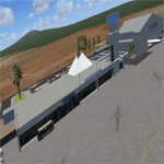
Praia International Airport (IATA: RAI, ICAO: GVNP) is an airport located on Santiago Island in Cape Verde. It was opened in late 2005,
replacing the old Francisco Mendes International Airport. It is located about 3 km northeast of central Praia in the southeastern
part of the island of Santiago.
The first flight to the new airport was on October 23, 2005. Even though the airport serves the capital and largest city, Praia,
Cape Verde's main international airport is AmiÂlcar Cabral International Airport located on the smaller island of Sal.
| Filename: | GVNP_Praia_International_Airport.zip |
| License: | Freeware |
| Added: | 24th August 2011, 12:59:06 |
| Downloads: | 3,440 |
| Author: | Miguel Diaz |
| Size: | 58.43 MB |
| Category: Flight Simulator 2002 - Scenery | |
| Bora Bora Hotels and Town |
|
File Description:
This scenery adds on 4 luxury resort hotels, and the main town of Vaitape in their approximate locations on the island of Bora Bora. It provides all kinds of eye candy, and each area also has night lighting. The areas are scattered around the island, and can be seen nicely by going around the island in a boat, then exploring them closer by driving around in a car. I included John de Langristin, since he provided me with most of the boats, and all of the Bamboo structures to make this scenery a reality!
| Filename: | Bora_Bora_Hotels_and_Town.zip |
| License: | Freeware |
| Added: | 6th October 2002, 12:49:58 |
| Downloads: | 3,349 |
| Author: | Bill Melichar and John de Langristin |
| Size: | 1.24 MB |


© 2001-2026 AVSIM Online
All Rights Reserved
Privacy Policy |