
Where Flight Simulation Enthusiasts Gather from Around the World!
AVSIM Library - Search Results

| Category: Flight Simulator X - Scenery | |
| INS Vikramaditya |

|
Images related to this file:
File Description:
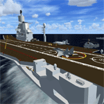
INS Vikramaditya was commisioned into the Soviet Navy as Baku in 1988. It is the third and final remaining Kiev class carrier, the other two being Admiral Kuznetsov and Lioning. Like Lioning, Vikramaditya was purchased from Russia but that is pretty much where the similarity ends. The Chinese quietly bought Varyag under the guise that it would be converted into another floating hotel or casino as had been done several times in the past; then, almost to everyones surprise, they re-built and announced they had an aircraft carrier. India contracted with Russia to complete the refit which began an epic saga of international proportions that encompassed espionage, honey traps and logarithmically expanding budgets. Originally promised for 2008, the latest quotes expect delivery in October/November 2013.
I think the carrier looks very sporty or yacht-like, with the ski-jump bow and the oversized island which has been criticized for being too far into the middle of the deck; it is said to be India's final non-indigenous warship and future flagship to serve for the next 20 to 30 years.
This model is intended for placement with AI Carriers, by Lamont Clark. It has animated radars, working cables, catapults and deck lights. The IFLOS is calibrated, but the catapults will only activate if the airplane deploys a launch bar. The Vikramaditya uses retractable chocks to allow aircraft to develop full thrust, but I could not find a way to lock an aircraft to represent the STOBAR configuration without using catapults. I did not define the elevators because they do not operate and are in the middle of the deck. There are two ships included for escort, the INS Talwar and a Russian Fregat II class ASW destroyer. They have hard decks and night lighting, animated radars, funnel smoke, etc.
| Filename: | INS_Vikramaditya.zip |
| License: | Freeware, limited distribution |
| Added: | 23rd August 2013, 21:43:41 |
| Downloads: | 1,002 |
| Author: | Rick Keller |
| Size: | 18.58 MB |
| Category: Flight Simulator 2004 - Scenery | |
| Nanisivik CYSR and Arctic Bay CJX7 in Nunavut, Canada |
|
Images related to this file:
File Description:
Nanisivik is an airfield in the north of Baffin Island, 470 miles north of the Arctic circle. It was built to service a zinc and lead mine that was opened in 1976 as Canada's first Arctic mine, now closed and dismantled. The deep water Strathcona Sound has been ear-marked by the Canadian government for development as a naval base, so I have left the large ore storage shed and the jetty in place. The airfield is at 2,106 feet on the top of the Borden Peninsula hills with a lighted 6,400 feet of 150 feet wide gravel runway runway aligned 11/29. There is a terminal and other maintenance buildings, and First Air have a building there from when the mine generated a lot of traffic and jets were used. Arctic Bay is a village 11 miles west of Nanisivik airfield with a population of around 690 which also uses the Nanisivik airfield. There is another gravel strip much closer to the village that is called Arctic Bay CJX7, but this is smaller with only 1,500' of 50' wide gravel and has no facilities of any sort. The village is partly dependent on visiting sports hunters and other limited tourist visits. At almost 73 degrees north the average year will have only four or even three months where the average high is above freezing. The buildings on the field have been modelled specifically for this scenery, and as in real life there is only JetA available. The AI visiting aircraft are a Kenn Borek Twin Otter and a First Air 42-300. As Nanisivik is in the "Northern Domestic Airspace" the runway is signed in "true" bearings and not magnetic as magnetic compasses become unreliable close to the magnetic pole.
| Filename: | Nanisivik_CYSR_and_Arctic_Bay_CJX7_in_Nunavut_Cana.zip |
| License: | Freeware, limited distribution |
| Added: | 28th May 2011, 19:59:18 |
| Downloads: | 497 |
| Author: | Roger Wensley |
| Size: | 2.64 MB |
| Category: Flight Simulator 2004 - Scenery | |
| Echo Bay CAA7 in British Columbia, Canada |
|
Images related to this file:
File Description:
This is the fifth in a series of new and renovated float bases in BC. Echo Bay is a floating marina on the northwest coast of Gilford Island, just 6 miles northwest of Health Bay (the previous post in this series). It is run by a beard called Pierre and his wife, and the food seems to attract crowds. Watch the video, and others about the marina; some of the more interesting buildings are replicated here, others are representative. There is no fuel or oil available but you can post a letter as there is a post office in the store that sells food etc to boaters. The AI is a further adaptation of the CF36 AI and involves a Baxter Beaver flying from Port Hardy on a round trip in the area through Port McNeill, Health Bay, Echo Bay, and Sullivan Bay, plus Harbour Air from Vancouver, and small GA. At Echo Bay the AI appears to work for both landing and takeoff for the Beaver and sometimes for the Otter, depending on wind direction. All of these float bases can be installed together in the same folders, with a saving in duplicate textures. So a series called BC Floats (or whatever you want to call it) or individually installed float bases; your choice. The next in the series will be Sullivan Bay, another floating marina. I have used what was a RWY12 boat here, but my RWY12 no longer includes the "Port and Sea" part that included this and other boats. Somewhere I must still have the textures as they are showing up as required, but I cannot find them to include them here. Hopefully your installation will find them on your hard drive and use them. If not, complain to me and I will attempt to demonstrate diligence.
| Filename: | Echo_Bay_CAA7_in_British_Columbia_Canada.zip |
| License: | Freeware, limited distribution |
| Added: | 18th January 2017, 17:09:19 |
| Downloads: | 205 |
| Author: | Roger Wensley |
| Size: | 6.92 MB |
| Category: Flight Simulator 2004 - Scenery | |
| Toronto Downtown Airport CYTZ Ontario, Canada |
|
Images related to this file:
File Description:
CYTZ is on an island in Lake Ontario and immediately adjacent to downtown Toronto. This updates the version made by Flight Ontario as there have been major changes since Porter Airlines purchased the airport. The obvious and main new item is the terminal, made with photo textures and with ten gates sized to accomodate the Dash 8-400 they currently use. The terminal has a passenger entrance and a vehicle setdown point as part of the link to the ferry terminal that wraps around the west side of the original and preserved terminal building. The ferry terminal is included here, along with a ferry. Also new are the car parking, road routing, gate and taxi markings, taxiways, taxiway signage, taxiway lighting, runway lighting, aprons, apron lighting (from Sid Schwartz and you will need to install his "lights_ss_v2"), fences, fuel tanks, tanker trucks, access roads to navigation equipment, ai parking, static parked planes, parked cars, apron equipment, and the useable floatplane ramp. The AI includes Porter, Jazz, several GA aircraft, and a helicopter. Only 3 of these require downloads. The Lake Ontario AI includes three large ships, typical of the traffic to be seen on all the Great Lakes. CYTZ has three runways and there is an airport diagram included. 08-26 has ILS and is the only runway actually long enough to be used by Porter; FS9 atc will ignore this. There is fuel available and it is dispensed from a truck. The longer projection from the front of the terminal building is a covered ramp that leads up from the terminal basement level, used by towed luggage trolleys. The gates are not powered in any way except for the weather cover that protects passengers as they cross the small area of asphalt between plane and gate. I did not try to reproduce this in FS9.
| Filename: | Toronto_Downtown_Airport_CYTZ_Ontario_Canada.zip |
| License: | Freeware, limited distribution |
| Added: | 23rd October 2012, 12:52:14 |
| Downloads: | 1,815 |
| Author: | Roger Wensley + Flight Ontario |
| Size: | 12.43 MB |
| Category: Flight Simulator 2004 - Scenery | |
| Toronto Downtown Airport CYTZ, Ontario Canada, for Toronto2 |
|
Images related to this file:
File Description:
CYTZ is on an island in Lake Ontario and immediately adjacent to downtown Toronto, and this is the version for use with Flight Ontario's Toronto2 scenery for the Greater Toronto Area. There have been major changes after Porter Airlines purchase of the airport. The obvious and main new item is the terminal, made with photo textures, and with ten gates sized to meet the requirements of the Dash 8-400 they currently use. The terminal has a passenger entrance and a vehicle setdown point as part of the link to the ferry terminal that wraps around the west side of the original and preserved terminal building. The ferry terminal is included here, along with a ferry. Also new are the car parking, road routing, gate and taxi markings, taxiways, taxiway signage, taxiway lighting, runway lighting, aprons, apron lighting (from Sid, and you will need to install his "lights_ss_v2"), fences, fuel tanks, tanker trucks, access roads to navigation equipment, ai parking, static parked planes, parked cars, apron equipment, and the useable floatplane ramp. The AI includes Porter, Jazz, several GA aircraft, and a helicopter; only 3 of these require downloads. The Lake Ontario AI includes three large ships, typical of the traffic to be seen on all the Great Lakes. CYTZ has three runways and there is an airport diagram included. 08-26 has ILS and is the only runway long enough for Porter to use; FS9 atc will ignore this. There is fuel available and it is dispensed from a truck. The longer projection from the front of the terminal building is a covered ramp that leads up from the terminal basement level, used by towed luggage trolleys. The gates are not powered in any way except for the weather cover that protects passengers as they cross the small area of asphalt between plane and gate. I did not try to reproduce this in FS9.
| Filename: | Toronto_Downtown_Airport_CYTZ_Ontario_Canada_for_T.zip |
| License: | Freeware, limited distribution |
| Added: | 23rd October 2012, 12:52:29 |
| Downloads: | 1,531 |
| Author: | Roger Wensley + Flight Ontario |
| Size: | 12.71 MB |
| Category: Flight Simulator 2004 - Scenery | |
| Port Hardy CAW5 in British Columbia, Canada |
|
Images related to this file:
File Description:
This is the sixth in a series of new and renovated float bases in BC. Port Hardy CAW5 is in a sheltered inlet on the northeast coast of Vancouver Island, close to the town and just 6 miles northwest of the Port Hardy airport. There is fuel (both JetA and 100LL) and also oil available, and the base acts as a refuelling centre for the other float bases in the neighbourhood. The dock is one-sided as the northern side borders a shallow area that is in fact exposed at low tide, as is most of the inlet to the south of BC Packers (adjacent to the float base, to the south). The parking along the dock is maximised by backing up each plane by hand so that it is close to the one behind it; this is not possible to replicate with AI in FS9 (watch the video). Watch out for the log boom on the other side of the inlet, it is there to protect fish farm "pools". The AI involves several Beavers and Otters, as listed in the AI folder. At Port Hardy all the AI works for both landing and takeoff for all of the planes, no matter what is the wind direction. There is a pic of the Supplement Port Hardy page, showing the two take-off and landing areas plus the third area that is to be used for take-off before 7am. All of these float bases can be installed together in the same folders, with a saving in duplicate textures. So a series called BC Floats (or whatever you want to call it) or individually installed float bases; your choice. The next in the series was suposed to be Sullivan Bay, another floating marina, but I digressed to Port Hardy and Port McNeill (next to be posted). The two hotels by the nearby marina are included. One of them gave me weird problems and I gave up on achieving the correct shape.
| Filename: | Port_Hardy_CAW5_in_British_Columbia_Canada.zip |
| License: | Freeware, limited distribution |
| Added: | 19th January 2017, 15:01:45 |
| Downloads: | 201 |
| Author: | Roger Wensley |
| Size: | 8.27 MB |
| Category: Prepar3D V1-4 - Aircraft Repaints, Textures and Modifications | |
| North American P-51D 3rd ACG (C) 'Bad Angel' |
|
Images related to this file:
File Description:
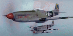
This folder contains a second repaint for the A2A WoP3 P-51D Mustang, in the colors of P-51D-20 44-63272 “Bad Angelâ€, flown by Lt. Louis Curdes of the 4th Fighter Squadron, 3rd Air Commando Group. He is one of a very few American pilots to have kills against each of the three major Axis powers, and I believe the only US pilot to display an American flag among his victory markings.
While serving in the MTO, Curdes downed several Fw-190’s, and one of the Macchi C.202’s he downed is now on display at the National Air & Space Museum in Washington DC. He was shot down over Italy and spent a short time as a POW before escaping. Because he was an escaped POW, he couldn’t fly again against the Germans for security reasons.
He was transferred to the PTO, and on February 10, 1945, during a sweep to Bataan Island, he saw a P-51 pilot parachute into the sea. Curdes circled around him to pinpoint his position to rescuers. While circling, he saw a USAAF C-47 that was preparing to land on the Japanese-held strip on Batan. The C-47 crew didn’t respond to repeated attempts at radio contact and, unable to shepherd the C-47 to safety, Curdes saw only two possibilities – first that it was a Japanese plane bearing false US markings (the DC-3 having been built under licence in Japan prior to the war), or it was a US plane whose crew was unaware the field had fallen to the Japanese. He therefore carefully shot out both engines, causing the plane to land in the sea. All 13 people on board the C-47 were rescued – and they were indeed Americans, including a nurse Curdes had previously dated. Repaint by Jan Kees Blom.
| Filename: | North_American_P51D_3rd_ACG_C_Bad_Angel.zip |
| License: | Freeware |
| Added: | 3rd November 2018, 23:18:24 |
| Downloads: | 49 |
| Author: | Jan Kees Blom |
| Size: | 6.11 MB |
| Category: X-Plane - Scenery | |
| San Diego, Ca. 2004 - v6.70thru v7.30 |
|
File Description:
San Diego Scenery Package
for X-Plane v6.51+v7.XX
by Bill Moore
January 3, 2004
Here is a new San Diego scenery package that I designed for my personal use. I have had numerous requests to do more cities and airports so this is my first free scenery for 2004. Being the lazy person I am, no research was done and no claim to real life designs are implied.
I have added many objects to the airports and cities including terminals, hangers, buildings, stadiums, balloons, city scapes and other fun and interesting things. All of which were begged, borrowed or stolen from all the wonderful designers in the X-Plane Community such as Ken Spiker, Christian Franz, Ted Davis, Robert Bunce, Tom Curtis, B. Brooks and all the others who have inspired me. Many thanks to each of you for your contributions to the X-Plane community.
Like all my scenery packages, the additions to the citys and airports are purely fictional. The airports themselves are unaltered. I have enhanced "San Diego Intl.-Lindburg Fld. (KSAN), "North Island NAS. (KNZY), Miramar MCAS (KNKX), Imperial Beach NOLF (KNRS), General Abelardo L. Rodriquez Intl. (MMTJ) and a few other near by airports. A special thanks to Ted Davis for creating the orignal San Diego scenery that led me to adding to his great work. Also, Ken Spikers new KWIKCITYS package contributed to the completion of my version of San Diego and surrounding areas. His cities really added the crowning touch. Thanks Ken. If I inadvertently left out other object designers, it was purely unintentional and I offer my apologies.
Installation: Place the extracted "San Diego" folders in your "Custom Scenery" folder.
Please send any comments or suggestions to [email protected]. If you choose to rate my Scenery Packs and give less than a "9" rating, I would appreciate knowing what I can do to improve them. I can only do that with your feedback.
Have fun and FLY SAFE!
| Filename: | San_Diego_Ca_2004__v670thru_v730.zip |
| License: | Freeware |
| Added: | 4th January 2004, 05:18:56 |
| Downloads: | 814 |
| Author: | Bill Moore |
| Size: | 7.96 MB |
| Category: Flight Simulator 2004 - Scenery | |
| Seward PAWD in Alaska V2 plus 6AK5 |
|
Images related to this file:
File Description:
This is V2, the combined original and also V1. If you have already installed V1 then you do not need this. The town of Seward (population around 2,700) is on the east coast of the Kenai Peninsula, 70 miles east of Kenai town and also 70 miles southeast of Anchorage, amid mountains and glaciers at the northern end of the 20 mile long and fjord-like Resurrection Bay. It is also at the southern end of both the Alaska Railway and the Seward Highway, and has a sheltered dock for freight and also for cruise liners. Passengers from the liners can enjoy local attractions (dog sledging on a glacier?) and also easily continue further north by bus or train to Anchorage or to other tourist attractions such as Denali. The airport is next to the port and the town, with two runways aligned (in FS9, not taking account of the recently wandering magnetic north) 15-33 and 12-30, both asphalt and 2,100 and 4,200 feet long respectively. Only 12-30 (and its taxiways) is lit, with VASI on 30. There are no regularly scheduled flights to Seward; with buses and trains running direct from Anchorage there is no money to be made. There are some charter flights coordinated with cruise liners, and some freight flights, the very occasional visit by the Coastguard, but most flights are GA, air taxi,or short scenery-viewing trips for summer tourists. In a mountainous area the only sure thing about the behaviour of AI aircraft is that it is unpredictable but often involves a mountain; nothing to be done about it. At Seward there is also marine AI from and to the port, in the shape of a cruise liner and an Alaskan ferry, but the latter only if you have Holger Sandmann's Alaska scenery installed. Also included with this is a correction for Fire Island 6AK5, near Anchorage, that takes the airfield out of the water; this is something I have meant to do for the last 5 years.
| Filename: | Seward_PAWD_in_Alaska_V2_plus_6AK5.zip |
| License: | Freeware, limited distribution |
| Added: | 19th January 2016, 18:27:26 |
| Downloads: | 592 |
| Author: | Roger Wensley |
| Size: | 12.47 MB |
| Category: Flight Simulator 2004 - Scenery | |
| Airstrips of the Falkland Islands |
|
Images related to this file:
File Description:
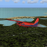
Inspired by Jim Keir's Falkland Islands mesh, coastlines and landclass, herewith a couple of dozen little strips from around the area, to give the opportunity to generate a bit of GA AI (and possibly a few scheduled flights) in an otherwise relatively ignored area in the South Atlantic. Please do note, other than Stanley, most of these airstrips are just that, a cleared strip of land in an otherwise empty landscape, (just as they are in real life), simply to provide a variety of destinations for the occasional aircraft to or from Stanley.
Most of the airfield locations are listed on WikiPedia and the layout confirmed using on-line satellite imagery. Other than the two main airports, none of these airstrips seem to have "official" ICAO codes, so I've generated a selection of alpha-numeric codes in the SF0* configuration, (as Stanley Airport has the ICAO code of SFAL), so the FS9 AI engine has some codes to work with and the airfields can be found on the map. Hopefully these pseudo-codes won't clash with anything else.
As with my other sceneries, the files for each airstrip can be easily identified by the ICAO code, even if the airfield names vary slightly, so you can pick and choose and mix and match to suit any sceneries you already have, should you so wish. There is no requirement for any other download. Each airstrip will exist as a stand-alone entity should you only want a few of them.
Having said that, Paul Denton's AFCAD and scenery for EGYP Mount Pleasant (available on AVSIM and possibly elsewhere) might be considered a worthwhile addition, especially if you want to see the twice-weekly scheduled RAF flights from Brize Norton (via Ascension Island), and the Saturday LATAM flight from Chile. Suitable AFCADs for EGVN Brize Norton and SCCI Punta Arenas may also be required. Appropriate traffic files and aircraft/texture suggestions are provided.
Please read the remainder of this "blurb" in the included text file, there may be a couple of details of interest.
| Filename: | Airstrips_of_the_Falkland_Islands.zip |
| License: | Freeware |
| Added: | 30th March 2025, 18:55:33 |
| Downloads: | 94 |
| Author: | Chris Eve |
| Size: | 295.87 KB |


© 2001-2026 AVSIM Online
All Rights Reserved
Privacy Policy |