
Where Flight Simulation Enthusiasts Gather from Around the World!
AVSIM Library - Search Results

| Category: Flight Simulator X - Scenery | |
| Palermo Punta Raisi LICJ, 2011 - version 2 |

|
Images related to this file:
File Description:
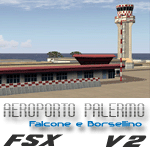
Palermo Falcone e Borsellino airport (also known as Punta Raisi) is an international airport serving the western part of Sicily Island. The airport itself is located 35 km west from Palermo. The airport (LICJ) ranks third by passenger number in southern Italy after Napoli and Catania. This scenery comes with custom terminals, tower, hangers, textures, night lighting, etc. It was designed to fit Mazzokan's Sicily photo scenery and Pietro Mauri's ItalyMesh2004. Both downloads are heavily encouraged. All details about these files are included in the LICJ 2011 User Manual. This scenery was created for FSX only. It has been tested with FSX sp2, but it should work fine with sp1.
This is version 2, it includes many more airport buildings than version 1, the existing buildings have been heavily updated, previous bugs are solved, etc.
| Filename: | Palermo_Punta_Raisi_LICJ_2011__version_2.zip |
| License: | Freeware, limited distribution |
| Added: | 15th July 2011, 14:58:16 |
| Downloads: | 11,032 |
| Author: | Thomas Lo Gerfo |
| Size: | 7.08 MB |
| Category: Flight Simulator 2004 - AI Flight Plans | |
| PRAMS (Puerto Rico Air Management Service) - Winter 2010-2011 |
|
Images related to this file:
File Description:

Puerto Rico Air Management Services (PRAMS) is an Air Charter and cargo operator out of the Luis Muñoz MarÃn International Airport, San Juan, Puerto Rico. The airline was founded in 2005. Its operating certificate allows it to fly to the USA, the entire Caribbean (including Cuba)and South America. The company also has a unique operating permit, that allows it to operate flights from the United States mainland to Cuba. Operating charter flights that usually carry excess baggage and other cargo for companies that arrange these unique flights leaving the Miami International Airport to the otherwise U.S. embargoed Caribbean island.
Flights taken from FlightAware for the week of March 6 - March 12, 2011, for N7994R. N801FL has not flown recently according to FlightAware thus the flights depicted in these flightplans for that aircraft are "representative".
| Filename: | PRAMS_Puerto_Rico_Air_Management_Service__Winter_2.zip |
| License: | Freeware |
| Added: | 15th March 2011, 00:09:46 |
| Downloads: | 815 |
| Author: | Steve Lewis |
| Size: | 20.32 KB |
| Category: Flight Simulator 2004 - Scenery | |
| Malta archipelago |
|
Images related to this file:
File Description:
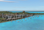
While I carried out a virtual flight from Africa toward Sicily I observes two totally naked islands. The biggest are Malta with its great airport LMML in the center. In Google earth I see that was the archipelago of Malta. Some islands that possess but churches that you hoist. I have just understood like in a piece of esth of 28x12 kilometers the biggest and 7x5 kilometers the island Gozo have been able to build so beautiful monuments. I have build some how many as some well strengths because Malta already takes many centuries defending of invasions of other towns and pirates. This archipelagos that I finish that it lacked to build in the Mediterranean. Now the "piccolissimas"
rot to alternate among my scenerys together with Baleares, Corcega, Cerdenia, Sicily, Cyprus, Crete and the group of islands of the Hreek territory.
| Filename: | Malta_archipelago.zip |
| License: | Freeware |
| Added: | 7th November 2009, 20:59:41 |
| Downloads: | 2,327 |
| Author: | Toni Agramont |
| Size: | 34.79 MB |
| Category: Flight Simulator 2004 - Scenery | |
| Port Armstrong, for Holger Sandmann's Tongass Fjords scenery |
|
Images related to this file:
File Description:
This is a fish farm, at the southern end of Baranof Island and Chatham Strait in southern Alaska. It is named on the chart of the area, and there is a section of the chart included here. This scenery is designed specifically for use in the Tongass Fjord scenery. The fish farm (or hatchery, the description varies) has an identifying code so it will show up on a gps as PAG. There is no interaction with atc as there are no designated water runways, so PAG on the gps just acts as a waypoint. I may have incorrectly identified Tongass Fjords as being required for Hawk Logging when Glacier Bay is needed. Ah well, it is one or the other of them. I still find these scenery areas by Holger and his crew the most satisfying in FS9.
| Filename: | Port_Armstrong_for_Holger_Sandmanns_Tongass_Fjords.zip |
| License: | Freeware, limited distribution |
| Added: | 18th November 2014, 15:14:57 |
| Downloads: | 222 |
| Author: | Roger Wensley |
| Size: | 3.89 MB |
| Category: Flight Simulator 2004 - Scenery | |
| Hall Beach CYUX in Nunavut, Canada |
|
Images related to this file:
File Description:
Hall Beach is on the Melville Peninsula, part of the mainland of Canada, south and west of Baffin Island. It is around 40 miles south of Igloolik and 50 miles west of Rowley, both of them my previous posts. The airfield was built to support the construction and operation of a main DEW line radar station and to support the rest of the associated chain. Because of the employment opportunities this brought, a village developed nearby. The airfield continues in regular use and the runway, though still gravel, is 5,400' long and 150' wide and lighted; the alignment is 124T and 304T as this is in northern domestic airspace and bearings are given as 'true" and not "magnetic". There are scenery folders for the village, roads, grass, etc, and AI for two airlines with regular service to Hall Beach.
| Filename: | Hall_Beach_CYUX_in_Nunavut_Canada.zip |
| License: | Freeware, limited distribution |
| Added: | 22nd November 2011, 14:33:08 |
| Downloads: | 458 |
| Author: | Roger Wensley |
| Size: | 3.83 MB |
| Category: Flight Simulator 2004 - Scenery | |
| Whenuapai Air Force Base , New Zealand. NZWP. |
|
File Description:
Welcome to Whenuapai Air Force Base. The base is situated north west of Auckland City, in Waitakari District, in the North Island of New Zealand. Whenuapai is home to several different R.N.Z.A.F. squadrons, with varying aircraft and helicopter types, including the Lockheed P3 Orion, Lockheed C130 Hercules, Iroquois and Seasprite helicopters. This scenery is designed and built to fit the "RealNZ Auckland City" photoreal scenery (payware) by Robin Corn. It will however, work fine in default FS9. The scenery contains some custom items, and also custom ground textures for all 4 seasons to replace the original RealNZ ground textures. The scenery was also designed to work with the newly updated RNZAF AI package, filename rnzafa11.zip, by Charl Du Toit. The AI package is freely available here on Avsim. Scenery also requires some EZ Scenery Object Sets (see INSTALL instructions for detsils).
| Filename: | Whenuapai_Air_Force_Base__New_Zealand__NZWP.zip |
| License: | Freeware, limited distribution |
| Added: | 26th February 2009, 11:32:03 |
| Downloads: | 1,588 |
| Author: | Lawrie Roache |
| Size: | 4.7 MB |
| Category: X-Plane - Original Aircraft | |
| Black Cat PBY5/5A |
|
File Description:
X-Plane 6.40
The PBY Catalina is probably the best known flying boat with over 4000 produced by Consolidated aircraft and licensees. The Black Cat squadrons all done in flat black played havoc particularly for the Japanese in the Pacific in WWII. Fitted with radar, with a 15 hour endurance and 2800 mile range they hunted Japanese naval ships and bombed or torpedoed them by the hundreds. This a fairly accurate rendition of the PBY except that the retractable pontoons are missing. Why? Well basically after using all the tricks I know I ran out of parts. There are 6 engine nacelles used in the model, 2 represent the 1200 HP radial engines driving the props, the others are jets with 5 lbs of thrust, 1 is used for the rear fuselage section, 1 is used for the wing pylon, 1 is used for the flare from the fuselage to the vertical stabilizer and the last is used for the forward observation and gunner space. Two are not used. Wing sections are taken up by the main wing and the support spars so there you go. The fuel tanks are used for the side gunner pods since these can be decorated separately. The plane flies very well and is stable. Takeoffs from water are quite easy as long as you don't dip a wing tip (no floats remember). This aircraft model and the paint scheme is copyright by Robert App, January 2003. Feel free to alter the paint scheme and instrument panel as long as you give me credit for the original design. The Black Cat squadron logo used in the paint scheme is courtesy of http://www.daveswarbirds.com/blackcat/logos.htm and is from the VP-71 Black Cat squadron. E mail me with any good panels or paint schemes and I will give full credit if used.
| Filename: | Black_Cat_PBY55A.zip |
| License: | Freeware, limited distribution |
| Added: | 16th January 2003, 02:56:49 |
| Downloads: | 1,386 |
| Author: | Robert L. App |
| Size: | 12.04 MB |
| Category: Flight Simulator 2004 - Scenery | |
| Kangiqsujuaq CYKF in northern Quebec, Canada |
|
Images related to this file:
File Description:
Kangiqsujuaq is on the north coast of Quebec, 85 miles west of Quaqtaq and 125 miles east of Salluit, while across the Hudson Strait and 100 miles away on Baffin Island is Kimmirut. The town grew around two trading posts, the first opened by Revillon Freres in 1910, and the second by the Hudson Bay Company in 1914. A school was opened in 1960, and a clinic in 1961. The town was known as Wakeham Bay until 1961, and now has a population of around 700. The airport is to the south of the town and up on the hill at 511 feet ASL (this has been remeasured since 2004 and is now known to be 501). The gravel runway is just over 3,500 feet long and aligned 15/33; there is no PAPI, but there is fuel available, both 100LL and JetA. There are flights by Air Inuit.
| Filename: | Kangiqsujuaq_CYKF_in_northern_Quebec_Canada.zip |
| License: | Freeware, limited distribution |
| Added: | 27th January 2013, 00:55:00 |
| Downloads: | 231 |
| Author: | Roger Wensley |
| Size: | 2.31 MB |
| Category: Flight Simulator 2004 - Scenery | |
| Argyle International Airport, Saint Vincent |
|
Images related to this file:
File Description:
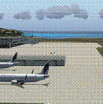
This is a scenery created by me of the soon to be completed Argyle International Airport on the island nation of Saint Vincent and the Grenadines. This scenery was created as a pet project of mine out of personal love for the project. The airport was created using only default scenery objects and the only thing that was changed was the type and direction of the turning point at the RWY04 end. I'm sharing this so FS2004 simmers can see what the airport will be like on completion. The scenery is 100% customizable to suit your preference. All I ask is that you don't change the actual airport design. I hope that this will bring you hours and hours of flying fun.
Important: This scenery requires the full RWY12 Scenery Library including the Gate Markings SS files. Also the Lesser Antilles Mesh is required.
| Filename: | Argyle_International_Airport_Saint_Vincent.zip |
| License: | Freeware |
| Added: | 22nd December 2013, 21:57:40 |
| Downloads: | 529 |
| Author: | Cilbert Campbell |
| Size: | 6.8 KB |
| Category: Flight Simulator 2004 - Scenery | |
| Coromandel Photoscenery Compilation *updated* |
|
File Description:
This is a compilation of the various addons developed for the Coromandel region of the North Island, New Zealand.
The basis of this scenery is the simply stunning Godzone Photoscenery developed by Robin Corn and the autogen created for it by Ian Warren. Their combined efforts have produced a wonderfully beautiful and realistic scenery for VFR flying. Lawrie Roache has produced some simply stunning renditions of the airports in the Coromandel area -
Thames (NZTH), Coromandel (NZCX), Pauanui Beach (NZUN), and Whitianaga (NZWT), which were created specifically to fit with the Coromandel Photoscenery by Robin Corn. Charl du Toit has finished and perfected the area with his adjustments to the photo-terrain.
This is simply a compilation (with permission) and re-release of the many fine sceneries these men have produced.
This updated version includes a newer version of the photoscenery and some bug-fixes.
| Filename: | Coromandel_Photoscenery_Compilation_updated.zip |
| License: | Freeware, limited distribution |
| Added: | 5th October 2012, 02:42:03 |
| Downloads: | 821 |
| Author: | Robin Corn, Ian Warren, Lawrie Roache, Charl du Toit, Ephram Matheson |
| Size: | 52.28 MB |


© 2001-2026 AVSIM Online
All Rights Reserved
Privacy Policy |