
Where Flight Simulation Enthusiasts Gather from Around the World!
AVSIM Library - Search Results

| Category: Flight Simulator X - Scenery | |
| Virac Airport RPUV with Photoreal Scenery |

|
Images related to this file:
File Description:
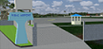
This is my reworked version of RPUV Airport. Now with Photorealistic Scenery, latest colors and updated terminal.
Virac Airport (IATA: VRC, ICAO: RPUV) is the only airport serving the island province of Catanduanes in the Philippines. It is located in the capital, Virac. The airport is classified as a Class 1 principal (major domestic) airport by the Civil Aviation Authority of the Philippines, a body of the Department of Transportation and Communications that is responsible for the operations of not only this airport but also of all other airports in the Philippines except the major international airports.
On October 27, 2013, Cebu Pacific launched the first ever Airbus flight in Virac.
| Filename: | Virac_Airport_RPUV_with_Photoreal_Scenery.zip |
| License: | Freeware |
| Added: | 26th November 2018, 16:20:24 |
| Downloads: | 832 |
| Author: | Aeron M. Tumanut |
| Size: | 35.35 MB |
| Category: Flight Simulator 2004 - Scenery | |
| KISP - Islip MacArthur Airport version 1.1 |
|
Images related to this file:
File Description:

New scenery for Islip/MacArthur Airport. This is a complete, ground up remake for the Long Island airport. Served mainly by Southwest Airlines, this mainline airfield is chock full of rich history and significance. It is also one of those neglected airports that could use some FS attention. The scenery is 100% accurate and very realistic. You will enjoy the experience.
Update: There was a typo in the readme file in the original download concerning correcting a texture issue with the terminal windows. If you have already downloaded version 1.0, and you are having no texture issues, you do not need this update. Only the readme file has been updated.
| Filename: | KISP__Islip_MacArthur_Airport_version_11.zip |
| License: | Freeware |
| Added: | 6th September 2012, 07:48:50 |
| Downloads: | 1,465 |
| Author: | FRF Studio / William Morgan |
| Size: | 23.27 MB |
| Category: Flight Simulator X - Missions | |
| HelicopterLighthouseMissionsVol69.zip |
|
File Description:
Six lighthouse tours: Au Sable, Crisp Point, Ile aux Galets, St. Helena Island, Marble Head, and Sunken Rock.These missions were programmed in Windows 10 (64bit)for FSX Acceleration and will also work in FSX Steam, P3DV3,V4,V5,and V6. However, several of these tours have specific requirements of Orbx scenery which is detailed in the .txt instructions.Photos of all the lites are included in each mission set. Once again, be sure to read the instructions in the .txt files. These missions have been thoroughly tested and should work as described. Due to large topographic differences in P3DV5 and V6, there will be peculiarities, but the missions should still work.
| Filename: | HelicopterLighthouseMissionsVol69zip.zip |
| License: | Freeware |
| Added: | 29th November 2025, 17:15:08 |
| Downloads: | 13 |
| Author: | Helomissionman |
| Size: | 32.57 MB |
| Category: Flight Simulator X - Missions | |
| HelicopterLighthouseMissionsVol41.zip |
|
File Description:
Eight lighthouse tours: Cape Finisterre, Chumbe Island, Holland Harbor, Kolka, Kopu, Lorain, PonceDeLeon, Fourteen Foot Bank.These missions were programmed in Windows 10 (64bit)for FSX Acceleration and will also work in FSX Steam, P3DV3,V4,V5,and V6. However, several of these tours have specific requirements of Orbx scenery which is detailed in the .txt instructions.Photos of all the lites are included in each mission set. Once again, be sure to read the instructions in the .txt files. These missions have been thoroughly tested and should work as described. Due to large topographic differences in P3DV5 and V6, there will be peculiarities, but the missions should still work.
| Filename: | HelicopterLighthouseMissionsVol41zip.zip |
| License: | Freeware |
| Added: | 9th May 2025, 21:35:52 |
| Downloads: | 17 |
| Author: | Helomissionman |
| Size: | 57.41 MB |
| Category: Flight Simulator X - Scenery | |
| Savannah, Georgia - USA |
|
Images related to this file:
File Description:
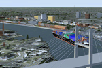
A large and detailed scenery of Savannah, Georgia. Includes downtown Savannah
and riverfront (with custom made buildings, hotels, convention center, gold domed
courthouse, and Talmadge Bridge), harbor with container terminal, AI ship traffic, and
a custom built streetcar to travel the downtown streets of Savannah.
KSAV Savannah/Hilton Head Intl Airport has a custom built terminal, Gulfstream factory, and Air National
Guard facility. KSVN Hunter AAF has a custom built US Coast Guard facility and AI helicopter
traffic. Coastal Tybee Island is represented with beachfront resorts and hotels, pier,
shopping district, and 2 functioning lighthouses. Great for the VFR flyer!
By Dan French.
| Filename: | Savannah_Georgia__USA.zip |
| License: | Freeware, limited distribution |
| Added: | 21st April 2014, 22:57:17 |
| Downloads: | 1,138 |
| Author: | Dan French |
| Size: | 11.51 MB |
| Category: Flight Simulator 2004 - Scenery | |
| RJTT - Tokyo (Haneda) International Airport - Tokyo, Japan |
|
Images related to this file:
File Description:
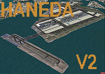
This is a reload of my recent Haneda scenery (RJTT_JS.zip) and contains all fixes and missing files. Haneda International (RJTT) is one of the oldest (1931) civil airports in Japan. Over 80% of its traffic is domestic and, with the opening of the new Terminal 2, is a major hub for both JAL and ANA airlines. This scenery I did for myself because I've always preferred Haneda to Narita. This scenery includes photo-ground cover for the airport with custom objects including the new runway 5 island and harbor Aqualine structures. Certainly not a patch on the many fine commercial sceneries available but it's free and an improvement over the default.
| Filename: | RJTT__Tokyo_Haneda_International_Airport__Tokyo_Ja.zip |
| License: | Freeware, limited distribution |
| Added: | 20th March 2015, 14:07:00 |
| Downloads: | 6,700 |
| Author: | John Stinstrom |
| Size: | 7.32 MB |
| Category: Flight Simulator 2004 - Scenery | |
| Repulse Bay CYUT in Nunavut Canada |
|
Images related to this file:
File Description:
This is a scenery that I started in 2013, temporarily abandoned when I found there was a fault in the coastline that reduced it all to straight lines, and then totally forgot about. Until now, when I discovered that while I had made the Repulse Bay terminal building I had mysteriously not made the scenery. Investigation revealed the reason why and here it is with a coastline that has been repaired to the extent that the fault allowed. Repulse Bay has a population of around 1,100 and since 2015 has been officially named Naujaat, the traditional Inuit name. It is located exactly on the arctic circle on the northern extension of the western side of Hudson Bay, in a large bay off the northern tip of Southampton Island. Coral Harbour is on the far side of the island, 180 miles to the south. The airfield is alongside the town and the coast, with the runway 3,400 feet of gravel with PAPI at both ends, aligned 161T-341T with "T" standing for true as opposed to the unreliable magnetic bearing this far north. The regular scheduled flights are by Air Baffin (an Air Nunavut subsiduary), connecting to Iqaluit some 550 miles to the east. The helicopters are there in the summer with their own fuel in drums around their own parking apron. They land directly on the apron, which cannot be replicated in AI, so they are present only as parked choppers and not flying ones.
| Filename: | Repulse_Bay_CYUT_in_Nunavut_Canada.zip |
| License: | Freeware, limited distribution |
| Added: | 6th September 2018, 00:34:38 |
| Downloads: | 180 |
| Author: | Roger Wensley |
| Size: | 7.87 MB |
| Category: Flight Simulator 2004 - Scenery | |
| Aasiaat BGAA on the west coast of Greenland |
|
Images related to this file:
File Description:
I wrote that Qikiqtarjuaq, on the east coast of Baffin Island, was the jumping off airfield for ferry flights for small planes from Canada to Europe via Greenland. Aasiaat is the airfield in Greenland that they jump to, 300 miles across the Davis Strait. The airfield is on the northern coast of Aasiaat Island, and the town of the same name is just two miles to the west. The runway is 2,600 feet of asphalt almost 100 feet wide and lit, at 74 feet ASL, aligned 12/30, with the apron and terminal building at the western end. Air Greenland run regular flights with a Dash-7 or 8, & Twin Otters, and the markings for the taxiway and parking spot in front of the terminal are exactly as they were six years ago. I have seen video since then that has further taxiway and parking spot markings added in, but I like the simplicity of the original. Unfortunately, given the limitations of FS and the single runway and simple taxiway routing there was no way to replicate both the parking facing away from the terminal AND the "through" taxiing to complete the circle back to the runway; after parking correctly the AI Air Greenland Dash-8 will reverse before heading out to take off. There is both JetA and 100LL fuel available. The surrounding area is rocky, and there is no grass around the runway; the airfield has compacted gravel instead.
| Filename: | Aasiaat_BGAA_on_the_west_coast_of_Greenland.zip |
| License: | Freeware, limited distribution |
| Added: | 26th March 2012, 11:01:16 |
| Downloads: | 691 |
| Author: | Roger Wensley |
| Size: | 2.73 MB |
| Category: Prepar3D V1-4 - Scenery | |
| TNCC - Curaçao International Airport |
|
File Description:
This is my first scenary, any problem or sugestion send-me an e-mail ([email protected]). The scenery was made using the Airport Design Editor, SketchUp 2017 an others.
Curaçao International Airport (IATA: CUR, ICAO: TNCC), (Dutch: Hato Internationale luchthaven) also known as Hato International Airport (formerly Dr. Albert Plesman International Airport), is the only airport for the island of Curaçao.
The airport is located on the north coast of Curaçao, 12 kilometres (7.5 mi) from the capital Willemstad. Curaçao International Airport services flights from the Caribbean region, South America, North America and Europe and has the third longest commercial runway in the Caribbean region after Rafael Hernández Airport in Puerto Rico and Pointe-à -Pitre International Airport in Guadeloupe.
The airport serves as a main base for Divi Divi Air, Jetair Caribbean as well as EZAir; it formerly served as a main base for ALM, KLM, DCA, DAE and Insel Air.
Located on the Dutch Caribbean island of Curaçao, connects Europe, the Americas and the Caribbean. Curaçao International Airport is served by several airlines.
The Curaçao International Airport has one of the longest runways in the Caribbean, accommodating up to a Boeing 747. In the early fall of 2014, Curaçao International Airport opened a new General Aviation Center offering premier service in a separate building with a private entrance and exit and special amenities.
| Filename: | TNCC__Curaao_International_Airport.zip |
| License: | Freeware |
| Added: | 8th March 2021, 19:00:36 |
| Downloads: | 558 |
| Author: | Eduardo Puelker |
| Size: | 7.24 MB |
| Category: Flight Simulator X - Aircraft Repaints, Textures and Modifications | |
| FSX/P3D/FS2004 Trinidad and Tobago Air Services DC-6B 1978 |
|
Images related to this file:
File Description:
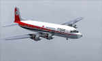
This is a repaint of the Douglas DC-6B in Trinidad and Tobago Air Services - TTAS colors. The freeware CalClassic DC-6B by Greg Pepper and Tom Gibson is needed for this repaint. Trinidad and Tobago is an island nation of the southeastern West Indies, in the Caribbean. It consists of two main islands — Trinidad and Tobago — and several smaller islands. Caribbean United Airlines Ltd. was the main carrier operating a service from Trinidad, the main island, to Tobago, which is off to the North of Trinidad. However, Caribbean United Airlines - established in 1970, failed as an airline and stopped operations in 1974. The government of Trinidad and Tobago consequently formed TTAS at Port of Spain on June 12, 1974 to take over the Port of Spain to Tobago service suspended upon the failure of Caribbean United Airlines. With a pair of Douglas DC-6Bs, TTAS, became the second national carrier, and undertook air bridge flights to Tobago, as well as routes to Grenada, Martinique, and St. Lucia. The DC-6Bs were replaced between 1977 and 1978 by HS-748s. After a short lifespan of 6 years, TTAS was taken over and merged into the main Trinidad and Tobago national carrier - British West Indies Airways, in 1980. Textures are 32bit bmp. This repaint was tested on FSX-SE and should work on FSX & P3D v1-3. It should also work on FS2004.
| Filename: | FSXP3DFS2004_Trinidad_and_Tobago_Air_Services_DC6B.zip |
| License: | Freeware |
| Added: | 24th June 2019, 16:57:14 |
| Downloads: | 109 |
| Author: | Ted Giana |
| Size: | 7.53 MB |


© 2001-2026 AVSIM Online
All Rights Reserved
Privacy Policy |