
Where Flight Simulation Enthusiasts Gather from Around the World!
AVSIM Library - Search Results

| Category: Flight Simulator X - Scenery | |
| Jersey X-HD |

|
Images related to this file:
File Description:

Jersey is a small airport located on the island of Jersey in the English Channel. Originally opened in March 1937 the airport has been through several changes and improvements. This scenery is an accurate representation of the airport today.
Features include: -High definition ground image. -High definition ground detailing. -Accurate ground markings. -Vehicles hidden inside closed hangars. -Beautiful night lighting. -Custom AFCAD for improved AI. -3D Approach lights. -Many static objects. -Reflective windows on tower. -Very frame rate friendly. -Hold short guards and PAPIs. -Illuminated Taxiway center light effect.
| Filename: | Jersey_XHD.zip |
| License: | Freeware, limited distribution |
| Added: | 20th January 2017, 17:42:42 |
| Downloads: | 3,369 |
| Author: | Mark Piccolo - Soarfly Concepts |
| Size: | 23.66 MB |
| Category: Flight Simulator X - Aircraft Repaints, Textures and Modifications | |
| BN-2 Islander (VH-SLM) |
|
Images related to this file:
File Description:
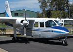
VH-SLM belongs to the Rockhampton Aero Club based in, of all places, Rockhampton, Queensland! Who'dda' believed it? It wouldn't surprise me to find out it paid for it's keep by ferrying holiday makers to Marble Island. Look it up, it looks fabulous!
Built in 1969, she was first registered in Australia in 1980. I think The Rockhampton Aero Club obtained it in 2005 and freshened up the paintwork. What I do know is that you need to have a paid for copy of Flight1's BN-2 Islander for the engines to work!
| Filename: | BN2_Islander_VHSLM.zip |
| License: | Freeware |
| Added: | 31st January 2013, 20:23:30 |
| Downloads: | 404 |
| Author: | Ron Attwood |
| Size: | 2.91 MB |
| Category: Flight Simulator 2004 - AI Flight Plans | |
| USN EP-3E Complete AI Package |
|
File Description:
Military AI Works is proud to present the USN EP-3E Complete AI Package for FS2004. This package depicts the EP-3E Aries aircraft flown by Fleet Reconaissance Squadron One (The World Watchers) and Two (The Dons) both stationed at NAS Whidbey Island. Credits: Models by Jake Burrus, Repaints by Andy Nott, FDE and Effects by Mike MacIntyre and Nick Needham, Flightplans by Barry Taylor, AFCADS by Desmond Burrell and Callsigns by Nick Black. NOTE: This is second version of this package and corrects errors found post release
| Filename: | USN_EP3E_Complete_AI_Package.zip |
| License: | Freeware, limited distribution |
| Added: | 6th August 2008, 05:42:55 |
| Downloads: | 4,372 |
| Author: | Steve Holland, Military AI Works (MAIW) |
| Size: | 3.15 MB |
| Category: Flight Simulator X - Scenery | |
| FSX Scenery Only Iceland Airports Update 2023 |
|
Images related to this file:
File Description:
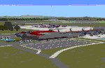
Published first in 2015 with over 11,000 downloads, I think it time to update since so many changes
have occurred around Keflavik and Reykjavik. This scenery offers extensive revisions to Keflavik airport
with a new terminal with transparent windows and interior, new passenger and cargo aprons, control tower,
and more. A totally new scenery of Vestmannaeyjar island and airport with harbor, volcanoes, ferries, and
two working lighthouses is included. Fagradasfjall volcano is now active and spewing fire and lava north
of Keflavik.Some free downloadable libraries required. This scenery REPLACES the old version.
by Dan French
| Filename: | FSX_Scenery_Only_Iceland_Airports_Update_2023.zip |
| License: | Freeware, limited distribution |
| Added: | 12th October 2023, 15:26:42 |
| Downloads: | 538 |
| Author: | Dan French |
| Size: | 12.49 MB |
| Category: Flight Simulator 2004 - Scenery | |
| Edinburgh Island, FOX-2, Horton River, Igloolik, & Kimmirut, adapted for the FSGenesis 76m North Canada Terrain Mesh |
|
Images related to this file:
File Description:
These are replacement bgl's to convert five northern Canada fields for use with the FSGenesis 76m terrain mesh for northern Canada. The five are Edinburgh Island CWEI, the FOX-2 DEW line station, Horton River CWHR, Igloolik CYGT, and Kimmirut CYLC. These are not stand-alone, and the presumption is that you have already downloaded and installed the previously posted sceneries. This installation consists solely of replacing the existing scenery bgl's with the new. There will be further posts of northern airfields in groups of five, alphabetically, and observations regarding the amendments and any further corrections that are required would be welcomed.
| Filename: | Edinburgh_Island_FOX2_Horton_River_Igloolik__Kimmi.zip |
| License: | Freeware, limited distribution |
| Added: | 10th September 2017, 19:29:57 |
| Downloads: | 86 |
| Author: | Roger Wensley |
| Size: | 3.55 MB |
| Category: Flight Simulator 2004 - Scenery | |
| E T Joshua TVSV on Saint Vincent in the eastern Caribbean |
|
Images related to this file:
File Description:
Saint Vincent island is the northernmost of the group of islands known as St Vincent and the Grenadines, just south of St Lucia. St Vincent is around 17 miles long and 10 miles wide and by far the largest in the group, and the islands have a total population of around 120,000. E T Joshua is at the southern end of the island, adjacent to the capital Kingstown. There is a new airport under construction a few miles to the east which will have a longer runway and a larger apron, and when it is ready E T Joshua will probably be closed and redeveloped.
The terminal and the other smaller buildings are all made with photographic textures; the terminal is now quite old and has seen better days. The airport is a hub for small local airlines and also has regular LIAT flights connecting to other islands. The runway is just a shade under 4,700 feet of asphalt, so there are no direct flights from Europe. The new airport to the east is depicted as under construction; obviously I have not flown there and I have not tried to depict the terminal building which is also under construction but a mystery to me.
| Filename: | E_T_Joshua_TVSV_on_Saint_Vincent_in_the_eastern_Caribbean.zip |
| License: | Freeware, limited distribution |
| Added: | 11th June 2013, 16:29:42 |
| Downloads: | 536 |
| Author: | Roger Wensley |
| Size: | 3.13 MB |
| Category: Flight Simulator 2004 - Scenery | |
| PAHT - Amchitka - Aleutians, Alaska - USA |
|
Images related to this file:
File Description:
Amchitka is near the western end of the Aleutian chain of islands in Alaska, around 180 miles west of Adak, and was not included in FS9. There is no small town on Amchitka Island, which is why it was used for atom bomb testing after being closed down as an Air Force base. There are three runways from the 1940's, the largest of which is aligned 07-25 and just over 10,000 feet of overgrown asphalt 300 feet wide. The second runway is aligned 15-33 and 6,000 feet (also 300 feet wide) and the third is 05-23 and 5,000 feet. The whole eastern end of the island is crowded with old munitions storage areas and other military paraphernalia, including old quonset huts; some of those are included here. There are also some old buildings still standing but on their way to becoming piles of old wood or rust, and some of these are included. There is almost no visual information available about Amchitka; even Google Earth has snow obscuring what buildings still exist and where they are, so much of this is at best only approximate apart from the two large hangars. There are no markings, lights, signage, or a control tower.
| Filename: | PAHT__Amchitka__Aleutians_Alaska__USA.zip |
| License: | Freeware, limited distribution |
| Added: | 6th February 2015, 00:06:26 |
| Downloads: | 269 |
| Author: | Roger Wensley |
| Size: | 2.6 MB |
| Category: Flight Simulator 2004 - Scenery | |
| Arctic Runway Signs in the "Northern Domestic Airspace", Canada |
|
Images related to this file:
File Description:
These are scenery bgl's to replace those previously posted for Cape Dorset, Gjoa Haven, Igloolik, and Whale Cove. All of these airfields are within what is marked on the chart as "Northern Domestic Airspace" and their runway signage is not given as a magnetic bearing but as a true bearing. This is because at those latitudes, close to magnetic north, the magnetic field is more vertical than horizontal and magnetic readings become unreliable. Planes report their course as a true course, and fly at a height that reflects their true course instead of their magnetic course. The picture shows the runway sign for Qikiqtarjuaq CYVM (which used to be called Broughton Island) which I am working on right now, and I realised that my training was so far behind me that I had forgotten all of the above. The boundary line of the two air spaces is not a straight line; the furthest south it reaches is on the west coast of Hudson Bay just north of Churchill. To the east it passes through the southern end of Baffin Island, and to the west it is north of the coast at the Alaskan border, and there is an illustration included here.
| Filename: | Arctic_Runway_Signs_in_the_Northern_Domestic_Airsp.zip |
| License: | Freeware, limited distribution |
| Added: | 11th June 2011, 03:06:36 |
| Downloads: | 310 |
| Author: | Roger Wensley |
| Size: | 1.21 MB |
| Category: Flight Simulator 2004 - Scenery | |
| Qikiqtarjuaq CYVM (Broughton) and DEW FOX-5 in Nunavut, Canada |
|
Images related to this file:
File Description:
Qikiqtarjuaq is an airfield on the northeast coast of Baffin Island, just over 100 miles north of Pangnirtung. The airfield is the closest Canadian airfield to Greenland and is used for ferry flights from Canada to Europe for small planes, though there is normally only JetA1 fuel available. The airfield is at only 18 feet ASL next to the sea with the village to the north; it was previously (before 1998) called Broughton Island. The runway is 3,800' of 100' wide gravel and is lighted; as it is in the Northern Domestic Airspace the runway is signed as 033T-213T, using "true" bearings instead of magnetic. There is a terminal and a small maintenance building on the apron and these have been modeled specifically for this scenery. There are AI parking spots; the AI visiting aircraft are a Canadian North Dash 8 and a First Air 42-300. Qikiqtarjuaq village is just north of the airfield and has a population of around 520; it is approximately the right size and shape but no buildings were specifically modeled for the village. There is also a North Warning System site called Fox-5 to the northeast, and this too is included. You will need Ultimate Terrain Alaska Canada.
| Filename: | Qikiqtarjuaq_CYVM_Broughton_and_DEW_FOX5_in_Nunavu.zip |
| License: | Freeware, limited distribution |
| Added: | 14th June 2011, 02:04:26 |
| Downloads: | 558 |
| Author: | Roger Wensley |
| Size: | 1.85 MB |
| Category: Flight Simulator 2004 - Scenery | |
| Cape Dyer CWFD in Nunavut, Canada |
|
Images related to this file:
File Description:
Cape Dyer is on the southeast corner of Baffin Island, around 120 miles east of Pangnirtung at approximately N66 45 W61 30. There is a fine view north up the Davis Strait between Baffin Island and Greenland, and this is the whole reason for the airfield's existance as it was built to support the construction and operation of a DEW line radar station, which has now been updated to a North Warning System site. There are two camps; the upper camp is on the east side of the Cape and is where the radars are located, linked by a gravel road to the lower camp, which is on the west and more sheltered side of the Cape on the clifs above Sunneshine Fjord. The runway is 5,000' of 150' wide gravel, and it is lighted and at 1,320' feet ASL. Cape Dyer is now listed as abandoned in the Canada Flight Supplement. It is, however, still there and presumably is still used for access to the North Warning System equipment, which is automated and generally unmanned. The buildings were modeled for this scenery and include a hanagar large enough to accommodate a C-130. Ultimate Terrain is not required as it does not cover northern Canada.
| Filename: | Cape_Dyer_CWFD_in_Nunavut_Canada.zip |
| License: | Freeware, limited distribution |
| Added: | 21st June 2011, 19:30:07 |
| Downloads: | 490 |
| Author: | Roger Wensley |
| Size: | 1.9 MB |


© 2001-2026 AVSIM Online
All Rights Reserved
Privacy Policy |