
Where Flight Simulation Enthusiasts Gather from Around the World!
AVSIM Library - Search Results

| Category: Flight Simulator X - Aircraft Repaints, Textures and Modifications | |
| Air Canada "Fictional Retrojet" Boeing 777-300ER |

|
Images related to this file:
File Description:
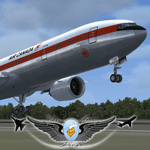
Fictional retrojet C-FNNW, Tail Nr. 747. Textures only for the PMDG 777-300ER.
| Filename: | Air_Canada_Fictional_Retrojet_Boeing_777300ER.zip |
| License: | Freeware |
| Added: | 14th June 2015, 00:26:49 |
| Downloads: | 631 |
| Author: | Matt Wynn |
| Size: | 12.67 MB |
| Category: Flight Simulator 2004 - Scenery | |
| Colville Lake CEB3 in Northwest Territories Canada |
|
Images related to this file:
File Description:
Colville Lake is a small village of around 150 Dene, located to the northwest of the Great Bear Lake and east of the Mackenzie River, 120 miles north of Norman Wells. The village and the airfield are next to each other and to the lake shore. I recently discovered which of the standard terminal buildings had been used there and this, along with information I already had, enabled me to now make the scenery, which is based on an approximate 2010 date. The gravel runway is lit and around 2,800 feet long, aligned 10-28. North Wright Air serves the village from it's headquarters at Norman Wells with daily flights by de Havilland Twin Otters, or "twotters" as they were quickly named among the northern Canadian airline personnel when they were first produced. The approximate time of this scenery is 2010. While testing this scenery I discovered that Tulita (previously called Fort Norman) which is another Mackenzie River airfield to the south of Norman Wells, needs to be reposted due to a terrain fault. If you find an error here then email me please, and note that my email address has been changed to rogwens at Gmail dot com.
| Filename: | Colville_Lake_CEB3_in_Northwest_Territories_Canada.zip |
| License: | Freeware, limited distribution |
| Added: | 31st July 2021, 18:23:48 |
| Downloads: | 68 |
| Author: | Roger Wensley |
| Size: | 4.51 MB |
| Category: Flight Simulator 2004 - Scenery | |
| CYSA - Stratford Municipal Airport - Ontario, Canada **Fix** |
|
File Description:
In the actual Stratford Municipal Version, the airport building and the hangars are 25 percent sunk into the ground. This update solve this problem.
| Filename: | CYSA__Stratford_Municipal_Airport__Ontario_Canada_.zip |
| License: | Freeware |
| Added: | 6th April 2015, 00:10:37 |
| Downloads: | 218 |
| Author: | David Kolas |
| Size: | 1.93 KB |
| Category: Flight Simulator 2004 - Scenery | |
| Whati CEM3 in the Northwest Territories, Canada |
|
Images related to this file:
File Description:
Whati is a village at the southern end of Lac La Martre, a smaller lake (only by Canadian standards, at over 40 miles long) halfway between the Great Slave Lake and the Great Bear Lake and around 100 miles north of Yellowknife. The North West Company established a trading post there in 1793, and this was the centre for local trading in the area for 100 years until a post was opened by the Hudson Bay Company on the Great Slave Lake. The current population is in the region of 520. There is no graded road access and access is by boat or air. The main local economy revolves around hunting and fishing, with efforts being made to increase tourism amid the wilderness and the wildlife. The airfield is just over a mile east of the village, with a runway of around 3,400 feet of gravel aligned 09-27 as of 2010, with PAPI at both ends and lit. There are scheduled flights from Yellowknife by Air Tindi, included in the AI, and some GA. The terminal building is similar to that of Lutselk'e, but with a different colour scheme and with solar panels on the roof. It appears that they repaint the sign on the front of the building with a different wording every time; the one I have used is one of three that have existed in the last few years. The photos I had originally were taken in the winter, with snow. Seeing it in the summer I discovered that my version of the building is not at the right level above the ground by about a foot, or 30cm. I was too lazy to make it again, which was the only way to get it right and still have it throw a shadow on the ground. This scenery modifies the lake shore, corrects levels for land and lake, and adds the village and a connecting road in addition to the airport. A note here about my scenery making. There will not be many more to follow this as I am almost at the end of the photos I either took or found for scenery purposes, plus I expect to move on from FS9 at some point during next year.
| Filename: | Whati_CEM3_in_the_Northwest_Territories_Canada.zip |
| License: | Freeware, limited distribution |
| Added: | 15th December 2019, 19:18:29 |
| Downloads: | 148 |
| Author: | Roger Wensley |
| Size: | 4.25 MB |
| Category: Flight Simulator 2004 - Scenery | |
| Silver City CFQ5 in Yukon Territory Canada |
|
Images related to this file:
File Description:
Silver City is a ghost town in the Yukon Territory, Canada, amid the Rocky Mountains and around 35 miles northwest of Haines Junction. It is on the southern end of Kluane Lake and in the Kluane National Park and this probably explains it's (minimal) survival after what appears to have been the shutdown of mining for silver. There is little information readily available. The date of this scenery is, as usual, around 2010. There was no recent regular service by Yukon Air North or any other airline, and the primary user of the airfield adjacent to the lake is a company called Icefield Discovery Tours. Their activity is probably very similar to the company at Haines Junction and involves trips to the National Park amid mountains and glaciers. There is also another organisation at the airfield, the Kluane Lake Research Station of the Arctic Institute. They have four buildings there but it is unclear how much aerial activity they generate, or if in fact they fly at all for their work. The runway is 3,000 feet of unlit gravel, aligned north-south. This post will be followed by Burwash, which is at the far northwestern end of the lake. There is no video of the Silver City airfield on Youtube, and it is not the most exciting airfield in the world, but the location is enough in real life for a visit to be made. On YouTube there is a series of posts by Angle of Attack showing the preparation and then the flight of an old Cessna 172 from Homer to Oshkosh for the installation of modern instruments. Interesting for me as they visit or fly over airfields I have made: Homer, Merrill, Tok Junction, Burwash, Silver City, Haines Junction, Watson Lake, Fort Nelson, and Grande Prairie. But they fly in the winter so it all looks very different.
| Filename: | Silver_City_CFQ5_in_Yukon_Territory_Canada.zip |
| License: | Freeware, limited distribution |
| Added: | 22nd January 2022, 21:57:41 |
| Downloads: | 96 |
| Author: | Roger Wensley |
| Size: | 9.86 MB |
| Category: Flight Simulator 2004 - Scenery | |
| Lutselk'e CYLK in the Northwest Territories, Canada |
|
Images related to this file:
File Description:
Lutselk'e is a village on the southern shore of the Great Slave Lake, at the eastern end and about 120 miles east of Yellowknife. The Hudson Bay trading company established a post there in 1925, and the current school opened in 1960. The population is in the region of 330. There is no road access, but the government runs a freight shipping service during the ice-free period of the Summer. The airfield is a mile or so east of the village, with a runway of around 3,500 feet of gravel aligned 08-26 with PAPI at both ends and lit, with lights atop traffic cones. There are scheduled flights from Yellowknife by Air Tindi, included in the AI, as is a once a week freight flight by Buffalo Airways. You will need to have downloaded and installed my runway and taxiway lighting library from recent posts. A note here about my scenery making. There will not be many more to follow this as I am almost at the end of the photos I either took or found for scenery purposes, plus I expect to move on from FS9 at some point during next year.
| Filename: | Lutselke_CYLK_in_the_Northwest_Territories_Canada.zip |
| License: | Freeware, limited distribution |
| Added: | 9th December 2019, 18:04:52 |
| Downloads: | 104 |
| Author: | Roger Wensley |
| Size: | 3.25 MB |
| Category: Flight Simulator 2004 - Scenery | |
| Embrun CPR2 in Ontario Canada 2012 Revision |
|
Images related to this file:
File Description:
Embrun is in Ontario a few miles southeast of Ottawa, and southwest of my posted strips Russel Farm, Russellet Strip, and Indian Creek. It is a real airfield, used by Embrun Flying Club, and there is now fuel since the owner built a house on the field and moved in, and more hangars than there used to be. All in all a nice airfield with a grass runway 2,260 feet long, and in this REVISED version with a new windsock. There are electric cables strung along the road at the eastern end of the runway, marked by visibility balls; watch out for those. At the western end there are some old grain silos; these shouldn't be a problem, and if you are flying a taildragger give you something to aim at until the tail comes up. I did my first grass field landing and take off there when I was learning to fly, and it is just the right distance from Rockcliffe for a nice afternoon training flight. Look out for geese taking off from the fields to the west when you use 26; that departure from Embrun along with 50 geese was more entertaining than most.
| Filename: | Embrun_CPR2_in_Ontario_Canada_2012_Revision.zip |
| License: | Freeware, limited distribution |
| Added: | 9th February 2012, 01:31:31 |
| Downloads: | 302 |
| Author: | Roger Wensley |
| Size: | 3.8 MB |
| Category: Flight Simulator 2004 - Scenery | |
| Jenny Lind Island CWJL in Nunavut, Canada |
|
Images related to this file:
File Description:
This was a DEW line Auxiliary Station on Jenny Lind Island; the island is about 14 miles by 12 miles and off the southeast corner of Victoria Island, 85 miles east of Cambridge Bay. The station was closed in 1992 but is still there as "closed" meant "shut the door and walk away". There has been some later removal of diesel tanks and other polluting items but the buildings are still intact, and the runway is 4,470 feet of gravel 150' wide. At the western end there is an apron and a large hangar. There are of course no lights, signage, or windsock. A North Warning System station was built in 1990, 6 miles inland to the northwest of the runway. This has a shorter (1,400'?) gravel runway (and named CWJX here).
| Filename: | Jenny_Lind_Island_CWJL_in_Nunavut_Canada.zip |
| License: | Freeware, limited distribution |
| Added: | 15th November 2012, 13:55:29 |
| Downloads: | 190 |
| Author: | Roger Wensley |
| Size: | 1.65 MB |
| Category: Flight Simulator 2004 - Scenery | |
| Waskaganish CYKQ in northern Quebec, Canada - revised |
|
Images related to this file:
File Description:
Waskaganish is at the southern end of James Bay, in Quebec, and this is a revised version. It deletes a hold short that should not have been showing on the gravel, and adds in signage, runway lights, taxiway lights, terminal night textures, and revised AI. I have no idea why I didn't include the night textures before. It presumes you have already installed my October 2010 Waskaganish.
| Filename: | Waskaganish_CYKQ_in_northern_Quebec_Canada__revise.zip |
| License: | Freeware, limited distribution |
| Added: | 6th January 2013, 00:08:58 |
| Downloads: | 222 |
| Author: | Roger Wensley |
| Size: | 1.49 MB |
| Category: Flight Simulator 2004 - AI Aircraft | |
| Air Canada Boeing 767-300 Fleet Package |
|
File Description:
Repaint package for Air Canada's fleet of Boeing 767-300s. Contains the entire current fleet fully color matched to Dave Wilkins Airbus fleet.
All current variants are included, with each relevant livery, exit door and engine variant. Please note window configurations may vary on some aircraft in the fleet. During my research I found that almost every aircraft has a different window configuration, and painting each one would have meant painting pretty much the whole fleet.
Liveries are correct as of April 19, 2008.
Included in this zip is a fleet file which details power plant, exit config and which repaint to assign to each aircraft in your flight plans.
Requires AI Aardvark Boeing 767-300 GE and PW models.
| Filename: | Air_Canada_Boeing_767300_Fleet_Package.zip |
| License: | Freeware, limited distribution |
| Added: | 19th April 2008, 23:54:36 |
| Downloads: | 4,272 |
| Author: | Garry Lewis |
| Size: | 4.7 MB |
© 2001-2026 AVSIM Online
All Rights Reserved
Privacy Policy |