
Where Flight Simulation Enthusiasts Gather from Around the World!
AVSIM Library - Search Results

| Category: Flight Simulator 2004 - Scenery | |
| Deline CYWJ - Northwest Territories, Canada |

|
Images related to this file:
File Description:
This is the third in a series of airfields that follow in a southward direction that early access route to the Canadian northern shore, the Mackenzie River. Deline is south of Tuktuk, Inuvik, Fort McPherson, and Fort Good Hope, all already posted. Deline is at 704 feet asl and around 50 miles east of the the Mackenzie, where the Great Bear River flows out of the western end of Great Bear Lake on its way to the Mackenzie. This lake is huge. The town of Deline has a population of around 500, and the first trading post (of the North West Company) was established there as early as 1799. The Hudson Bay Company opened an outpost in 1825 to support the Franklin Arctic Exploration expedition, and it was then called Fort Franklin. The name was changed to Deline in 1993. The airport is just over a mile north of the town, and has almost 4,000 feet of gravel runway. There is no fuel available. The original airfield is still visible just to the north of the town, from before it was rebuilt on higher ground (better drainage) and away from the houses. AI will follow with later posts.
| Filename: | Deline_CYWJ__Northwest_Territories_Canada.zip |
| License: | Freeware, limited distribution |
| Added: | 5th July 2014, 14:47:36 |
| Downloads: | 240 |
| Author: | Roger Wensley |
| Size: | 2.54 MB |
| Category: Flight Simulator 2004 - Scenery | |
| CZFN - Tulita - Northwest Territories, Canada |
|
Images related to this file:
File Description:
Tulita (Fort Norman until 1996) is another in the series of airfields that follow (approximately) the Mackenzie River. At the far northern end of the river and on the eastern side of the delta there is Tuktoyaktuk, then Inuvik, Fort McPherson, Fort Good Hope, Deline, Wrigley, Fort Simpson Island and Fort Simpson, and then Fort Liard at the southern end of the list of those in the Northwest Territories. South of Fort Liard there are Peace River and Dawson Creek, both of which are already posted. Tulita is at the junction of the Mackenzie and Great Bear Rivers, on the east bank of the Mackenzie and the south bank of the Great Bear, around 40 miles southeast of Norman Wells. The town has a population of about 480 folks. The airport is above and to the east of the town, and has 3,000 feet of gravel runway. The scheduled flights are by North Wright and I have also added a Buffalo DC3 and GA. There is a mandatory radio frequency but in this case I have set the "tower" to "unmanned" so you will report position and intentions. There is no fuel available.
| Filename: | CZFN__Tulita__Northwest_Territories_Canada.zip |
| License: | Freeware, limited distribution |
| Added: | 12th July 2014, 08:05:54 |
| Downloads: | 271 |
| Author: | Roger Wensley |
| Size: | 2.66 MB |
| Category: Flight Simulator 2004 - Scenery | |
| (CSS3) Les Cedres, Quebec, Canada |
|
File Description:
Situated just 20 miles southwest of Montreal international airport (CYUL), it is the home of Laurentide aviation school. Gmax buildings, Landclass of the area, AI trafic and AFCAD file included. With buildings in Vaudreuil: Cite des jeunes and the Future complex. Most of the textures are from photographs. My first contribution.
| Filename: | CSS3_Les_Cedres_Quebec_Canada.zip |
| License: | Freeware, limited distribution |
| Added: | 27th February 2005, 20:41:24 |
| Downloads: | 3,933 |
| Author: | Jacques Bellavance |
| Size: | 590.72 KB |
| Category: Flight Simulator 2004 - Scenery | |
| Kugluktuk CYCO in Nunavut, Canada |
|
Images related to this file:
File Description:
Kugluktuk is on the coast of northern mainland Canada on the mouth of the Coppermine River. It is around 250 miles west of Cambridge Bay and 200 miles south of Ulukhaktok. Tuktoyaktuk is 450 miles west. Kugluktuk used to be called Coppermine as copper was mined along the banks of the river and used for spear and arrow heads, and this attracted a semi-permanent population. The population now numbers around 1,450. The airfield is inland from the village and the 5,500 feet of 100 feet wide gravel runway is aligned 121T/3301T where T stands for "true" as opposed to magnetic in the Northern Domestic Airspace. Both JETA-1 and 100LL are available, dispensed by a truck as the storage tanks are just off the northern edge of the field. There are flights by First Air and Canadian North and the AI includes a daily flight of each, plus a cargo visit by Buffalo; the closest large city is Yellowknife, 375 miles south. I should have mentioned a long time ago that to see the apron lights working requires you to have the "lights_ss_v2" by Sidney Schwartz installed.
| Filename: | Kugluktuk_CYCO_in_Nunavut_Canada.zip |
| License: | Freeware |
| Added: | 10th November 2012, 04:03:35 |
| Downloads: | 428 |
| Author: | Roger Wensley |
| Size: | 3.04 MB |
| Category: Flight Simulator 2004 - Scenery | |
| Kangirsuk CYAS in Quebec Canada |
|
Images related to this file:
File Description:
Kangirsuk is an Inuit village in northern Quebec, on the coast of Ungava Bay. The airport is the only means of access on this coast for the population of around 550, apart from a period in late summer. It is between Quaqtaq and Aupaluk, and around 140 miles north of Kuujjuaq, a major centre in this area for supplies, medical care, education, and anything to do with local government. This version of the airport and village is from around 2010, with the original terminal building that has now been replaced. The runway is just under 3,500 feet of lit gravel aligned 04-22 and the AI includes the daily Air Inuit flight that connects Kangirsuk with Kuujjuaq and other local airfields en route. This is almost certainly the last of the northern Quebec coastal airfields that I will be able to model with the correct buildings; only two missing so not too bad.
| Filename: | Kangirsuk_CYAS_in_Quebec_Canada.zip |
| License: | Freeware, limited distribution |
| Added: | 27th August 2020, 17:41:07 |
| Downloads: | 84 |
| Author: | Roger Wensley |
| Size: | 5.67 MB |
| Category: Flight Simulator 2004 - Scenery | |
| Elko Field B C Canada |
|
File Description:
This scenery is located in B.C. Canada.
Airport name,
1.Elko Field(CBE2) default enhanced. 3000' grass
Aircraft involved: Dc3. call sign,58 kilo lima and the piper 180 call sign, 18 foxtrot lima Doing touch and go's start time 22:00 GMT.
| Filename: | Elko_Field_B_C_Canada.zip |
| License: | Freeware |
| Added: | 15th February 2004, 23:35:15 |
| Downloads: | 1,652 |
| Author: | Frank Betts |
| Size: | 1.63 MB |
| Category: Flight Simulator X - Aircraft Repaints, Textures and Modifications | |
| Air Canada Airbus A330-300 |
|
Images related to this file:
File Description:

Repaint of the Blackbox Simulations A330-300.
| Filename: | Air_Canada_Airbus_A330300.zip |
| License: | Freeware, limited distribution |
| Added: | 9th May 2013, 08:15:21 |
| Downloads: | 1,501 |
| Author: | Jon Murchison / BlackBox Simulations |
| Size: | 5.9 MB |
| Category: Flight Simulator 2004 - AI Flight Plans | |
| Air Canada Jazz Summer 2008 |
|
File Description:
This is part of our first round of Summer flightplans for 2008. The team aims to provide high quality quality flightplans for the FS community. Each flightplan has been throughly tested using all available resources, and our goal is to make the most accurate possible representation of each airline's route network. Visit us here for more information.
| Filename: | Air_Canada_Jazz_Summer_2008.zip |
| License: | Freeware, limited distribution |
| Added: | 27th April 2008, 16:49:41 |
| Downloads: | 2,184 |
| Author: | Garry Lewis & Alpha India Group |
| Size: | 109.87 KB |
| Category: Flight Simulator X - Scenery | |
| CYFB - Iqaluit Airport - Nunavut, Canada |
|
Images related to this file:
File Description:
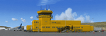
Iqaluit is the capital of Nunavut, a vast northern region that covers almost all of the Canadian North. The airport is of critical importance to the community, especially when ice makes boat travel impossible.
The scenery includes all airport buildings with custom designed and generic buildings nearby. Several typical airlines are represented, both by their flights by their facilities, including First Air, Canadian North, Air Greenland, Ken Borek Air and Keewatin. The Airbus A380 was in Iqaluit in February 2006 for flight testing in cold weather, as do other manufacturers. Airbus will also carry out the same tests for its new A350.
CYFB is also a Canadian Force base. Several units are parked in the military area, in addition to the C- 177 and his escort on ramp 2. A Twin Otter from the RCMP, and some general aviation aircrafts complement the fleet. Six ships are in the scenery: four static and two mobile (AI). Zodiacs and a balloon tourist flow into the bay. These, and the ships AI, start their movements 1100Z. The weather station launches a weather balloon regularly. Three small caribou herds are in the vicinity.
| Filename: | CYFB__Iqaluit_Airport__Nunavut_Canada.zip |
| License: | Freeware, limited distribution |
| Added: | 5th April 2014, 14:37:23 |
| Downloads: | 3,969 |
| Author: | Jean-Pierre Fillion, Pierre Gallant |
| Size: | 16.88 MB |
| Category: Flight Simulator X - Aircraft Repaints, Textures and Modifications | |
| Wardair Canada Boeing 747-400 |
|
Images related to this file:
File Description:
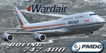
Re-paint of Wardair Canada's 747 for the PMDG 747 Queen of the Skies II v3. Textures only.
| Filename: | Wardair_Canada_Boeing_747400.zip |
| License: | Freeware |
| Added: | 10th March 2017, 07:14:42 |
| Downloads: | 244 |
| Author: | Ray Reyes |
| Size: | 9.69 MB |
© 2001-2026 AVSIM Online
All Rights Reserved
Privacy Policy |